Snow and Ice Spread Across the South

A major winter storm will continue to impact travel through the end of the week from Texas through North Carolina as it drops snow and ice along its path. Winter storm warnings are in effect (top of page) from Dallas through Nashville and Louisville. Winter Storm Watches are now being upgraded to warnings and advisories all the way to the East Coast.
Timing & Precipitation
Snow and ice will continue to push East on Friday morning.
Areas that stay below freezing through the atmosphere will be looking at snow some hefty snow totals, while just to the south a mix of snow, ice, and rain is expected. Either way, expect major travel impacts from Dallas to Virginia Beach. Snow load impacts (weight of ice & snow) are highlighted below.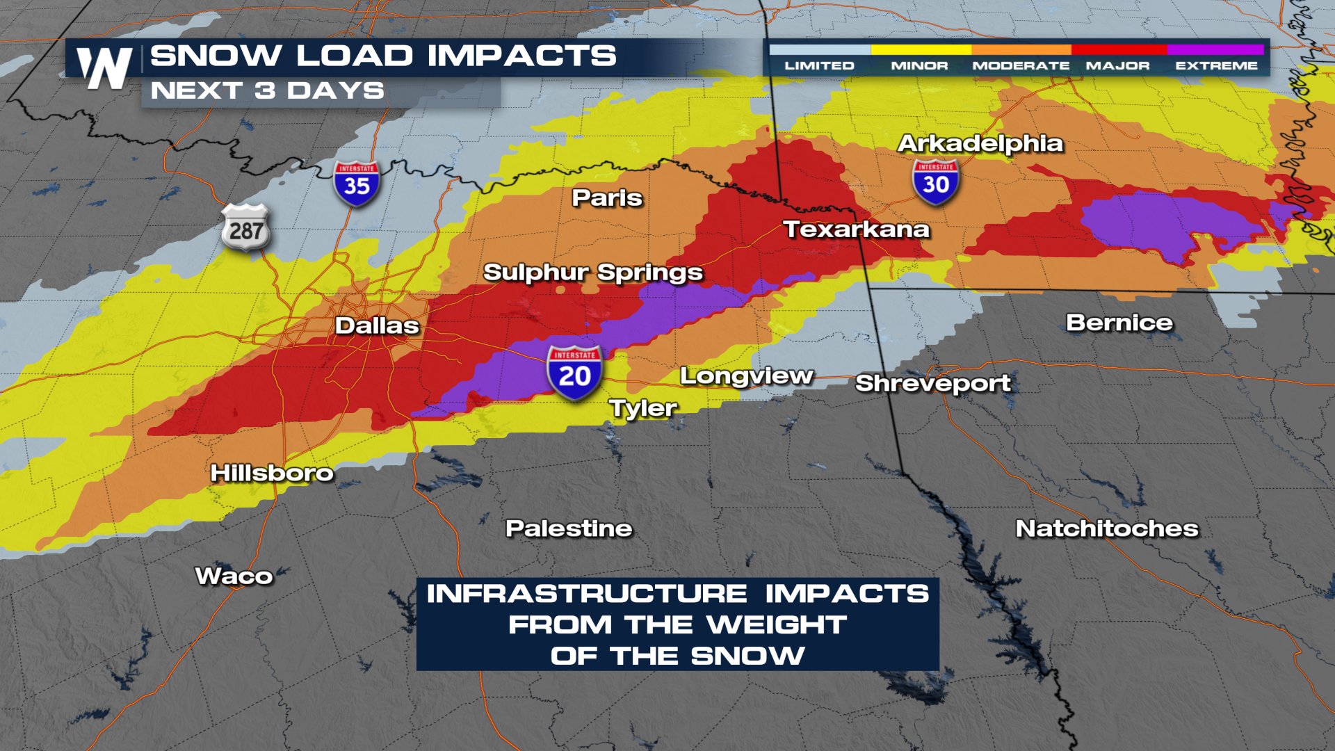
SNOW
A stripe of heavy snow is expected from just north of Dallas through Little Rock to Nashville. I-40 and areas just south can expect the highest snow totals (6"+ purple region). Dallas is likely looking at 1-3 inches of snow, with more on the northern side of the DFW metroplex.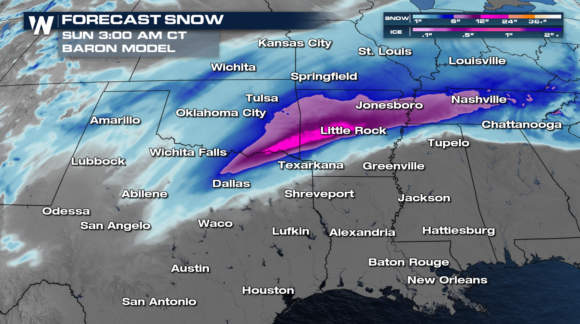
Ice
Ice impacts are expected for a few areas, with southern Arkansas expecting the highest impacts from ice accretions (ice accumulation).
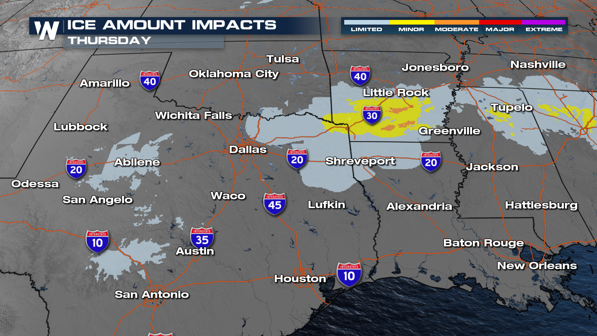 Freezing rain could top one-quarter of an inch in southern Arkansas, potentially leading to spotty power outages. Sleet (orange color below) could make roads quite slick at times.
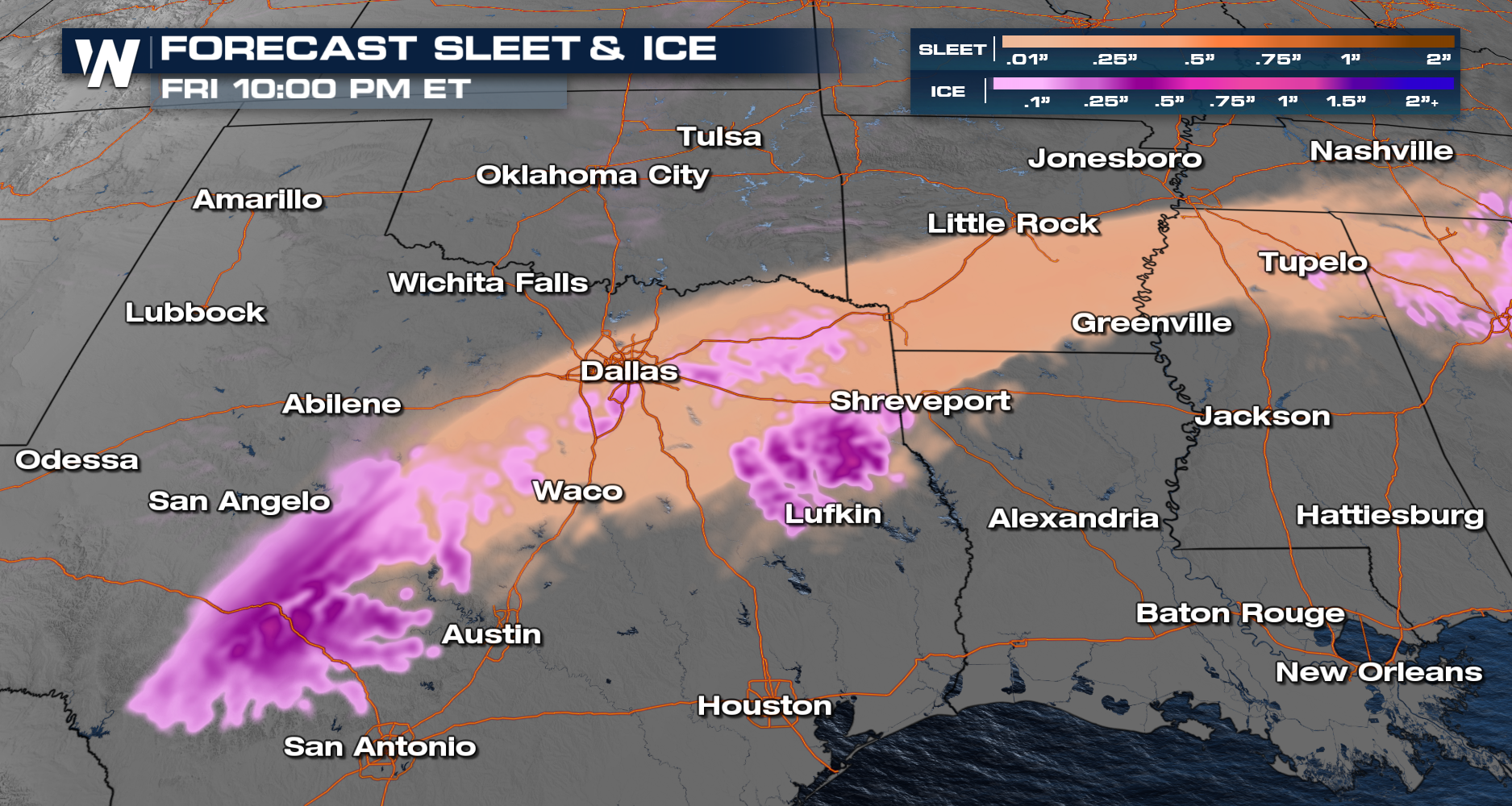
Tune in at :30 past the hour for the latest Central Regional Forecast!


