Messy Storm System for the Middle of the Country

We have the opportunity for wet weather in the High Plains through the weekend as an area of low-pressure sweeps across the country. It will also bring a severe weather threat to the Deep South through Saturday.
Related Article - Severe Weather in the Deep South
Temperatures will be generally too warm to see widespread snow. Rain will impact much of the Great Lakes and Midwest on Friday thanks to mild temperatures before cold air arrives by Saturday night, transitioning rain to snow on the backside of a low-pressure system for northern Illinois and eastern Iowa.
The snow potential depends greatly on the temperature profile and will be greatly limited. Behind the main low-pressure system, light snow accumulations will be possible around Lake Michigan and Superior thanks to Lake Effect Snow.
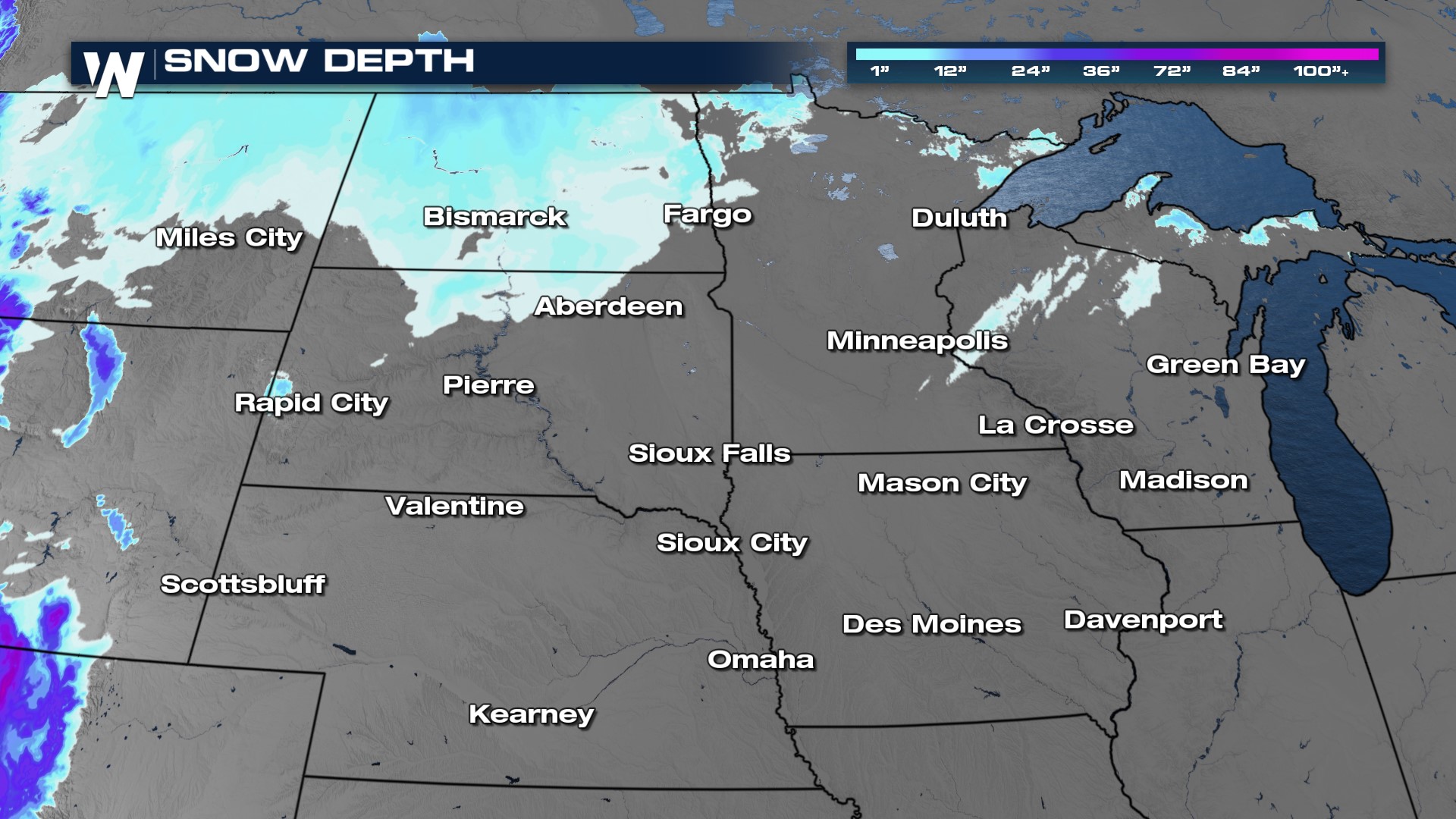
 We need the snowfall region-wide, snowpack is at zero through much of the High Plains with the only spot seeing snow on the ground being North Dakota and the U.P. of Michigan.
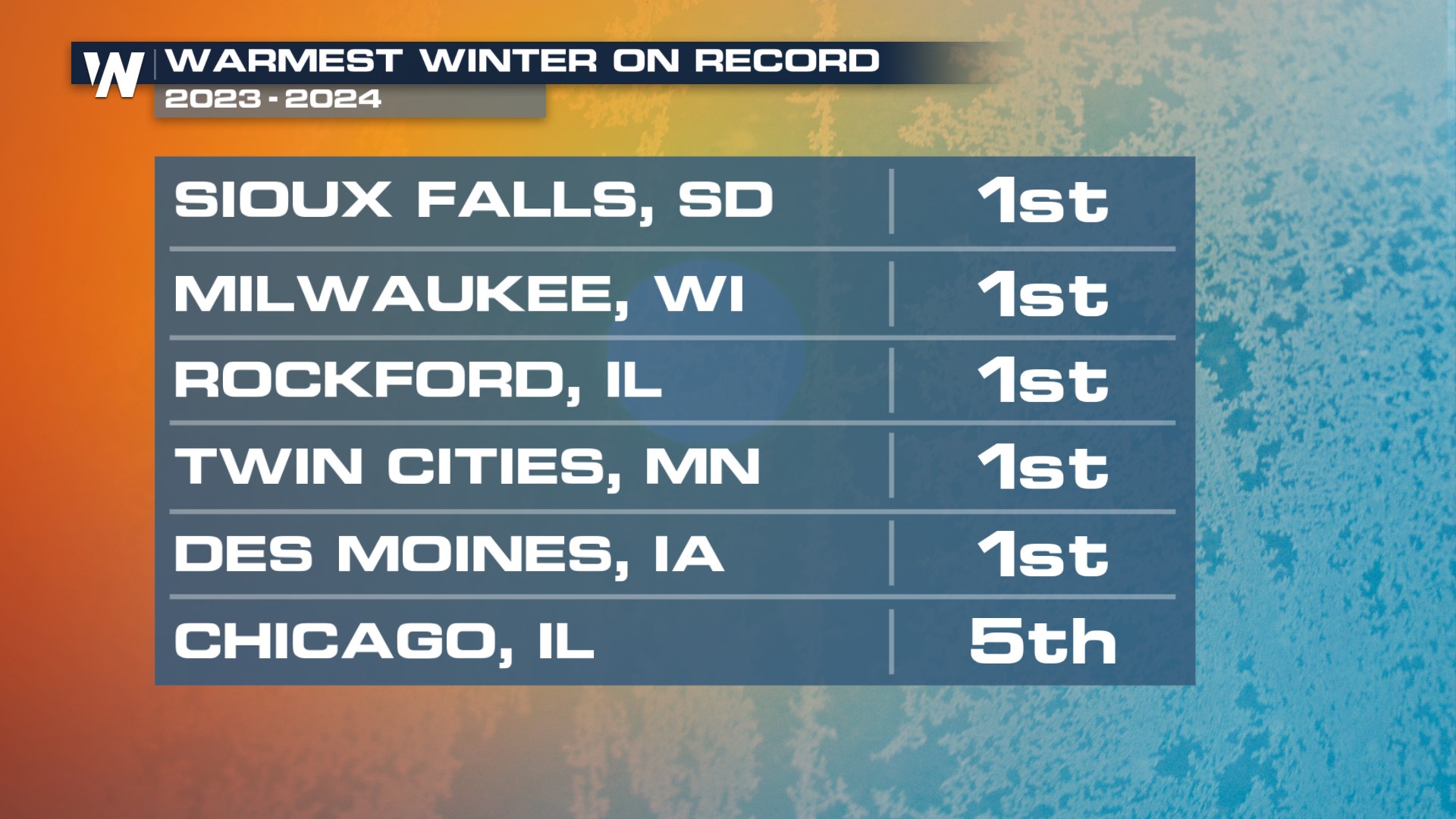
 This meteorological winter (December 2023 - February 2024) was the warmest on record for many cities in the heart of the country, including Milwaukee, Des Moines, and the Twin Cities. Chicago saw their 5th warmest winter on record. That meant snow melted quickly reducing snowpack or we hardly saw any snow at all because it fell as rain instead.