Another Clipper System Across the Northeast Friday

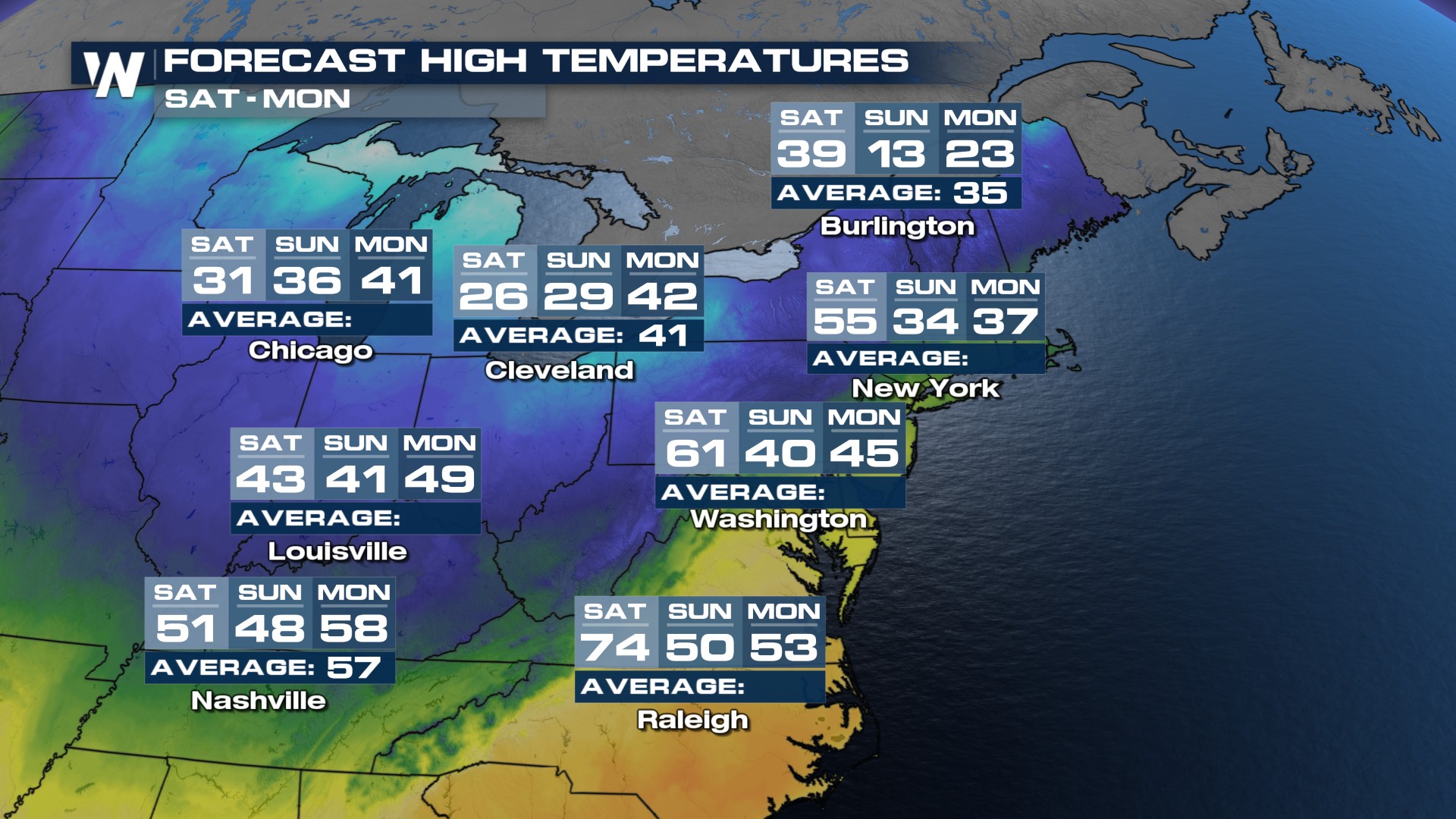
GREAT LAKES to NORTHEAST - Another fast-moving system, known as a "clipper", will bring unsettled weather to the Great Lakes, Midwest, Northeast, and New England through the weekend. Temperatures look too warm for many outside of mountain areas or northern latitudes to see snow initially, but cold air behind the low will drop snow levels into Sunday.
 Here is a look at the latest guidance for our snowfall chances. Many spots in New England look cool enough overnight and into Saturday to see snowfall. Boston in this round could see snow before sunrise, and then transition to rain.
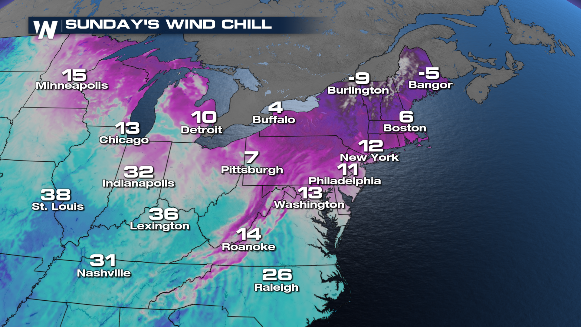
Winds & Wind Chills
Gusty winds will push into the Northeast and Mid-Atlantic this weekend. The strong, gusty winds will combine with the cold air to generate strong wind-chill values. Check out how cold it could feel by Sunday morning!!!