Monday's Severe Weather Risk Areas
Special Stories
13 Apr 2020 9:00 AM
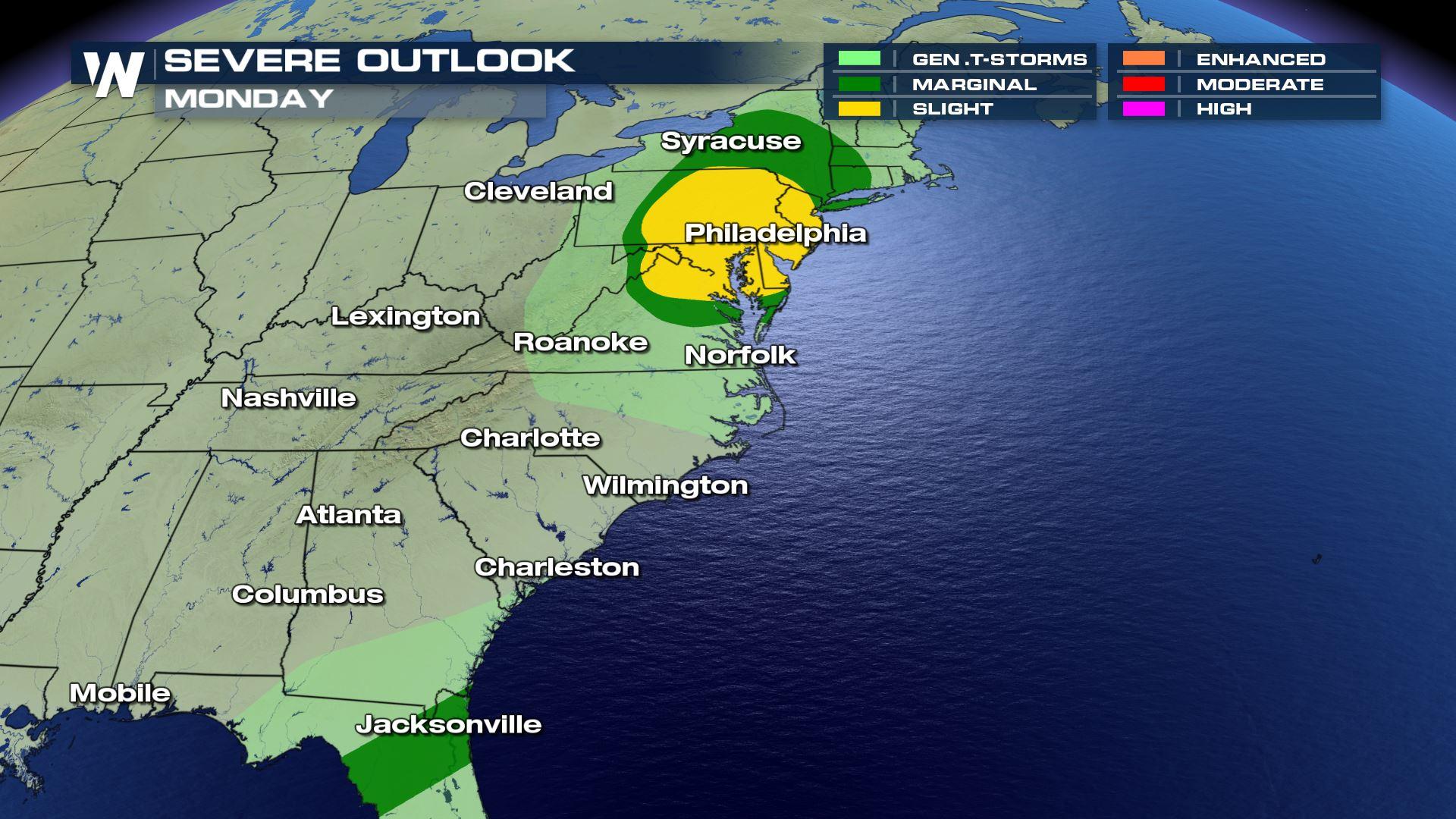
After a day of damaging and deadly tornadoes on Sunday, the threat for severe weather continues for today (Monday). The potential for severe thunderstorms extends along the Eastern Seaboard from Long Island to the Big Bend of Florida. The tornado threat is highest south of New York City down to Richmond, VA.
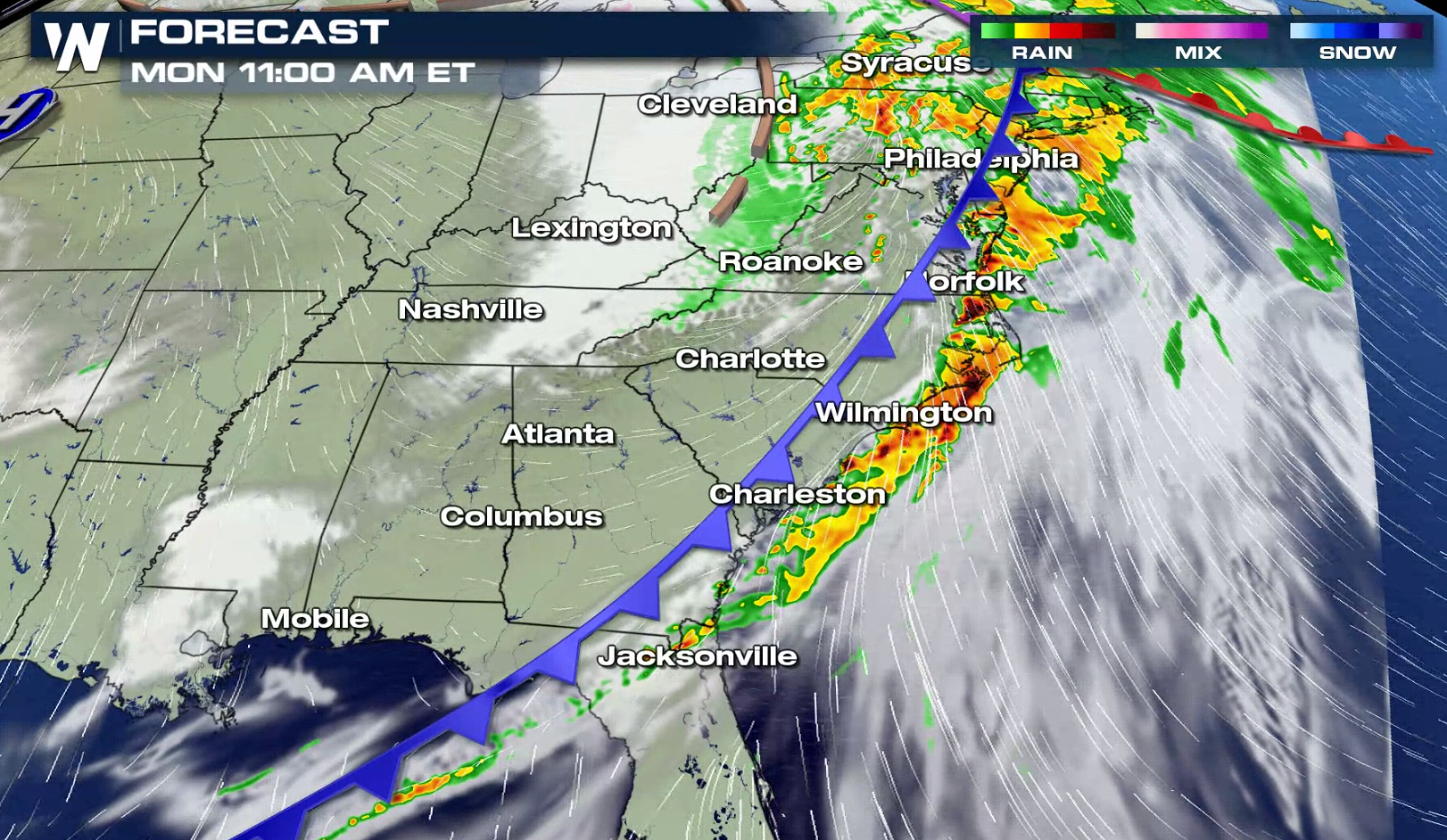
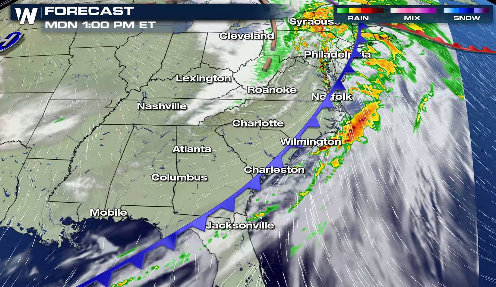
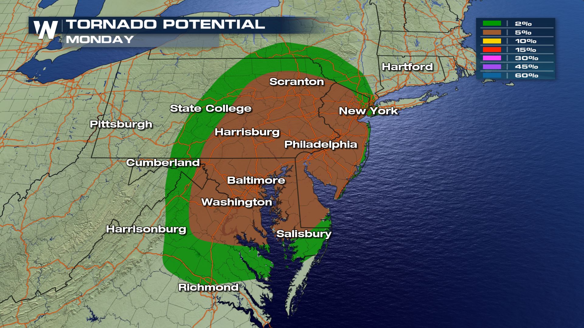 A strong cold front has moved across the Appalachians, headed east toward the Eastern Seaboard and into Florida. Severe storms will continue along the front, producing damaging wind gusts, isolated tornadoes and large hail. The front will move into the Atlantic Ocean in the late afternoon, bringing an end to the severe weather threat for most areas.
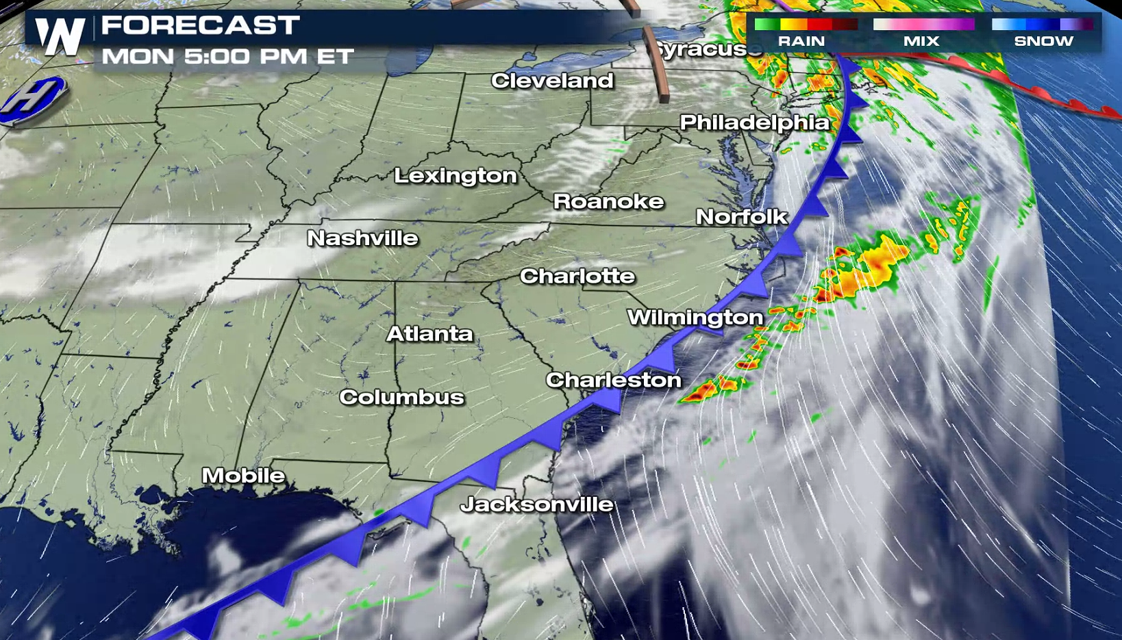 With the front lagging behind in Florida through the middle of the week, portions of the Southeast will see a continued risk for severe storms. Check back with WeatherNation on-air and online for the latest severe weather updates.
A strong cold front has moved across the Appalachians, headed east toward the Eastern Seaboard and into Florida. Severe storms will continue along the front, producing damaging wind gusts, isolated tornadoes and large hail. The front will move into the Atlantic Ocean in the late afternoon, bringing an end to the severe weather threat for most areas.
With the front lagging behind in Florida through the middle of the week, portions of the Southeast will see a continued risk for severe storms. Check back with WeatherNation on-air and online for the latest severe weather updates.All Weather News
More

Flooding, Severe Storms Target the Midwest Again
After an active week of storms across the nor
1 Aug 2026 1:40 AM


After Reaching Category 5, Genevieve Weakens in the Pacific
PacificFausto is now a post-tropical cyclone.
31 Jul 2026 1:30 AM

Flooding Risk Increases as Heavy Rain Targets the Tri-State Area
Tuesday, heavy rainfall moved across the Nort
30 Jul 2026 12:25 AM

Severe Weather: Energy From the Midwest Now in the Southeast
UPPER MIDWEST - Through Monday, dangerous tor
29 Jul 2026 10:30 PM