Monday Severe Weather Update
Top Stories
22 Jul 2019 4:11 AM
Strong to severe storms today for areas in the Plains and a good portion of the Mid-Atlantic and Southern New England areas. These storms could contain large hail, damaging winds and a few tornadoes. Here is the latest forecast.
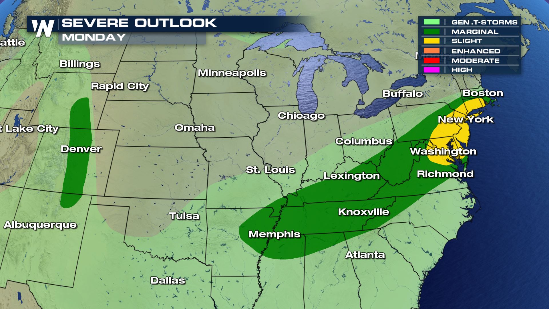 A large cold front extending from New England to the Southern Plains will be the focus for showers and storms today. Areas in the Mid-Atlantic will likely have the higher chance for severe storms.
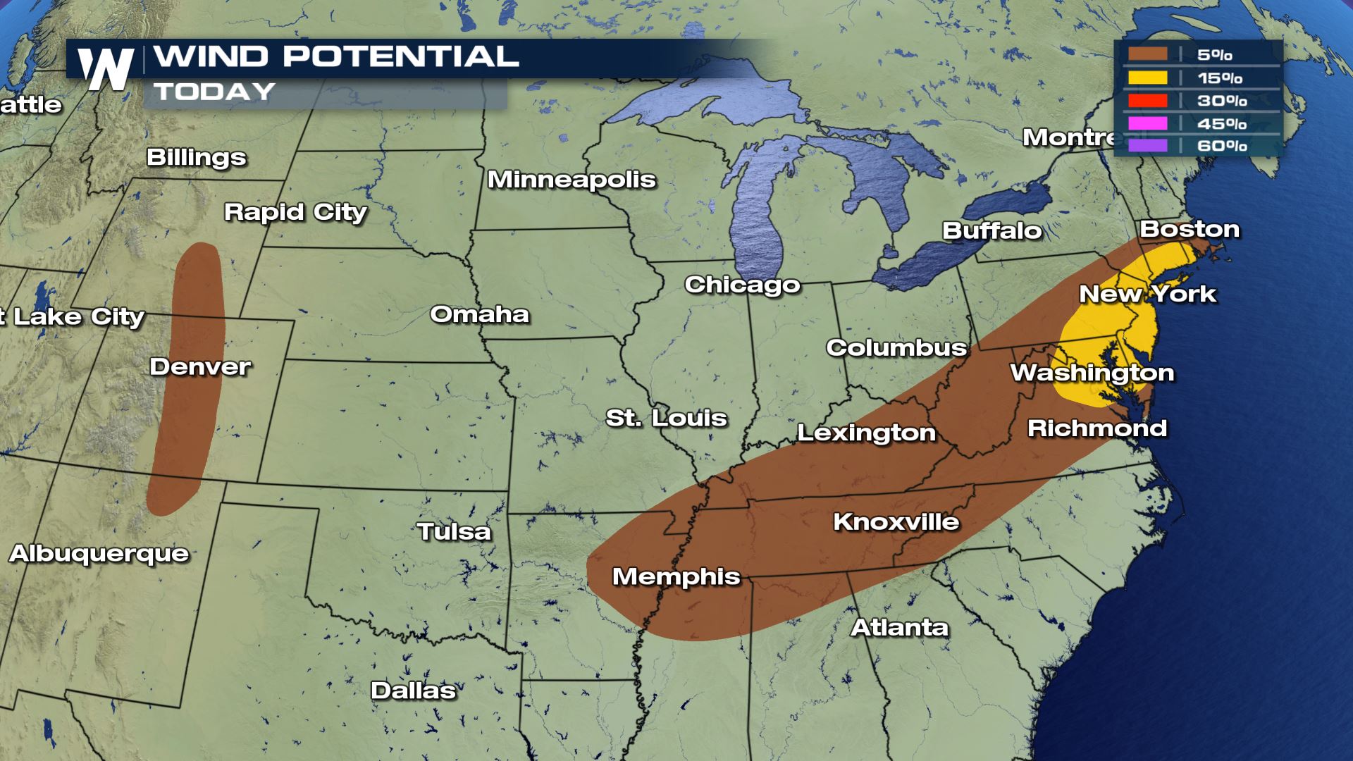 Areas in the Central Rockies will have an isolated risk for hail and wind, but cities like Baltimore and New York will have a chance for scattered severe storms.
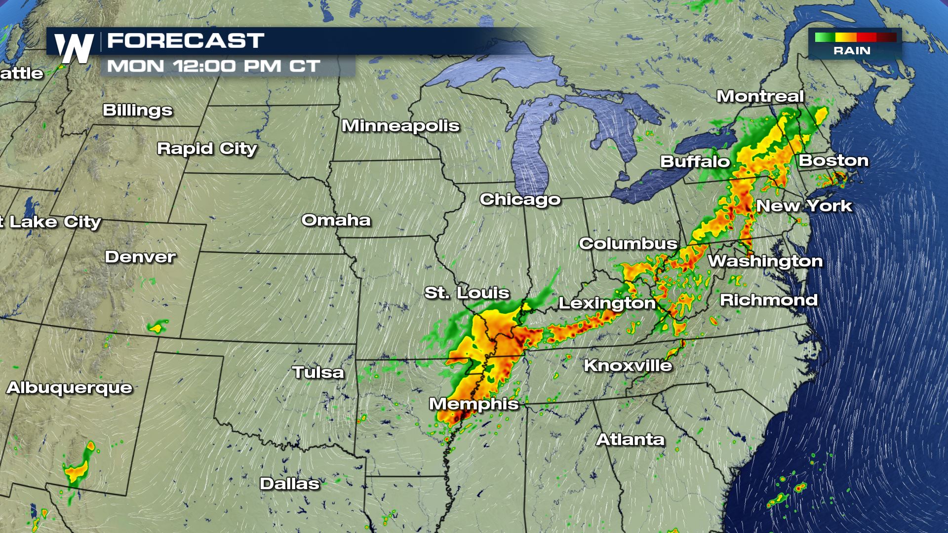
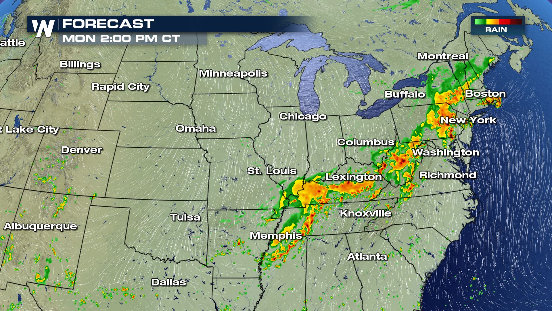
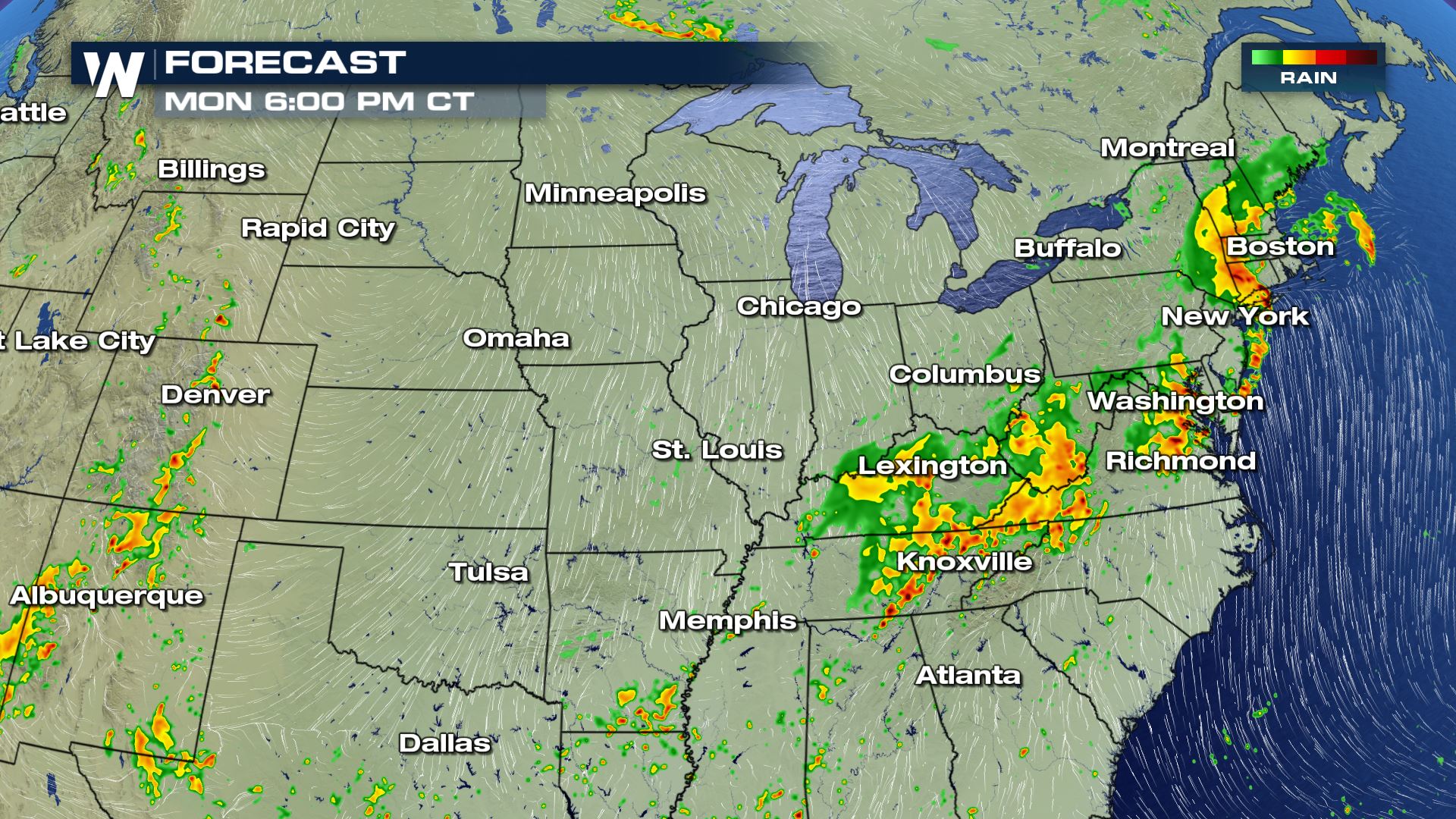
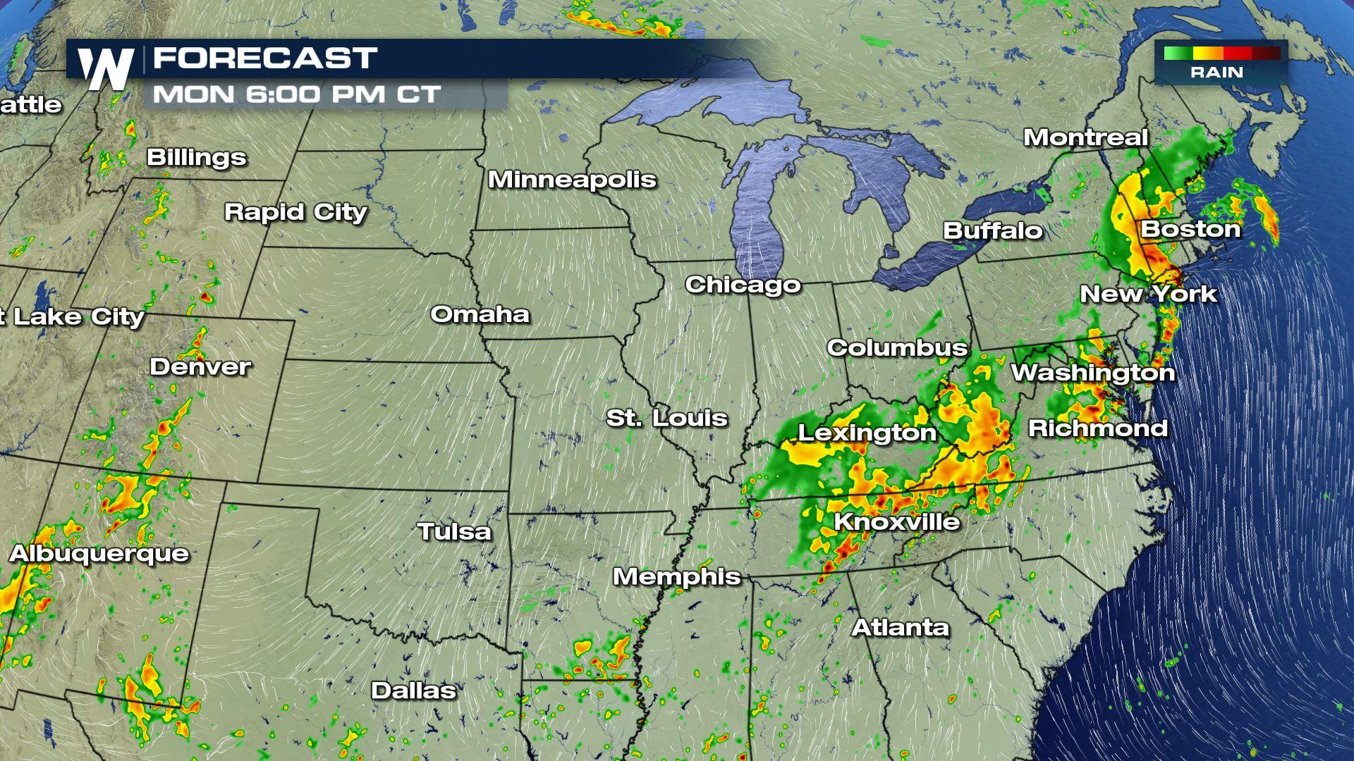
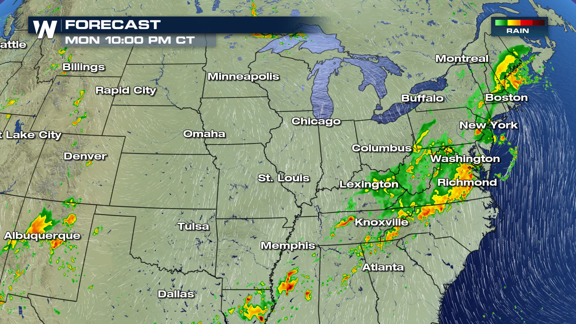 The latest timing for today's storms will be from Monday morning through Monday night. Storms could linger along the East Coast into early Tuesday morning.
Severe Outlook
A large cold front extending from New England to the Southern Plains will be the focus for showers and storms today. Areas in the Mid-Atlantic will likely have the higher chance for severe storms.
Severe Risks
Areas in the Central Rockies will have an isolated risk for hail and wind, but cities like Baltimore and New York will have a chance for scattered severe storms.
Forecast
The latest timing for today's storms will be from Monday morning through Monday night. Storms could linger along the East Coast into early Tuesday morning.All Weather News
More
Wildfire Outbreak in the Pacific Northwest
Conditions have been incredibly dry out west.
2 Aug 2026 12:20 PM


More Storms for the East Sunday and Monday
A low-pressure system crashing through the Mi
2 Aug 2026 2:20 AM

After Reaching Category 5, Genevieve Weakens in the Pacific
PacificGenevieve formed on last Friday south
2 Aug 2026 1:30 AM

Flooding, Severe Storms Target the Midwest Again
After an active week of storms across the nor
1 Aug 2026 1:40 AM

Flooding Risk Increases as Heavy Rain Targets the Tri-State Area
Tuesday, heavy rainfall moved across the Nort
30 Jul 2026 12:25 AM

Severe Weather: Energy From the Midwest Now in the Southeast
UPPER MIDWEST - Through Monday, dangerous tor
29 Jul 2026 10:30 PM