Monsoonal Moisture Brings Rainy Days to the Southwest
Top Stories
4 Jul 2021 5:45 AM
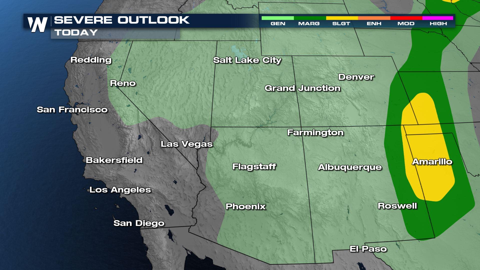
It's that time of the year in the Southwest when moisture from the tropical Pacific and Gulf of Mexico is pulled into the region around the monsoonal high. The monsoonal moisture in combination with the stalled frontal boundary have left a lot of rain across the central U.S. and Red River Valley.
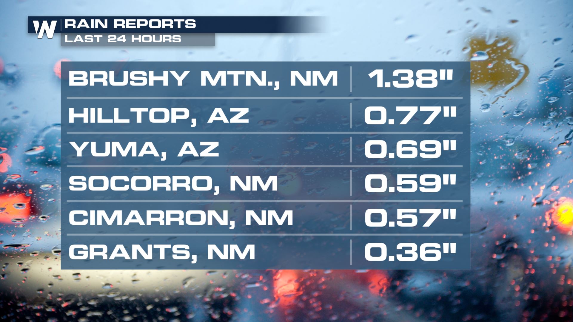
The last few days have brought pockets of moisture to the Four Corners. Just in the last 24 hours, some spots in Arizona and New Mexico have received soaking rain.
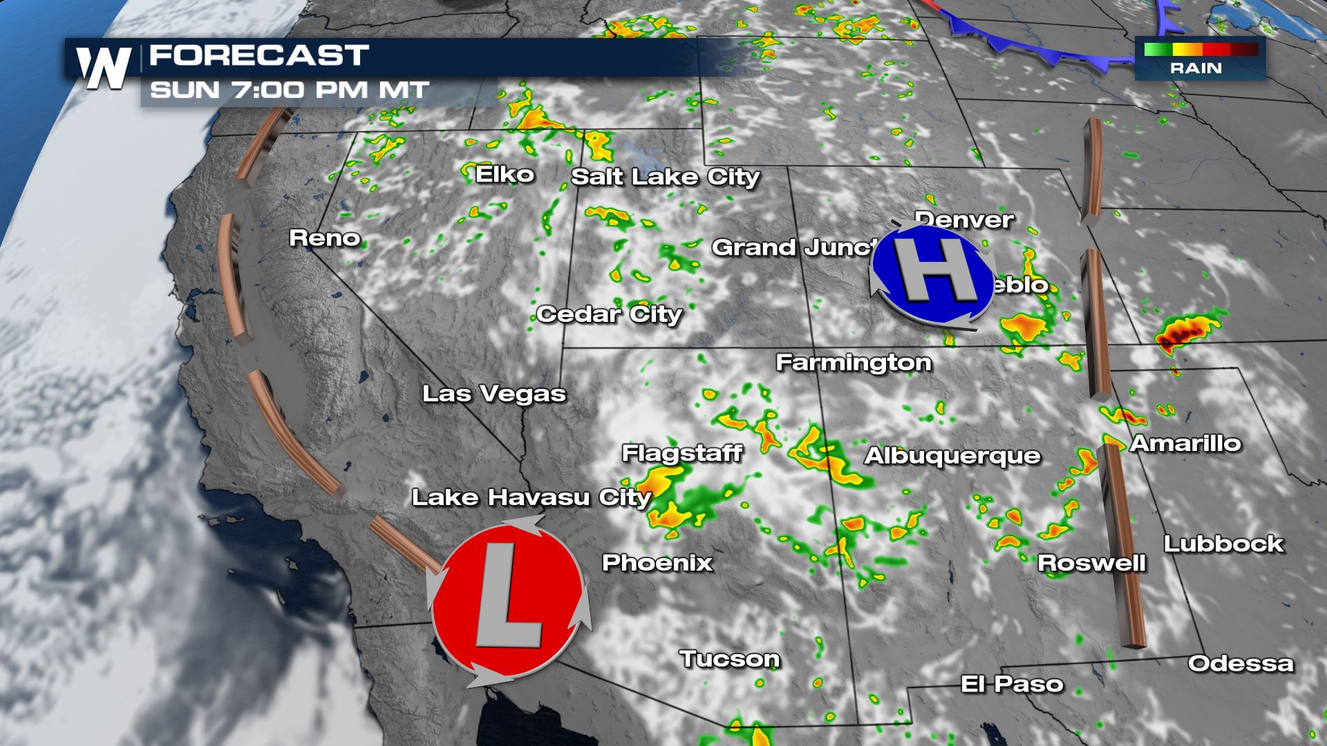
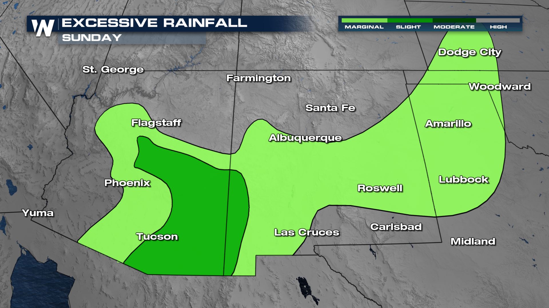 Areas near Tucson, Arizona have the highest chance for flooding today as pockets of moisture moving in from Mexico will concentrate and lead to higher rainfall rates. New Mexico has an elevated chance for flooding, by tomorrow.
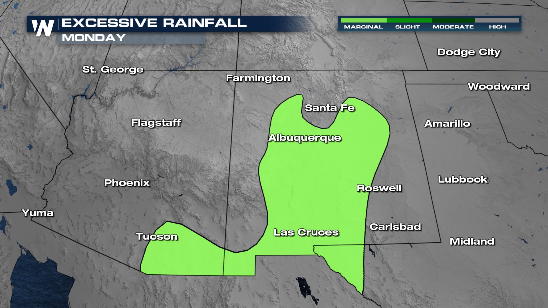 Moisture will be slightly lower across the region tomorrow, but pockets of heavy rain could result in brief flash flooding from Flagstaff to the Mexico border and for much of New Mexico.
 Rain will diminish overnight and redevelop each afternoon. Scattered but intense storms could lead to mudslides over burn scars.
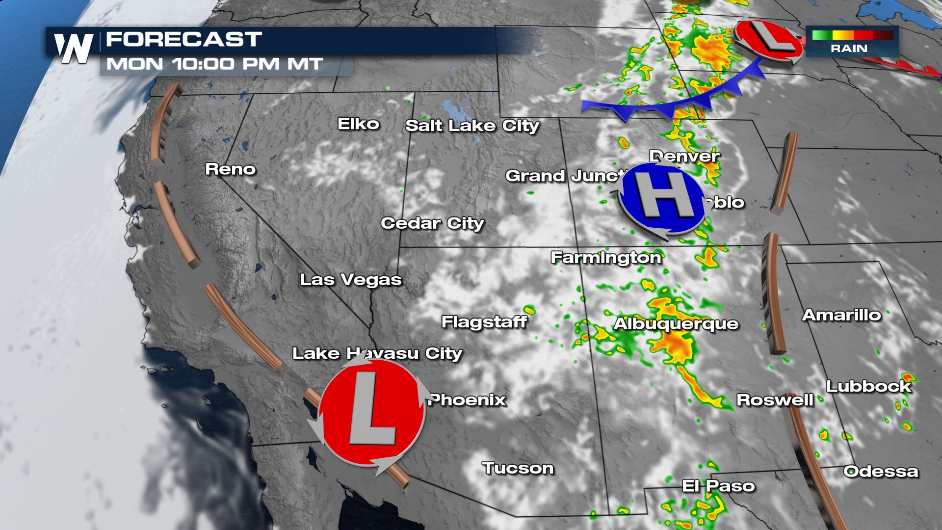 A few thunderstorms could be gusty at times or produce pea to penny size hail in addition to the heavy rain.
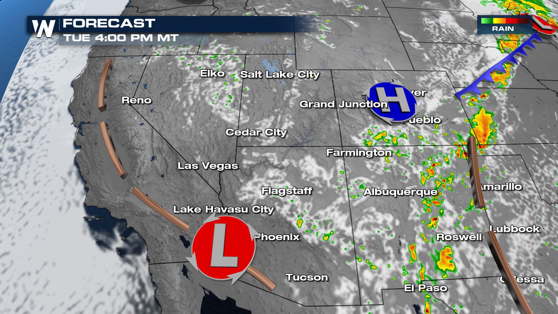 We could see an additional 1-2" of rainfall in some of stronger thunderstorms. Flash and urban flooding is possible especially in Arizona.
 Keep checking with WeatherNation for all the latest updates on the active pattern for the Southwest. Want to stream WeatherNation 24/7 for free? Here is how to STREAM
Alerts & Outlooks
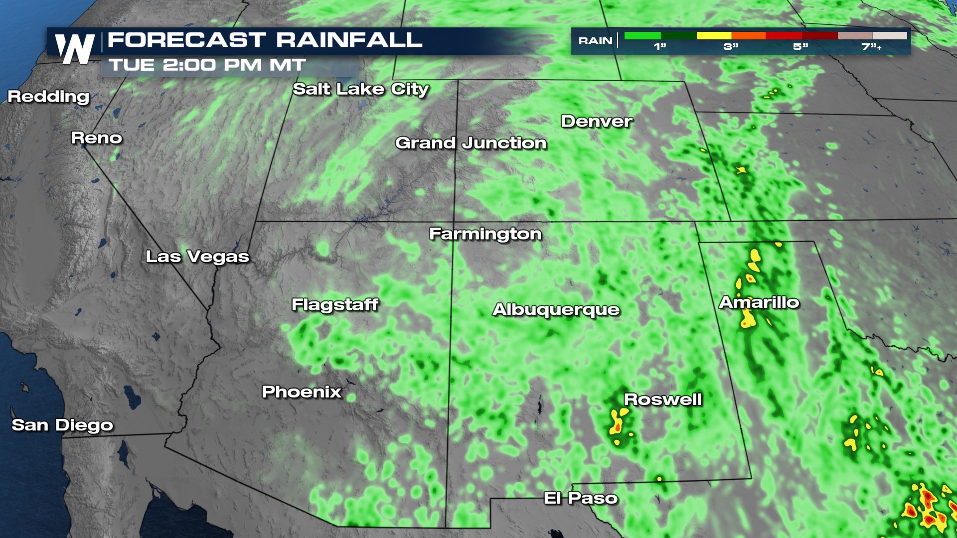
An additional 1-2" of rain will occur and create flooding concerns. These are areas that have received heavy rain over the last week too. Below are the next 2 days of rainfall outlooks, where we are anticipating the highest rainfall totals and subsequent flooding concerns.
Areas near Tucson, Arizona have the highest chance for flooding today as pockets of moisture moving in from Mexico will concentrate and lead to higher rainfall rates. New Mexico has an elevated chance for flooding, by tomorrow.
Moisture will be slightly lower across the region tomorrow, but pockets of heavy rain could result in brief flash flooding from Flagstaff to the Mexico border and for much of New Mexico.
Forecast
Heavy rain will build through the afternoon and evening, maintaining strength through sunset.
Rain will diminish overnight and redevelop each afternoon. Scattered but intense storms could lead to mudslides over burn scars.
A few thunderstorms could be gusty at times or produce pea to penny size hail in addition to the heavy rain.
We could see an additional 1-2" of rainfall in some of stronger thunderstorms. Flash and urban flooding is possible especially in Arizona.
Keep checking with WeatherNation for all the latest updates on the active pattern for the Southwest. Want to stream WeatherNation 24/7 for free? Here is how to STREAMAll Weather News
More
Wildfire Outbreak in the Pacific Northwest
SPOKANE, WA - On Saturday, August 1st, the Ol
3 Aug 2026 1:55 AM

More Storms for the East Through Monday
A low-pressure system that moved through the
3 Aug 2026 1:50 AM


After Reaching Category 5, Genevieve Weakens in the Pacific
PacificGenevieve formed last Friday south of
3 Aug 2026 12:30 AM

Flooding, Severe Storms Target the Midwest Again
After an active week of storms across the nor
1 Aug 2026 1:40 AM

Flooding Risk Increases as Heavy Rain Targets the Tri-State Area
Tuesday, heavy rainfall moved across the Nort
30 Jul 2026 12:25 AM

Severe Weather: Energy From the Midwest Now in the Southeast
UPPER MIDWEST - Through Monday, dangerous tor
29 Jul 2026 10:30 PM