Flood Threat Returns to the South
The threat of flooding will persist throughout the South, as the same weather system that brought torrential rainfall to California moves eastward. Friday afternoon and evening, severe storms in west Texas produced numerous quarter to half-dollar-size hailstones, gusts to 60 mph, and there was even a confirmed tornado in Haskell, Texas.
Although the severe threat has subsided slightly Saturday evening, storms continue to move east with the threat of gusty winds and hail. Heavy rain and flooding will also be possible, especially along the immediate Gulf coast. Thunderstorms moving across Louisiana on Saturday may put a damper on parades scheduled ahead of Mardi Gras. Most of the heavy rainfall and storms will take shape through Saturday night. The storms will continue to head farther east throughout the weekend across the Southeast and into Florida, Georgia, and the Carolinas on Sunday with locally heavy rain.
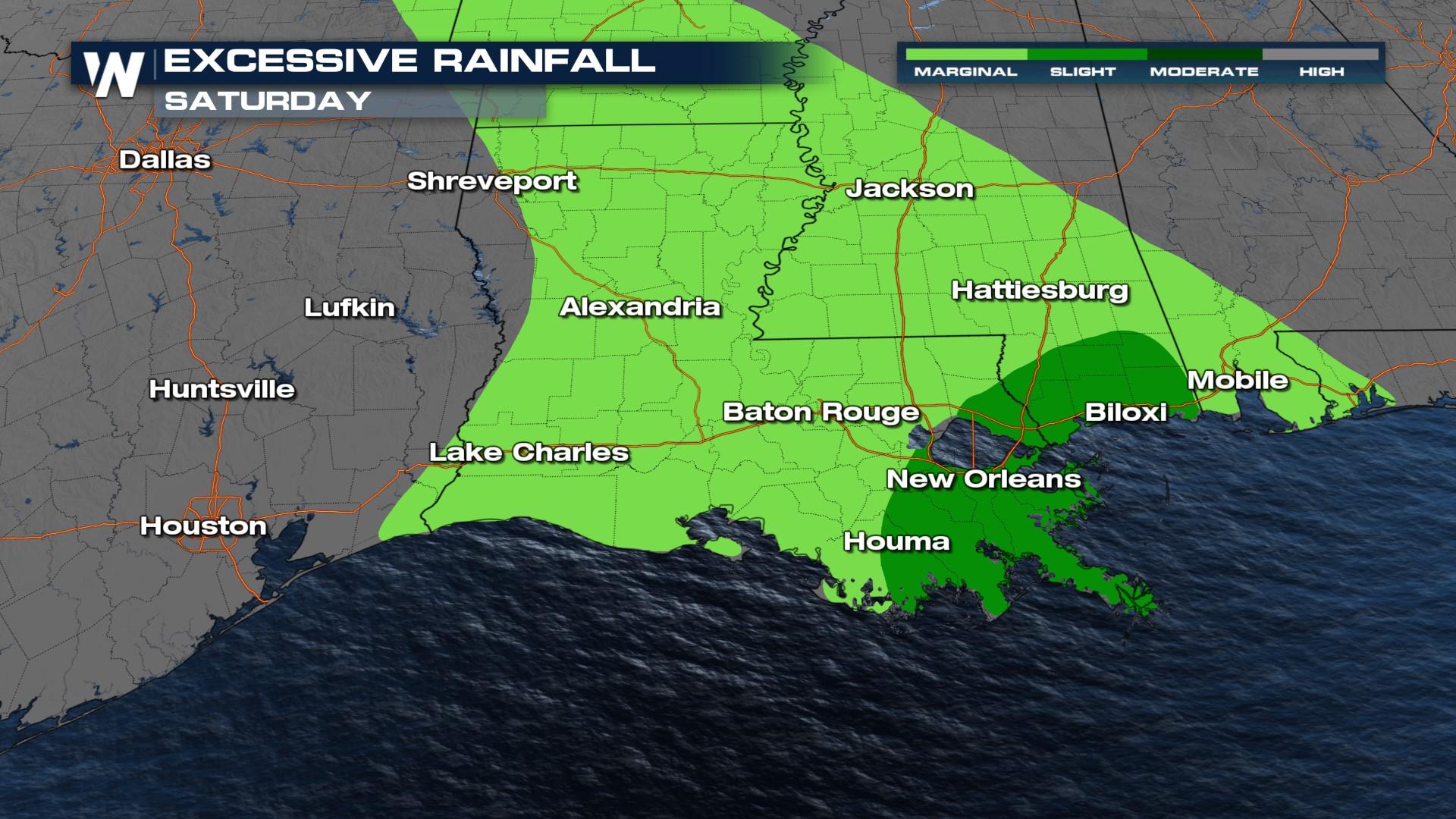
With the additional rainfall that the South gets this weekend, there will be more flooding concerns in the upcoming days. Flood warnings are in effect throughout the next few days across east Texas, Louisiana, Mississippi, Arkansas, and western Alabama. This is due to river flooding and high tributary levels. The forecast rainfall indicates that 1-2" can be widespread. However, some spots have the possibility of seeing 3"+ inches.
 The Weather Prediction Center (WPC) has highlighted the area in dark green as an area particularly prone to flooding. The WPC's Excessive Rainfall Outlook takes into account multiple factors: ground saturation, river levels, forecasted rainfall, etc. The Slight Risk of Excessive Rainfall areas from Houston to New Orleans will be one to watch with us LIVE on VIPIR Radar on WeatherNation.
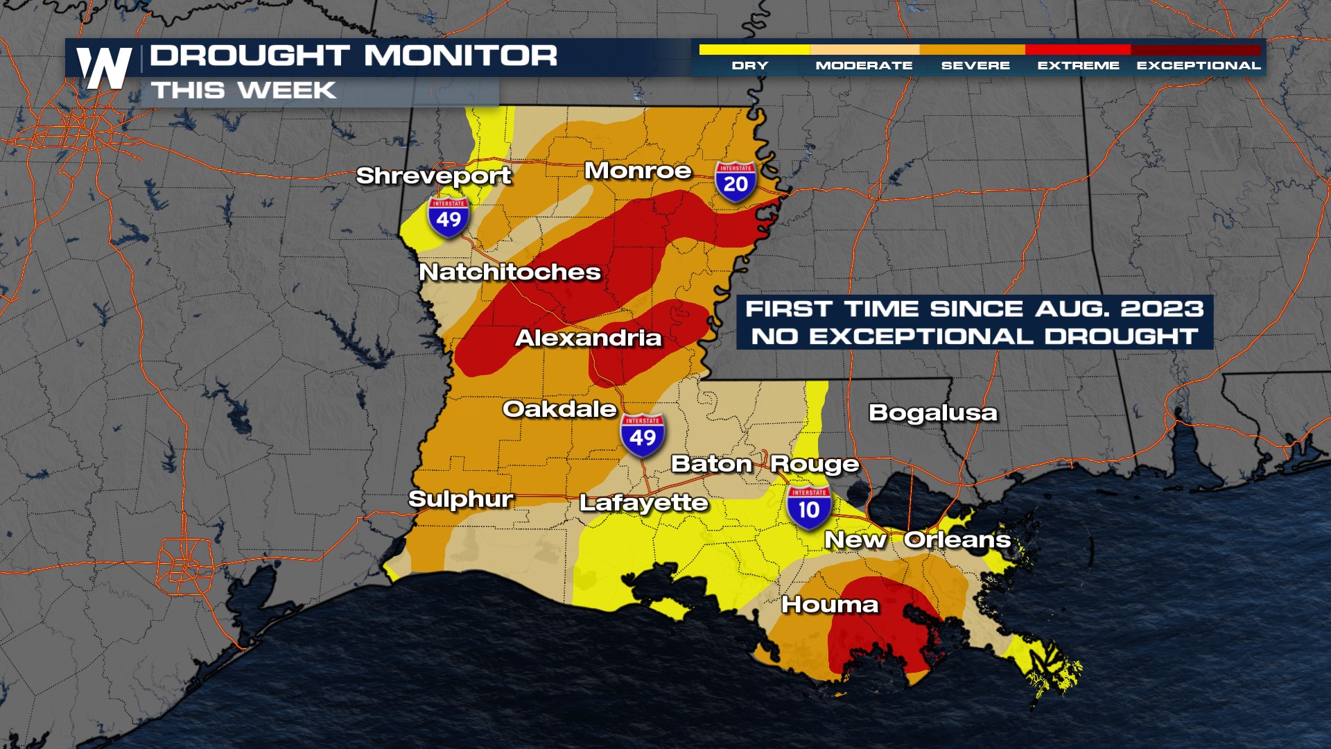
 The good news out of this is that the "Exceptional Drought" category, the worst and the driest, has been removed from the state of Louisiana for the first time since August of 2023.
 Make sure you keep an eye on this upcoming forecast, and take any weather alerts seriously.


