More Snow & Cold for the Front Range and High Plains
Special Stories
30 Oct 2019 7:30 AM
https://www.facebook.com/WeatherNation/videos/411271606227815/
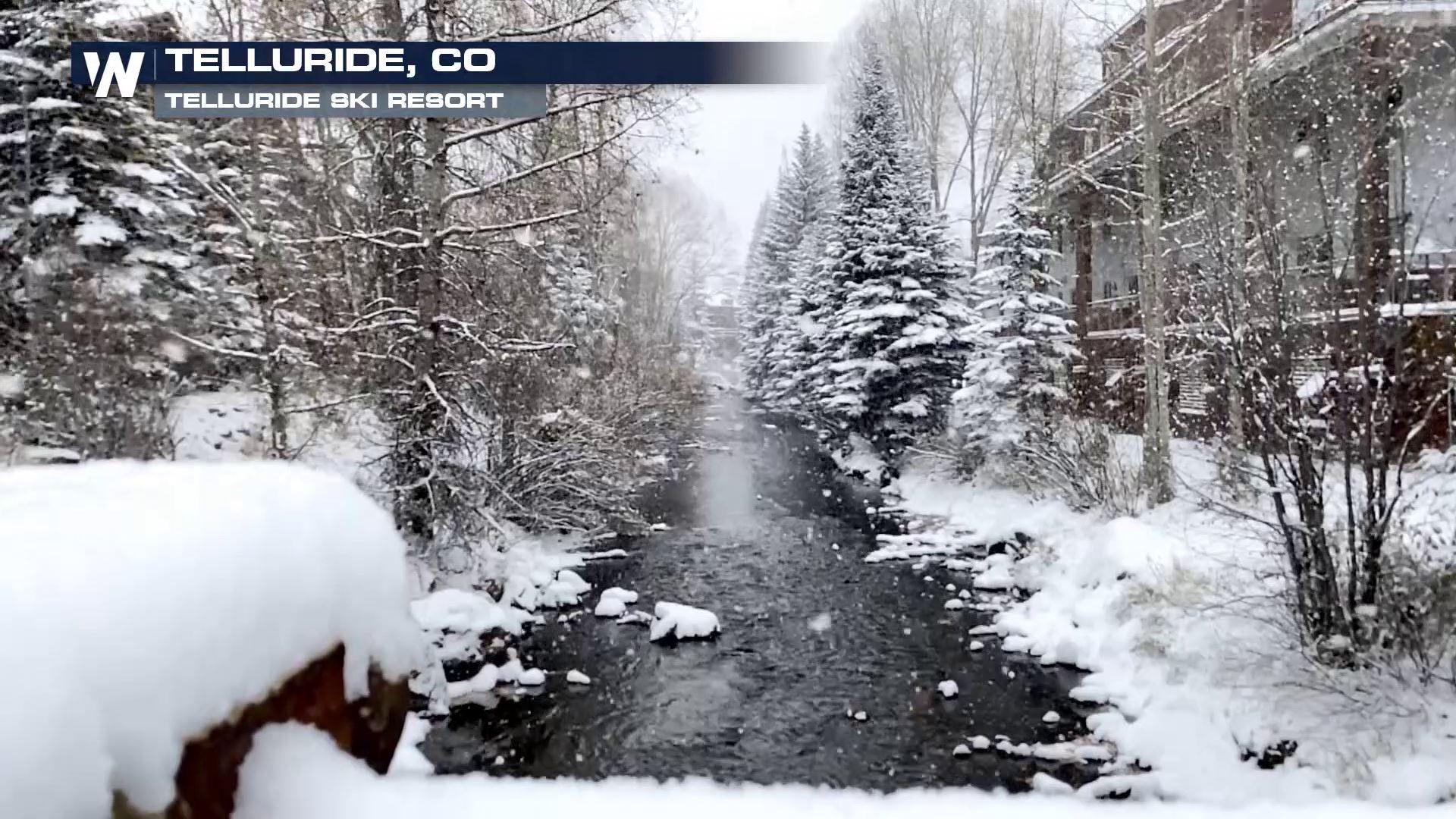
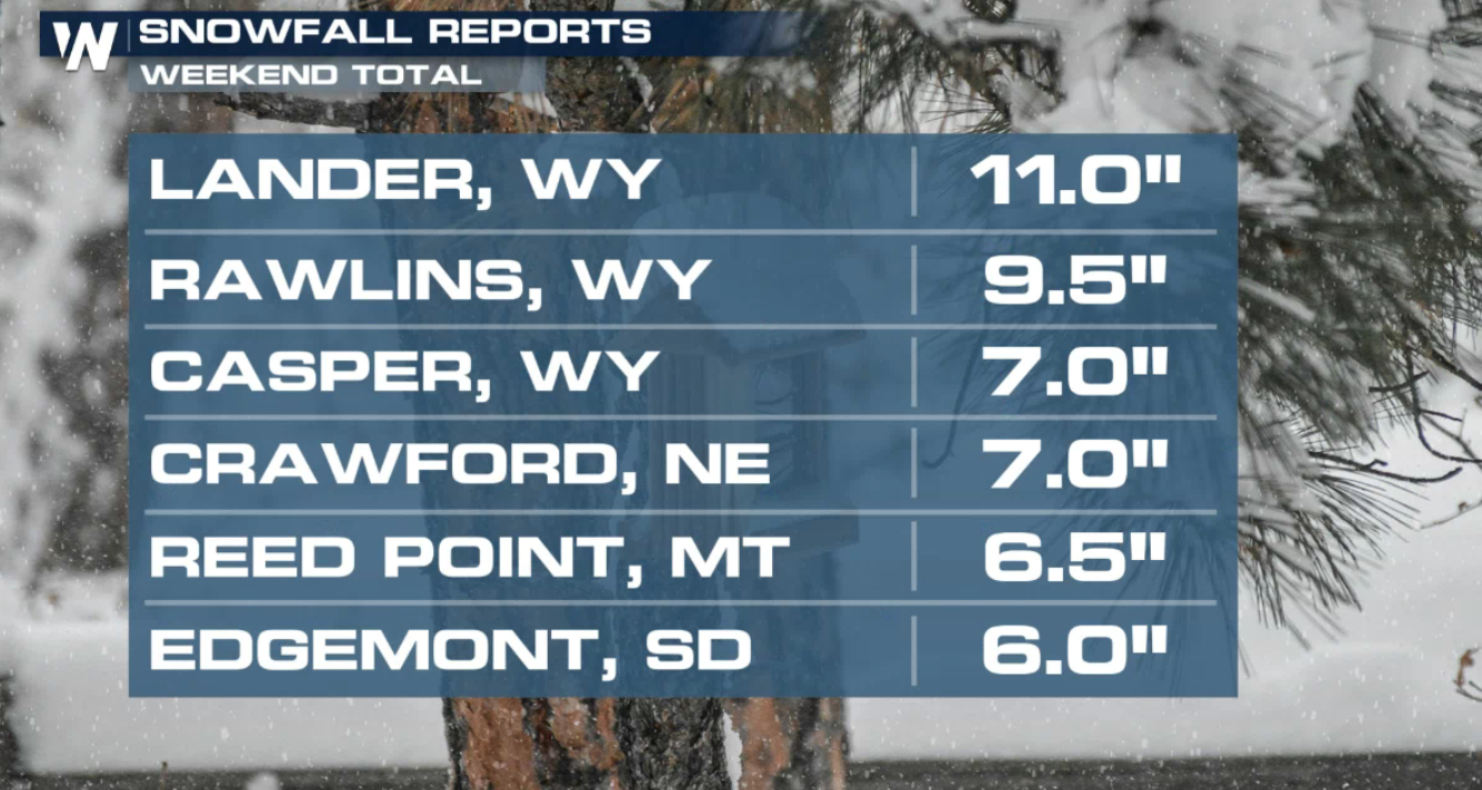
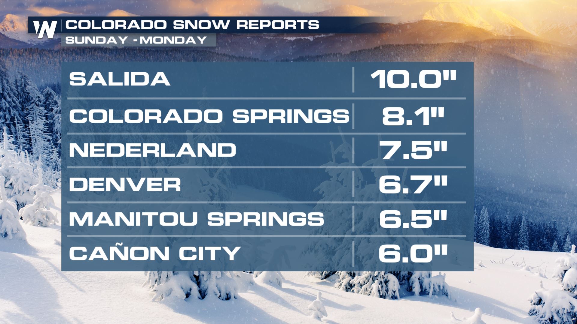
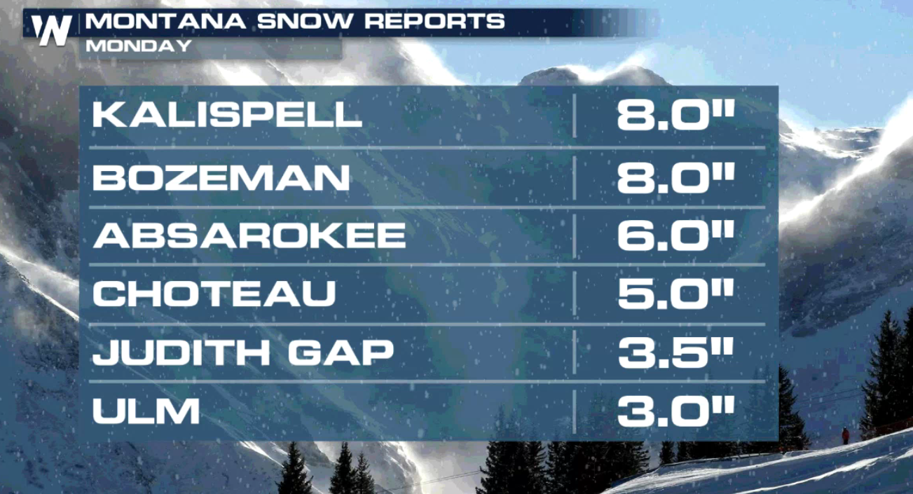
Another shot of cold and snowy conditions are in the forecast for the Rockies and High Plains after a powerful cold front moved through the area to start the week. Several areas in Colorado, Wyoming and Montana picked up 6" to 12" of snow this weekend and Monday.
 The National Weather Service, or NWS, has issued widespread Winter Weather Advisories for more moderate to heavy snow and some areas of ice. Very cold air will move south from Canada, dropping temperatures to record setting levels. Roads will likely become slick and snow-packed, so allow yourself extra travel time if you're in the area over the next few days!
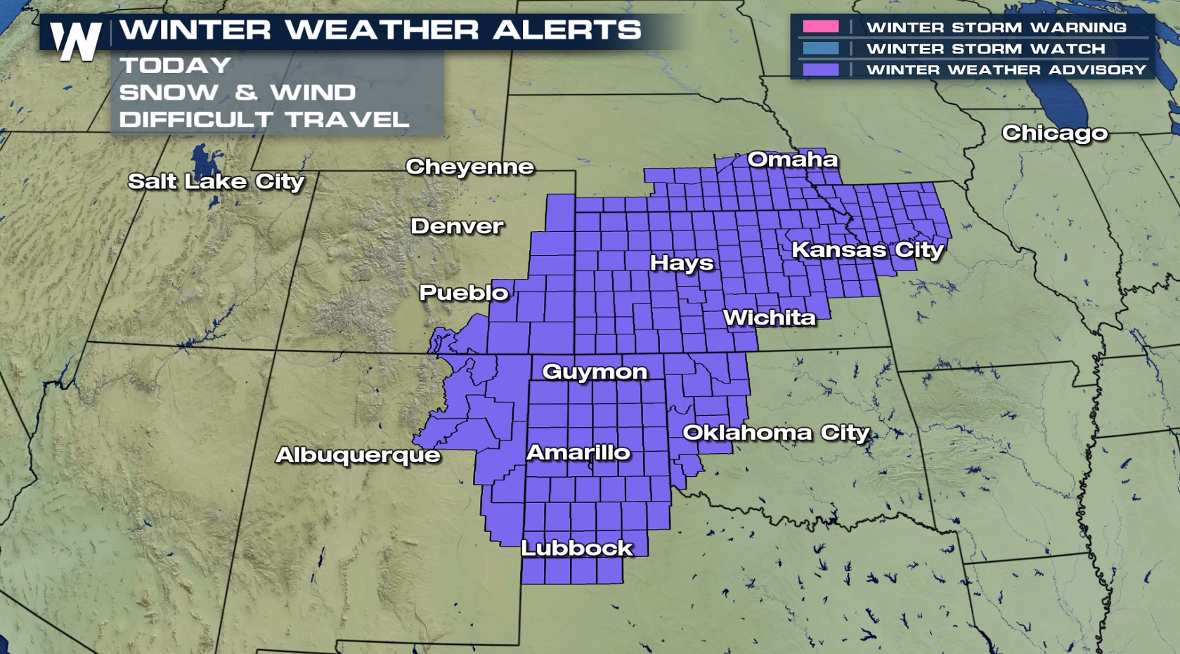 Moderate to heavy snow will remain in the forecast from the Colorado Rockies and Front Range into the Plains. Roadways will likely become slick, causing hazardous and difficult driving conditions throughout the area as system moves east.
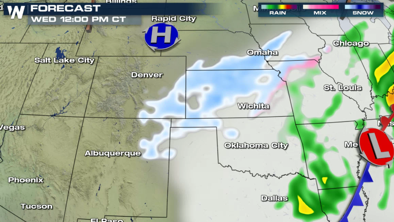
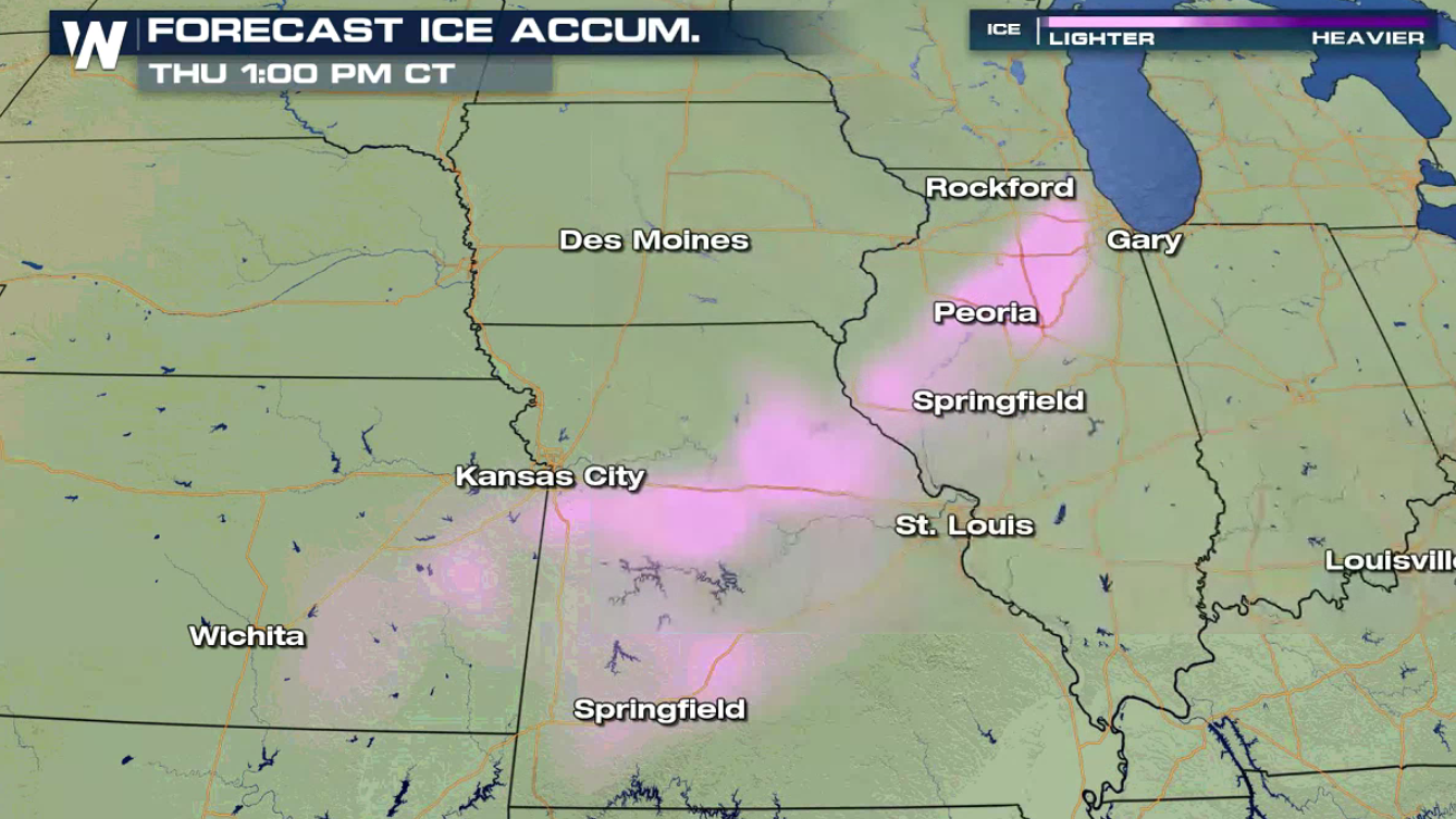
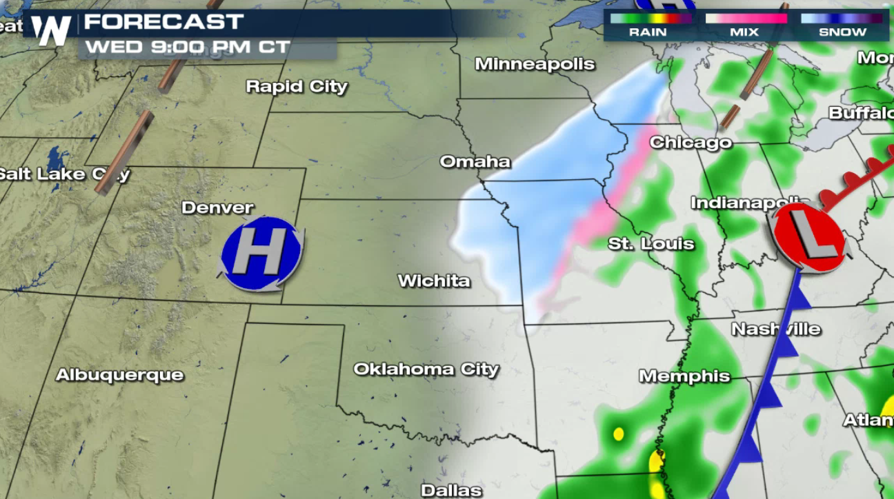 Impressive snowfall accumulations are projected through the middle of the week. Note the darker shades of pink and purple, representing 6" to 12" of snow! A few icy areas are possible in the Central Plains.

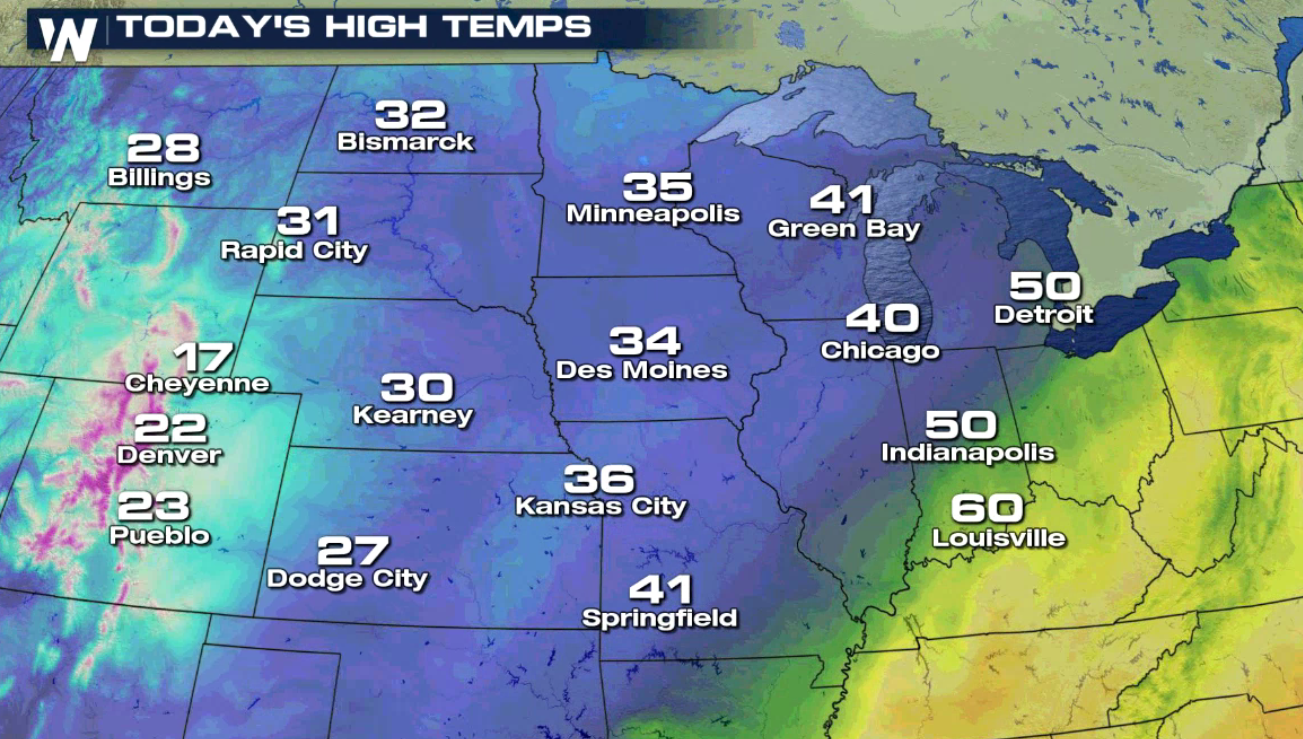
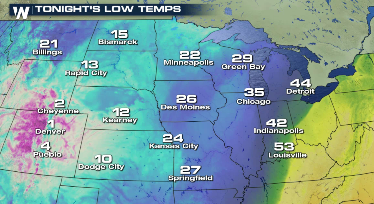
 A blast of cold air following the storm will keep much of the west in a deep freeze. In fact, multiple locations could see record setting low temperatures. Some may even drop below zero.
 It's important to get your car ready for winter weather travel heading into the colder months.
Here’s some advice from AAA to go over before you drive on wet, snowy, and icy roads.
It's important to get your car ready for winter weather travel heading into the colder months.
Here’s some advice from AAA to go over before you drive on wet, snowy, and icy roads.
The National Weather Service, or NWS, has issued widespread Winter Weather Advisories for more moderate to heavy snow and some areas of ice. Very cold air will move south from Canada, dropping temperatures to record setting levels. Roads will likely become slick and snow-packed, so allow yourself extra travel time if you're in the area over the next few days!
Moderate to heavy snow will remain in the forecast from the Colorado Rockies and Front Range into the Plains. Roadways will likely become slick, causing hazardous and difficult driving conditions throughout the area as system moves east.
Impressive snowfall accumulations are projected through the middle of the week. Note the darker shades of pink and purple, representing 6" to 12" of snow! A few icy areas are possible in the Central Plains.
A blast of cold air following the storm will keep much of the west in a deep freeze. In fact, multiple locations could see record setting low temperatures. Some may even drop below zero.
It's important to get your car ready for winter weather travel heading into the colder months.
Here’s some advice from AAA to go over before you drive on wet, snowy, and icy roads.
- Do not drive if you are tired. Make sure you are well rested before getting behind the wheel
- If you warm up your vehicle before you head out, make sure to do it in an open area and never in a garage
- Check your tires, make sure they have the proper amount of air in them
- If there is a small amount of gas in your tank, the gas line could freeze up. Make sure you have it at least halfway filled
- Do NOT use cruise control when the road is slippery
- Always wear a seatbelt
- Take it slow, it will help you maneuver the car on snowy and icy roads as the time it takes to stop is much longer once you start to slide
- Increase the amount of space between other cars and yourself. This will give you a longer distance if you must stop or start to slide
- Know what kind of breaks you have in your car. Threshold breaking is the best way to stop using the ball of your foot to apply steady pressure on the breaks
- If you can avoid driving when the weather is bad, sometimes staying in is the best decision.
All Weather News
More

Severe Storms, Flash Flooding Overnight In Midwest
WHAT TO EXPECTIt was a very active day across
22 Jun 2026 1:50 AM


Summer Solstice Kicks Off Father's Day Sunday
Fathers across the country will have to share
21 Jun 2026 5:20 PM

Flood Risk Continues This Weekend for the Gulf Coast States
Numerous flash flood warnings were issued as
21 Jun 2026 1:15 PM

Dry T-Storms & Fire Danger in the West
A weak low-pressure system moving through the
20 Jun 2026 1:40 PM

Tornadoes Tear Through The Midwest, Isolated Severe Storms in the South
EARLIER THIS WEEKMONTROSE, IL - A dangerous t
20 Jun 2026 1:30 AM