More Snow on the Way!
Top Stories
4 Nov 2018 1:53 PM
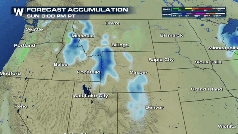
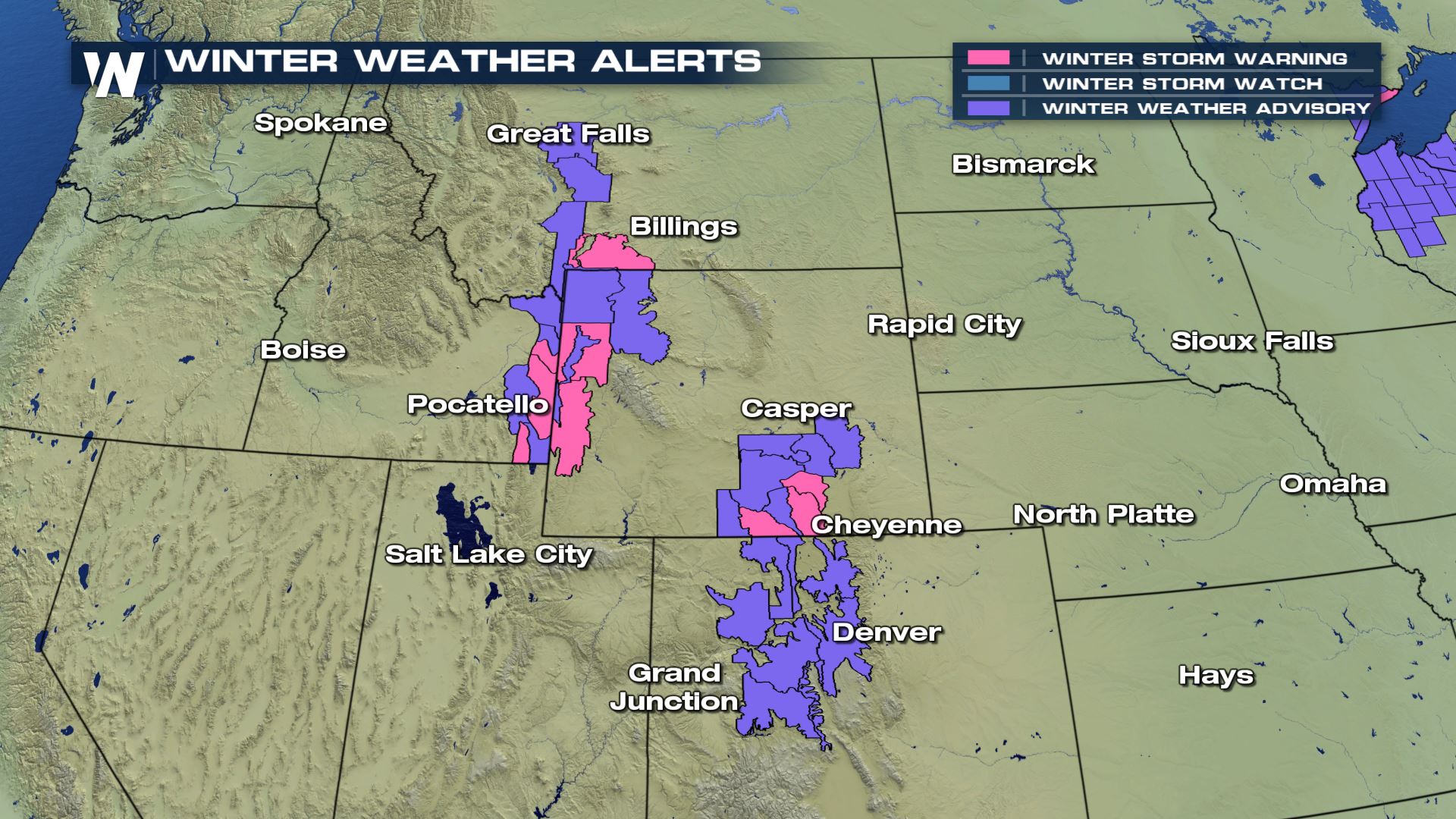
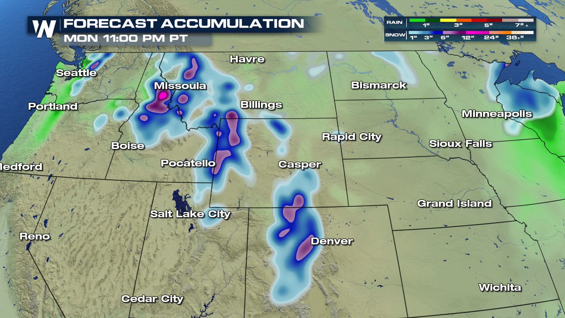
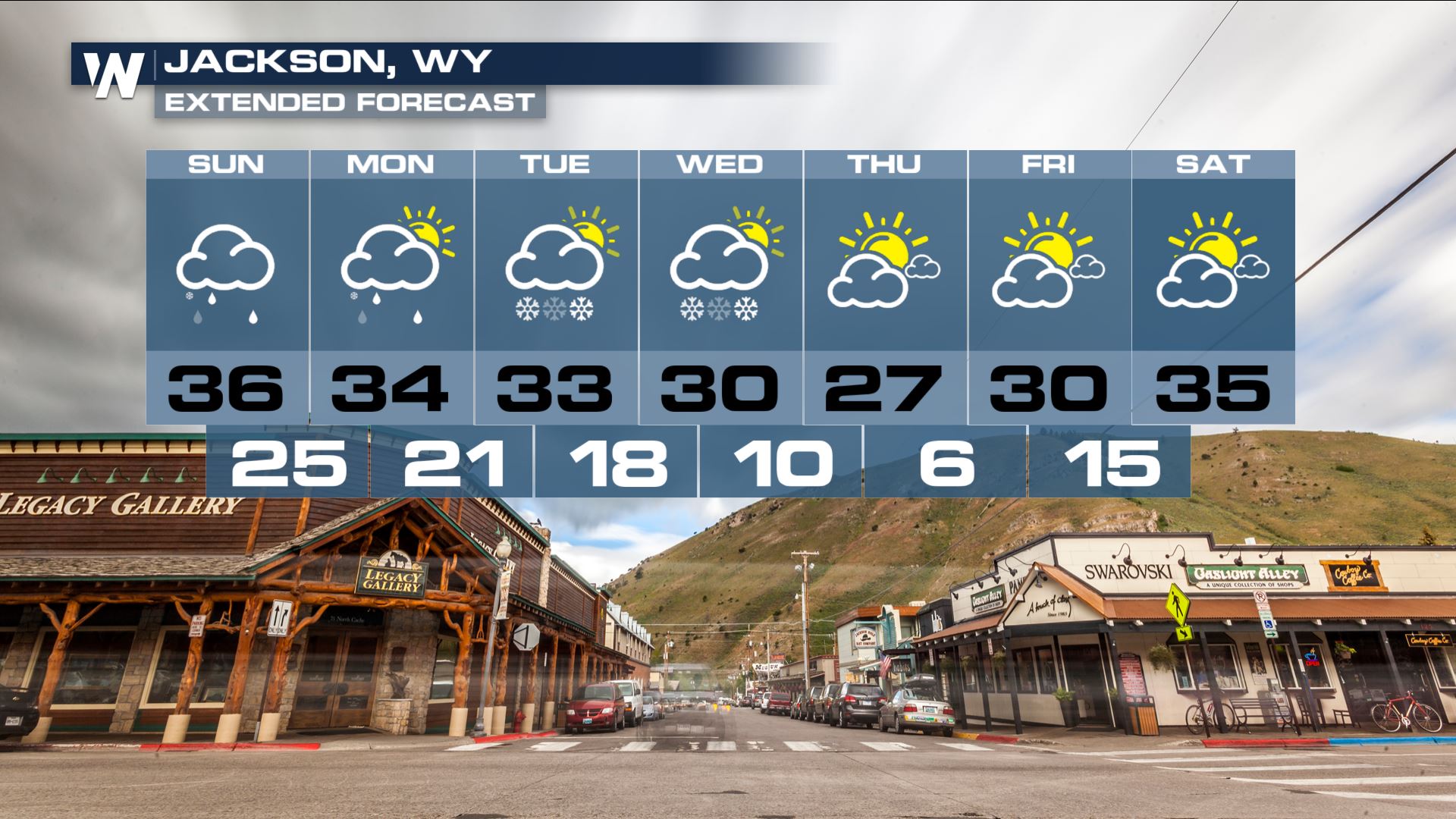
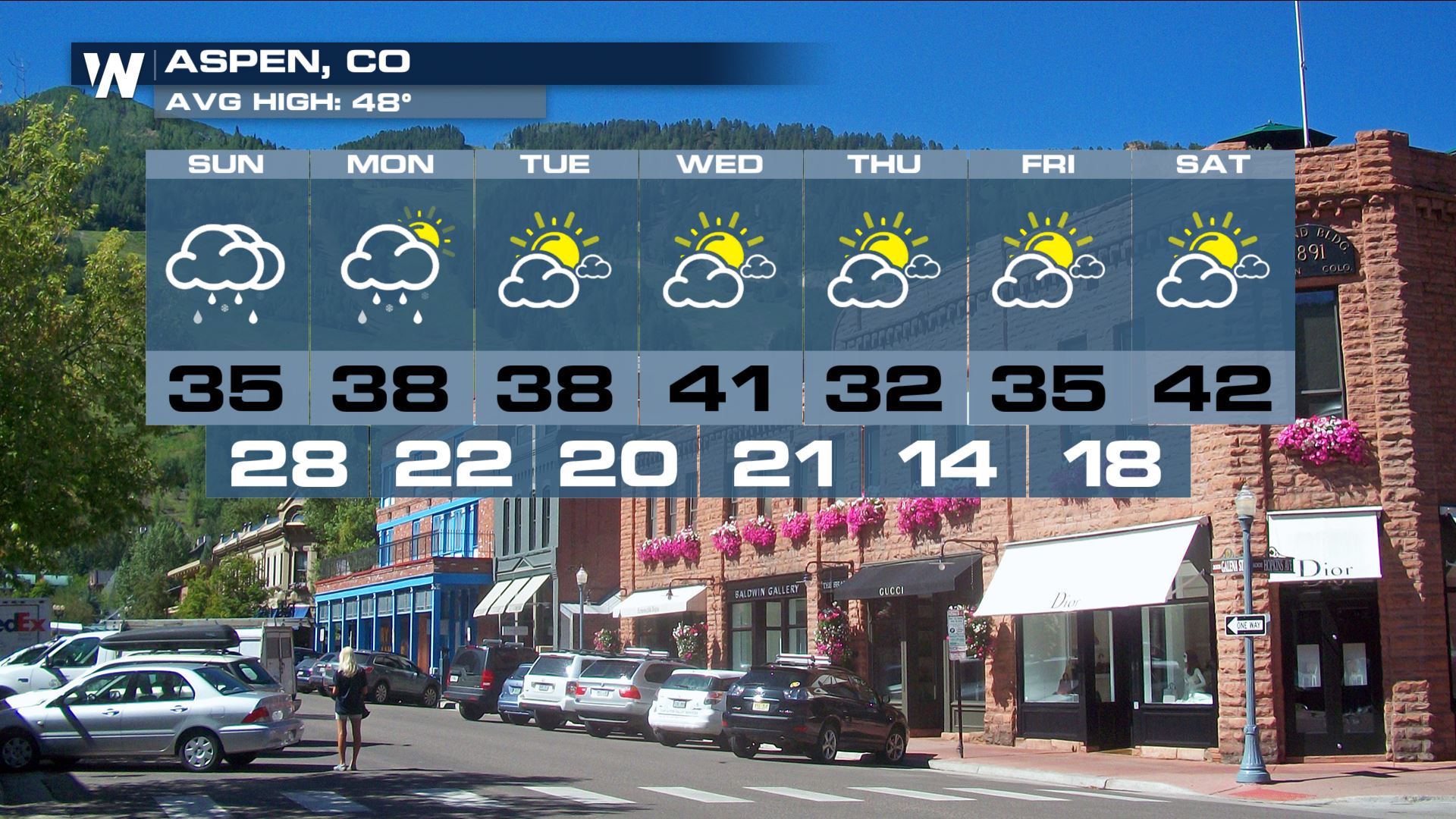
An active pattern is setting up across the West. Multiple systems will move through returning the chance for heavy snow in the higher elevations. Winter Weather Alerts are posted from the northern Rockies and south to Colorado. Elevations above 8000 ft could see a foot or more of snow Sunday into Monday. The heavy snow combined with strong winds will make for poor visibility.
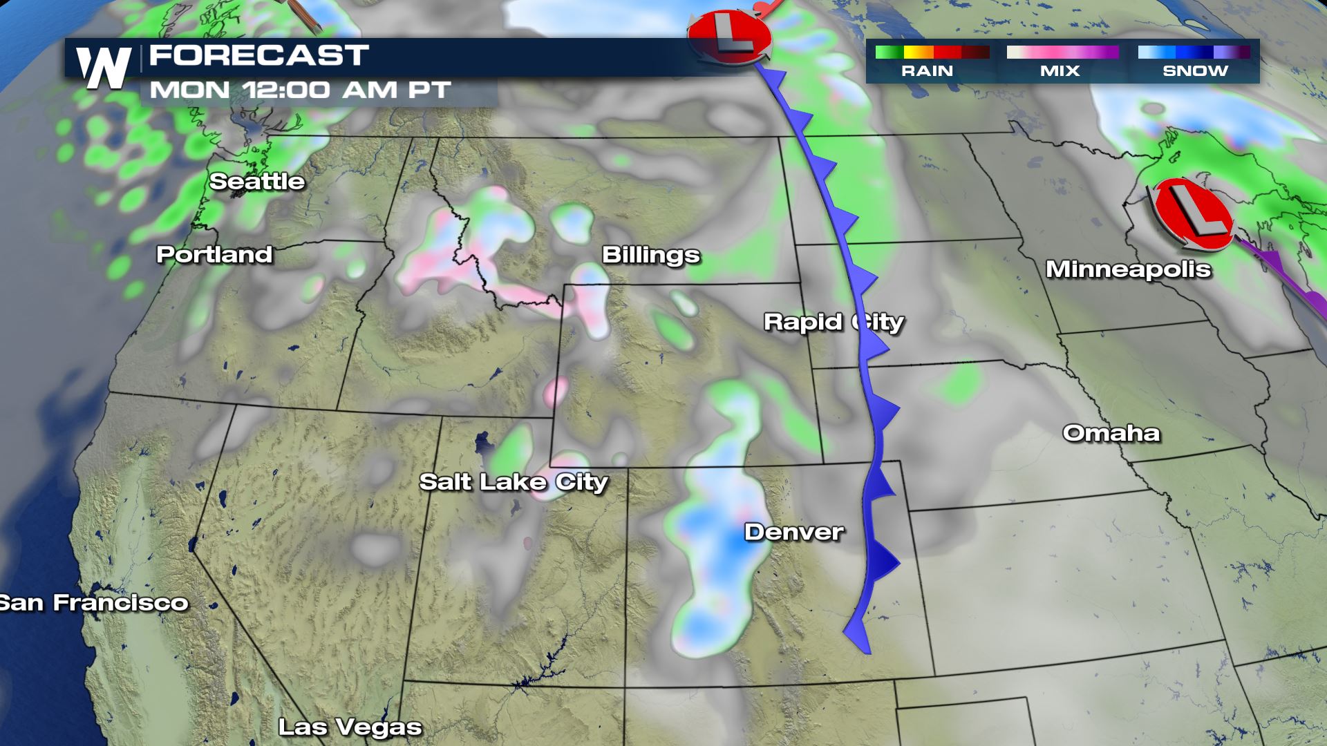
 As a cold front moves eastward, snow and rain will break out. Snow will be for elevations over 8000 ft.
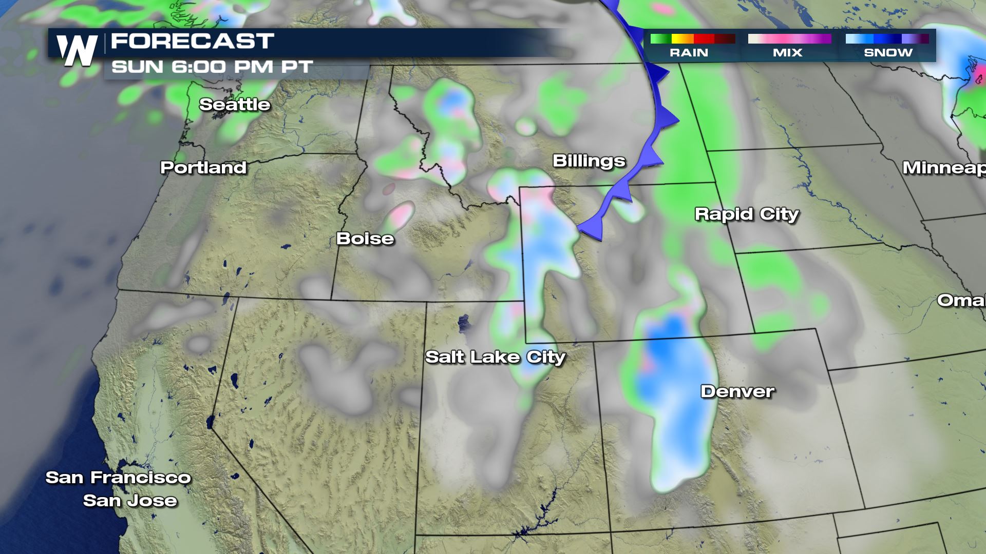 While some spots have already been seeing the snow the past few days, the heaviest will be late Sunday into early Monday.
 Most spots can expect about 6-12" but higher elevations could see close to 2 feet of snow! That's some great news for the skiers and snowboarders ready for the new season. This is also just one of many snow chances for some spots this week.
 For WeatherNation, Meteorologist Kate Mantych
As a cold front moves eastward, snow and rain will break out. Snow will be for elevations over 8000 ft.
While some spots have already been seeing the snow the past few days, the heaviest will be late Sunday into early Monday.
Most spots can expect about 6-12" but higher elevations could see close to 2 feet of snow! That's some great news for the skiers and snowboarders ready for the new season. This is also just one of many snow chances for some spots this week.
For WeatherNation, Meteorologist Kate MantychAll Weather News
More
Flooding Risk Increases as Heavy Rain Targets the Tri-State Area
Tuesday, heavy rainfall moved across the Nort
30 Jul 2026 12:25 AM


Genevieve Down to a Category 2 Hurricane
PacificFausto is now a post-tropical cyclone.
30 Jul 2026 12:00 AM

Severe Weather: Energy From the Midwest Now in the Southeast
UPPER MIDWEST - Through Monday, dangerous tor
29 Jul 2026 10:30 PM


Southeast Flood Risk Lingers Near Stalled Front
A stalled boundary over the Southeast will ke
25 Jul 2026 10:55 AM

Another Round of Storms Targets the Northeast
Tuesday brought severe weather again across p
23 Jul 2026 1:15 AM