More Snow to Add to the Sierra Snowpack
Special Stories
6 Jan 2021 3:00 AM
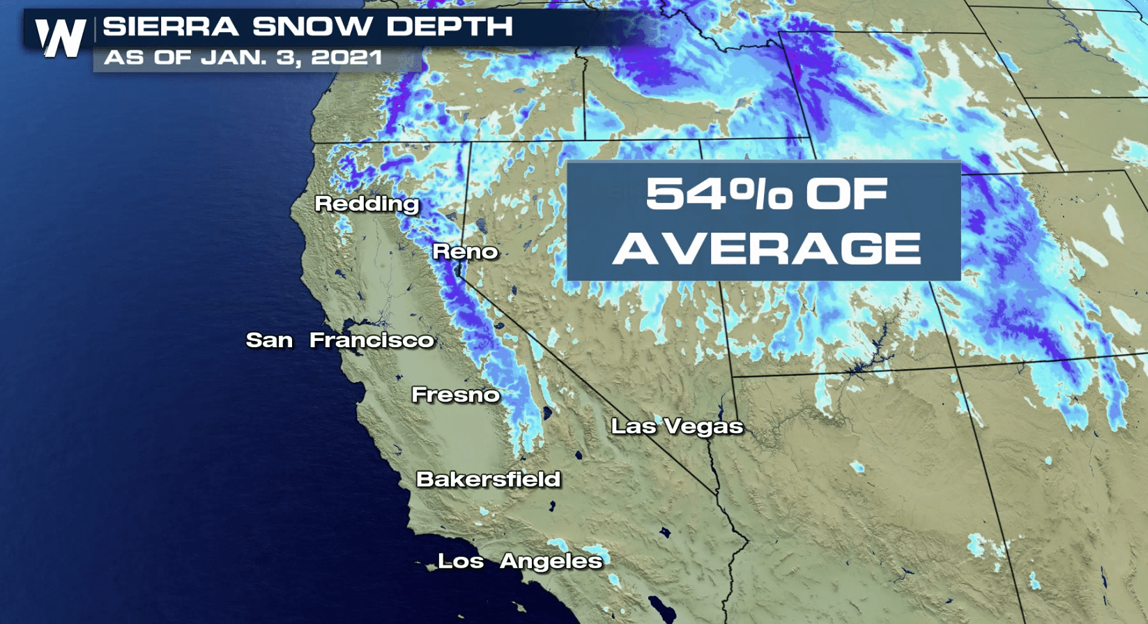
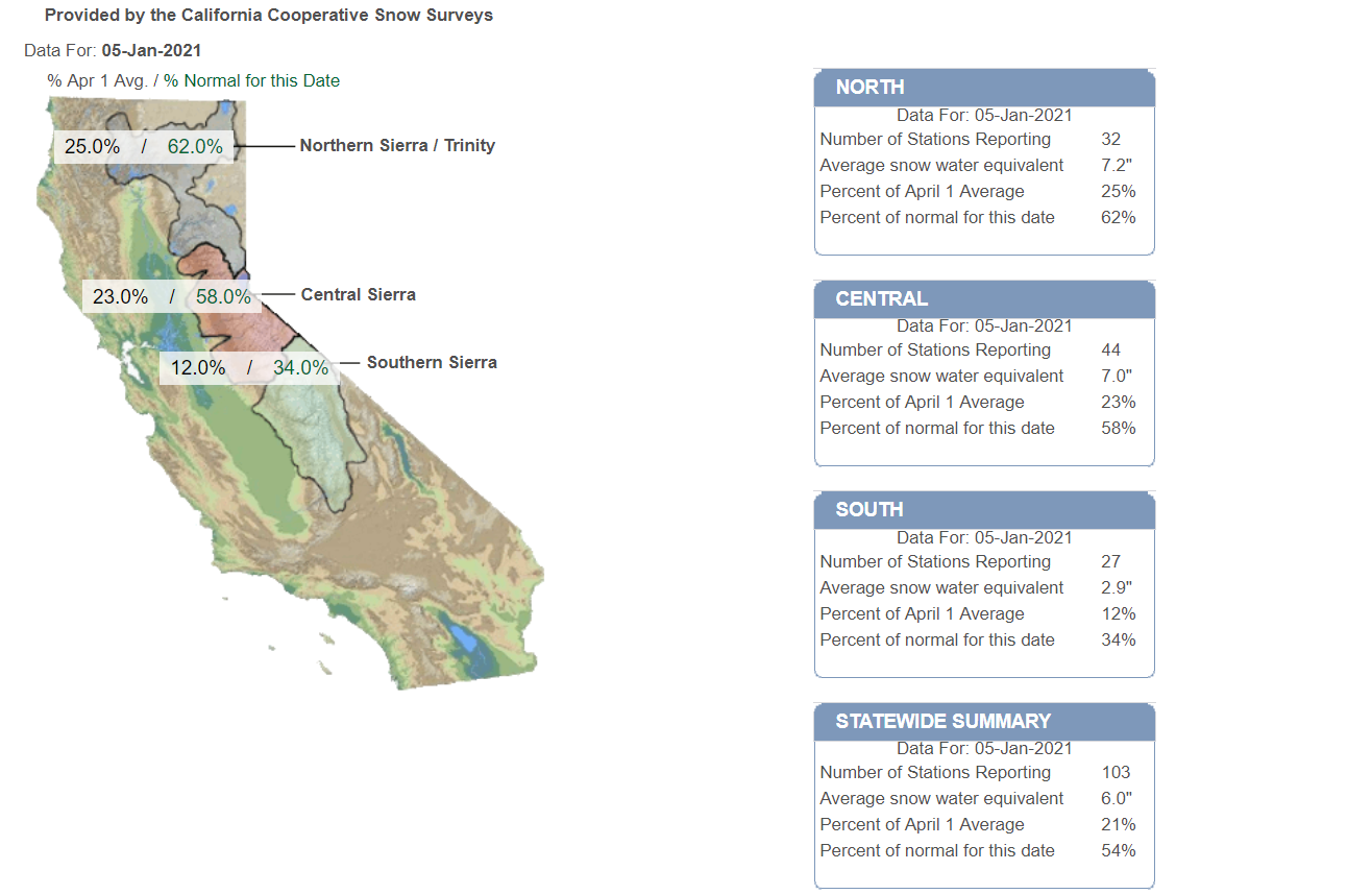
The snowpack in the Sierra Nevada and northern California remains below average for this time of year, but with more moisture ahead, some improvement is expected over the next few days. The recent storm system that moved through earlier this week improved some areas by as much as 10%.
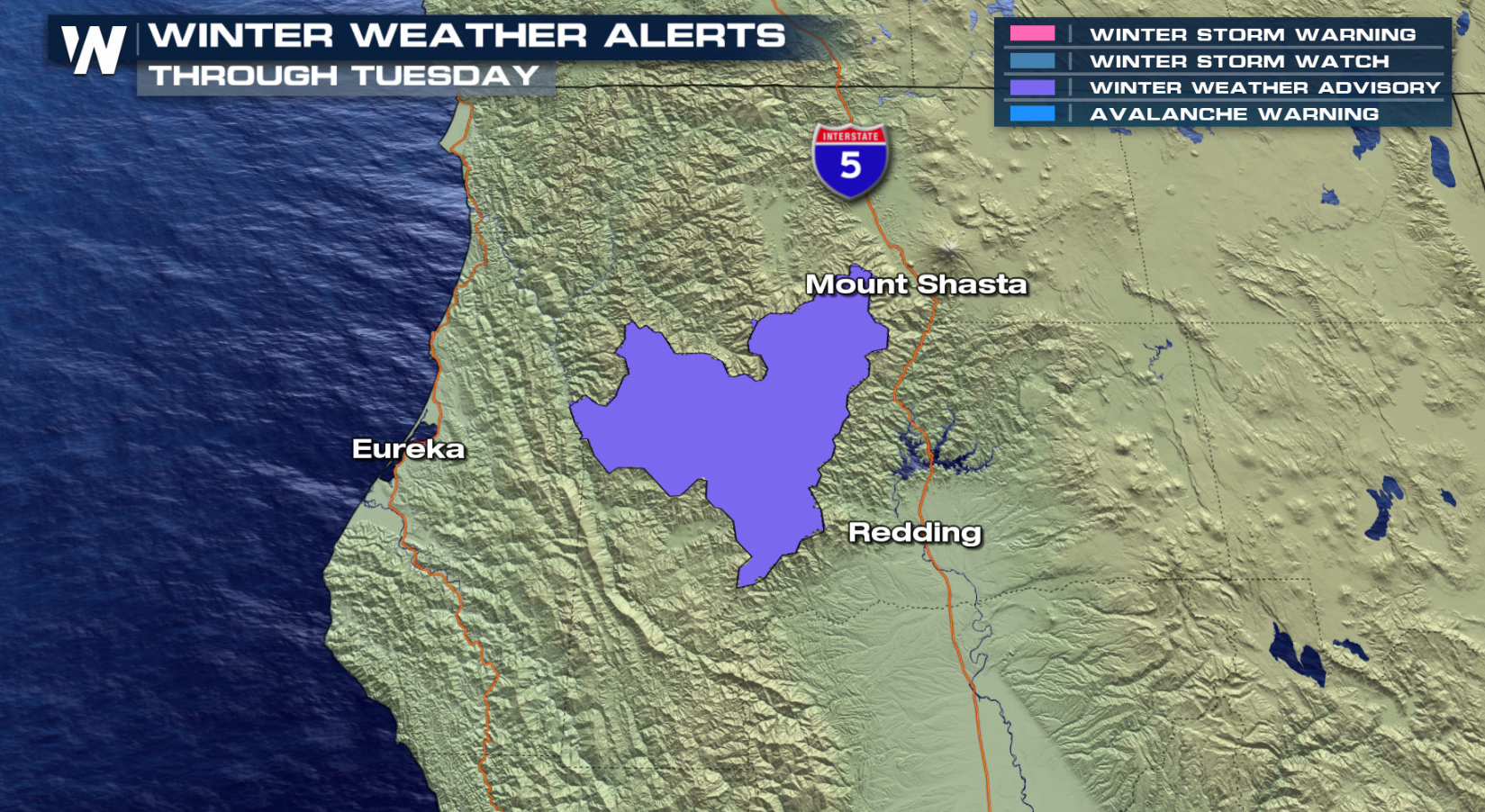
 Winter weather alerts continue near Mount Shasta around Scott Mountain Summit through this evening. Up to 6" of new snowfall is possible.
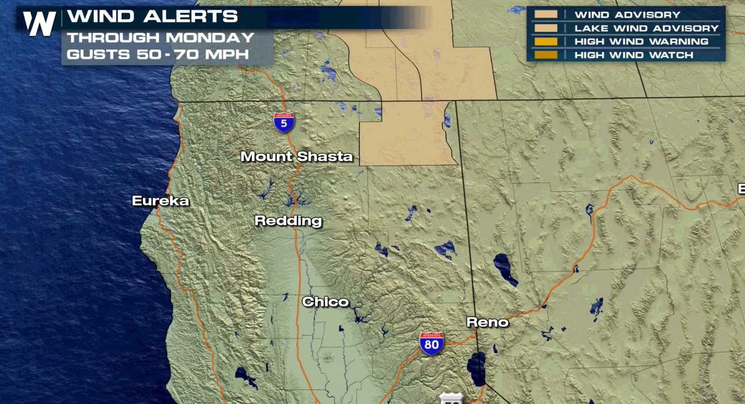
 The front will also bring strong winds so power outages will be possible. Wind alerts remain in place east and north of Mount Shasta.
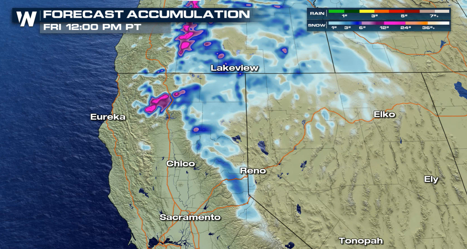
 Additional snowfall totals will be 3" to 6", especially for areas above 6,000 feet today in Trinity County. Another surge of moisture will bring snow to the region Friday.
 Stay with WeatherNation for the latest updates.
Winter weather alerts continue near Mount Shasta around Scott Mountain Summit through this evening. Up to 6" of new snowfall is possible.
The front will also bring strong winds so power outages will be possible. Wind alerts remain in place east and north of Mount Shasta.
Additional snowfall totals will be 3" to 6", especially for areas above 6,000 feet today in Trinity County. Another surge of moisture will bring snow to the region Friday.
Stay with WeatherNation for the latest updates.All Weather News
More
Massive Fires Burn in the Four Corners
The Aspen Acres fire burning in Southern Colo
1 Jul 2026 7:25 PM

Storms Spark up in the Northeast Ahead of Heatwave
Severe storms will be possible as we head tow
1 Jul 2026 7:25 PM

Dangerous Stretch of Heat Leads Us to the 4th
The hottest temperatures of the year are loom
1 Jul 2026 7:20 PM

Severe Storms Keep Northern U.S. Active
Winds hit 85 mph in Nebraska in the last 24 h
1 Jul 2026 7:10 PM

Slow-Moving Front No Longer Expected to Develop Tropically, Monitoring Eastern Pacific
Early in the season, we watch closer to the c
30 Jun 2026 9:00 PM

'MCS' Season Brings Severe and Flooding Threats Across the Southeast
As Summer settles in across the Central U.S.,
28 Jun 2026 2:10 AM

Severe Threat Tracks into the Northeast Friday
Another day, another Illinois tornado. That's
26 Jun 2026 2:25 AM