More West Coast Storms Are on the Way
Special Stories
21 Mar 2020 5:01 PM
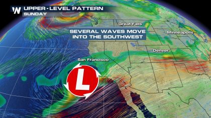
We’re tracking another active weather pattern that will affect the Western U.S. The first storm will bring rain to Southern California while a second storm will bring rain and mountain snow to the Pacific Northwest. Here’s a look at where the storm will make landfall on Sunday that brings rain to the Central California Coast.
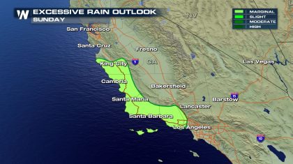
 Be aware that there is a very small threat, a marginal risk, for possible flooding from rain forecast on Sunday.
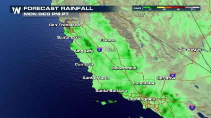
 Here’s a look at our forecast for how much rain is to be expected.
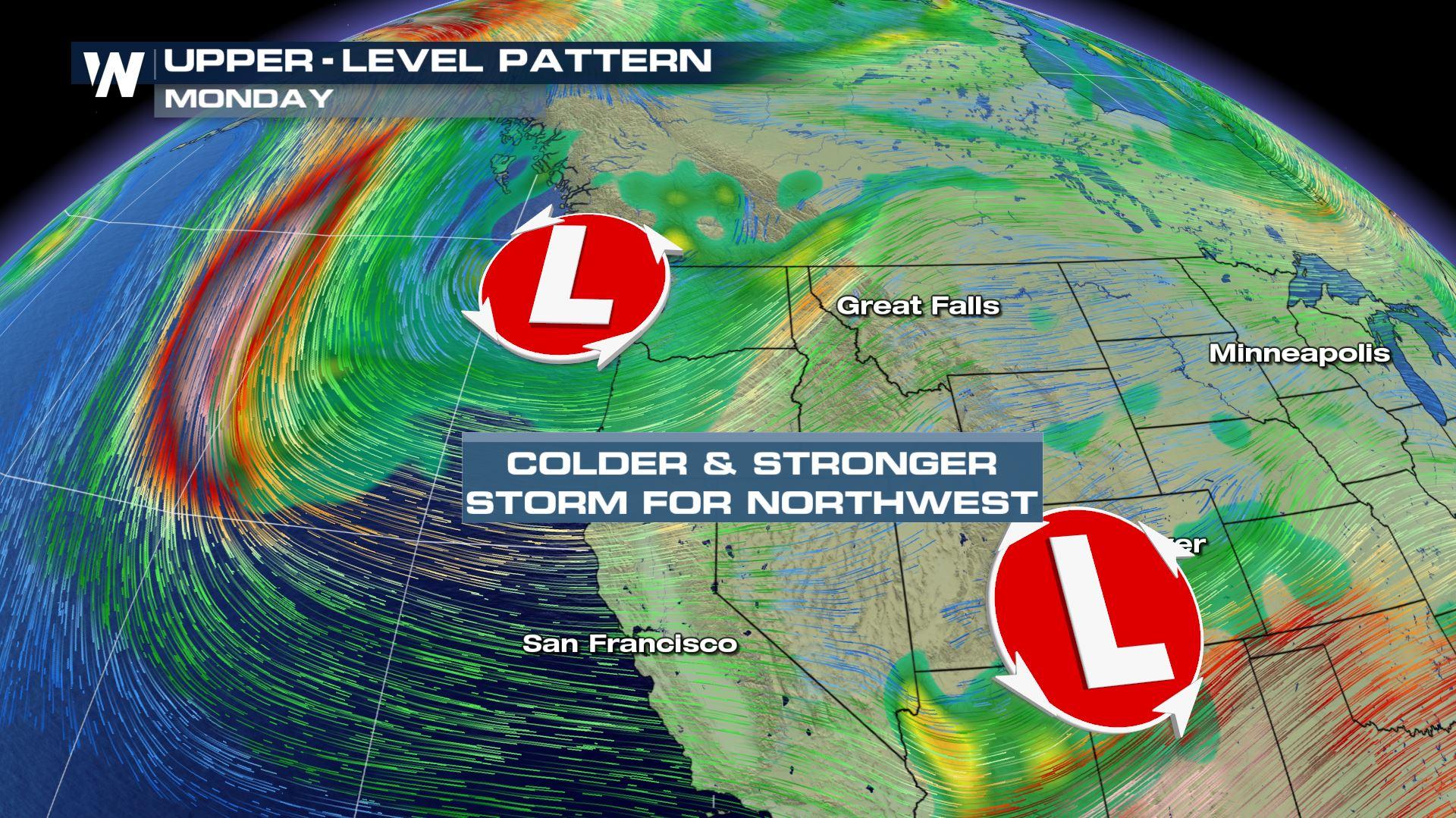
 A stronger, and colder storm is anticipated to move into the Pacific Northwest by next week putting an end to nice stretch of weather.
 Look for a rainy day in Seattle and Portland by Monday with showers that should linger into Wednesday.
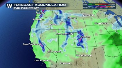
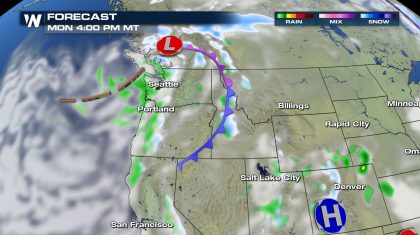 Rainfall amounts should stay under 1” for our coastal cities, but snowfall over the Cascades could reach up to 6” to 12”+ in some localized areas.
 Be sure to keep up with the latest information on our website here and also streaming 24/7 on your mobile device. Download our app here: https://media.weathernationtv.com/apps/
Be aware that there is a very small threat, a marginal risk, for possible flooding from rain forecast on Sunday.
Here’s a look at our forecast for how much rain is to be expected.
A stronger, and colder storm is anticipated to move into the Pacific Northwest by next week putting an end to nice stretch of weather.
Look for a rainy day in Seattle and Portland by Monday with showers that should linger into Wednesday.
Rainfall amounts should stay under 1” for our coastal cities, but snowfall over the Cascades could reach up to 6” to 12”+ in some localized areas.
Be sure to keep up with the latest information on our website here and also streaming 24/7 on your mobile device. Download our app here: https://media.weathernationtv.com/apps/
All Weather News
More
Severe Storms Move From Midwest to Northeast
UPPER MIDWEST - Through Monday, dangerous tor
28 Jul 2026 2:25 PM


Tropics: Fausto Heads towards Hawaii; Genevieve Cat 4 Hurricane
PacificTropical Storm Fausto continues to tra
28 Jul 2026 10:30 AM

Southeast Flood Risk Lingers Near Stalled Front
A stalled boundary over the Southeast will ke
25 Jul 2026 10:55 AM

Another Round of Storms Targets the Northeast
Tuesday brought severe weather again across p
23 Jul 2026 1:15 AM

Another Round of Severe Weather for the Upper Midwest and Great Lakes
The upper-level low train continues to keep t
21 Jul 2026 1:45 AM

Air Quality Improvements in the Forecast
Wildfires burning in Northwestern Ontario, Ca
20 Jul 2026 7:20 PM