New Technology Research Projects Underway at NOAA in Boulder
Special Stories
5 Oct 2018 9:25 AM
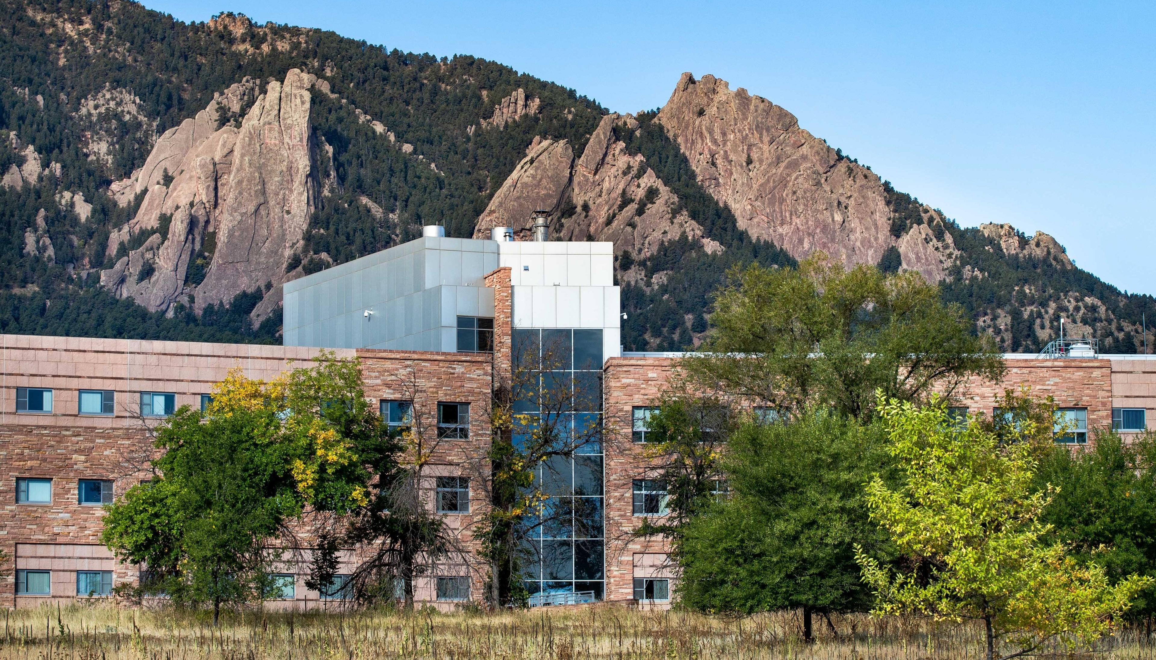
[NOAA's David Skaggs Research Center in Boulder, Colorado. (NOAA)]
[NOAA] From the foothills of the Rockies, NOAA is pioneering science, life-saving products, and enduring contributions to America’s economy have enormous impact. Here's a look at some of the projects underway at the NOAA in Boulder, Colorado:
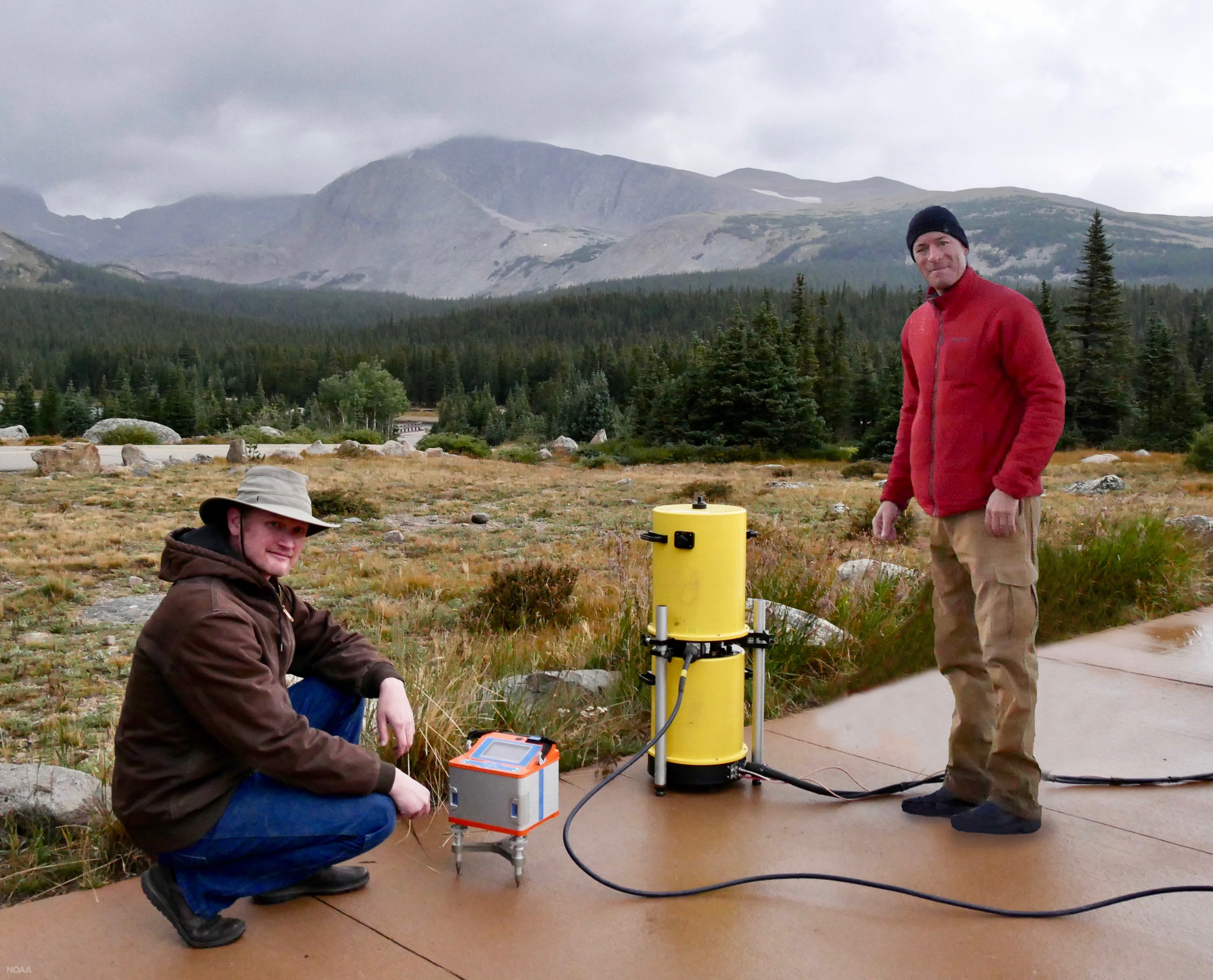 [Jeff Kanney (left) and Derek van Westrum prepare to calibrate gravity meters in the high altitudes west of Boulder. Gravity and height are critical to mapping where water will flow. (NOAA)]
Rather than being accurate to about one foot, new benchmark heights will be accurate to about one inch. Everywhere!
Surveying and construction positioning will be faster and more accurate. Air and marine traffic will be more efficient. Agriculture will be more precise. Better mapping will redefine floodplain zones, fine-tune evacuation routes, and save the economy about $240 million per year.
[Jeff Kanney (left) and Derek van Westrum prepare to calibrate gravity meters in the high altitudes west of Boulder. Gravity and height are critical to mapping where water will flow. (NOAA)]
Rather than being accurate to about one foot, new benchmark heights will be accurate to about one inch. Everywhere!
Surveying and construction positioning will be faster and more accurate. Air and marine traffic will be more efficient. Agriculture will be more precise. Better mapping will redefine floodplain zones, fine-tune evacuation routes, and save the economy about $240 million per year.
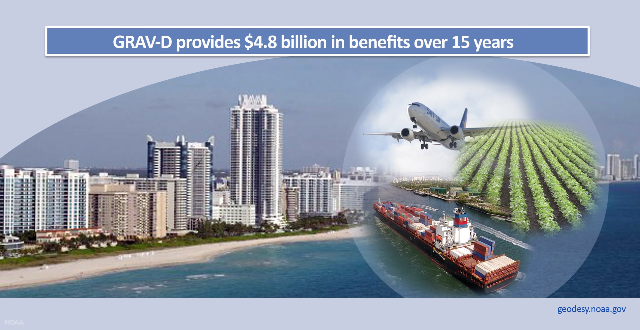 [GRAV-D has provided $4.8 billion in benefits over 15 years. (NOAA)]
Unmanned Aerial Systems
NOAA leads in understanding our planet in ever-finer slices. This is especially true when it comes to bridging information gaps in hazardous and remote regions. "Unmanned aircraft offer innovative, new perspectives on our environment, just as when satellite and radar assets were introduced decades ago", says Gijs de Boer, a Research Scientist at the Cooperative Institute for Research in Environmental Sciences (CIRES), a partnership of NOAA and the University of Colorado Boulder. https://www.youtube.com/watch?v=HeeS7WTw1M4 In such challenging environments, NOAA flies remotely-piloted Unmanned Aerial Systems (UASs), collecting data at relatively slow speeds and ensuring finer resolution and fresh views of our planet. Cost-effective UASs provide real-time hurricane data and improve weather forecasts and flood warnings. They monitor Arctic wildlife and map marshes with no harm to fragile landscapes. Leaving no human footprint, for example, an entire 1,700-acre marsh on the Gulf Coast was mapped in less than a day. https://www.youtube.com/watch?time_continue=1&v=scxVUqNudvsSURFRAD
At the Earth’s surface, solar and heat radiation drive weather, climate and the circulation in the world’s ocean. “Earth has a radiation budget. Measuring it correctly, getting the data precisely right, is fundamental to understanding weather, climate and ocean circulation", says John A. Augustine, a Meteorologist at NOAA's Global Monitoring Division, Earth System Research Laboratory. NOAA's SURFRAD network measures this radiation. The sum of incoming and outgoing solar and heat radiation, or the radiation budget, reflects the energy available for weather and climate. Any systematic change is fundamental to weather variability and climate change. https://www.youtube.com/watch?v=CsqXGZjFLTw It’s critical to get the intensities of radiation in weather and climate models precisely right. If not, significant errors will propagate, resulting in inaccurate forecasts and misguided policy decisions. Clouds have the largest influence on how much solar radiation reaches Earth's surface. As shown here, NOAA’s “Total Sky Imager” uses a camera to record the amount of clouds in the sky view. Clouds come in many forms, each with a distinct impact on the surface radiation budget. https://www.youtube.com/watch?v=r8LcJpc6hMEGRAV-D
For our nation to be resilient, it’s essential to know how heights on land compare with local sea level. This relationship is critical to safety, security and much of America’s economy. Yet current measurements haven’t kept pace with changing technology. “NOAA is positioning America for the future with a revolutionary new mapping system that will serve our nation for decades to come", says Derek van Westrum, a Physicist with NOAA National Geodetic Survey. NOAA’s GRAV-D project is changing that by defining a new and more precise “sea level” so that heights across the nation will be more accurate. When the project is completed in 2020, it will form the basis of all of our national mapping systems.
[Jeff Kanney (left) and Derek van Westrum prepare to calibrate gravity meters in the high altitudes west of Boulder. Gravity and height are critical to mapping where water will flow. (NOAA)]
Rather than being accurate to about one foot, new benchmark heights will be accurate to about one inch. Everywhere!
Surveying and construction positioning will be faster and more accurate. Air and marine traffic will be more efficient. Agriculture will be more precise. Better mapping will redefine floodplain zones, fine-tune evacuation routes, and save the economy about $240 million per year.
[GRAV-D has provided $4.8 billion in benefits over 15 years. (NOAA)]
Weather Forecasting
Just as at NOAA’s two other Colorado forecast offices and every NOAA forecast office across our nation, NOAA’s Boulder forecasters support fire-fighting partners with tools and other vital resources. “Wildfire season is no longer really a season. We need to be vigilant year-round. When there’s no snow on the ground, fire is a possibility and, even though rare, some fires can smolder under snow all winter", says Nezette Rydell, Meteorologist-in-Charge at the NOAA National Weather Service in Denver/Boulder. Spot forecasts let firefighters know about current conditions. NOAA’s forecast grid system generates a tailored forecast, detailing conditions over the next 24 to 72 hours. Throughout the year, weekly fire weather forecasts help fire agencies plan. https://www.youtube.com/watch?v=a43VbN4Y5w4 Already this year, fire has ravaged more than 400,000 Colorado acres, including four of the largest by acreage wildfires in the state’s history. Wildfires are often just the beginning, with flash flooding and landslides a concern for years to come. When there are major fires, a specially trained meteorologist works on-scene, guiding understanding about how weather will drive fire behavior. This guidance saves lives and property, helping to determine whether, when and where to evacuate and position fire crews. Forecasters also prepare for surprises. This tornado appeared on the edge of a wildfire 117 miles from Boulder, a rare event at 10,000 feet above sea level. https://www.youtube.com/watch?v=vWun9CIPHmYHigh Resolution/Rapid Refresh Forecast Model
NOAA’s High-Resolution Rapid Refresh model, or HRRR, brings hazardous weather into focus. Its sharp resolution pinpoints thunderstorms and potential flooding, and it’s the only operational model that runs a new forecast each hour. “HRRR is useful in myriad forecast applications because it predicts all aspects of the weather -- wind, precipitation, clouds, thunderstorms, even smoke, and how they evolve in the atmosphere”, says Terra Ladwig, a Meteorologist from NOAA's Global Systems Division, Earth System Research Laboratory and Cooperative Institute for Research in Environmental Sciences (CIRES). With remarkable consistency from one model run to the next, HRRR successfully forecast a severe hail storm that hit Colorado Springs on August 6. https://www.youtube.com/watch?v=0SvQ4uDA9Do Since better predictions of wind, clouds and visibility are critical to many industries, including aviation and renewable energy, NOAA researchers work with experimental versions of the HRRR to make improvements that will eventually become operational. Energy providers, for example, can use wind and cloud forecasts to integrate more wind and solar energy onto the grid. Shown in the video below “red” (left side) in the model forecast points to a likely severe storm. This indicates strong agreement with the actual observed radar shown on the right. https://www.youtube.com/watch?v=Y8n6Tb9Lc8IGreenhouse Gas Network
Pieter Tans and his Boulder colleagues invented AirCore. They also developed the complementary Global Greenhouse Gas Reference Network, which tracks carbon dioxide and other gas levels worldwide. "AirCore works like a tape recorder, logging multiple atmospheric gases critical to climate and human health. AirCore is simply constructed, rugged and low-cost, and it dramatically extends our reach into the upper atmosphere by collecting samples at heights no aircraft can reach", says Colm Sweeney, Lead Scientist, Aircraft Program NOAA Global Monitoring Division, Earth System Research Laboratory. https://www.youtube.com/watch?time_continue=2&v=dpgvFHgehxw This widely-used network sets the global standard for knowing where emissions are and where they have been removed. Continuous sampling from the NOAA Barrow Observatory in Alaska and three other highly remote sites ensures measurements of the most pristine air on our planet. “Clean air” samples also come from nearly 100 other global sites.Space Weather
NOAA always has an eye on the Sun. As America’s space weather watchdog, NOAA remains vigilant about the Sun’s eruptions. With profound implications, solar flares, energetic particles and solar wind can affect Earth at any time.“In our increasingly interconnected world, the stakes have never been higher. Space weather has the potential to seriously disrupt daily life and cause enormous economic consequences. A space weather-related power outage alone could exceed $20 billion.”
William Murtagh, Program Coordinator NOAA Space Weather Prediction Center https://www.youtube.com/watch?v=-OghJtFNViA Taking just a day or two to arrive, and traveling up to five million miles per hour, high-speed solar wind can significantly affect the magnetic field and upper atmosphere surrounding Earth. This can result in disruptions to communications, satellite and airline operations, human space flight, and navigation and surveying systems. The worst case scenario is a widespread power outage. With instruments on the ground and in space, NOAA predicts the onset, duration and strength of solar storms and works closely with civil, government and industry sectors to support national preparedness for space weather events. Edited for WeatherNation by Meteorologist Mace MichaelsAll Weather News
More
Heavy Rain Returns to Texas This Weekend
It's been a week since the devastating floods
12 Jul 2025 3:10 AM

Medium Range Tropics Forecast Favors Gulf, CSU Updates Seasonal Forecast
While the Atlantic appears quiet, conditions
12 Jul 2025 3:05 AM

Elevated Tornado Risk Targets the Midwest Friday
Friday was another busy day with severe weath
12 Jul 2025 3:00 AM

Storms Return From the Front Range to Texas
Moisture is moving back into the Central and
12 Jul 2025 2:50 AM

Timeline: How Catastrophic Flooding Unfolded in Texas Hill Country
TEXAS - Catastrophic flooding devastated port
11 Jul 2025 10:00 AM

Severe Thunderstorms Expected Across the East Coast
The severe weather and flood threat continues
11 Jul 2025 2:35 AM

Ruidoso Flash Flooding - Record Crest for the Rio Ruidoso River
A slow-moving monsoonal thunderstorm develope
10 Jul 2025 1:55 AM