North Central Cold Blast
Special Stories
2 Dec 2018 11:22 AM
FORECAST
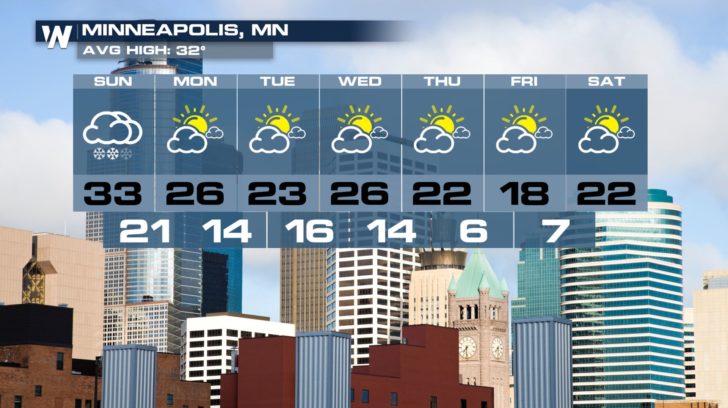
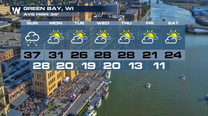
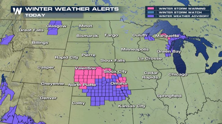 Multiple winter weather alerts are in effect for the northern central U.S today. Another several inches of snow will be possible for today alone.
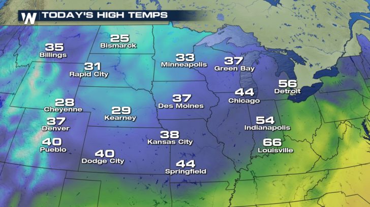
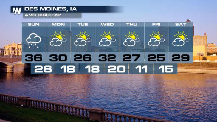
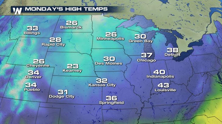 Temperatures will also be very chilly with most cities staying in the 20s and 30s for the high temperatures throughout the work week.
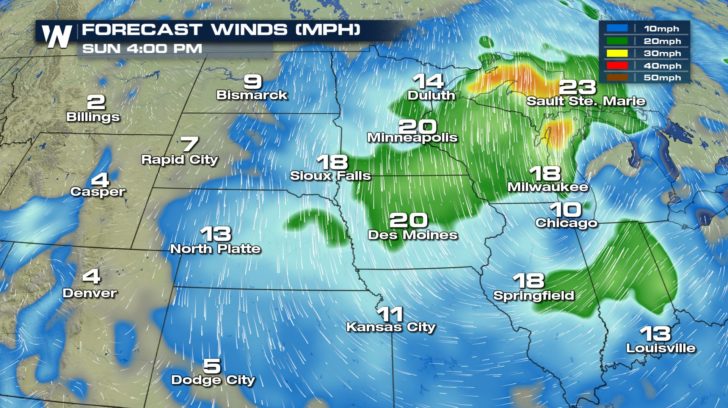
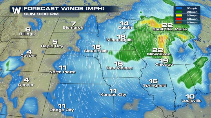 Winds will also be on the stronger side ranging from 10 to 25 mph. Gusts will be even higher, so blowing snow will be possible. This could reduce visibility throughout the day. Make sure to take extra time for commutes.
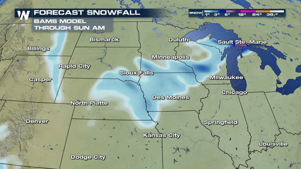
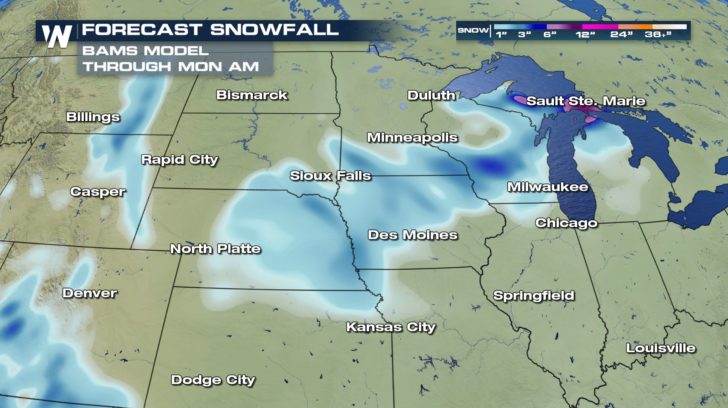 Snowfall will range anywhere from 1 to 6 inches of snow just into Monday morning. Most of the heavy snow will be confined to the upper peninsula of Michigan.
A LOOK AHEAD
Snowfall will range anywhere from 1 to 6 inches of snow just into Monday morning. Most of the heavy snow will be confined to the upper peninsula of Michigan.
A LOOK AHEAD
Multiple winter weather alerts are in effect for the northern central U.S today. Another several inches of snow will be possible for today alone.
Temperatures will also be very chilly with most cities staying in the 20s and 30s for the high temperatures throughout the work week.
Winds will also be on the stronger side ranging from 10 to 25 mph. Gusts will be even higher, so blowing snow will be possible. This could reduce visibility throughout the day. Make sure to take extra time for commutes.
Snowfall will range anywhere from 1 to 6 inches of snow just into Monday morning. Most of the heavy snow will be confined to the upper peninsula of Michigan.
A LOOK AHEAD
All Weather News
More
Wildfire Outbreak in the Pacific Northwest
SPOKANE, WA - On Saturday, August 1st, the Ol
2 Aug 2026 7:20 PM

More Storms for the East Through Monday
A low-pressure system that moved through the
2 Aug 2026 7:20 PM


After Reaching Category 5, Genevieve Weakens in the Pacific
PacificGenevieve formed on last Friday south
2 Aug 2026 6:25 PM

Flooding, Severe Storms Target the Midwest Again
After an active week of storms across the nor
1 Aug 2026 1:40 AM

Flooding Risk Increases as Heavy Rain Targets the Tri-State Area
Tuesday, heavy rainfall moved across the Nort
30 Jul 2026 12:25 AM

Severe Weather: Energy From the Midwest Now in the Southeast
UPPER MIDWEST - Through Monday, dangerous tor
29 Jul 2026 10:30 PM