Northeast & Midwest Severe Forecast
Special Stories
7 Aug 2018 11:46 AM
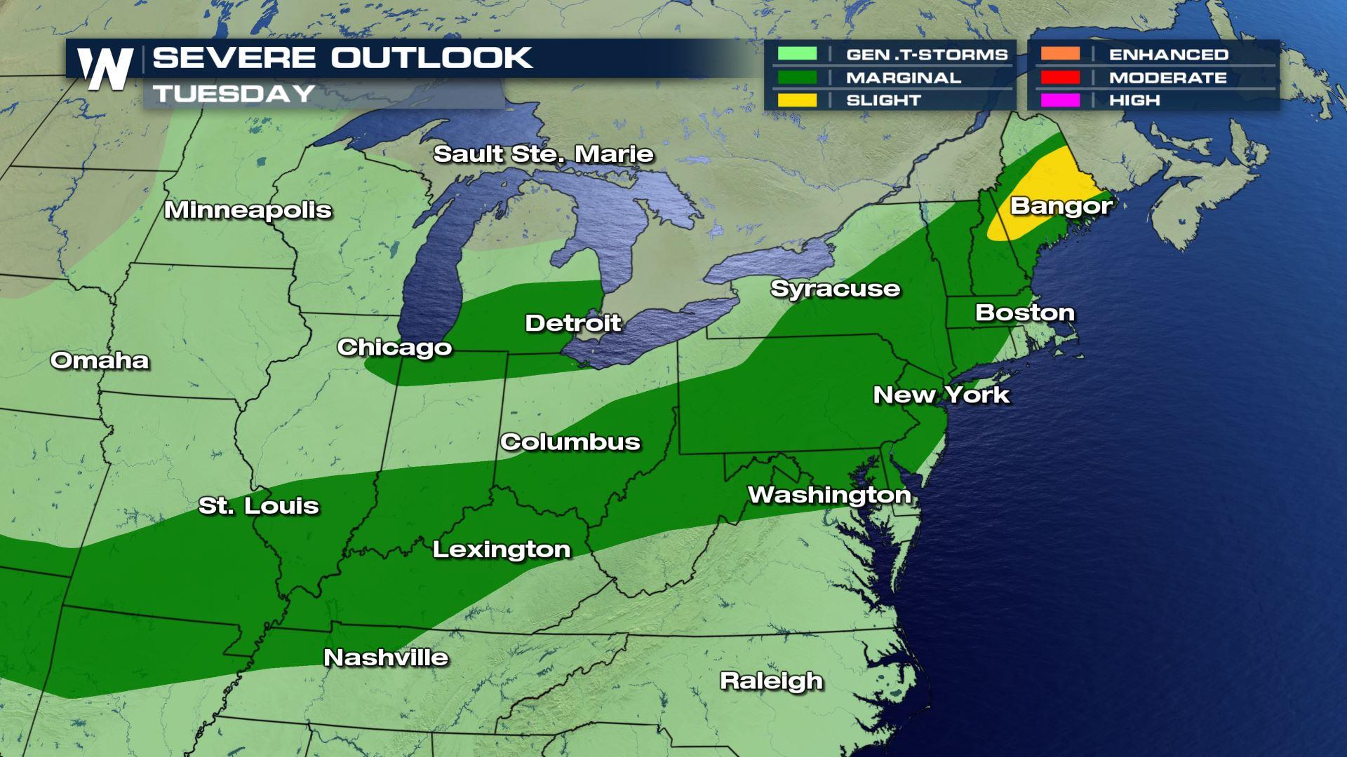
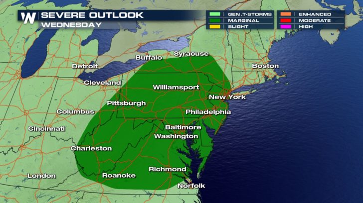
The Storm Prediction Center has outlined the Northeast and the Midwest severe chances for Tuesday.
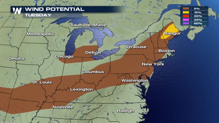
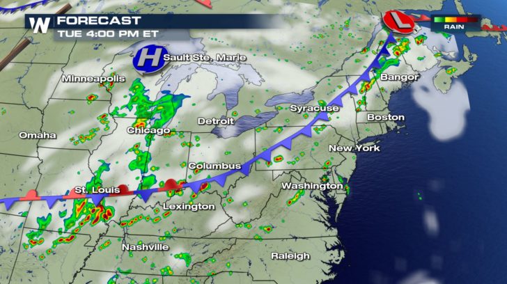
A cold front moving through the Midwest and Ohio Valley and eventually the Northeast will bring some much-needed relief from the hot and humid conditions, especially for the East Coast. The threat of severe thunderstorms will exist all along the cold front as well. Thunderstorms that reach severe limits Tuesday afternoon and evening will bring the risk of damaging wind gusts in excess of 60 mph.
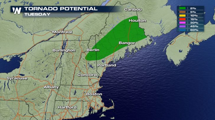
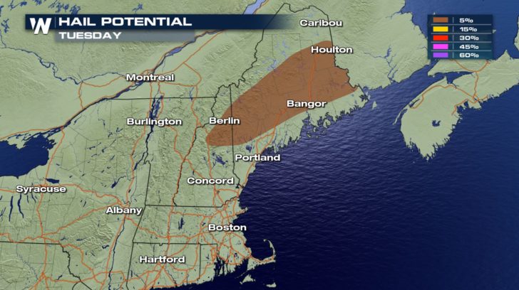
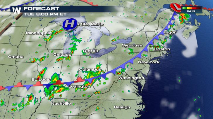
 Closer to an area of low pressure, the state of Maine may also experience hail and an isolated tornado risk as thunderstorms rumble through the region on Tuesday.
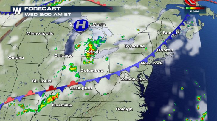
 Thunderstorm coverage will be spotty in nature through the evening, with the potential for lingering thunderstorms after midnight in the lower Great Lakes region and lower Ohio Valley.
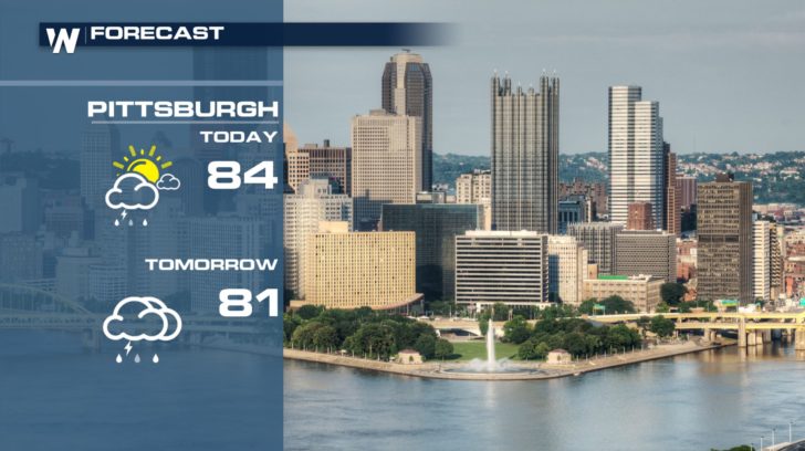
 Cities such as New York, Pittsburgh, and Richmond will hang onto the chance for showers and thunderstorms on Wednesday. A few storms may reach severe limits.
 Be sure to follow WeatherNation on Facebook and Twitter for the latest severe weather updates.
- Meteorologist Joe Astolfi
Be sure to follow WeatherNation on Facebook and Twitter for the latest severe weather updates.
- Meteorologist Joe Astolfi
Closer to an area of low pressure, the state of Maine may also experience hail and an isolated tornado risk as thunderstorms rumble through the region on Tuesday.
Thunderstorm coverage will be spotty in nature through the evening, with the potential for lingering thunderstorms after midnight in the lower Great Lakes region and lower Ohio Valley.
Cities such as New York, Pittsburgh, and Richmond will hang onto the chance for showers and thunderstorms on Wednesday. A few storms may reach severe limits.
Be sure to follow WeatherNation on Facebook and Twitter for the latest severe weather updates.
- Meteorologist Joe AstolfiAll Weather News
More
Flooding Risk Increases as Heavy Rain Targets the Tri-State Area
Tuesday, heavy rainfall moved across the Nort
30 Jul 2026 12:25 AM


Genevieve Down to a Category 2 Hurricane
PacificFausto is now a post-tropical cyclone.
30 Jul 2026 12:00 AM

Severe Weather: Energy From the Midwest Now in the Southeast
UPPER MIDWEST - Through Monday, dangerous tor
29 Jul 2026 10:30 PM


Southeast Flood Risk Lingers Near Stalled Front
A stalled boundary over the Southeast will ke
25 Jul 2026 10:55 AM

Another Round of Storms Targets the Northeast
Tuesday brought severe weather again across p
23 Jul 2026 1:15 AM