Northwest Rain and Snow Continues
Special Stories
19 Dec 2018 7:07 AM
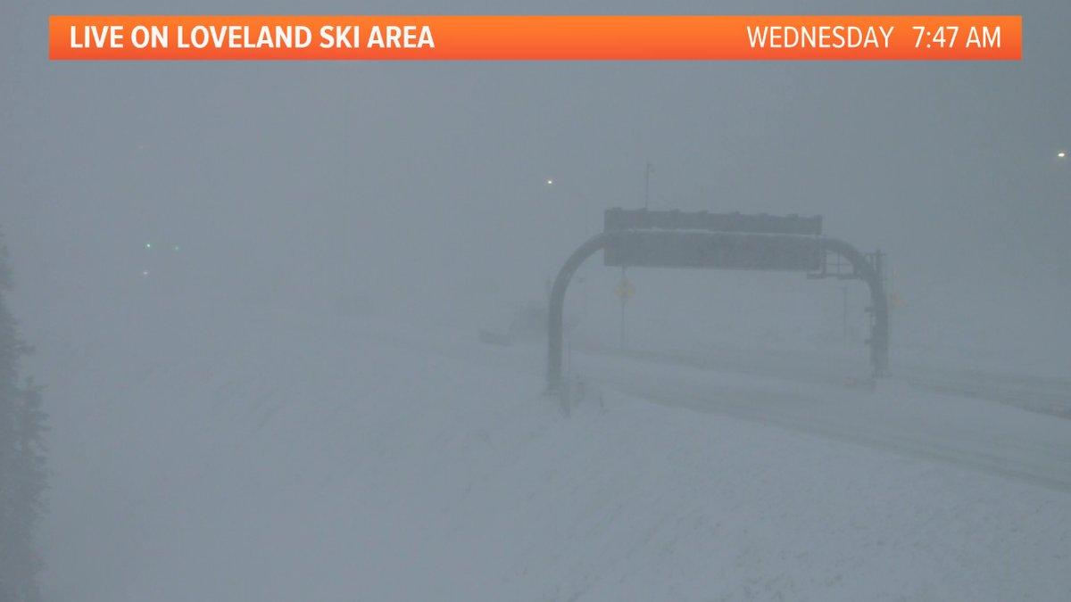
[From Loveland Ski area in Colorado Wednesday morning. Via WeatherNation affiliate KUSA in Denver]
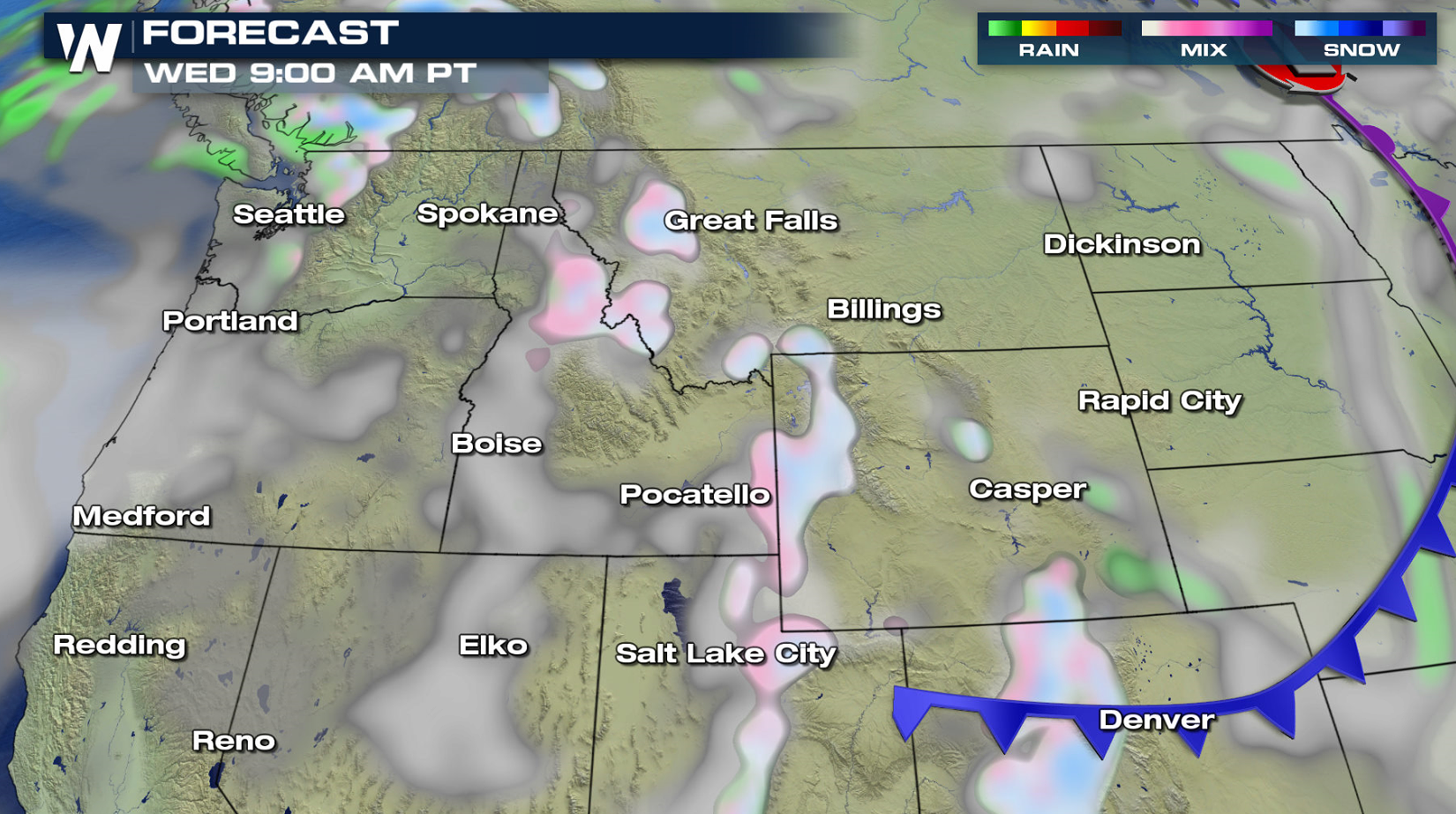
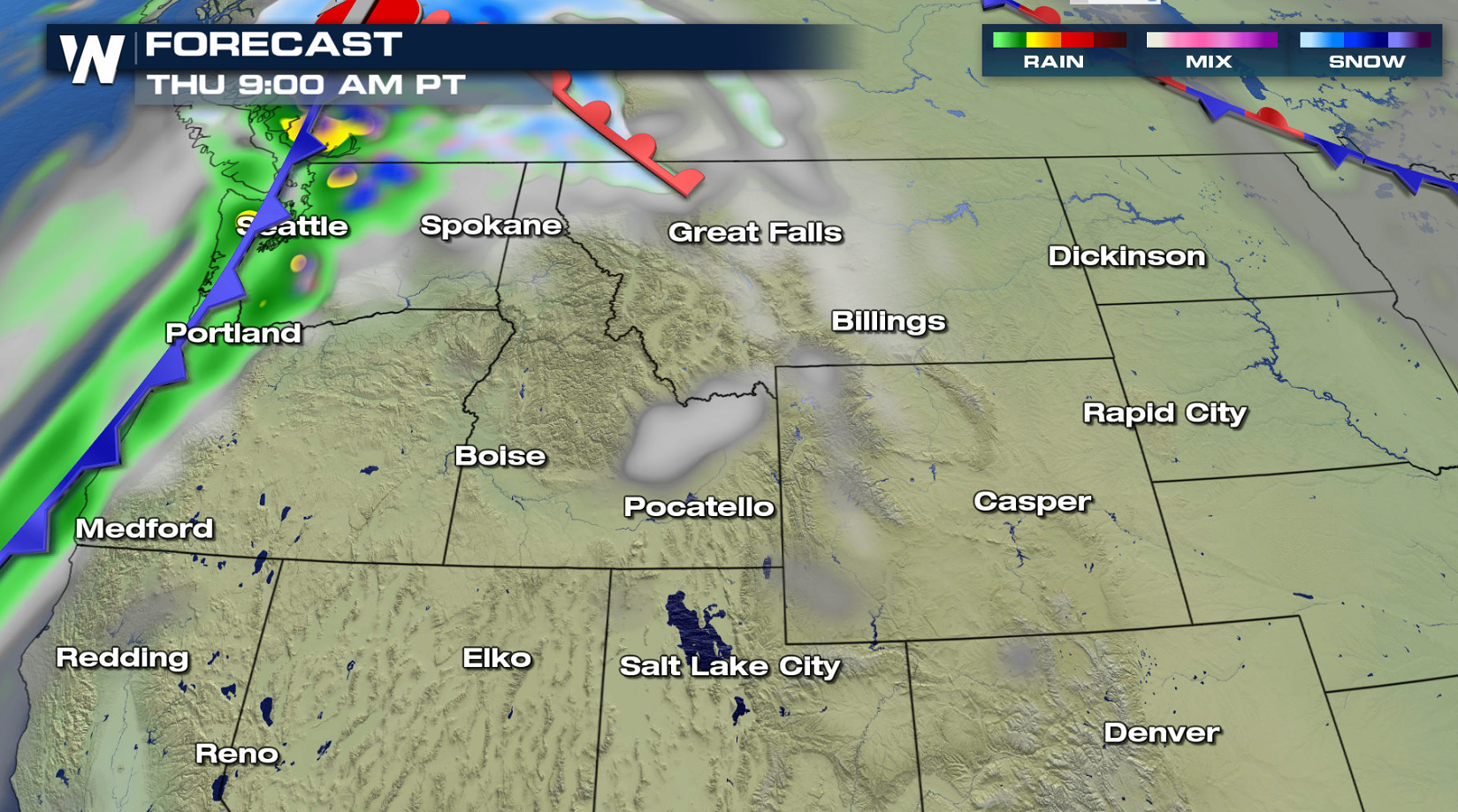
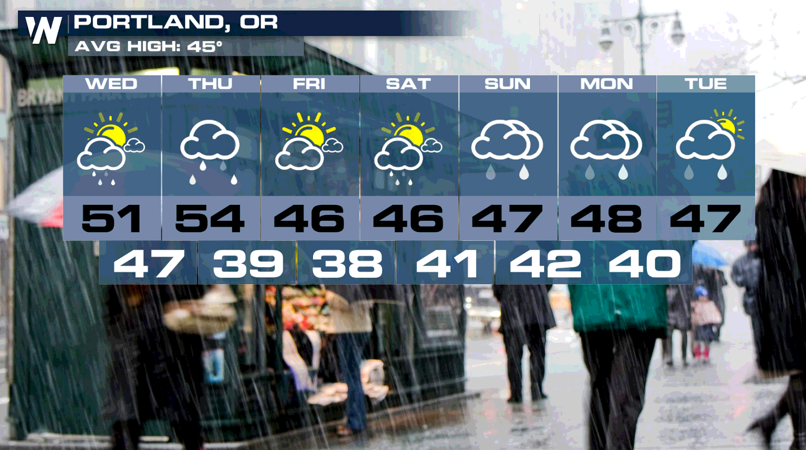
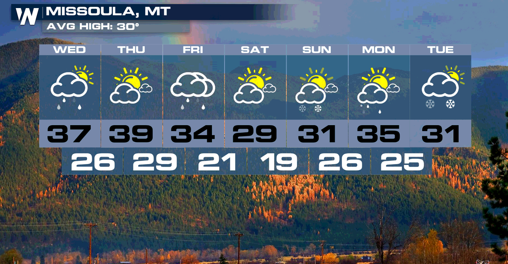
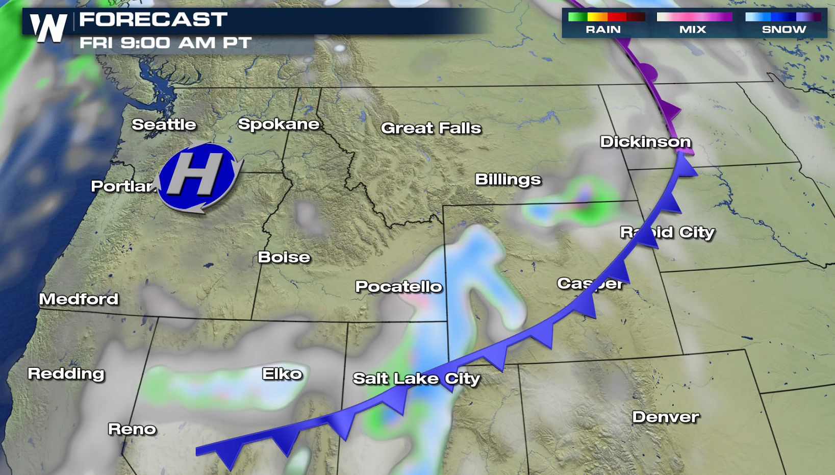 Wet weather has been the news since this past weekend. The Northwest is seeing a break this morning (Wednesday), with from the Rockies through the Bitterroots seeing snow. A warm front pushes into the region today (Wednesday). The precipitation will start mostly to Washington, until a trailing cold front arrives Thursday. Rain and snow will become widespread once again as it marches across the West.
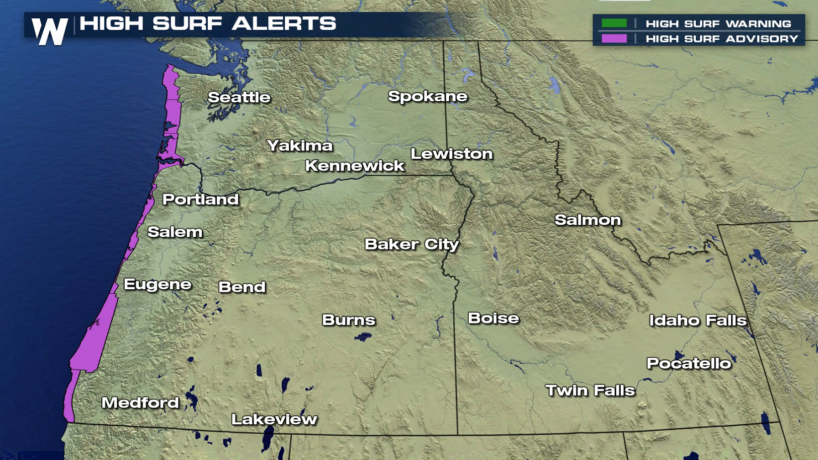
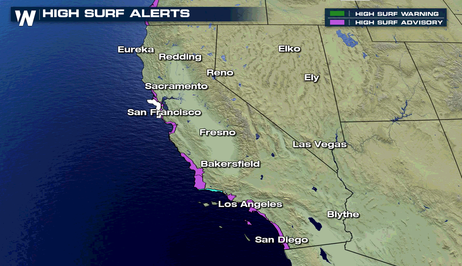
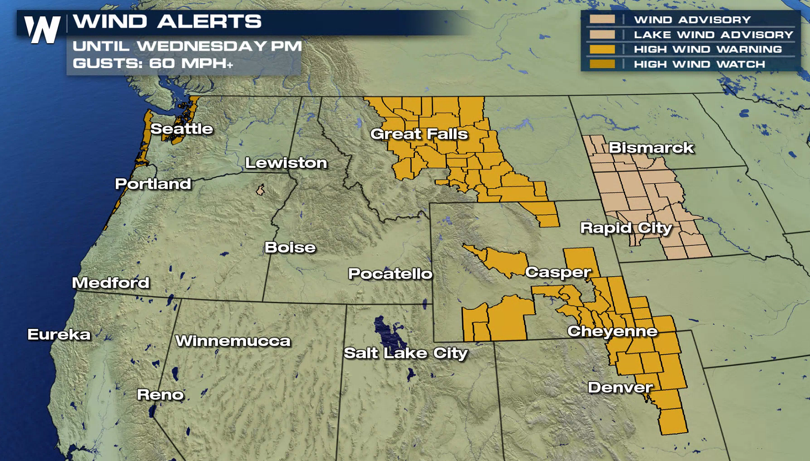
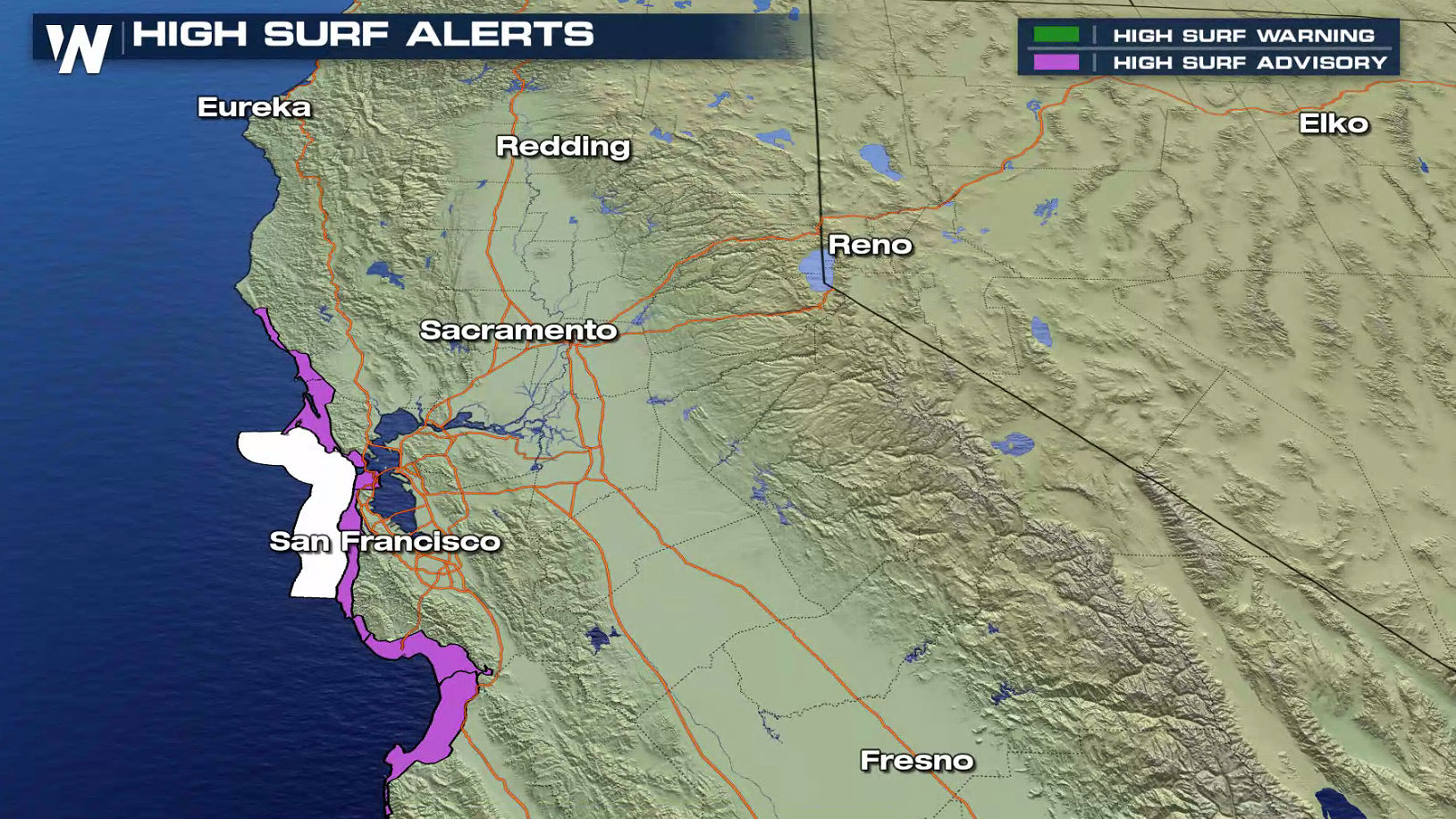 On top of the heavy rain and snow, winds will be gusty and seas will be rough. Power outages may occur. Make sure to take extra time while commuting. Visibility could be reduced at times. Surf and wind alerts extended from the Canadian Border to the Mexican Border.
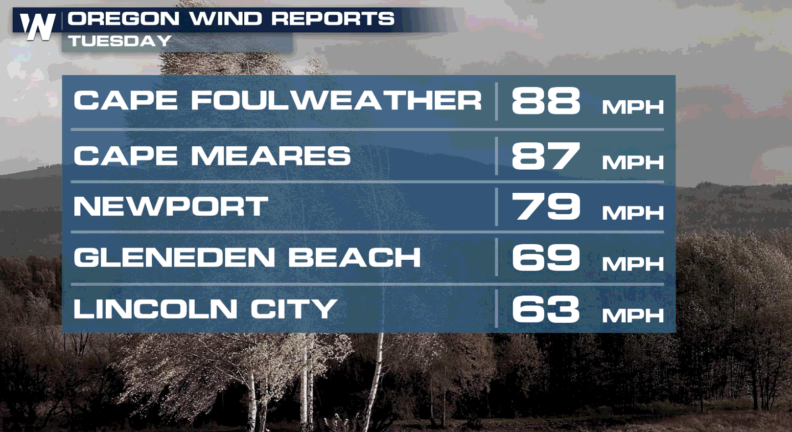
 Snowfall in the higher elevations will likely be measured with a yard stick, with rainfall amounts above 6" in many areas. Numbers could grow significantly as we make our way into the weekend.
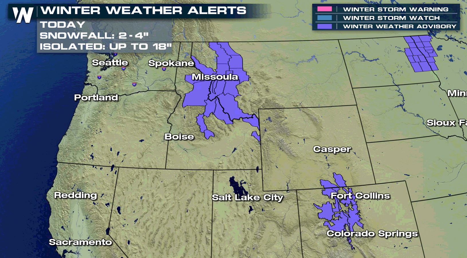
ALERTS
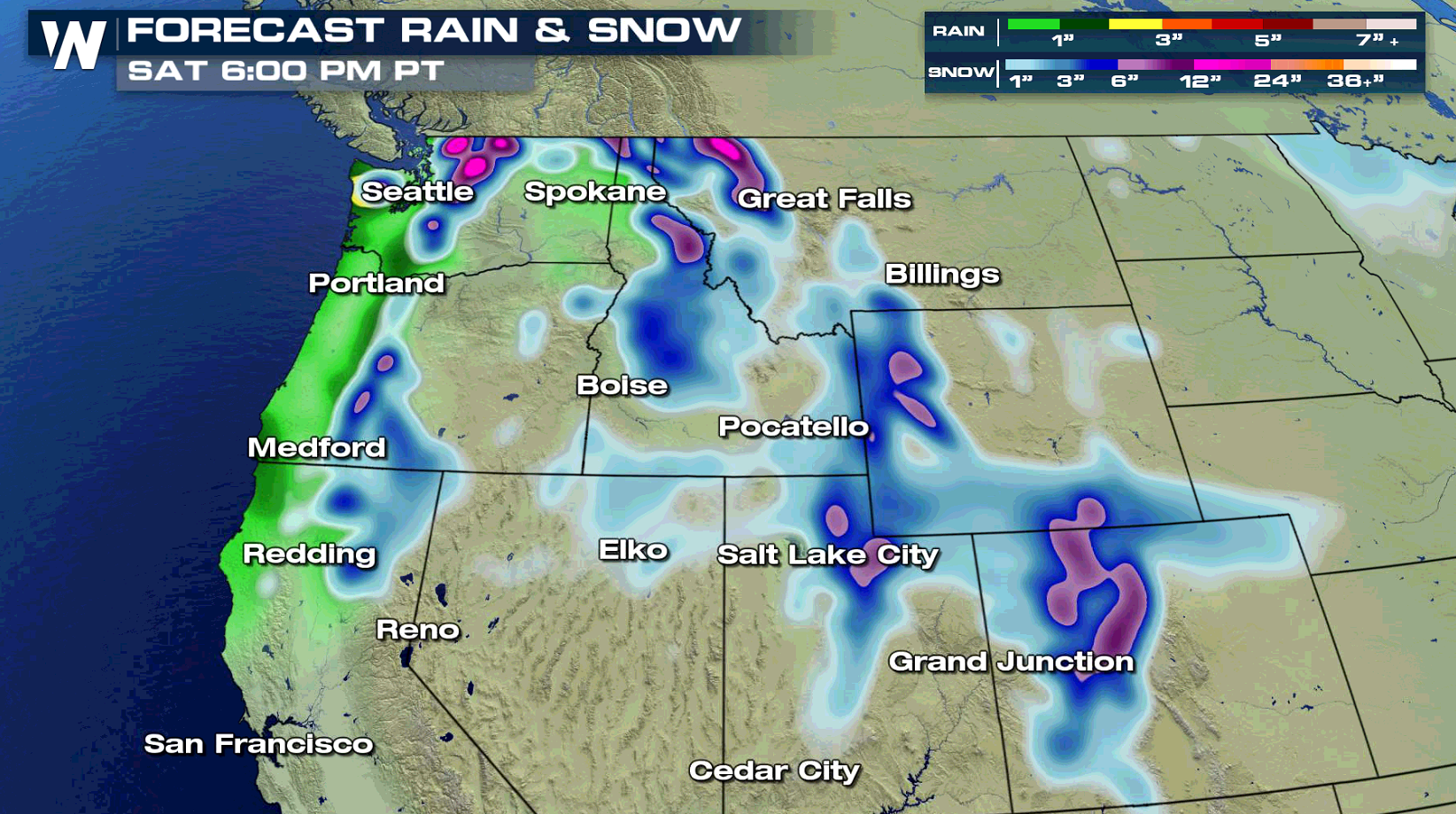
Persistent moisture streaming in from the Pacific Ocean will continue to bring waves of rain and snow to the West. Several feet of snow has fallen in the higher elevations, with lots of rain along the coast. More is on the way into the weekend as winter weather alerts continue.
FORECAST
Wet weather has been the news since this past weekend. The Northwest is seeing a break this morning (Wednesday), with from the Rockies through the Bitterroots seeing snow. A warm front pushes into the region today (Wednesday). The precipitation will start mostly to Washington, until a trailing cold front arrives Thursday. Rain and snow will become widespread once again as it marches across the West.
On top of the heavy rain and snow, winds will be gusty and seas will be rough. Power outages may occur. Make sure to take extra time while commuting. Visibility could be reduced at times. Surf and wind alerts extended from the Canadian Border to the Mexican Border.
RAIN AND SNOW FORECAST
Snowfall in the higher elevations will likely be measured with a yard stick, with rainfall amounts above 6" in many areas. Numbers could grow significantly as we make our way into the weekend.
A LOOK AHEAD
All Weather News
More

More Storms for the East Through Monday
A low-pressure system that moved through the
3 Aug 2026 12:20 PM


After Reaching Category 5, Genevieve Weakens in the Pacific
PacificGenevieve formed last Friday south of
3 Aug 2026 12:30 AM

Flooding, Severe Storms Target the Midwest Again
After an active week of storms across the nor
1 Aug 2026 1:40 AM

Flooding Risk Increases as Heavy Rain Targets the Tri-State Area
Tuesday, heavy rainfall moved across the Nort
30 Jul 2026 12:25 AM