Numerous Severe Storm Chances for the Plains Tuesday
Top Stories
18 Jun 2019 6:32 AM
Severe Weather Alerts
A Tornado Watch remains in effect for central Kansas through late Tuesday evening. A Severe Thunder Storm Watch stretches from southeastern Colorado to portions to New Mexico, Oklahoma, and Texas. Keep alerts turned on through tonight in case strong storms continue after dark.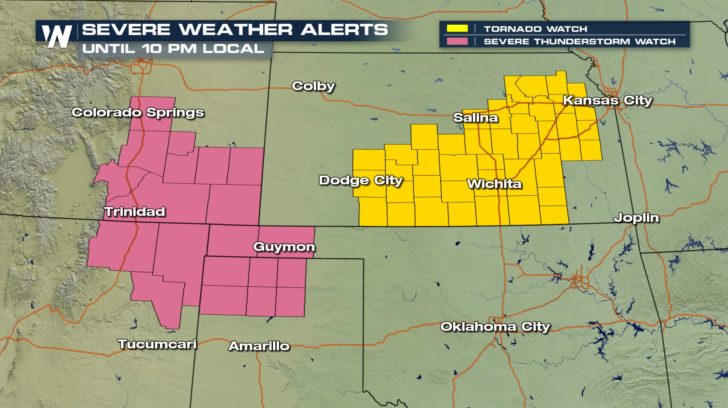
Severe Outlook
Thanks to 2 upper-level ridges on each coast of the Country, the Central Plains will have a very active forecast for Tuesday. This includes the risk for scattered to numerous severe storms with large hail, damaging wind gusts and several tornadoes. Here is the very latest information.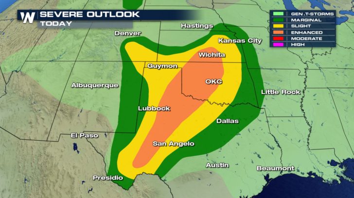 Several states are under a risk of sever storms today. Oklahoma and Texas could see the worst weather but areas of Kansas and Colorado could also see some dangerous weather.
Severe Risks
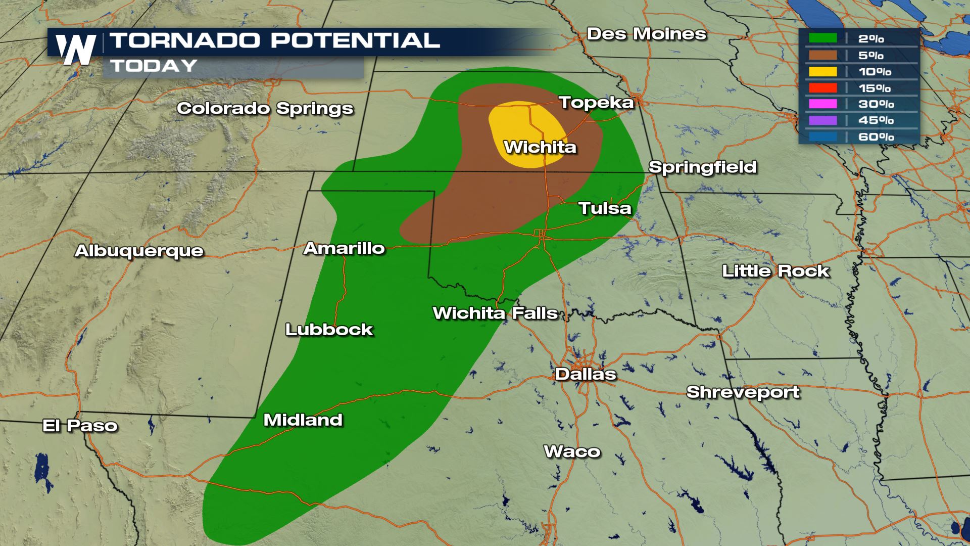
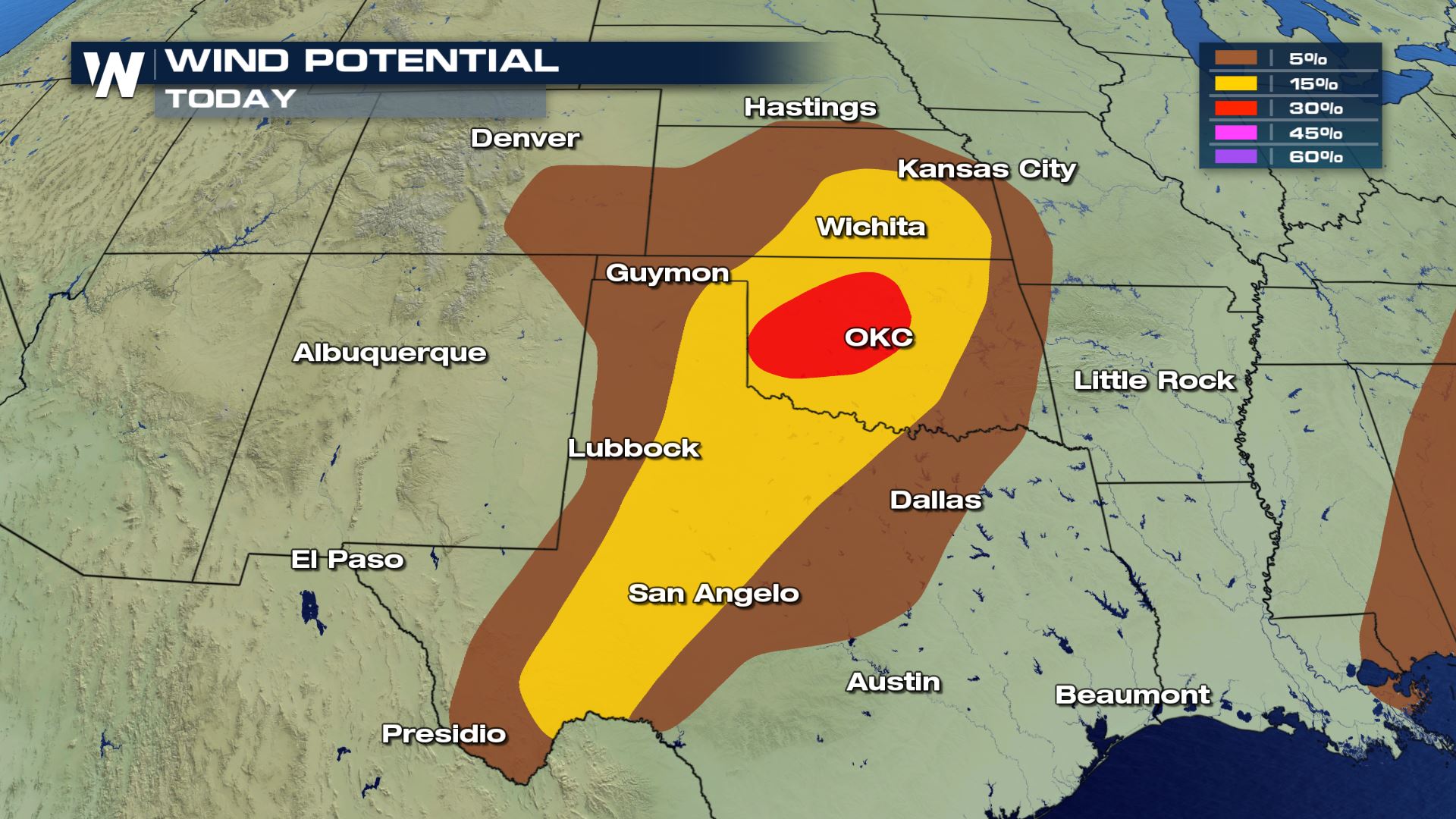
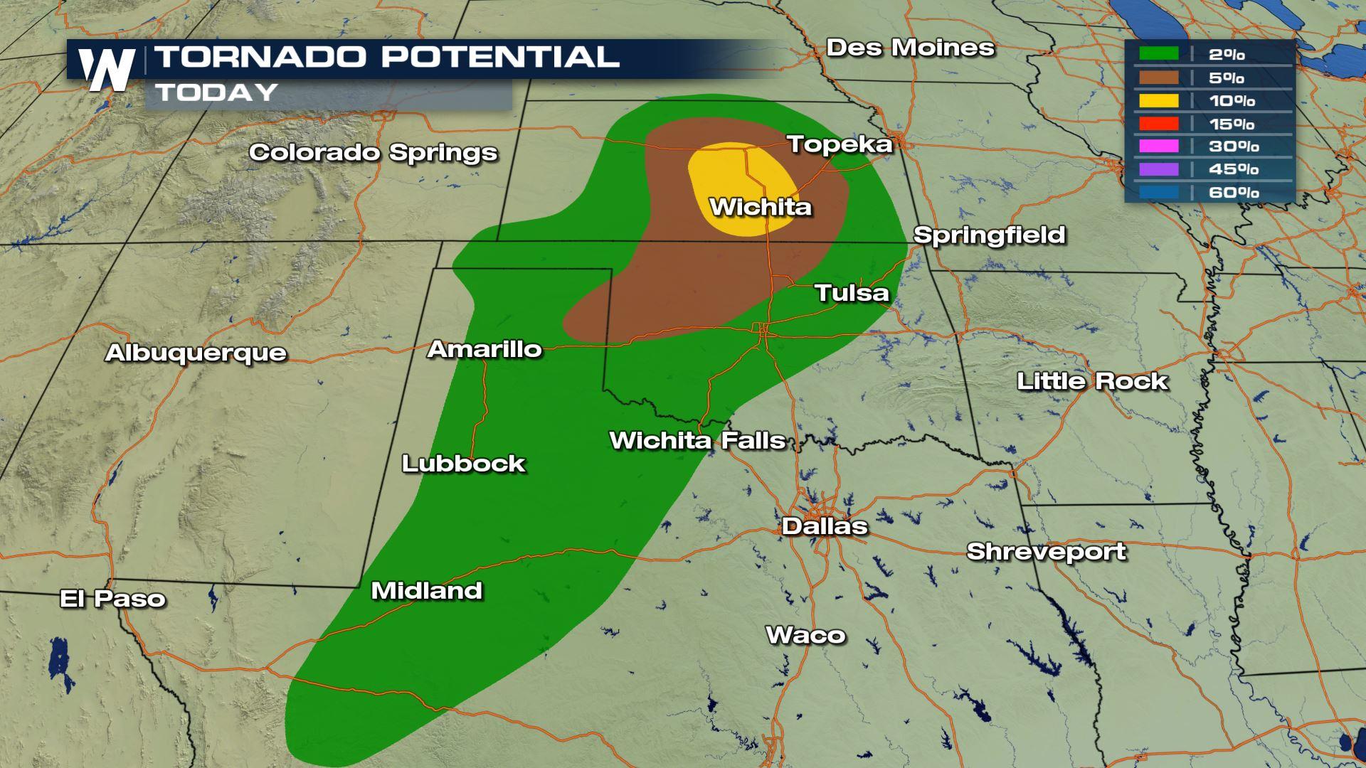
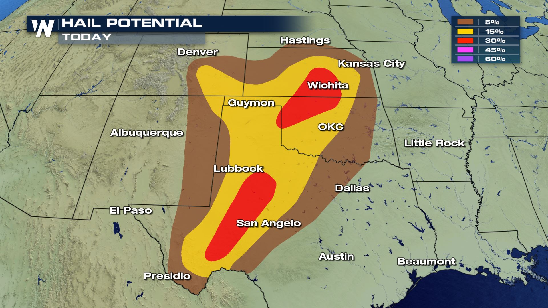 Large hail, damaging winds, frequent lightning and isolated tornadoes will all be possible with today's storms. The tornado risk is much higher over areas of Kansas, including Wichita. The biggest risk will be large hail with some areas of Texas and Oklahoma seeing the potential for hail up to tennis balls.
Forecast
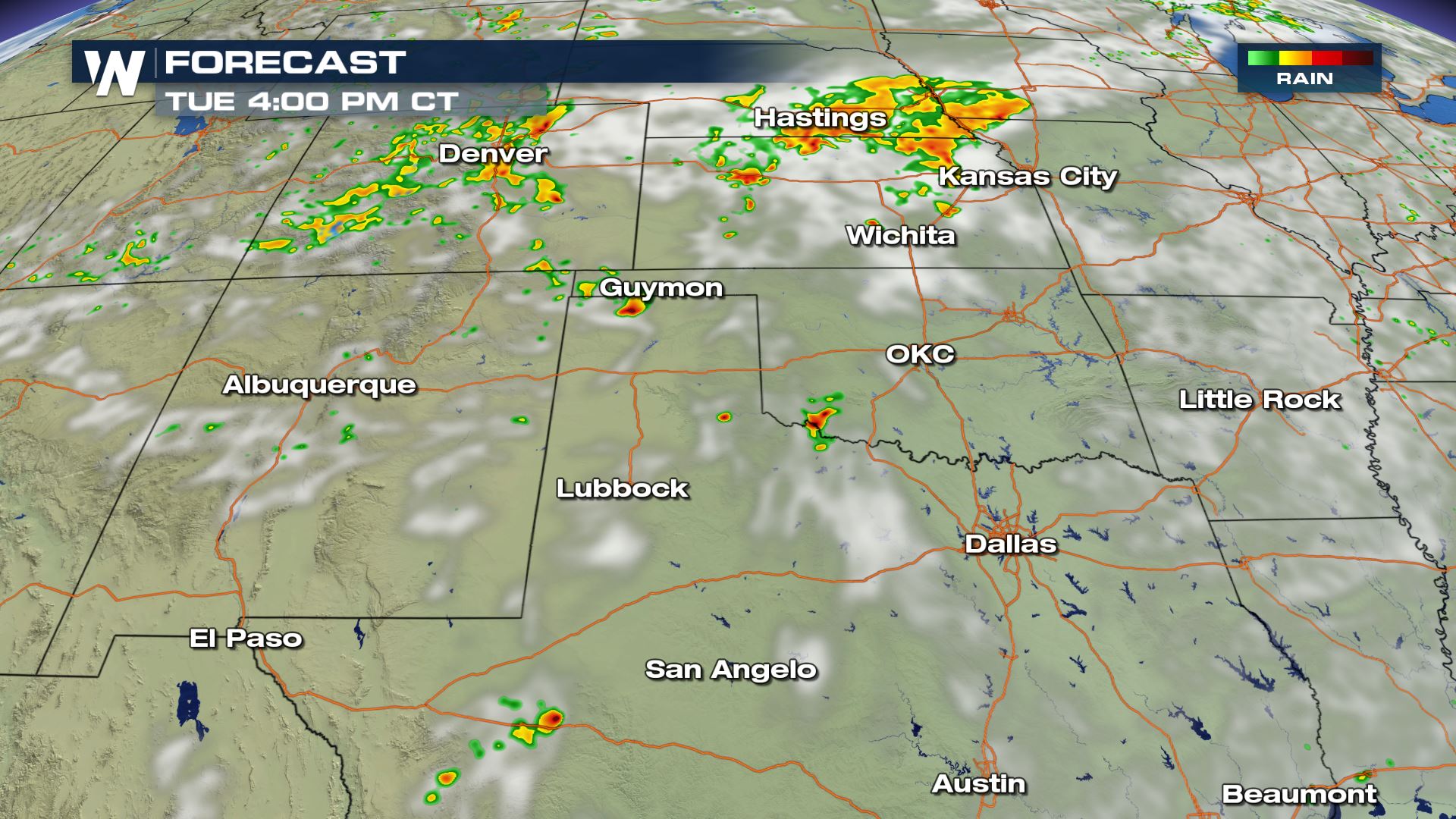
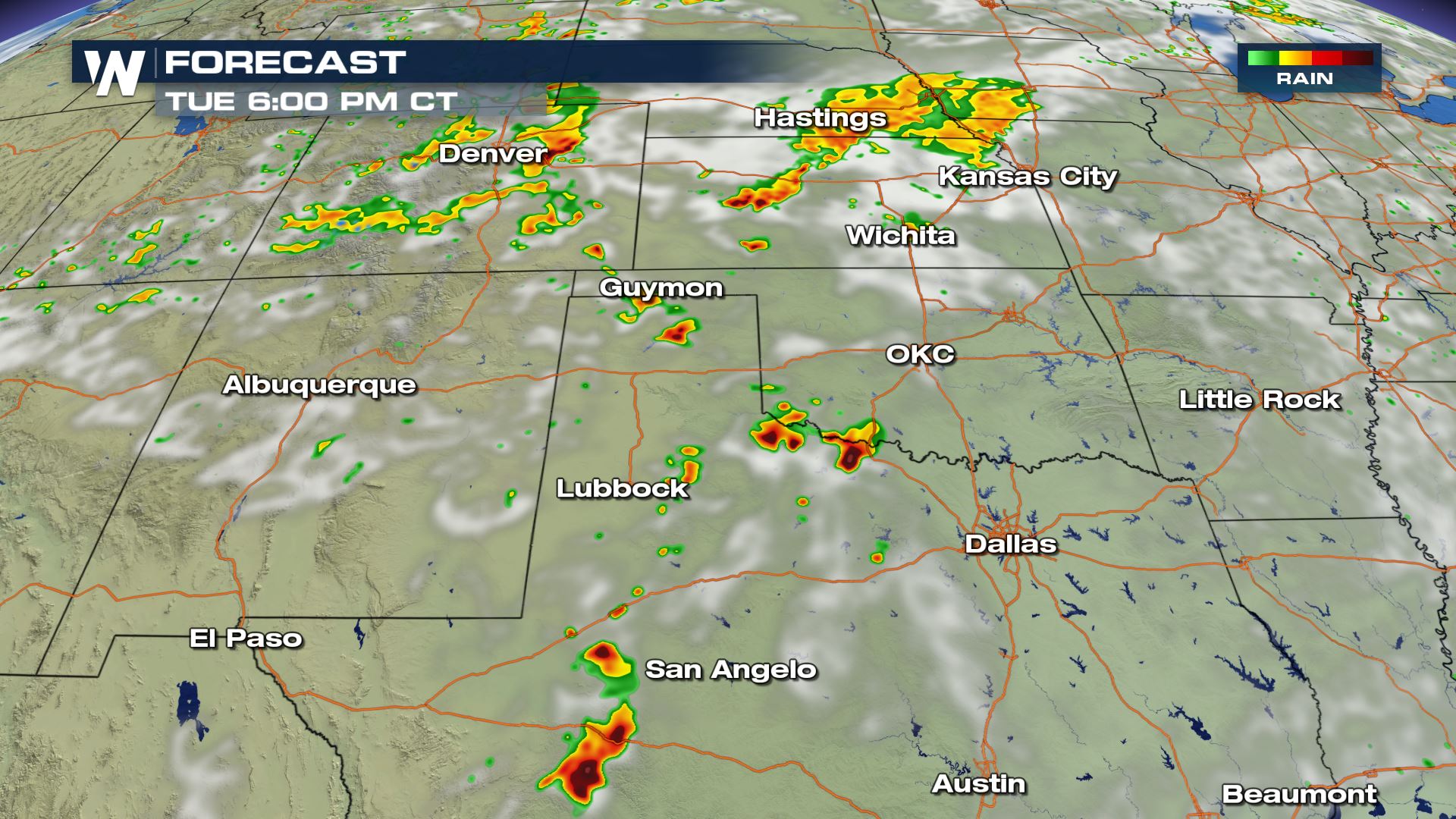
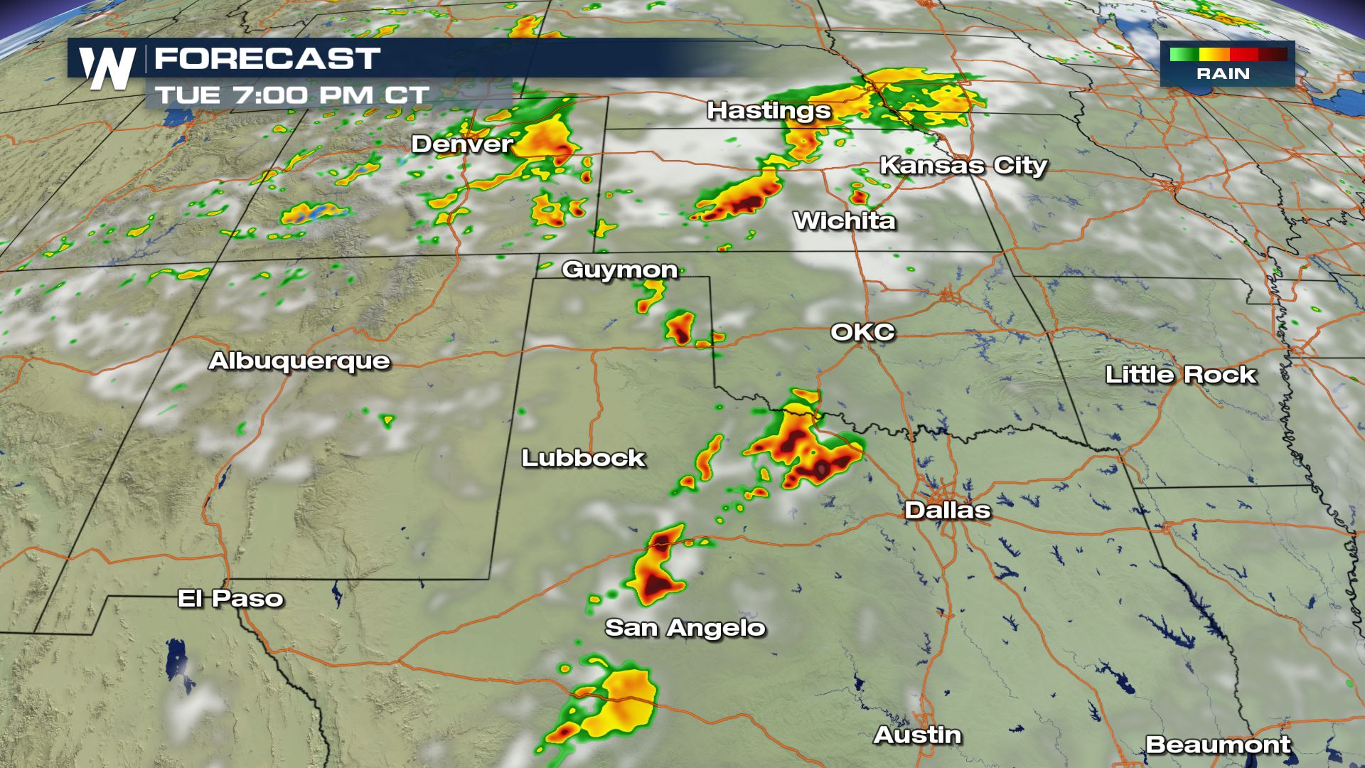
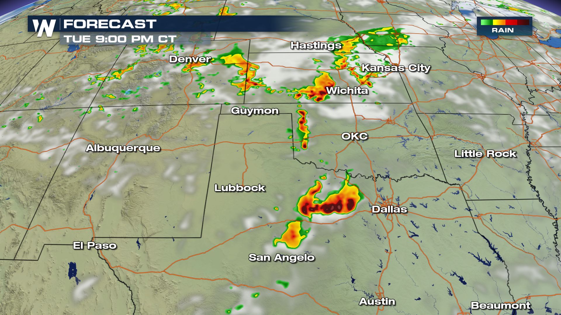 One of the ingredients needed for today's storms will be the hot temperatures. This means the storms should should off until the afternoon over these areas. So the highest risk of severe weather will during the later afternoon and early evening. Keep checking with WeatherNation for more severe weather updates.
All Weather News
More
Texas Facing Major Flood Threat This week
A moisture-rich weather pattern is expected t
15 Jul 2026 9:50 PM

Canadian Wildfires to Send Thick Dense Smoke Across The Northern U.S.
As temperatures have soared across the Northe
15 Jul 2026 9:50 PM

Two New Tropical Areas to Monitor in the Atlantic
Two areas of potential tropical development a
15 Jul 2026 9:50 PM

Historic Heatwave Hits the Northern Rockies, California Heat Expands
Dangerous heat and record high temperatures c
15 Jul 2026 7:00 PM

Monsoon Moisture Returns to the Southwest, Increasing Storm and Flash Flood Potential
After weeks of hot and mostly dry weather, th
15 Jul 2026 9:15 AM

Rare Enhanced Severe Threat For New England
WHAT TO EXPECT The SPC has issued a severe ou
15 Jul 2026 1:35 AM

Saharan Dust and Excessive Heat Impact the Southeast
Hazy skies will be hovering over portions of
14 Jul 2026 10:05 AM