Olivia Continues On Path Through Hawaii

Special Stories
12 Sep 2018 6:44 AM
The Pacific has had an active season. This increased activity has lead to a more active tropical season for Hawaii as well and the trend continues with yest another tropical storm taking aim at the islands. This one with a more direct impact.
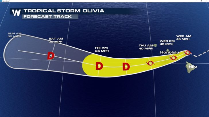
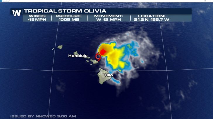 Olivia's track will take the storm through the Hawaiian islands Wednesday, continuing to impact Hawaii with heavy rain, storm surge and wind as it moves away on Thursday.
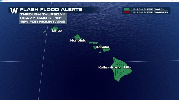
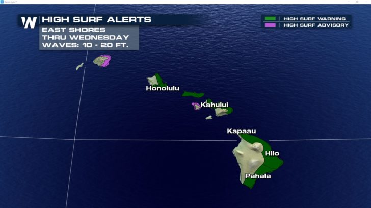
 The high surf and heavy rain threat will not only lead to coastal flooding but also flooding inland. As the storm interacts with mountains some of the higher elevations could end up with totals reaching over 15" by the time Olivia moves out of reach.
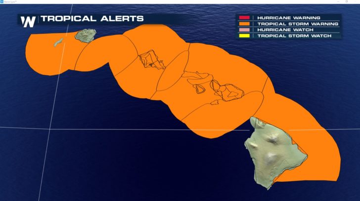
 Tropical storm warnings, flood alerts and surf alerts are out for the islands through Thursday.
 Stay with WeatherNation for the latest.
For Weather Nation: Meteorologist Emily Roehler
Stay with WeatherNation for the latest.
For Weather Nation: Meteorologist Emily Roehler
Olivia's track will take the storm through the Hawaiian islands Wednesday, continuing to impact Hawaii with heavy rain, storm surge and wind as it moves away on Thursday.
The high surf and heavy rain threat will not only lead to coastal flooding but also flooding inland. As the storm interacts with mountains some of the higher elevations could end up with totals reaching over 15" by the time Olivia moves out of reach.
Tropical storm warnings, flood alerts and surf alerts are out for the islands through Thursday.
Stay with WeatherNation for the latest.
For Weather Nation: Meteorologist Emily RoehlerAll Weather News
More
Wildfire Outbreak in the Pacific Northwest
SPOKANE, WA - On Saturday, August 1st, the Ol
3 Aug 2026 1:55 AM

More Storms for the East Through Monday
A low-pressure system that moved through the
3 Aug 2026 1:50 AM


After Reaching Category 5, Genevieve Weakens in the Pacific
PacificGenevieve formed last Friday south of
3 Aug 2026 12:30 AM

Flooding, Severe Storms Target the Midwest Again
After an active week of storms across the nor
1 Aug 2026 1:40 AM

Flooding Risk Increases as Heavy Rain Targets the Tri-State Area
Tuesday, heavy rainfall moved across the Nort
30 Jul 2026 12:25 AM

Severe Weather: Energy From the Midwest Now in the Southeast
UPPER MIDWEST - Through Monday, dangerous tor
29 Jul 2026 10:30 PM