Pacific Moisture Bringing Rainy Conditions to West Texas Monday

Special Stories
14 Oct 2019 7:33 AM
Southwesterly flow in the upper-levels of the atmosphere is allowing abundant moisture in the Eastern Pacific to stream into West Texas today. This means consistent rain chances throughout the day and the possibility of isolated flash flooding. Here is the very latest.
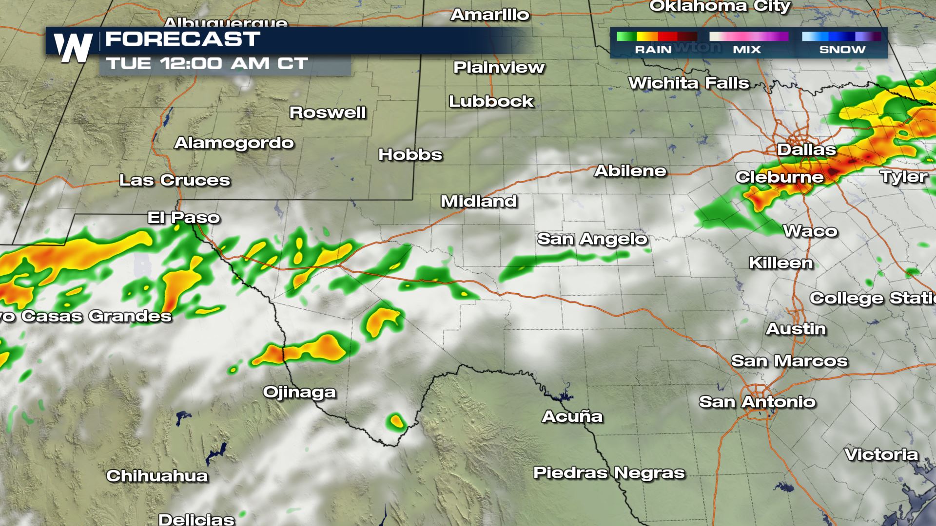
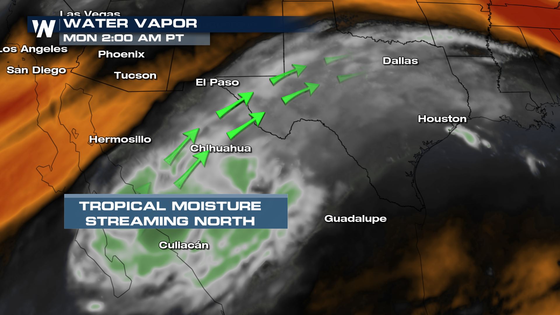 You can see all the moisture located in western Mexico this morning and with the southwesterly flow that moisture is heading into the Lone Star State. Clouds and off and on rain chances will be possible throughout the morning, afternoon and evening. Luckily the severe storm risk is very low, but the heavy rain could lead to some issues.
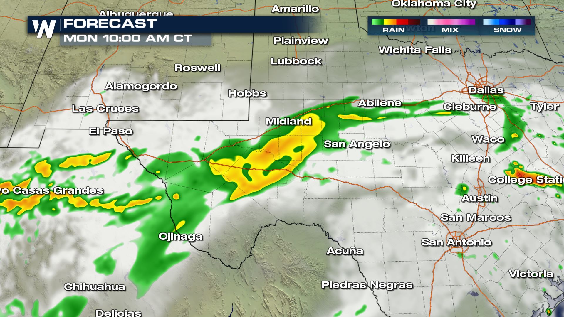
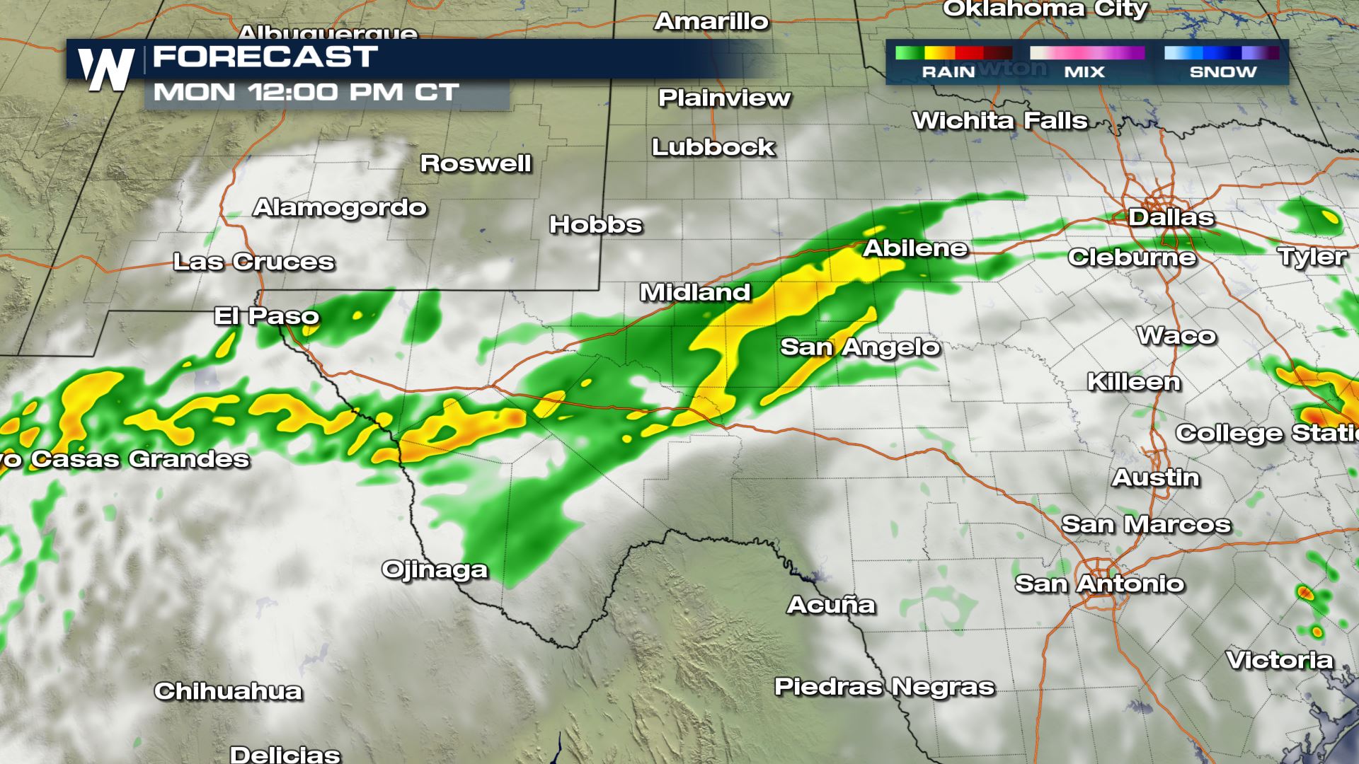
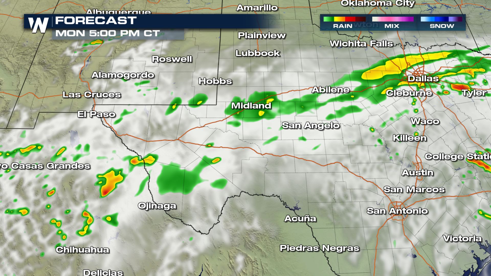
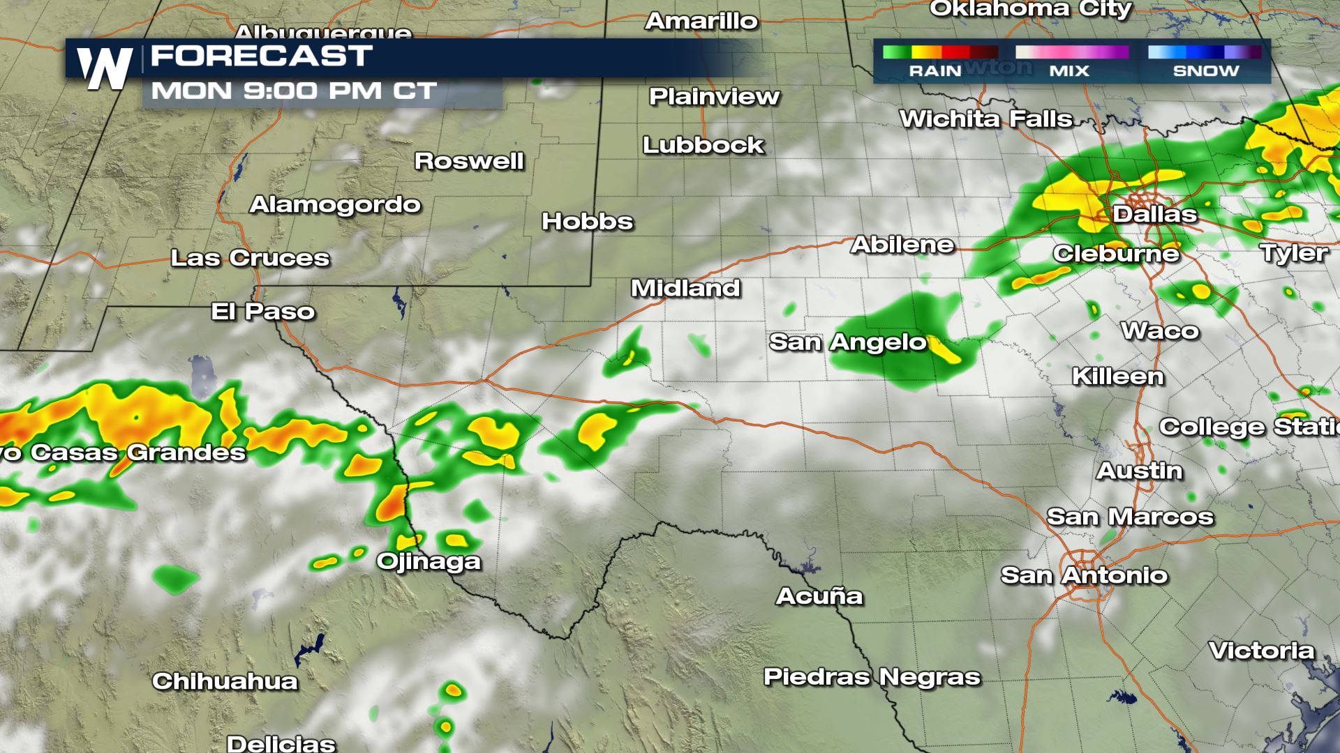
 You can see the shower and storm chances will last all day and night with this particular set-up. There could be some lightning embedded withing this activity, so you will want to use caution if you plan on being outdoors today. Cities like El Paso and Midland are included with the rainy forecast.
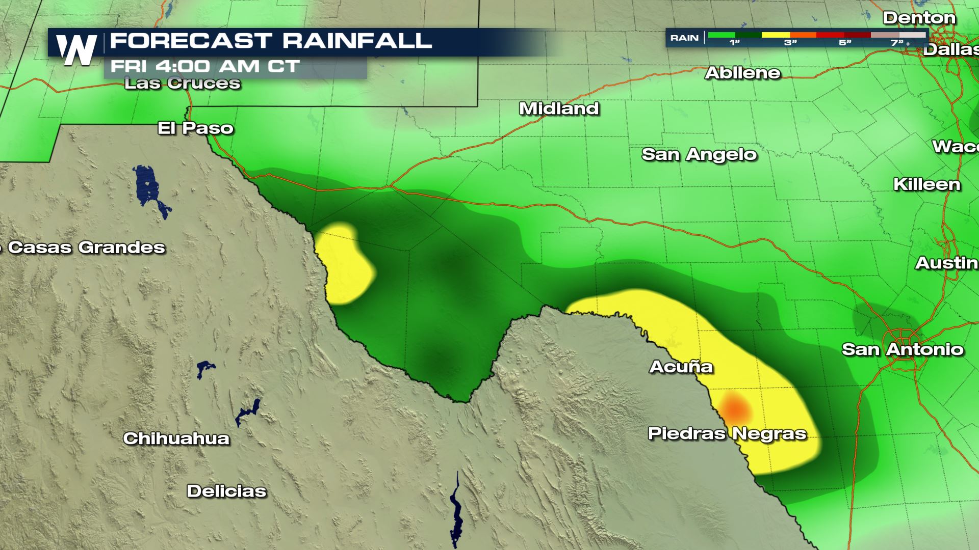 The rainfall isn't too extreme with our in house forecast model, but it is definitely picking up on isolated spots of heavy rainfall this week.
Keep checking with WeatherNation for more updates. Not sure how to watch WeatherNation? It's easy! You can stream us in so many different ways...here's how--->WeatherNation
The rainfall isn't too extreme with our in house forecast model, but it is definitely picking up on isolated spots of heavy rainfall this week.
Keep checking with WeatherNation for more updates. Not sure how to watch WeatherNation? It's easy! You can stream us in so many different ways...here's how--->WeatherNation
Water Vapor Satellite
You can see all the moisture located in western Mexico this morning and with the southwesterly flow that moisture is heading into the Lone Star State. Clouds and off and on rain chances will be possible throughout the morning, afternoon and evening. Luckily the severe storm risk is very low, but the heavy rain could lead to some issues.
Forecast
You can see the shower and storm chances will last all day and night with this particular set-up. There could be some lightning embedded withing this activity, so you will want to use caution if you plan on being outdoors today. Cities like El Paso and Midland are included with the rainy forecast.
Rainfall Potential
The rainfall isn't too extreme with our in house forecast model, but it is definitely picking up on isolated spots of heavy rainfall this week.
Keep checking with WeatherNation for more updates. Not sure how to watch WeatherNation? It's easy! You can stream us in so many different ways...here's how--->WeatherNationAll Weather News
More


More Storms for the East Sunday and Monday
A low-pressure system crashing through the Mi
2 Aug 2026 2:20 AM

After Reaching Category 5, Genevieve Weakens in the Pacific
PacificGenevieve formed on last Friday south
2 Aug 2026 1:30 AM

Flooding, Severe Storms Target the Midwest Again
After an active week of storms across the nor
1 Aug 2026 1:40 AM

Flooding Risk Increases as Heavy Rain Targets the Tri-State Area
Tuesday, heavy rainfall moved across the Nort
30 Jul 2026 12:25 AM

Severe Weather: Energy From the Midwest Now in the Southeast
UPPER MIDWEST - Through Monday, dangerous tor
29 Jul 2026 10:30 PM