Pacific Northwest Lingering Snow Through Early Monday
Top Stories
7 Nov 2021 2:00 PM
We have been generally unsettled in the western United States the last few days and weeks. This weekend will follow suit, with the potential for heavy mountain snowfall and coastal rainfall.
Related Article - Potent Wave for Pacific Northwest Monday
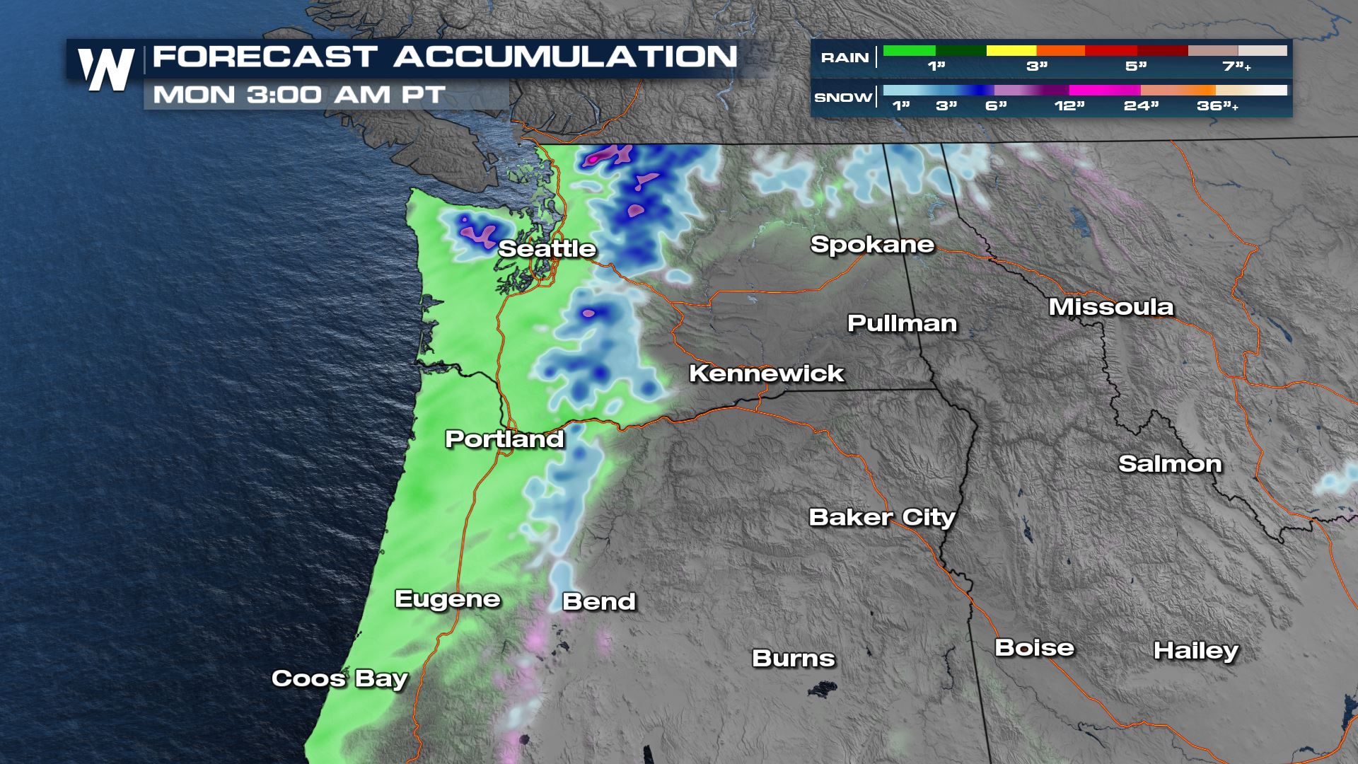
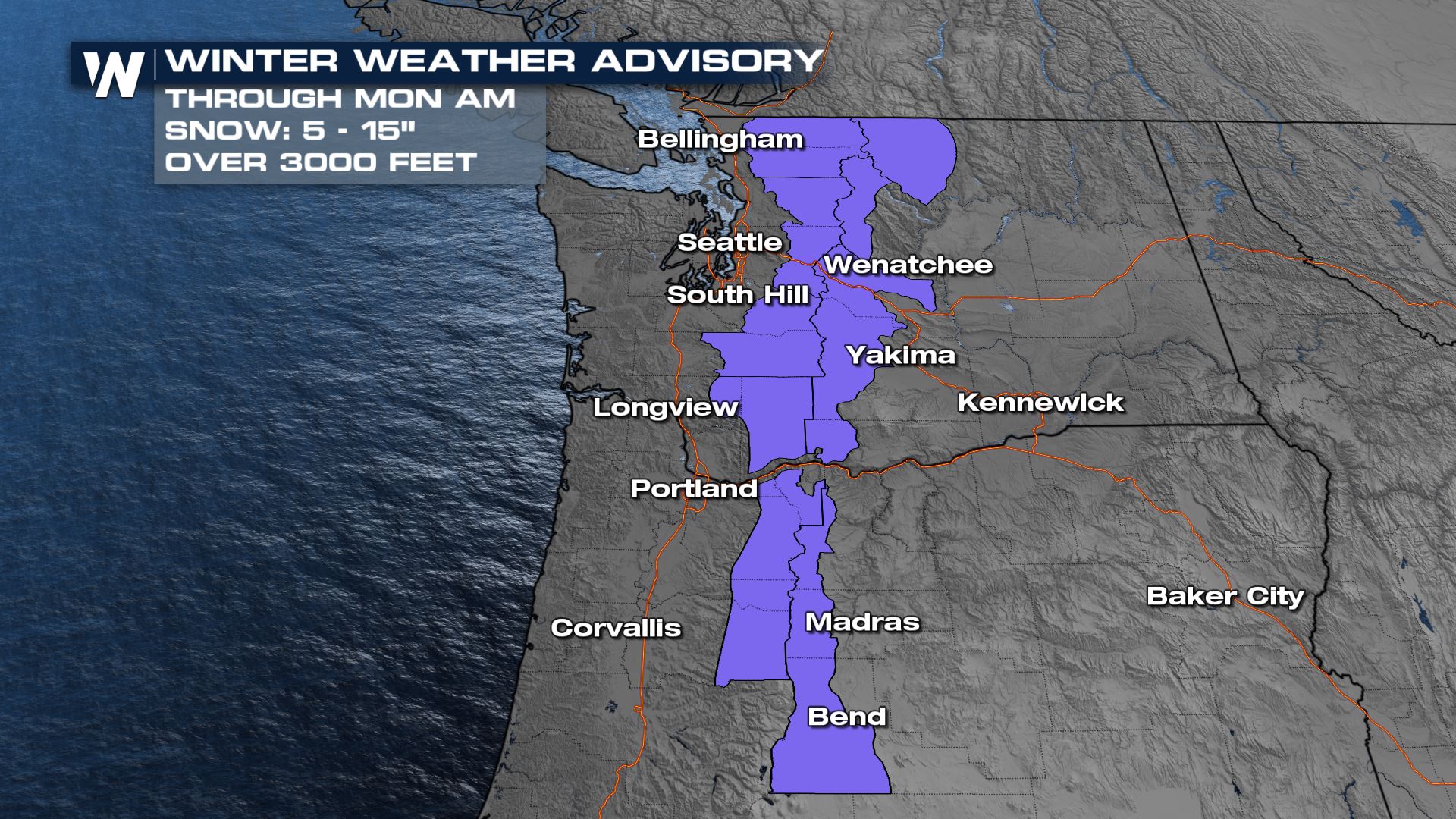 Our forecast model is highlighting the potential for a foot plus of snow up and down the Cascades into Washington and Oregon through tonight.
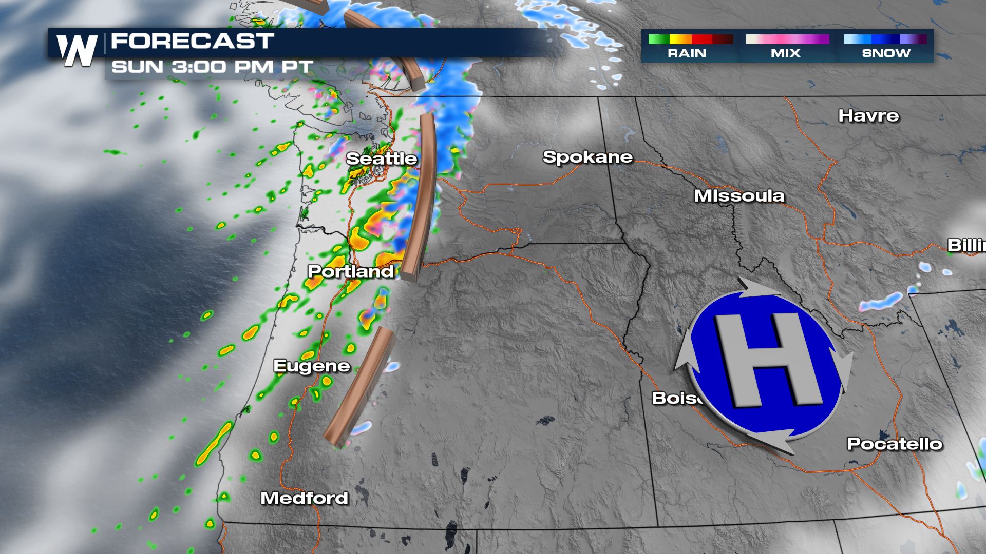
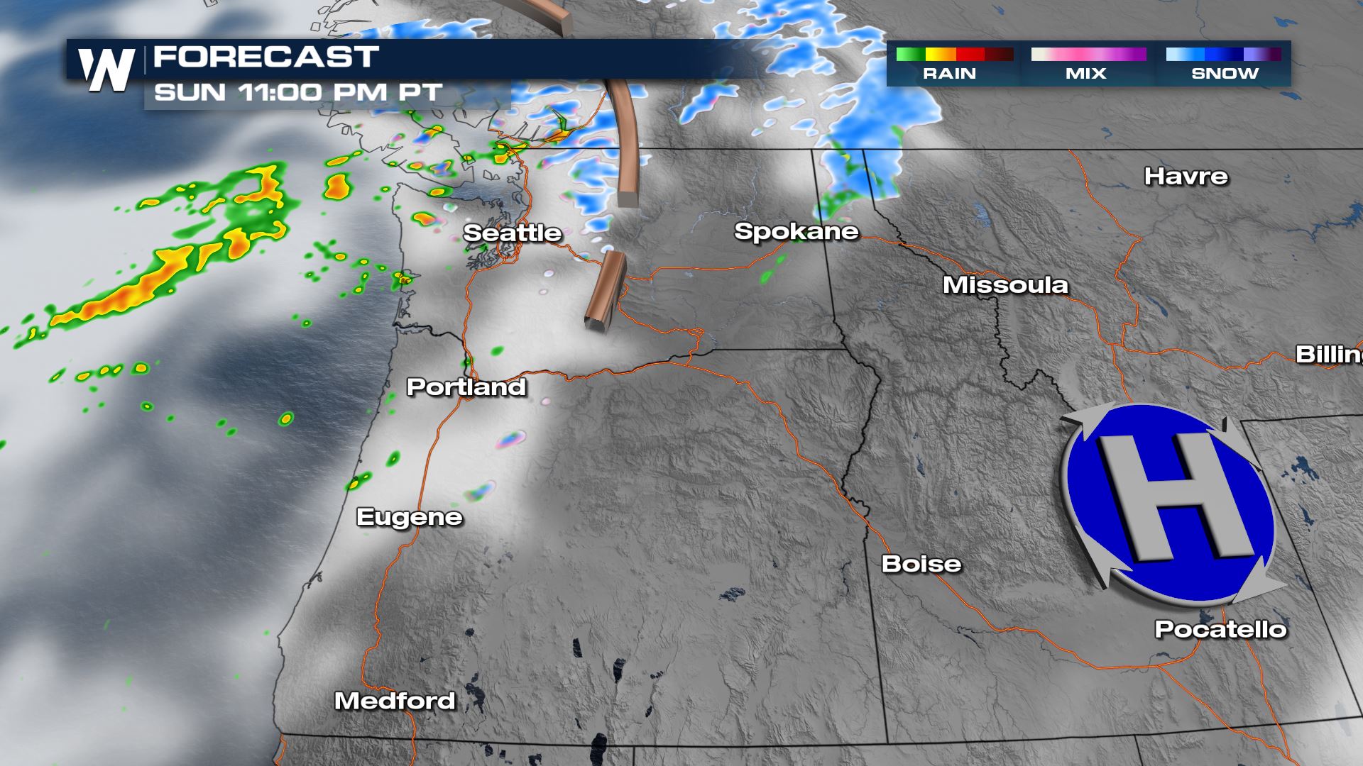
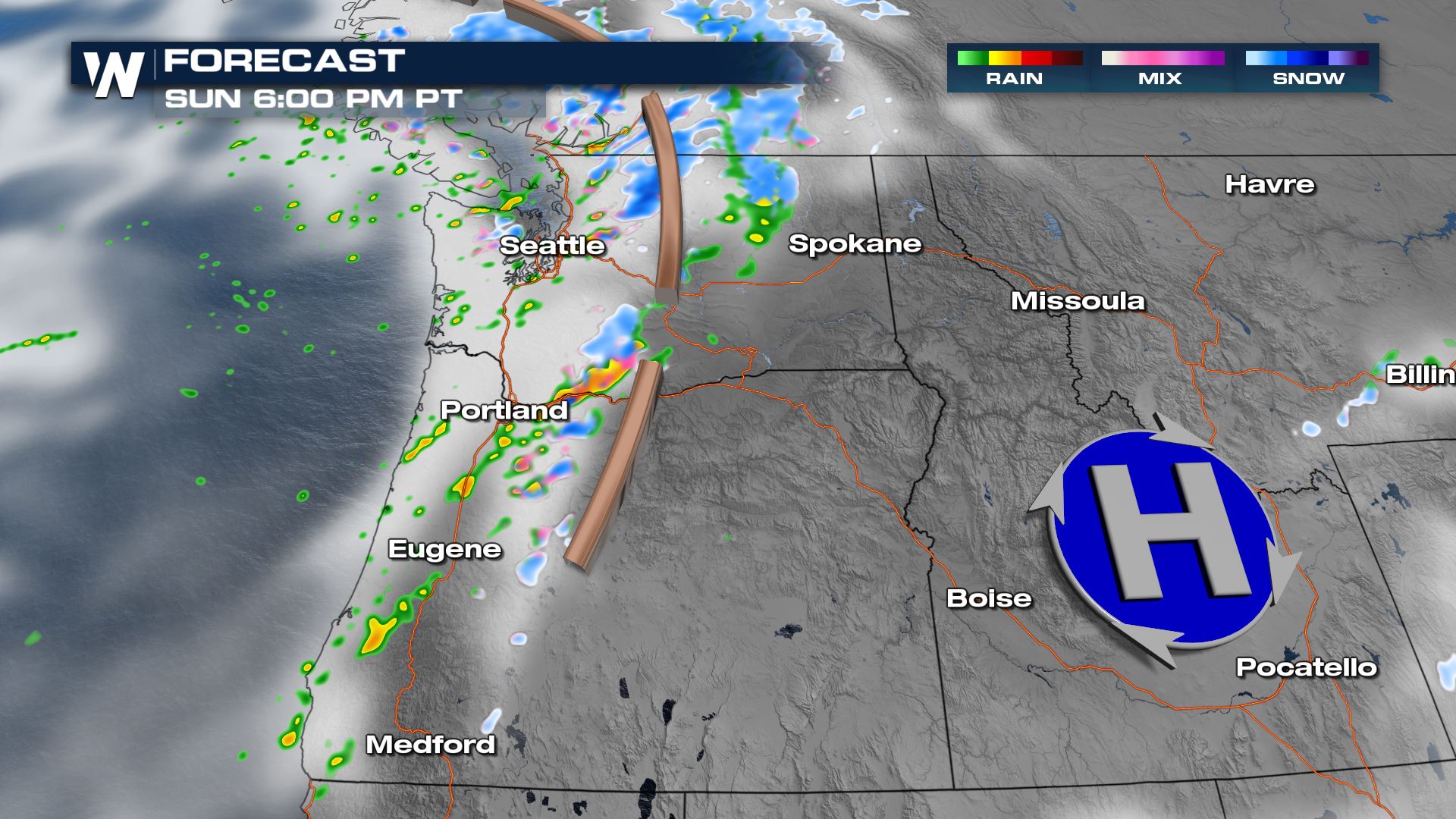 A brief lull in the activity is expected Sunday night into Monday morning, before our next wave moves onshore.
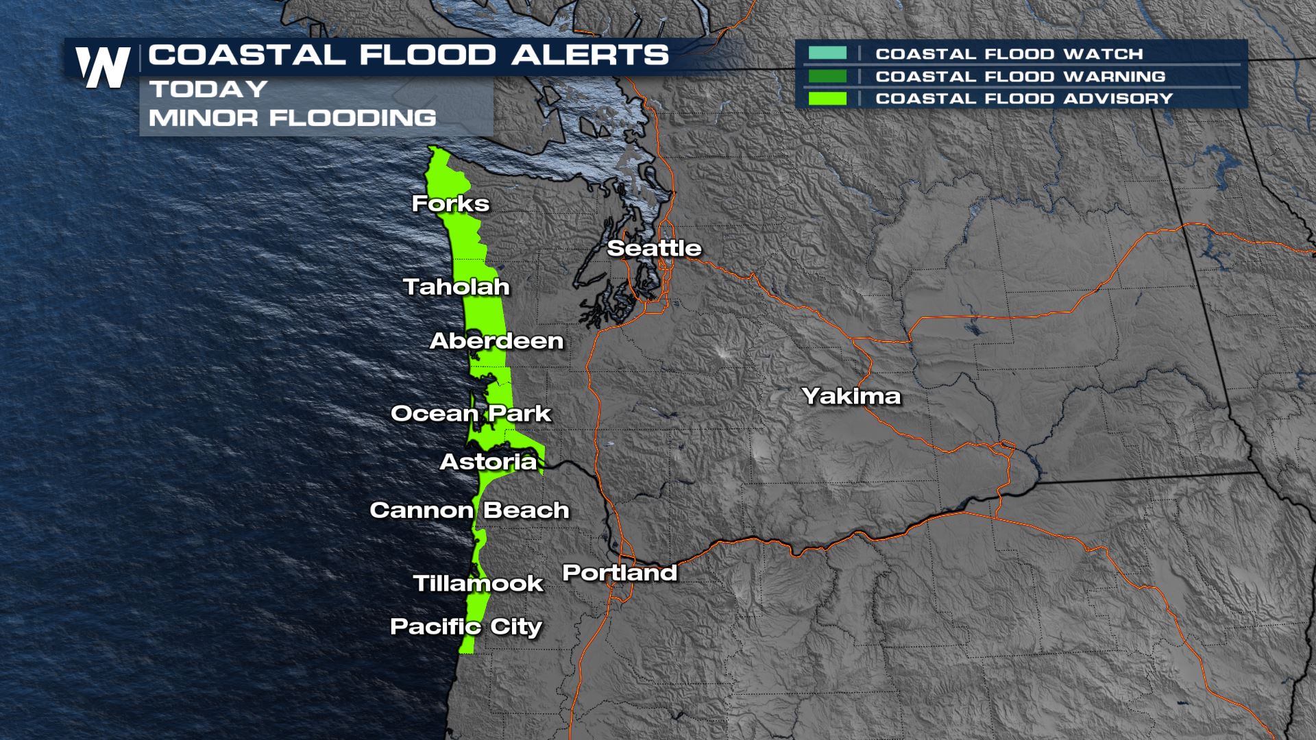
 Winds will also be strong at times this afternoon in combination with high tide. The winds could push water onshore and contribute to coastal flooding, up to about half a foot along the immediate coastline.
 Stay with WeatherNation as we keep you up to date on all of our top weather headlines and active pattern in the west!
Snow Potential
A winter weather advisory continues through the evening and into early Monday morning for parts of Washington and Oregon, where high elevations could see over a foot of snowfall. This will generally not impact too many roadways, but locally challenging travel is anticipated in the Cascades. Our forecast model is highlighting the potential for a foot plus of snow up and down the Cascades into Washington and Oregon through tonight.

Forecast
The mountains will stop a lot of the moisture from traveling into eastern Washington and Oregon, but expect a generally cool and cloudy day throughout the Pacific Northwest with bursts of heavy rain and snow at times.
 A brief lull in the activity is expected Sunday night into Monday morning, before our next wave moves onshore.
 Winds will also be strong at times this afternoon in combination with high tide. The winds could push water onshore and contribute to coastal flooding, up to about half a foot along the immediate coastline.
 Stay with WeatherNation as we keep you up to date on all of our top weather headlines and active pattern in the west!
All Weather News
More