Potential for Flooding in the Southwest with Heavy Snow Continues
Special Stories
22 Feb 2020 3:35 PM
SETUP
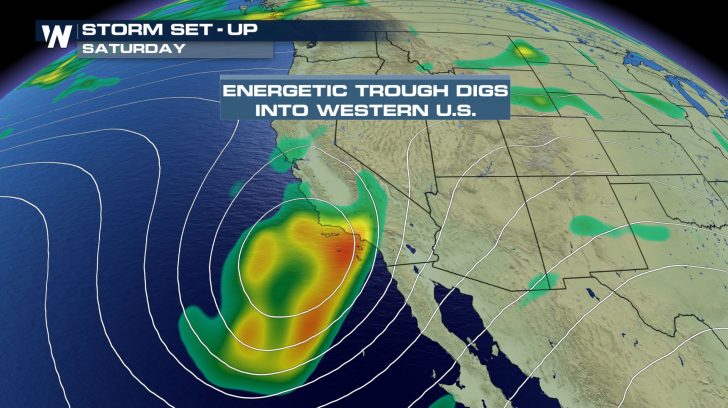 A wave of energy has moved into the southwest bringing plenty of rain and snow to the region. This will be much needed after an extended period of dry weather, however it may be too much at once for some areas.
FLOOD ALERTS
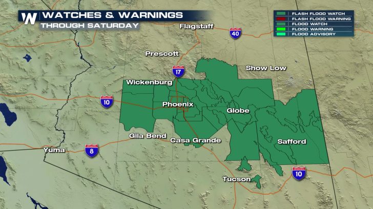 Flash flood watches have been issued for Central Arizona, including the Phoenix metro area and the I-10 corridor. These watches last through Saturday evening.
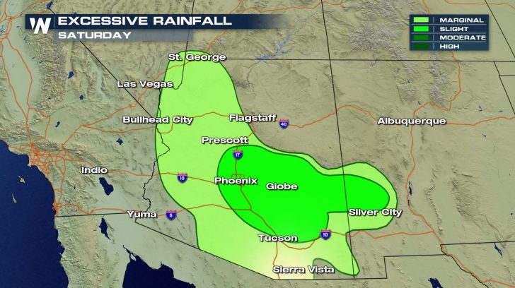 The greatest risk for flash flooding will be east of Phoenix, especially in the mountains and foothills. Rain totals could approach one to two inches in the area indicated by the slight risk for excessive rainfall.
WINTER WEATHER ALERTS
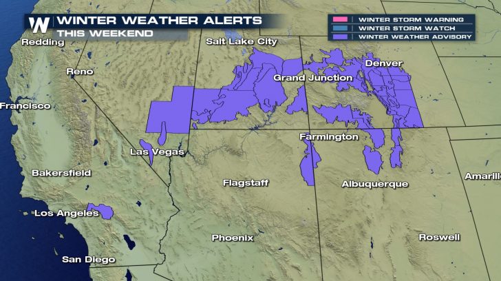 Winter weather advisories have also been issued for several mountain ranges from Southern California through Southwestern Colorado.
FORECAST
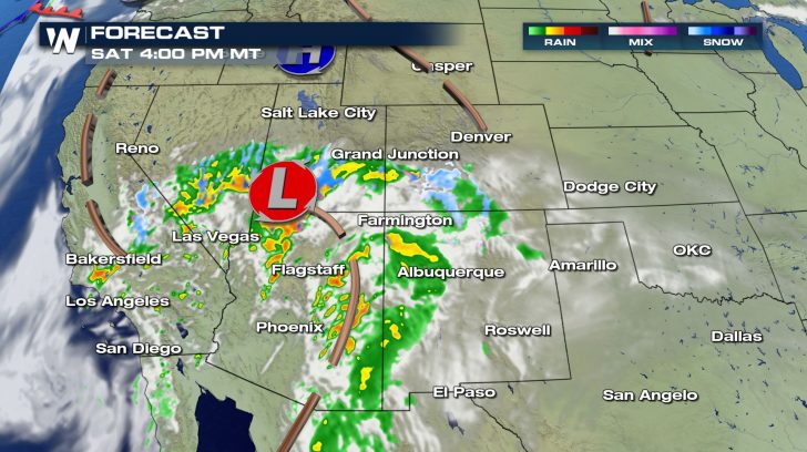
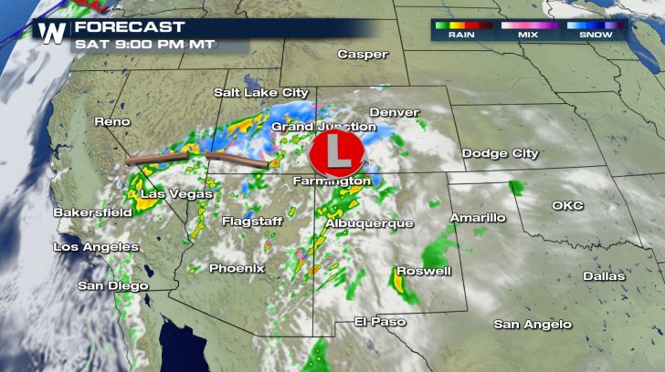
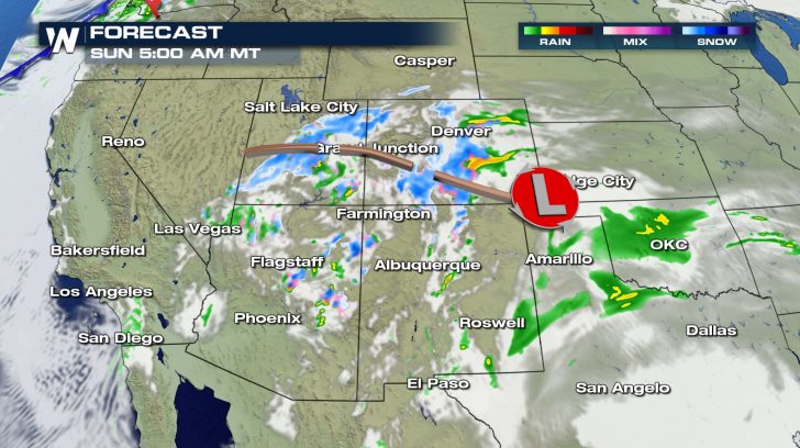 Widespread rain will continue for the remainder of the Saturday with snow finally picking up in Utah and Colorado by this evening.
Once we dive into Sunday morning, the precipitation will be more in the form of snowfall into the higher elevations. Gradually snow levels will drop and places such as Denver and Colorado Springs will see their fair share of snow throughout a majority of the Sunday.
FORECAST RAIN AND SNOW
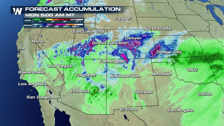 The heaviest rain over the weekend is expected to fall in Arizona and New Mexico, with mostly light accumulations elsewhere. Snow totals could top a foot in the mountains of New Mexico, Utah, and Colorado.
Aside from the flooding concerns, this weekend's rain will be beneficial for the region which is experiencing widespread drought conditions. Spring training games being held around the Phoenix area could be impacted by this storm.
Stay with WeatherNation through the weekend for updates and live coverage of this storm system.
The heaviest rain over the weekend is expected to fall in Arizona and New Mexico, with mostly light accumulations elsewhere. Snow totals could top a foot in the mountains of New Mexico, Utah, and Colorado.
Aside from the flooding concerns, this weekend's rain will be beneficial for the region which is experiencing widespread drought conditions. Spring training games being held around the Phoenix area could be impacted by this storm.
Stay with WeatherNation through the weekend for updates and live coverage of this storm system.All Weather News
More