Rain Chances Increase For the West Coast This Week
Top Stories
31 Oct 2021 7:40 AM
Precipitation chances will increase this week across the West as several waves of energy move onshore in the region. A few showers and cloudy skies will be possible today before a more robust system moves onshore into Monday.
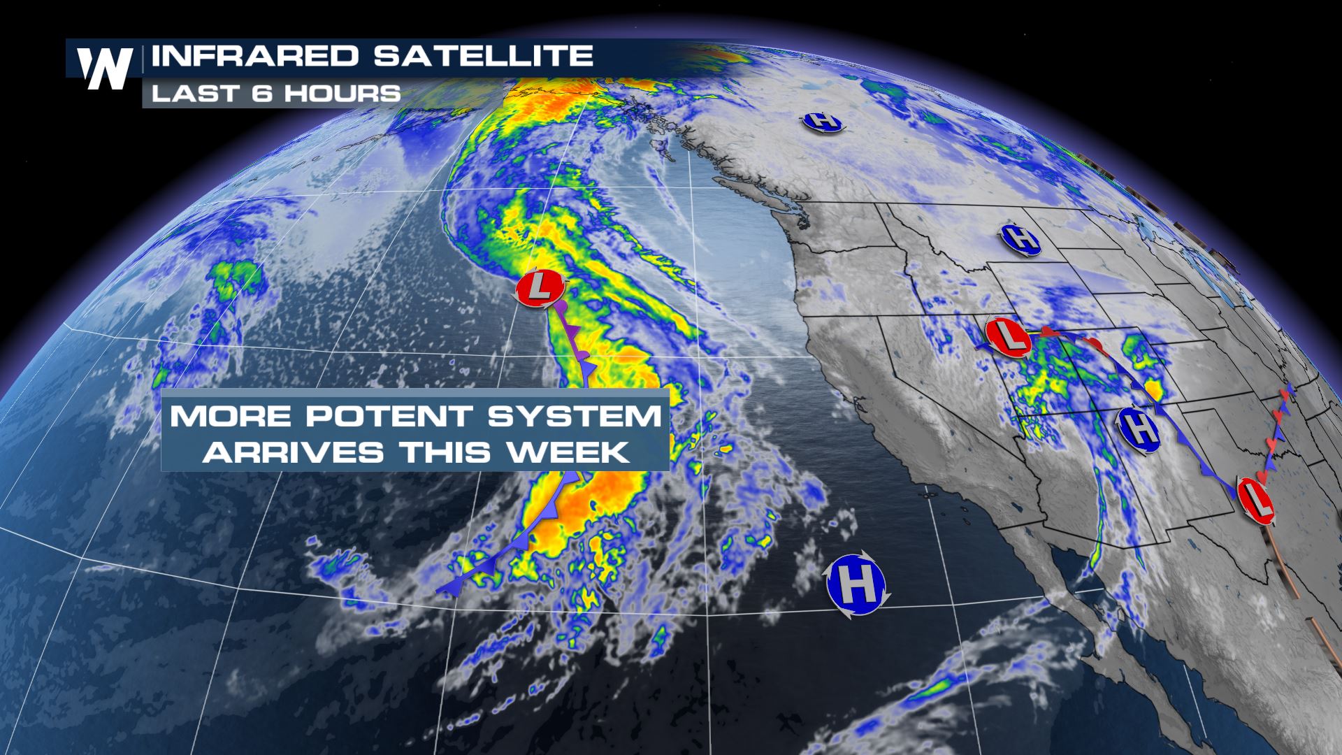
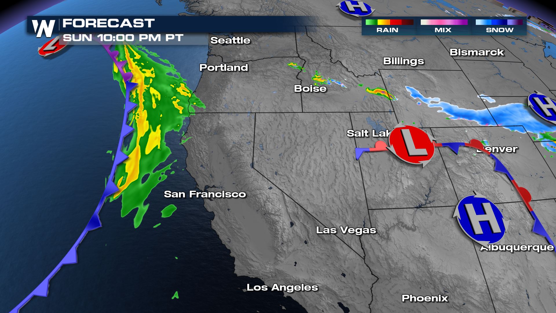
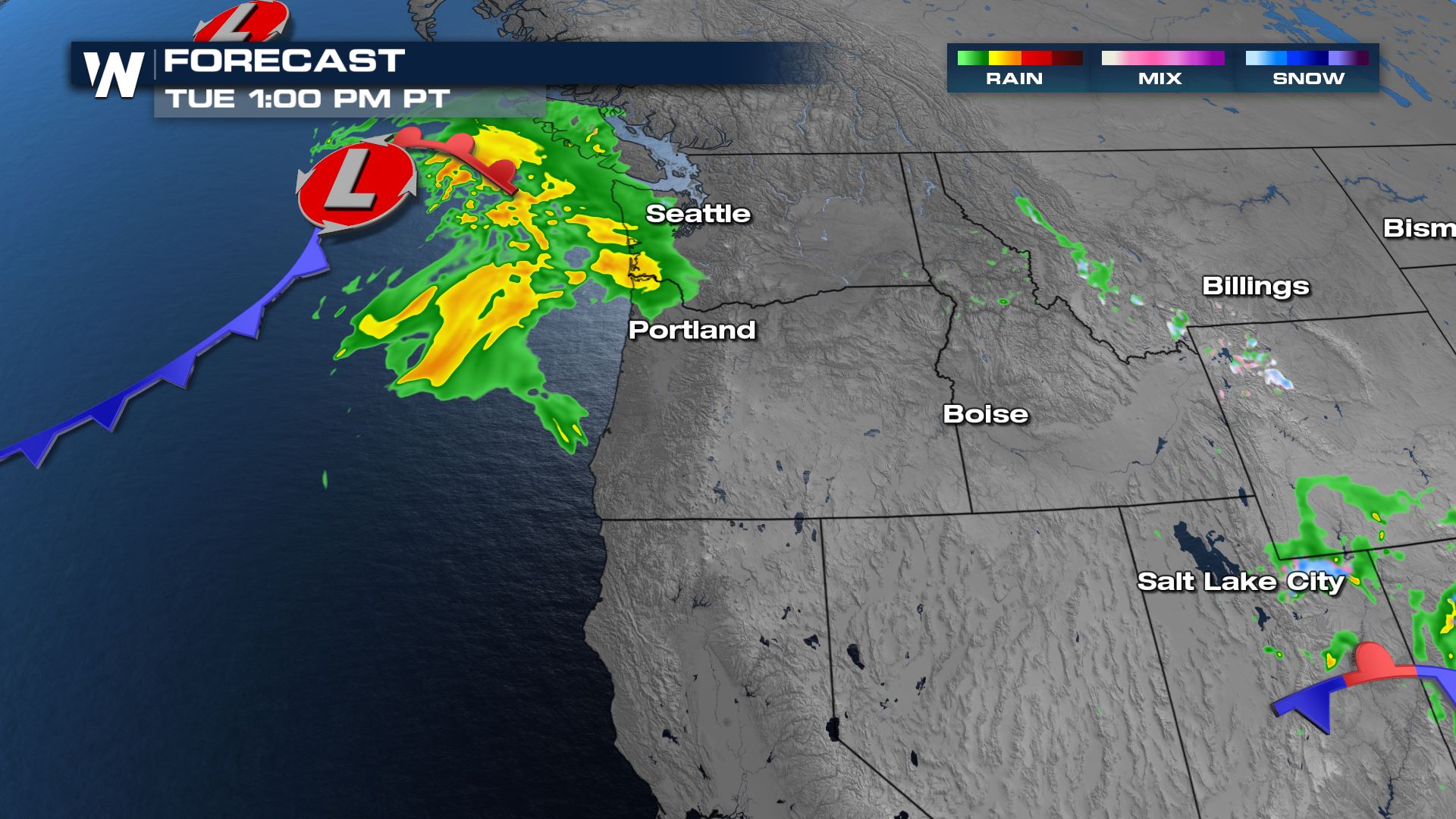
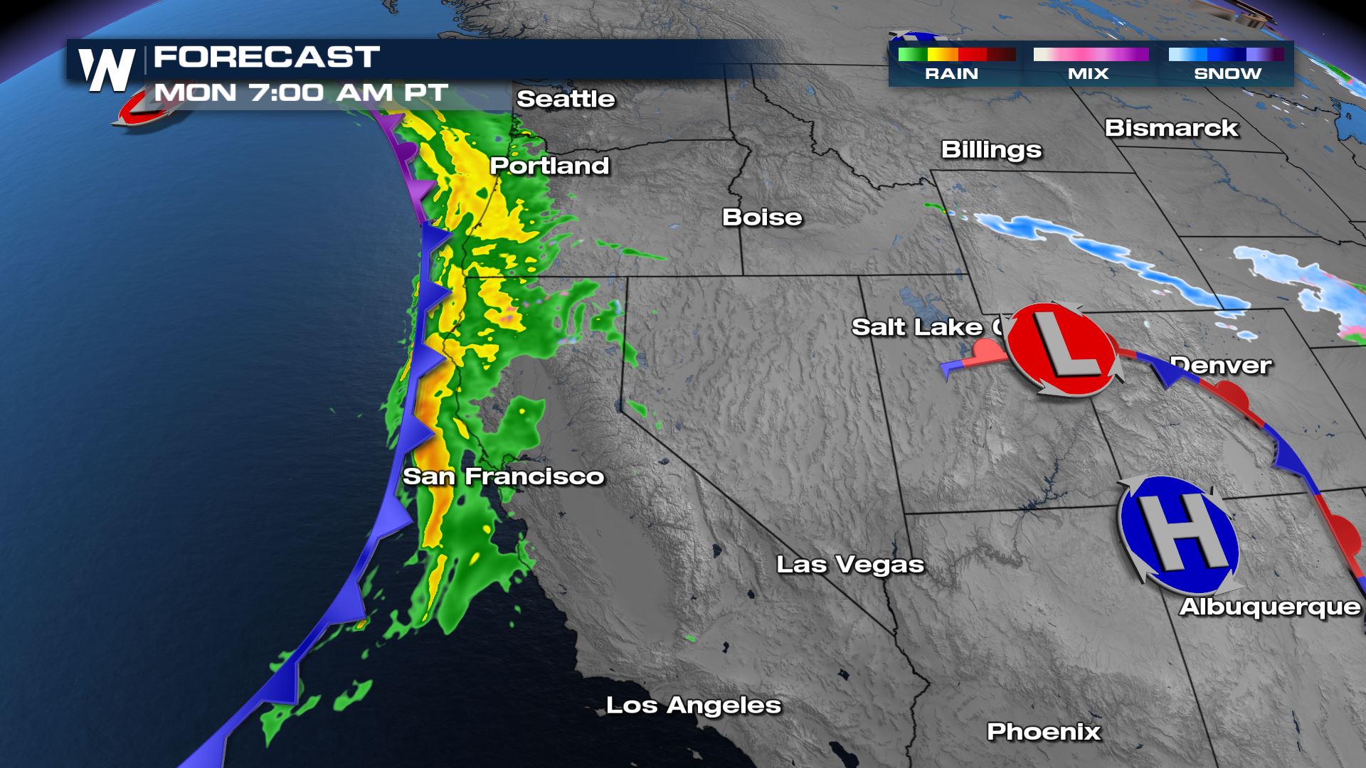 Rain will be confined to the coastal regions and mountains early in the day before spreading onshore to the I-5 corridor in the mid-morning. Rain and snow are expected in the Sierra through midday with precipitation moving out of the region by the evening, spreading into Washington and Idaho.
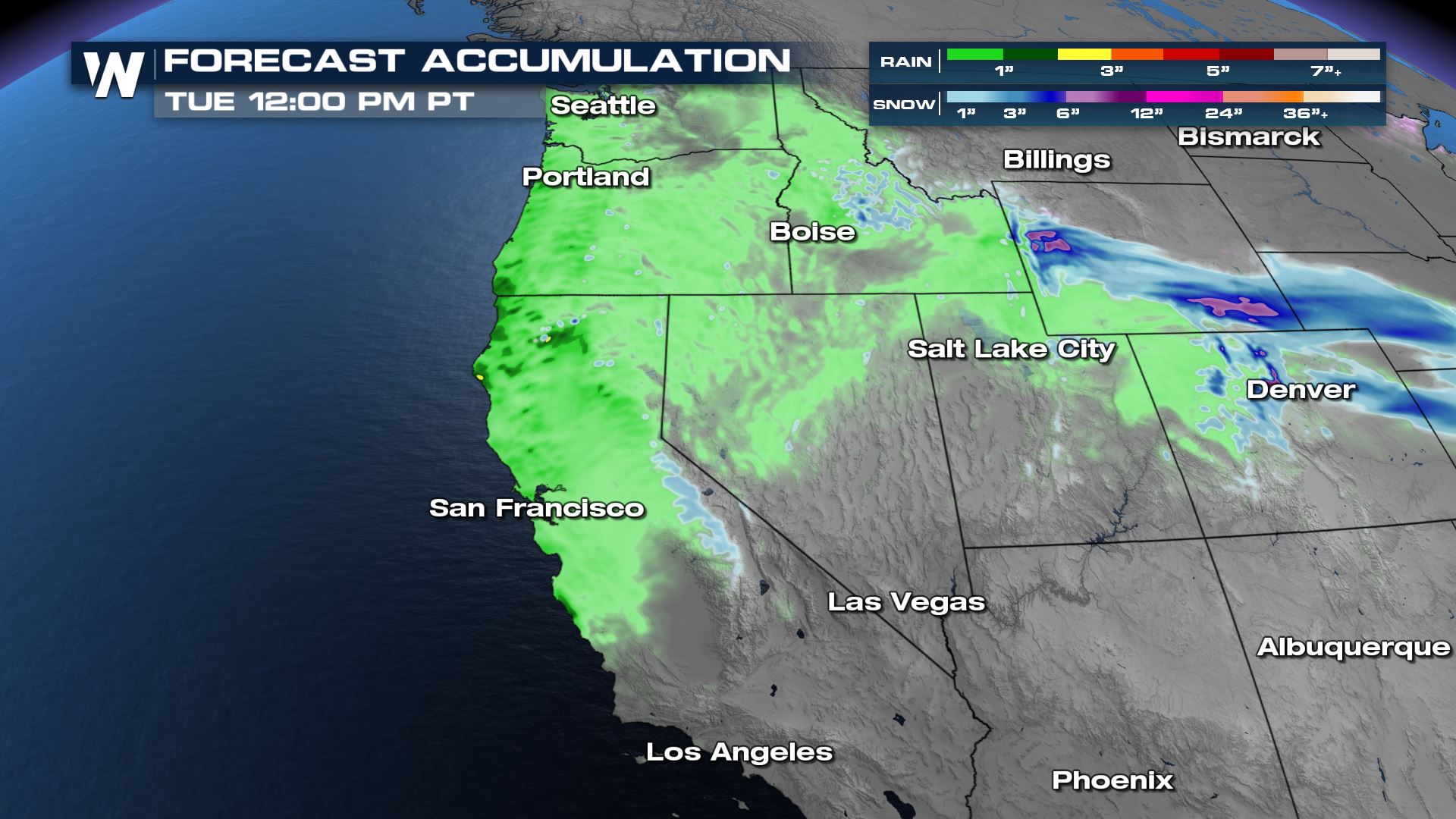
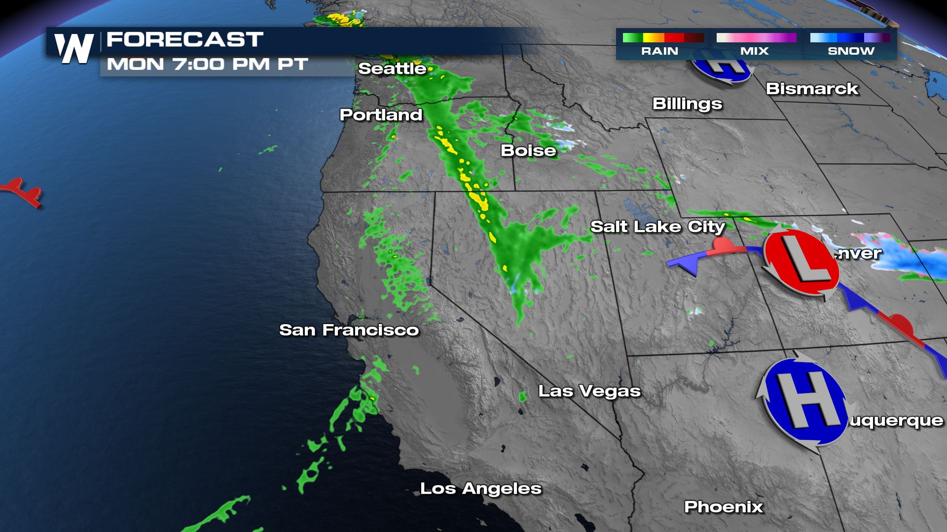 Rain totals are expected to generally range between a quarter and a half of an inch, with higher end totals over an inch and a half.
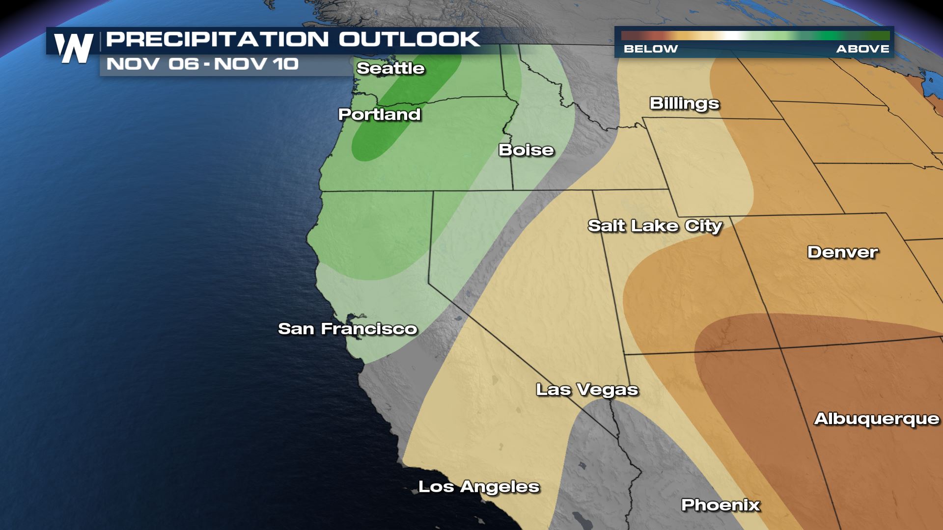
 Another system arriving around the mid-week time frame looks to keep precipitation chances above average in the region, with a generally active period expected through the end of the first week of November.
 Get the latest forecast for the Western Region at :50 past each hour, or anytime through the WeatherNation app.
Sunday
Clouds and choppy surf start working towards the coastal areas of the western US into the late night hours tonight with the next trough.
Monday
A stronger trough will push a cold front onshore across Oregon and California on Monday with moderate to heavy rain and some high elevation snow.
 Rain will be confined to the coastal regions and mountains early in the day before spreading onshore to the I-5 corridor in the mid-morning. Rain and snow are expected in the Sierra through midday with precipitation moving out of the region by the evening, spreading into Washington and Idaho.
 Rain totals are expected to generally range between a quarter and a half of an inch, with higher end totals over an inch and a half.
 Another system arriving around the mid-week time frame looks to keep precipitation chances above average in the region, with a generally active period expected through the end of the first week of November.

 Get the latest forecast for the Western Region at :50 past each hour, or anytime through the WeatherNation app.
All Weather News
More