Tornado Warning Issued Sunday near West Palm Beach, FL

The National Weather Service in Miami issued a tornado warning on Sunday afternoon including Boynton Beach, Delray Beach, and Greenacres. After a busy day today, limited storms remain. A few storms will be possible through this evening, but the severe threat has lessened and storms continue to taper off due to the loss of daytime heating.
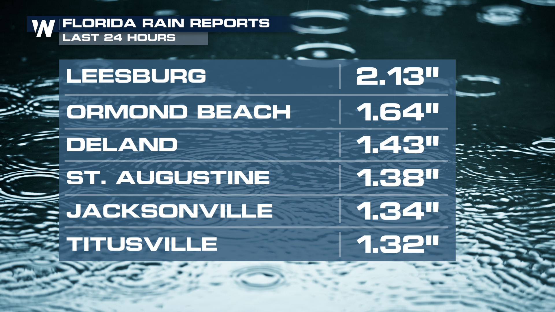
This low brought heavy rain to the Lower Mississippi Valley on Friday and will continue to stream moisture through the Carolinas over the next few days. Rainfall reports through Florida have been 1 - 2".
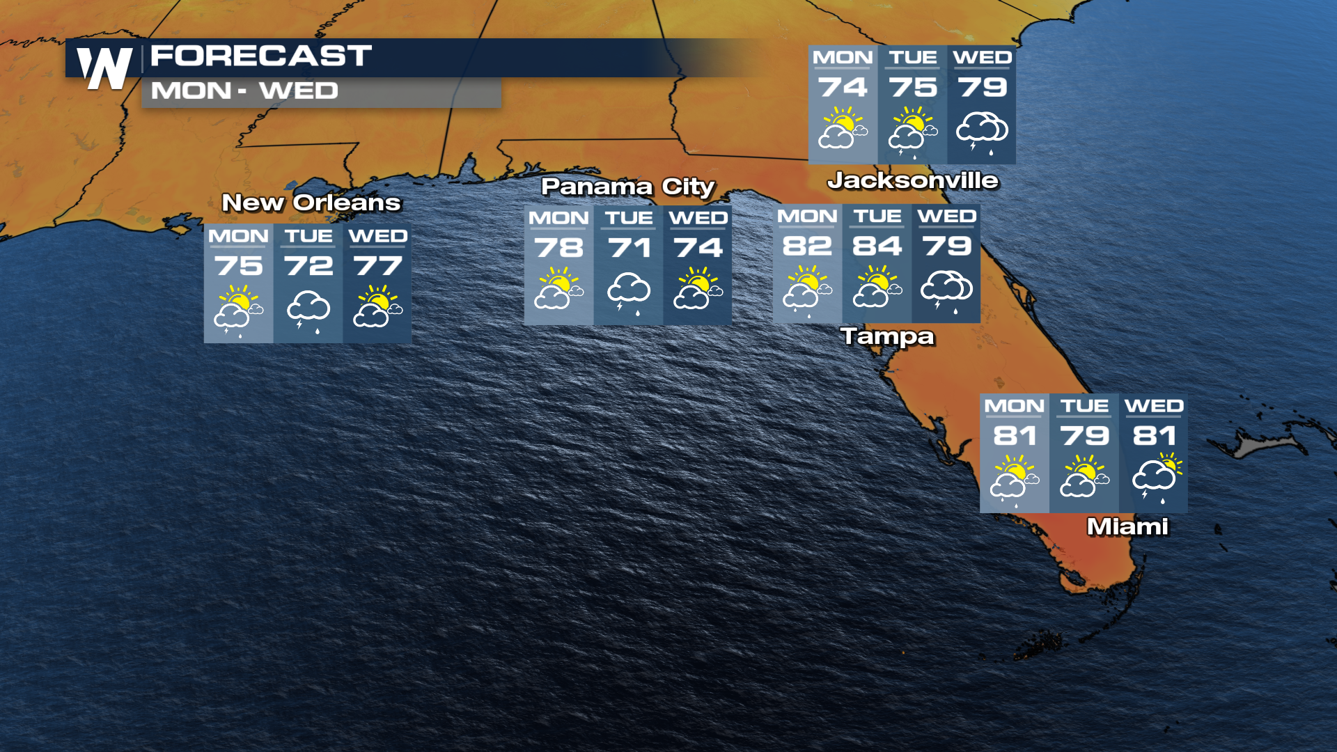
 The severe threat has been downgraded to a general risk, but a strong storm or two will still be possible. Throughout the day Monday, additional sea-breeze thunderstorms are also possible.
After a cool, rainy last few days the weekend promises a warmup! As this low moves away and wind surges from the south through Monday, temperatures will rebound back into the 60s and 70s; above average for many.
Despite a rather wet winter across the southern tier of the country (El Nino pattern), which has eradicated much of the drought through Louisiana, Mississippi, and central Texas over the last three months, parts of the Southeast have been dry and breezy the last week so rainfall is welcomed. The Jefferson Davis fire broke out on Monday, south of Jackson, MS, and quickly burned 1,300 acres.


