Overnight Severe Threat Continues in the PacNW

A slight risk for severe weather continues overnight for portions of the Northwest, including Seattle, WA, and Portland, OR. This is not something we see often! Both Seattle and Portland are under a Slight Risk of severe weather.
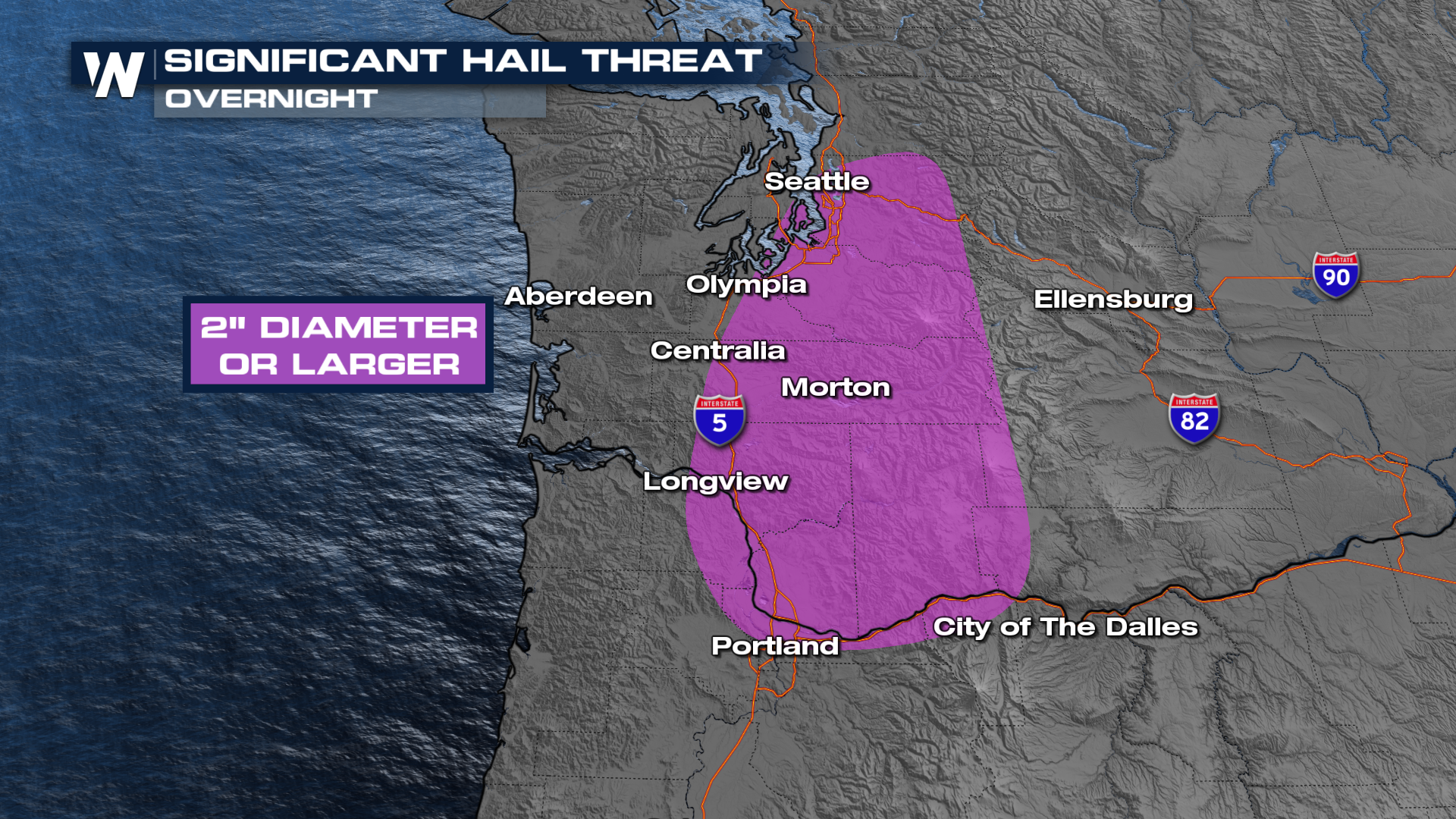
A powerhouse system will spin onshore, but it's coming on the heels of record-warm temperatures. That combination typically doesn't happen up here, especially not this early. The Storm Prediction Center has a significant hail threat along the I-5. This means hailstones greater than 2" will be possible.
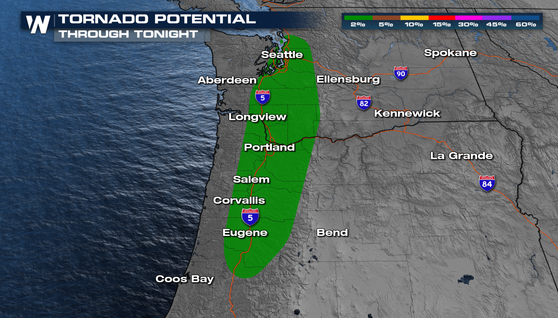
The tornado threat has also been downgraded to a 2% risk. It is essential to have multiple ways to get alerts, as the storms continue overnight.
 The thunderstorms will continue through the night, and multiple waves will move through the Northwest keeping things active.
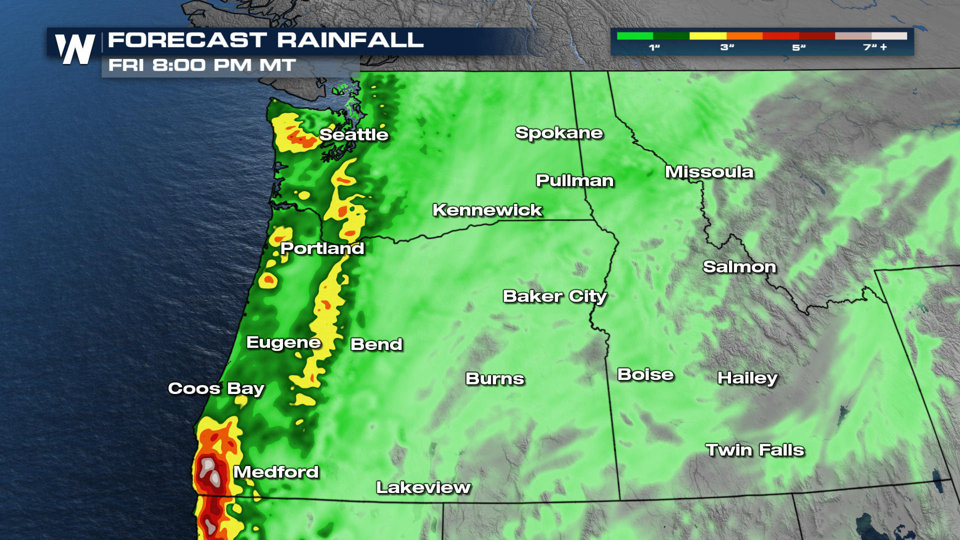
Heavy rainfall could lead to additional flooding in the Pacific Northwest. Some areas in the next week will pick up 3-5 inches of rain, on top of what has fallen recently.
 More on the northwestern forecast can always be found :50 past the hour on WeatherNation.


