Severe Risk Continues In the Central Plains

Top Stories
11 Jun 2021 5:00 PM
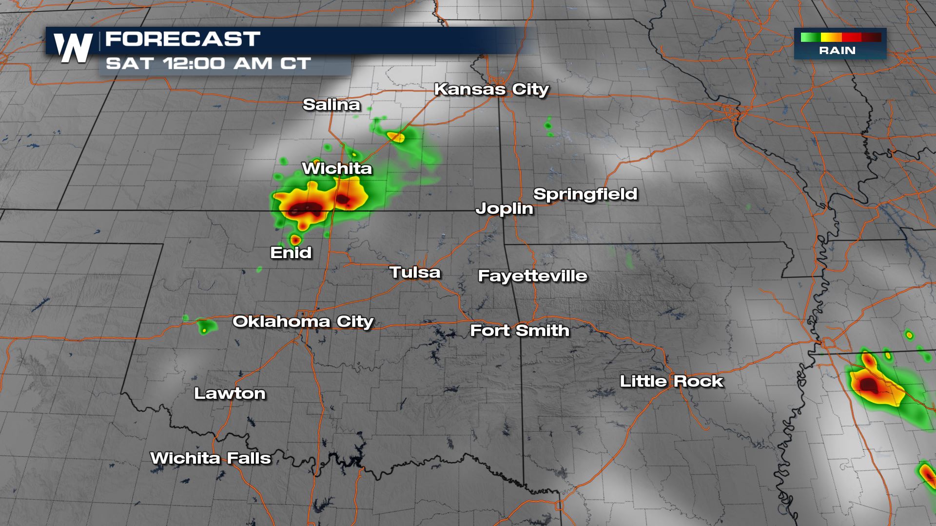
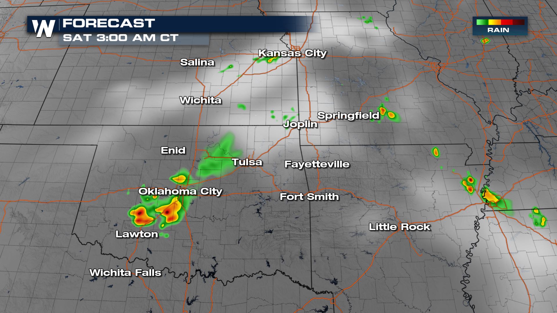
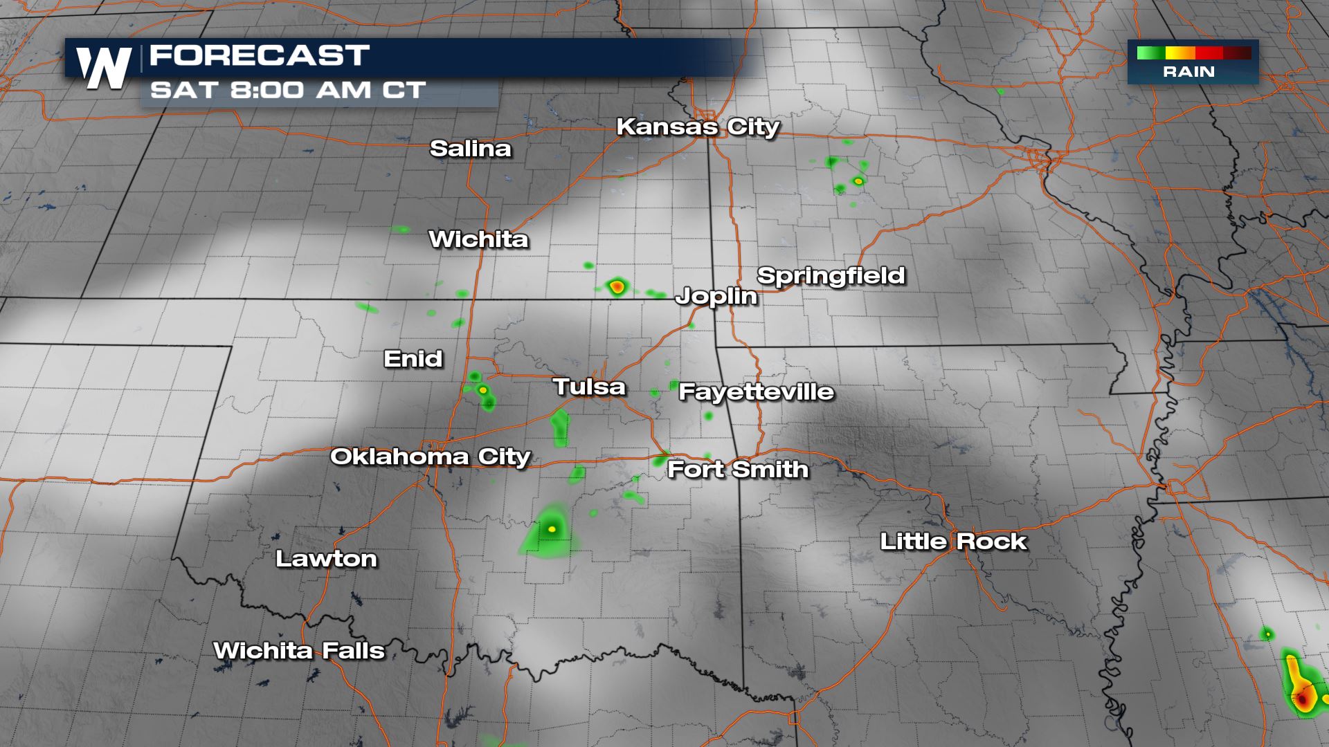
Intense thunderstorms impacted the central Great Plains Friday with wind gusts up to 90 miles per hour! Now the storms are expected to continue to drift to the south through the overnight hours and into early Saturday.
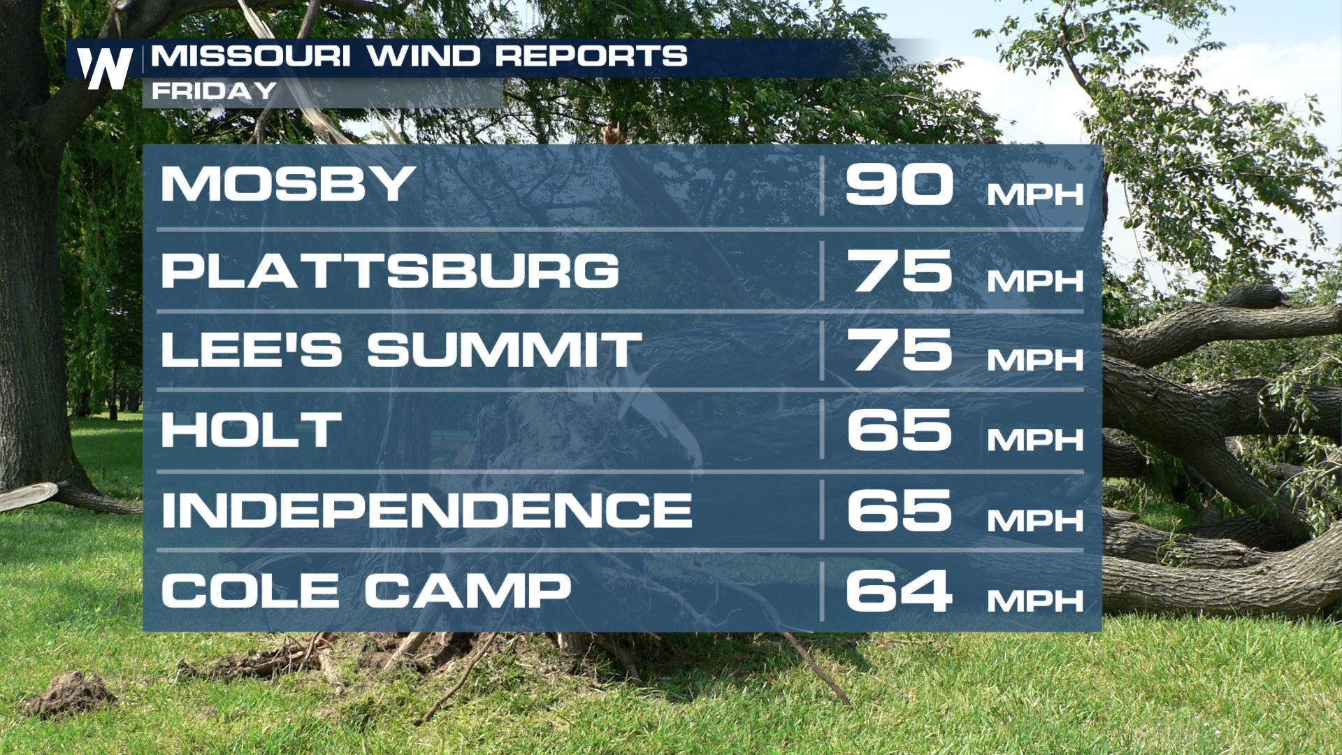
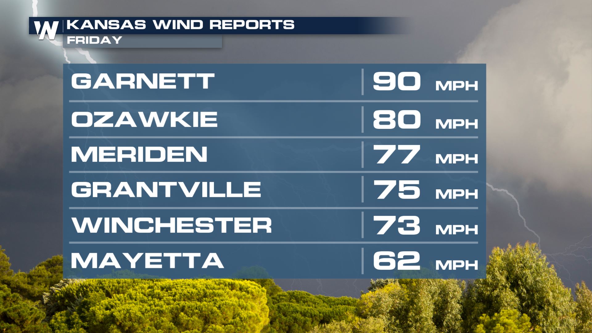
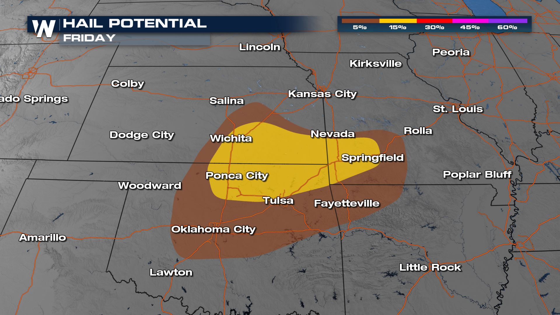
 Damaging wind gusts are the primary risk from storms but large hail is also expected with several storms.
 More updates can always be found on WeatherNation. Find out how to stream our live coverage here ——–>Stream WeatherNation
Storm Reports
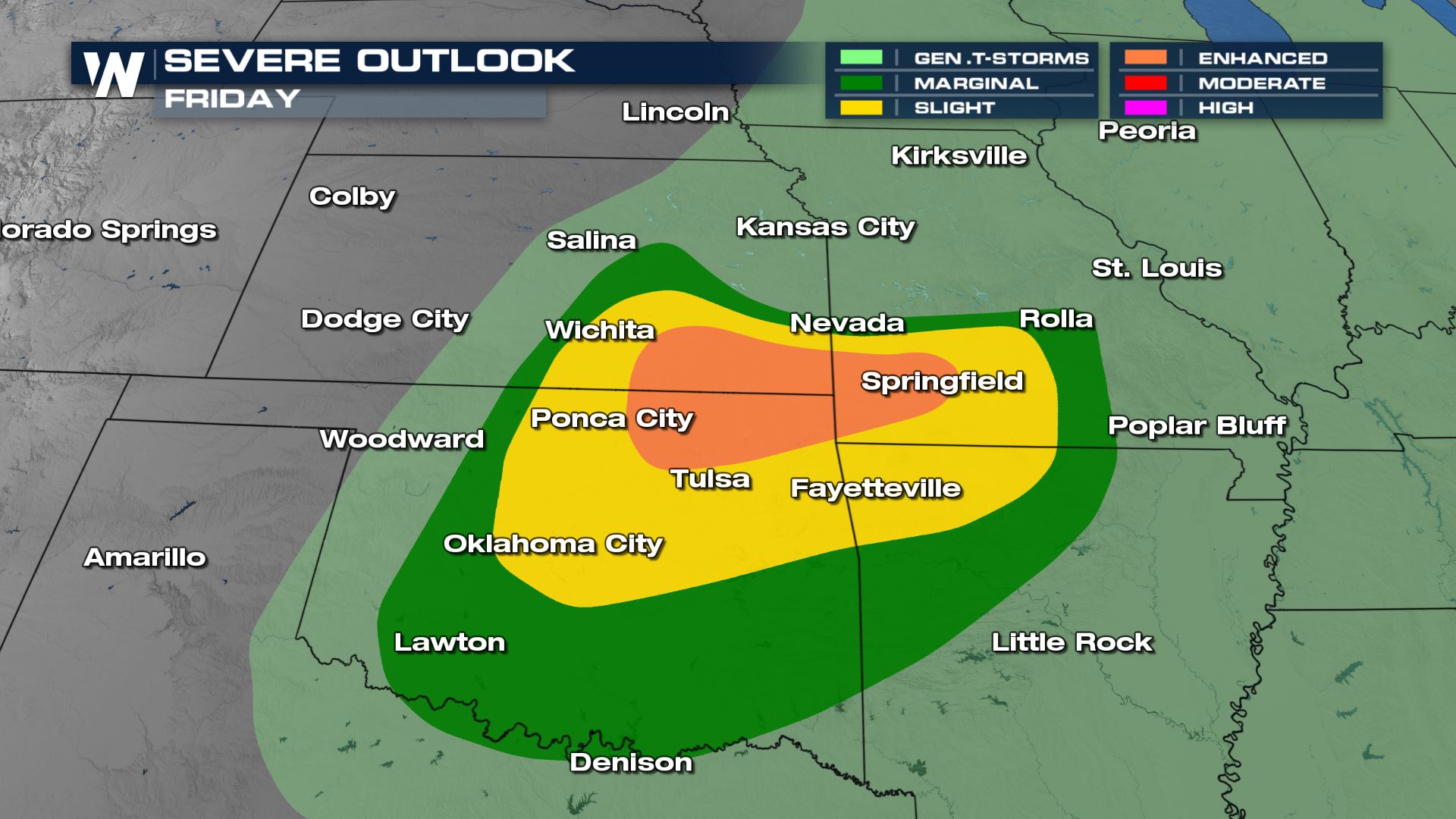
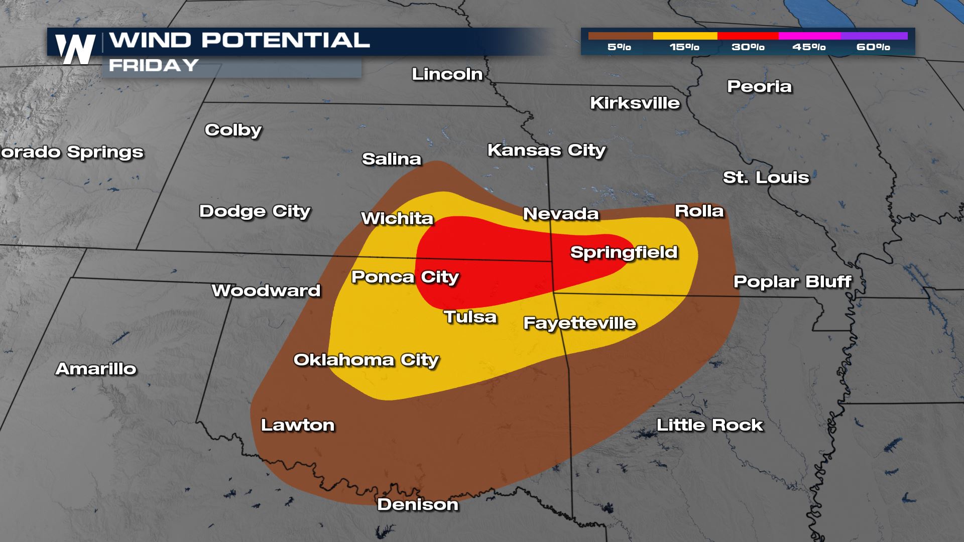
Severe Outlook
Scattered to numerous strong to severe thunderstorms are expected along the tail end of a cold front overnight into Saturday morning, as the remnant energy Friday dives south. An enhanced risk (category 3 out of 5) has been issued across portions of Northeast Oklahoma.
Damaging wind gusts are the primary risk from storms but large hail is also expected with several storms.
Forecast
Storms will continue to move south from Kansas and Missouri overnight, into Oklahoma and perhaps western Arkansas.
More updates can always be found on WeatherNation. Find out how to stream our live coverage here ——–>Stream WeatherNationAll Weather News
More
Flooding Risk Increases as Heavy Rain Targets the Tri-State Area
Tuesday, heavy rainfall moved across the Nort
30 Jul 2026 12:25 AM


Genevieve Down to a Category 2 Hurricane
PacificFausto is now a post-tropical cyclone.
30 Jul 2026 12:00 AM

Severe Weather: Energy From the Midwest Now in the Southeast
UPPER MIDWEST - Through Monday, dangerous tor
29 Jul 2026 10:30 PM


Southeast Flood Risk Lingers Near Stalled Front
A stalled boundary over the Southeast will ke
25 Jul 2026 10:55 AM

Another Round of Storms Targets the Northeast
Tuesday brought severe weather again across p
23 Jul 2026 1:15 AM