Severe Weather Threat in the Northeast
Top Stories
21 Jun 2021 7:43 PM
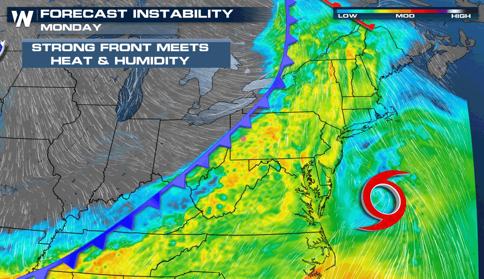
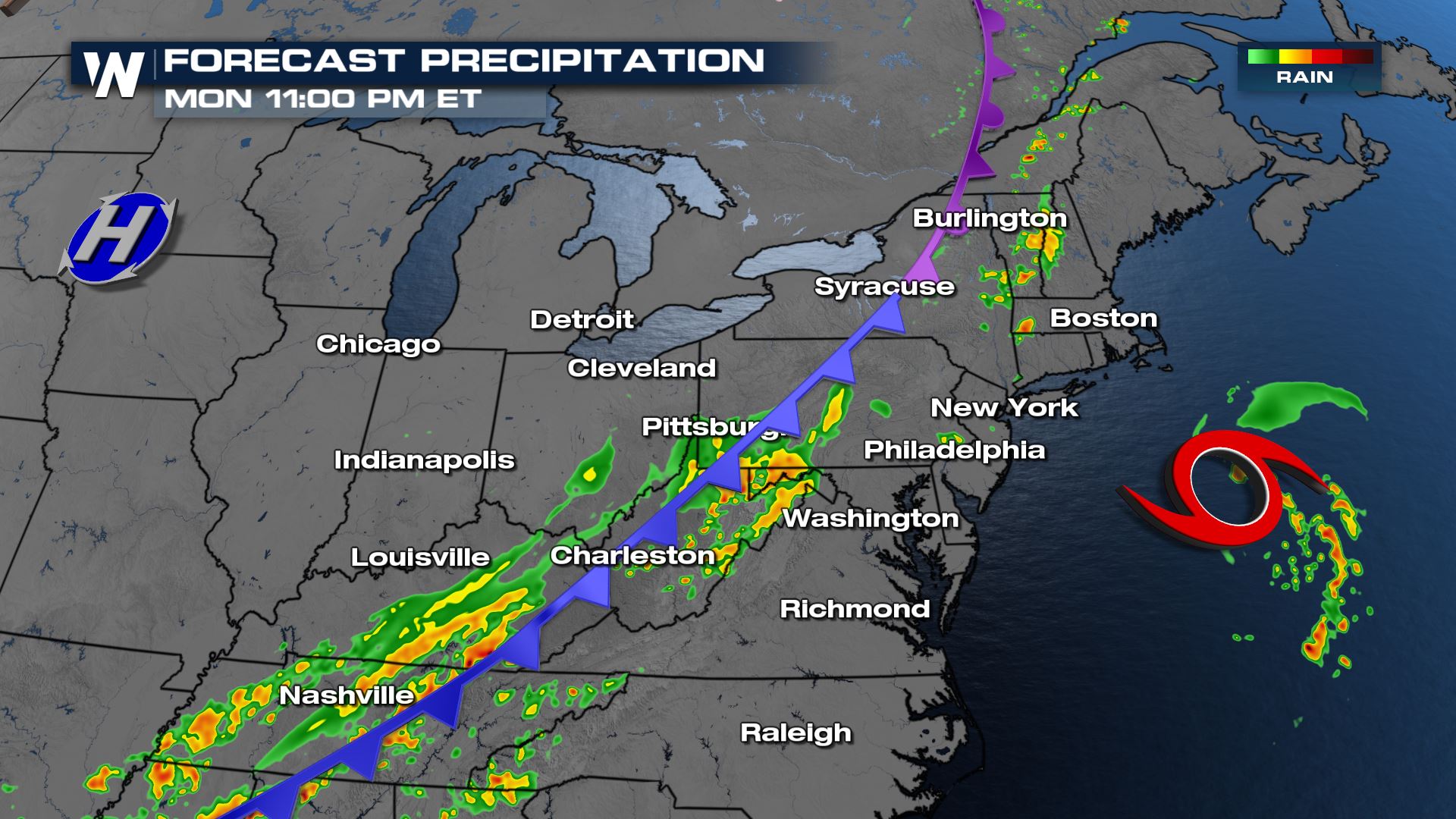
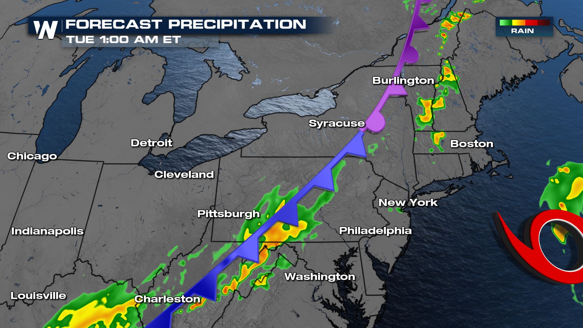
A strong cold front is moving through the eastern third of the U.S. tonight (Monday Night). Heat and humidity will create instability ahead of a cold front, helping to build the severe weather threat.
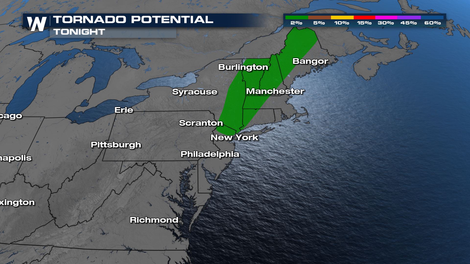
 Isolated tornadoes are possible ahead of the cold front.
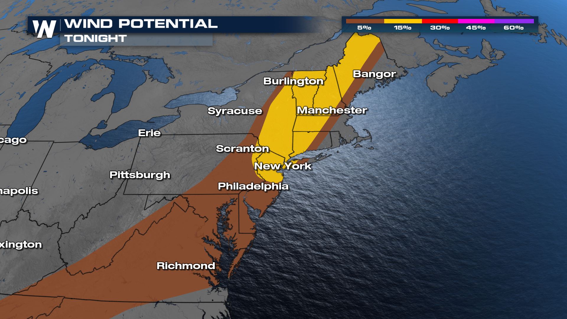
 Gusts stronger than 60 mph are also possible in the area shaded in yellow.
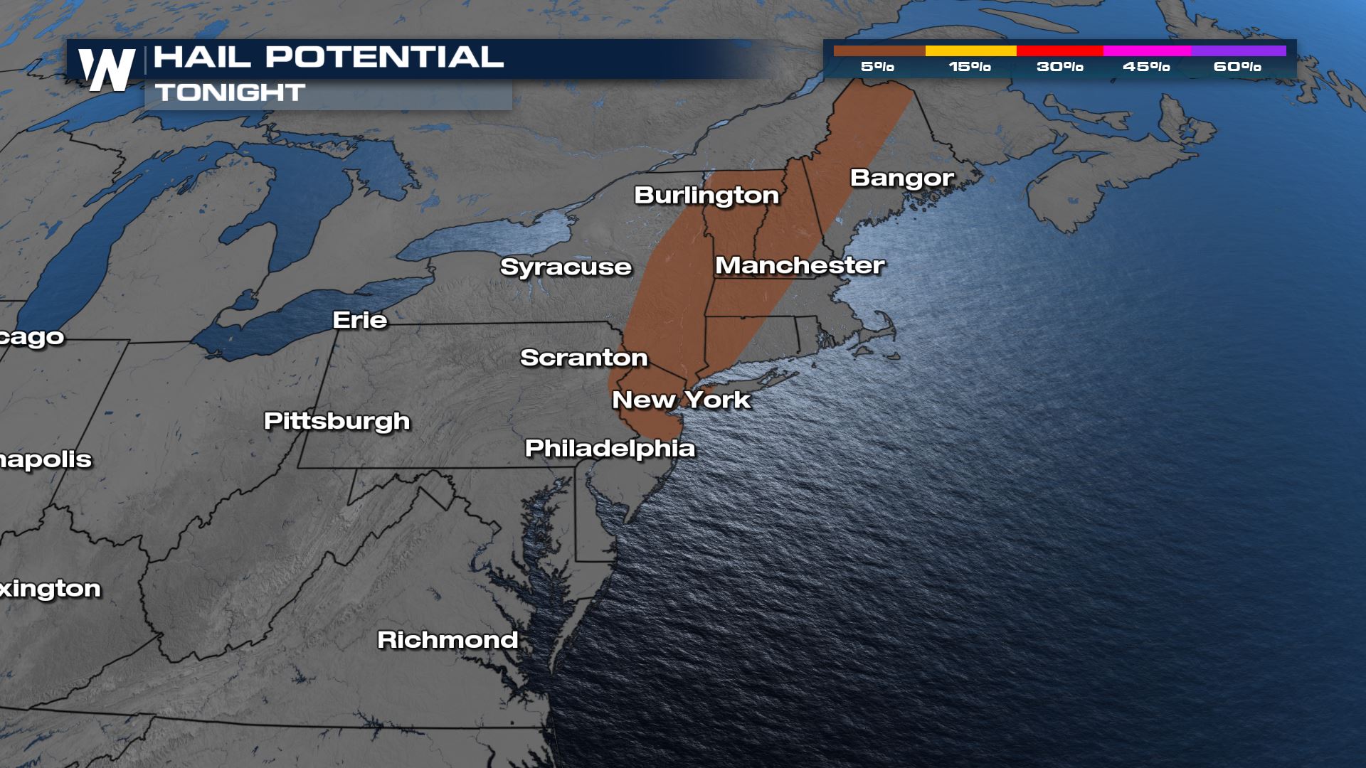
 Large hail stones upwards of 1" in diameter may also occur.
 Be sure to stay up to date on this evolving severe weather situation by checking the Eastern regional forecasts at 10 minutes and 30 minutes past the hour. This article will also be updated as new information becomes available.
Severe Weather Outlook
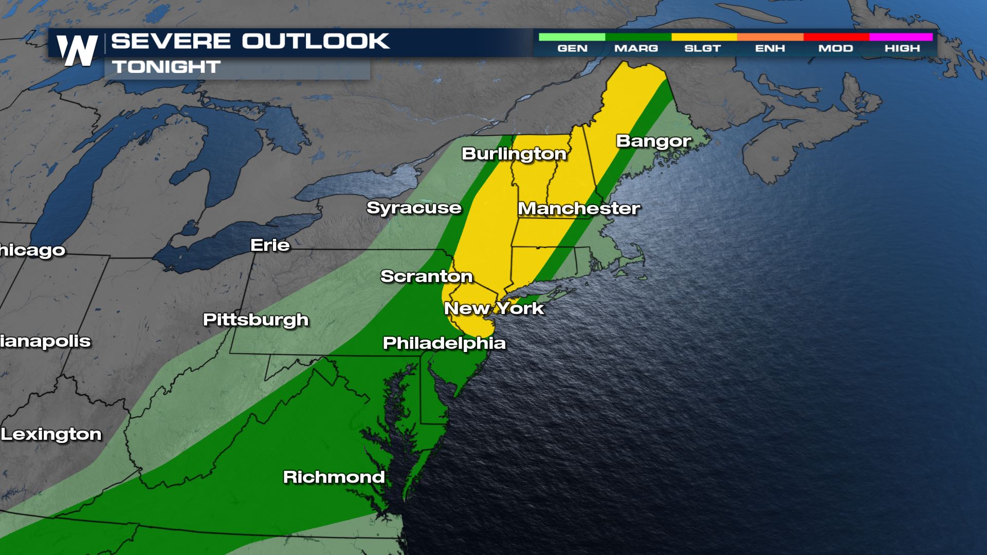
The Storm Prediction Center has downgraded the severe threat tonight to a level II 'slight risk' for the worst severe risk area tonight.
Isolated tornadoes are possible ahead of the cold front.
Gusts stronger than 60 mph are also possible in the area shaded in yellow.
Large hail stones upwards of 1" in diameter may also occur.
Forecast
Strong storms are still possible into the earliest parts of the overnight hours.
Be sure to stay up to date on this evolving severe weather situation by checking the Eastern regional forecasts at 10 minutes and 30 minutes past the hour. This article will also be updated as new information becomes available.All Weather News
More

More Storms for the East Through Monday
A low-pressure system that moved through the
3 Aug 2026 12:20 PM


After Reaching Category 5, Genevieve Weakens in the Pacific
PacificGenevieve formed last Friday south of
3 Aug 2026 12:30 AM

Flooding, Severe Storms Target the Midwest Again
After an active week of storms across the nor
1 Aug 2026 1:40 AM

Flooding Risk Increases as Heavy Rain Targets the Tri-State Area
Tuesday, heavy rainfall moved across the Nort
30 Jul 2026 12:25 AM