Severe Risk for the Mid-Atlantic Sunday
Top Stories
27 Oct 2019 4:10 AM
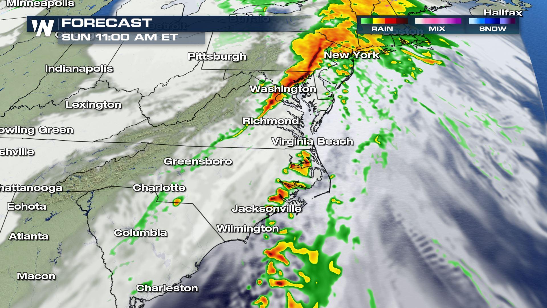
A strong cold front will be tapping into abundant moisture across the Eastern United States. Showers and storms will be likely along the frontal boundary with a risk of severe storms setting-up over North Carolina and Virginia for the later morning and early afternoon. Here is the latest severe forecast.
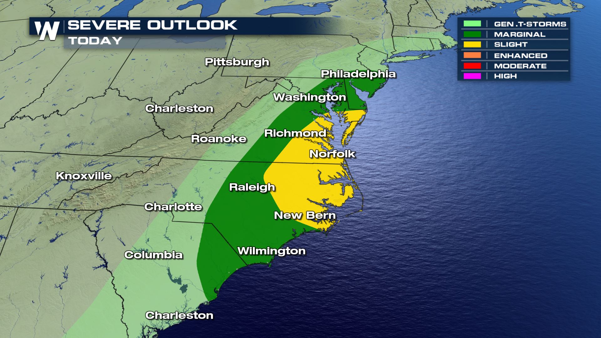 Strong to severe storms will be possible from the coast of South Carolina up to southern Pennsylvania and Delaware. Damaging winds will be the main weather risk with an isolated tornado chance. Cities like Norfolk and New Bern will need to be weather alert with today's severe risk.
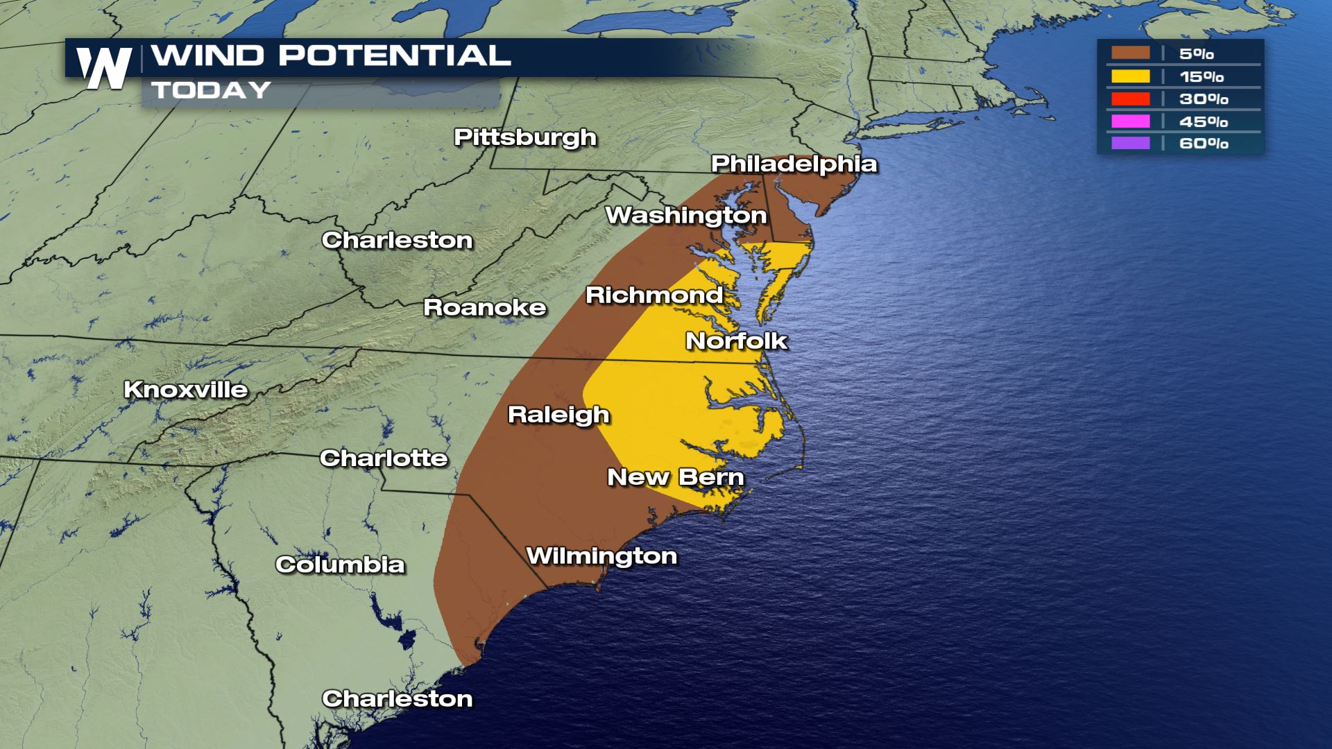
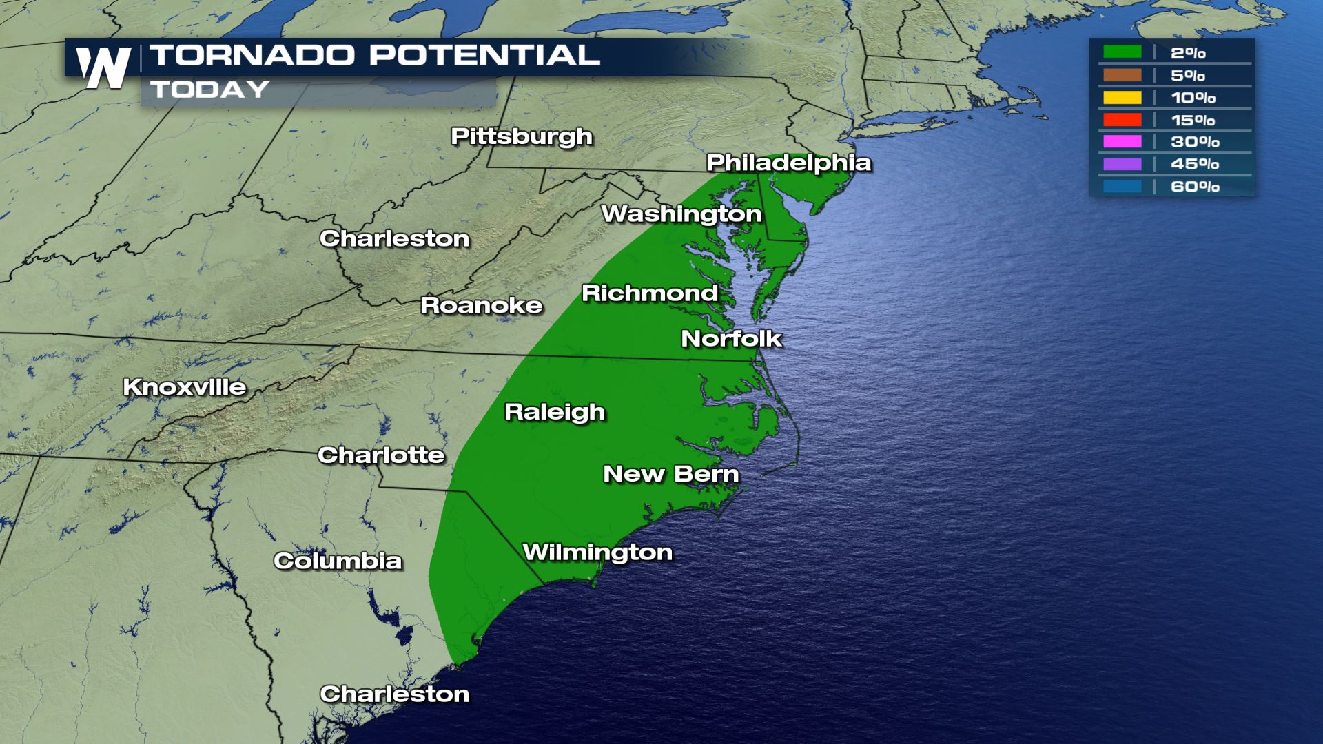 Areas in North Carolina and Virginia will have the biggest risk of damaging winds and tornadoes. The tornado threat will be isolated with a higher risk of damaging wind gusts over 70 mph. Definitely secure any loose outdoor items in these areas.
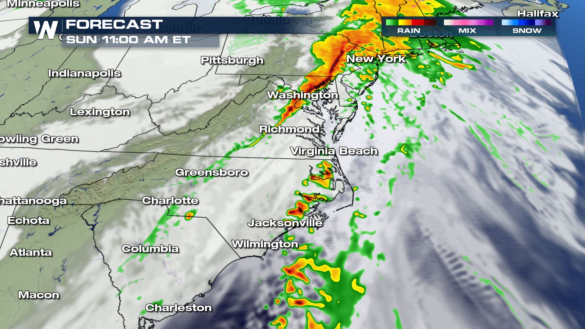
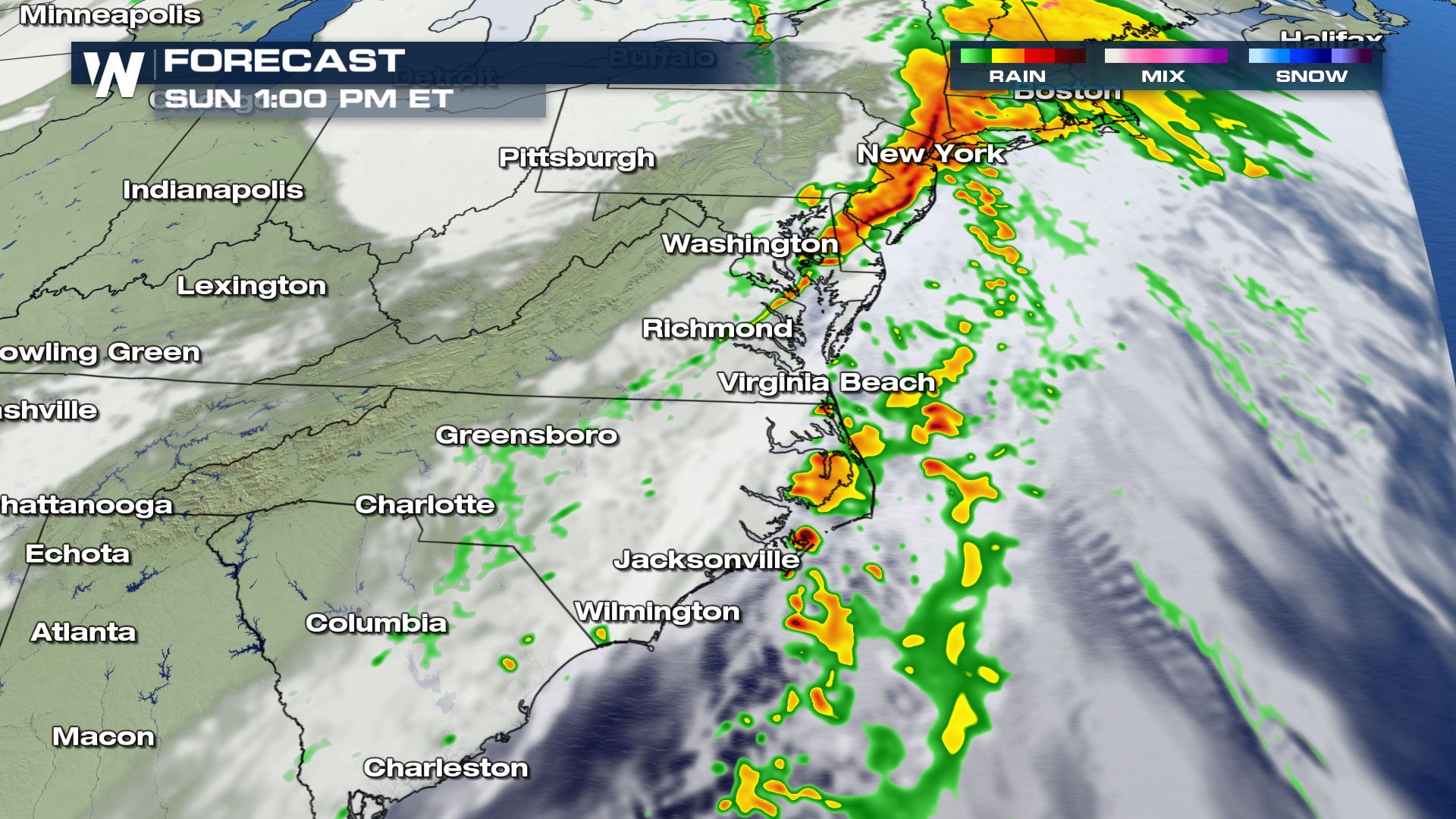
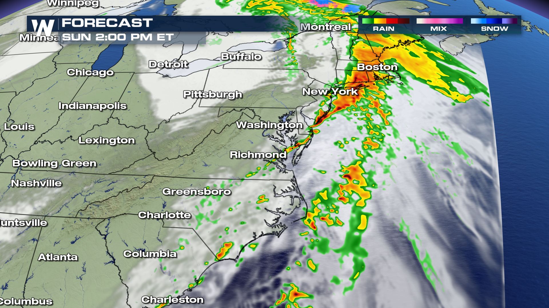 The timing for today's storms will likely be from the late morning into the early afternoon. The front will be moving over the Atlantic waters by this afternoon and evening. Once this happens, the severe risk will be over. Keep checking with WeatherNation for the very latest severe updates.
Severe Outlook
Strong to severe storms will be possible from the coast of South Carolina up to southern Pennsylvania and Delaware. Damaging winds will be the main weather risk with an isolated tornado chance. Cities like Norfolk and New Bern will need to be weather alert with today's severe risk.
Severe Risks
Areas in North Carolina and Virginia will have the biggest risk of damaging winds and tornadoes. The tornado threat will be isolated with a higher risk of damaging wind gusts over 70 mph. Definitely secure any loose outdoor items in these areas.
Forecast
The timing for today's storms will likely be from the late morning into the early afternoon. The front will be moving over the Atlantic waters by this afternoon and evening. Once this happens, the severe risk will be over. Keep checking with WeatherNation for the very latest severe updates.
All Weather News
More
More Storms for the East Through Monday
A low-pressure system that moved through the
2 Aug 2026 10:40 PM

Wildfire Outbreak in the Pacific Northwest
SPOKANE, WA - On Saturday, August 1st, the Ol
2 Aug 2026 10:35 PM


After Reaching Category 5, Genevieve Weakens in the Pacific
PacificGenevieve formed on last Friday south
2 Aug 2026 6:25 PM

Flooding, Severe Storms Target the Midwest Again
After an active week of storms across the nor
1 Aug 2026 1:40 AM

Flooding Risk Increases as Heavy Rain Targets the Tri-State Area
Tuesday, heavy rainfall moved across the Nort
30 Jul 2026 12:25 AM

Severe Weather: Energy From the Midwest Now in the Southeast
UPPER MIDWEST - Through Monday, dangerous tor
29 Jul 2026 10:30 PM