Southeast Storms Bring Mid-Atlantic Flooding Concern

Top Stories
2 Jan 2021 6:45 PM
The severe weather risk for the Southeast continues tonight. Isolated severe storms with gusty straight line winds and brief, weak spin-up tornadoes are possible across southeast Georgia and into South Carolina. This is from the same system that produced isolated severe storms yesterday, including several tornadoes in middle Georgia.
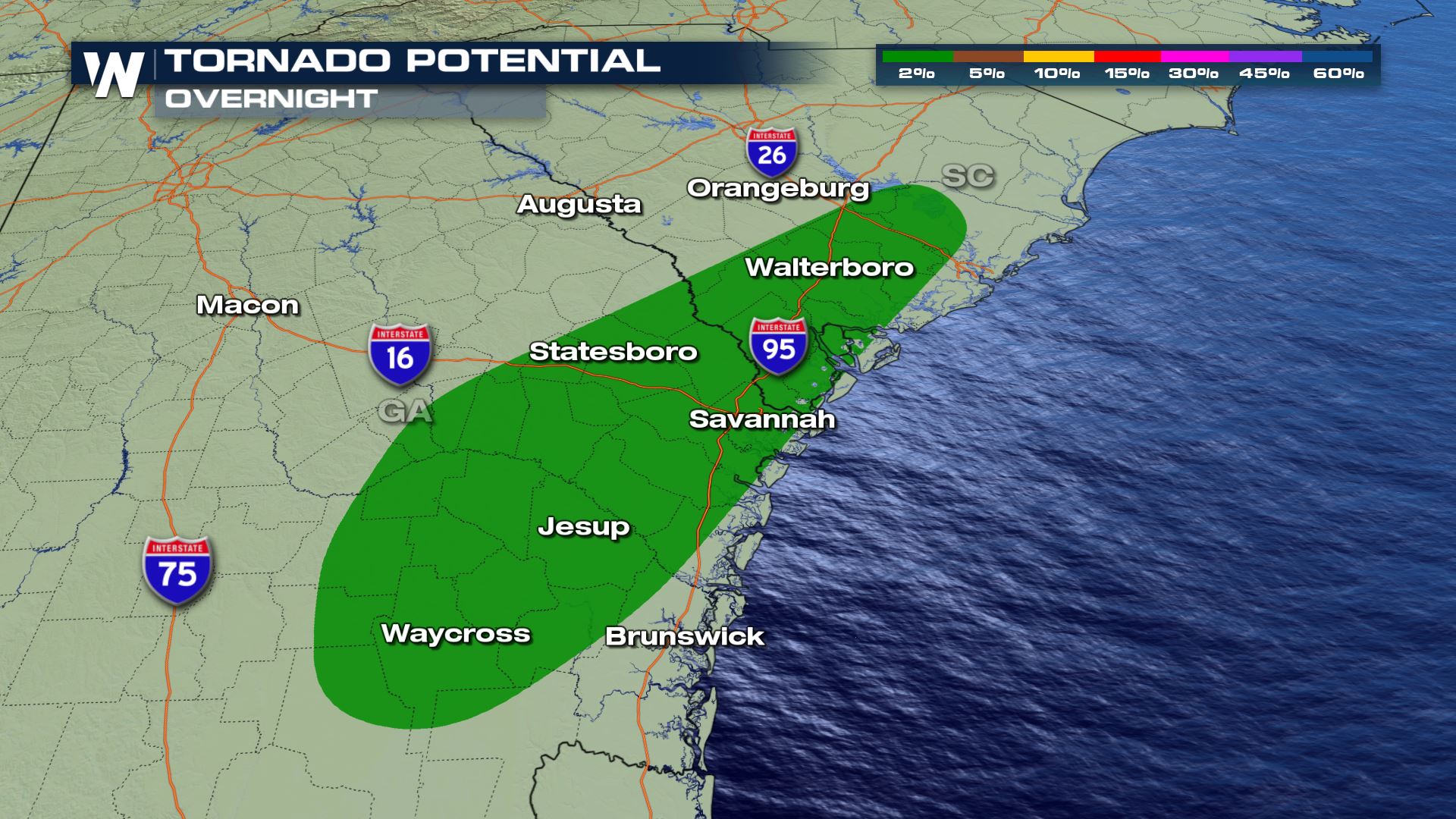
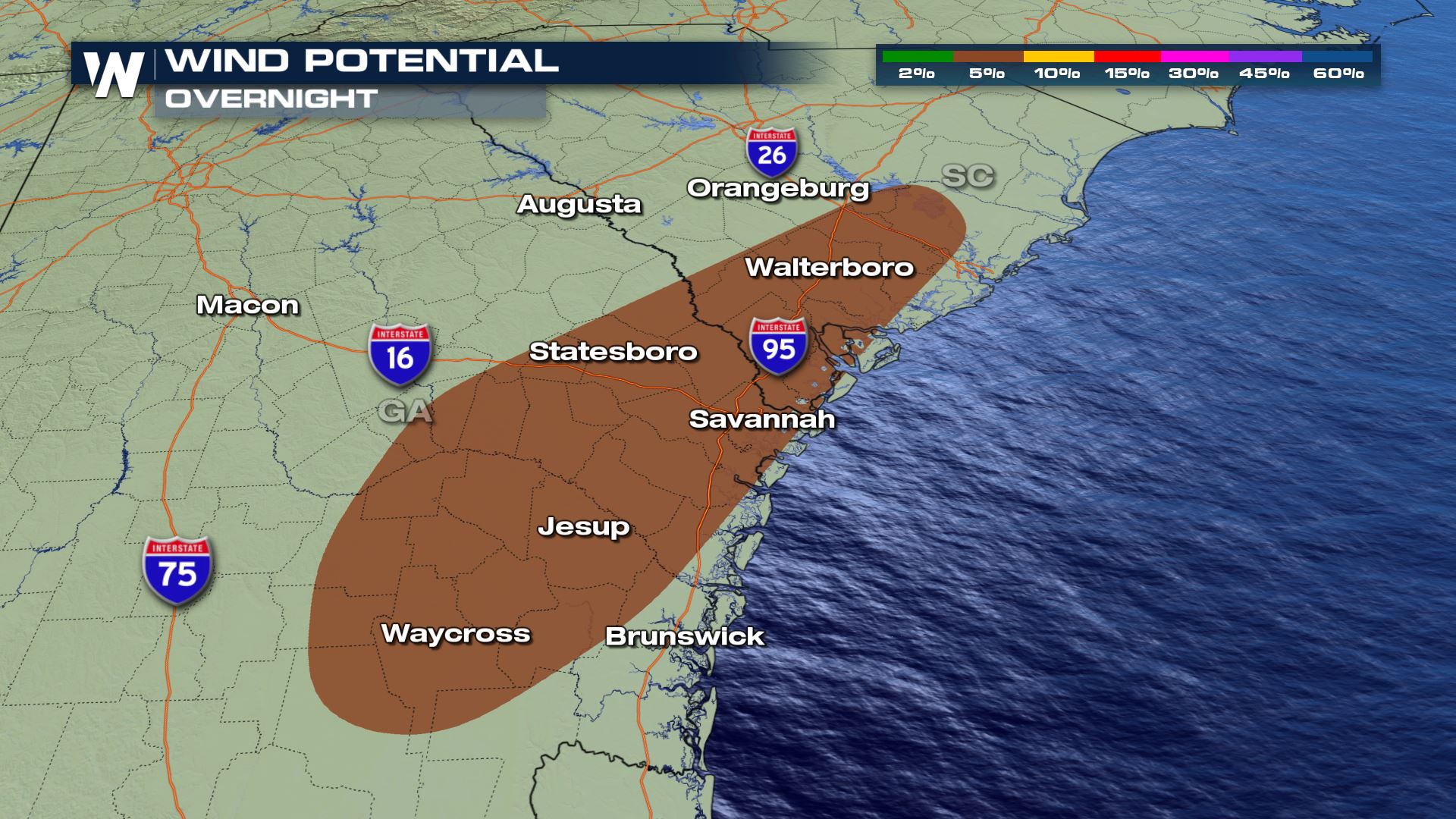
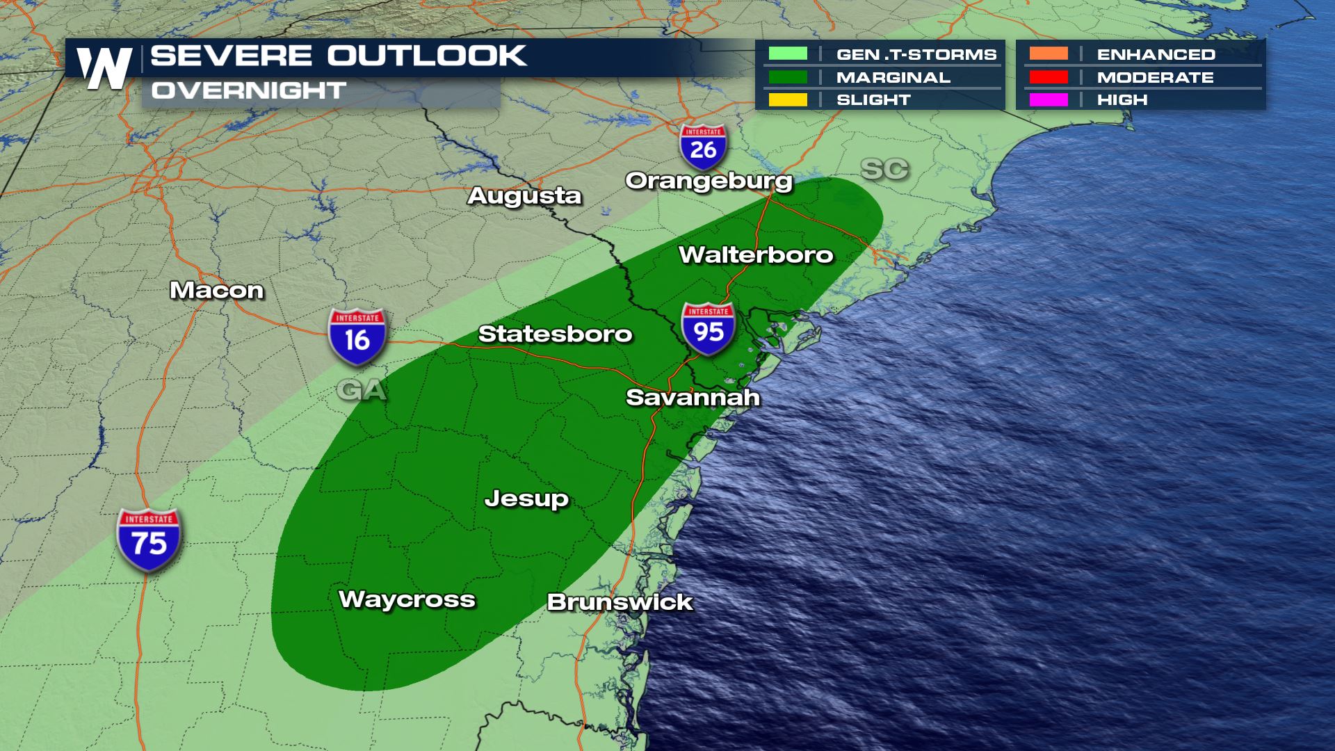 While gusty downdraft winds in excess of 60 mph are the biggest threat, a brief, weak spin-up tornado can't be ruled out. This is especially possible with bowing line segments or any thunderstorms that are able to form ahead of the main line.
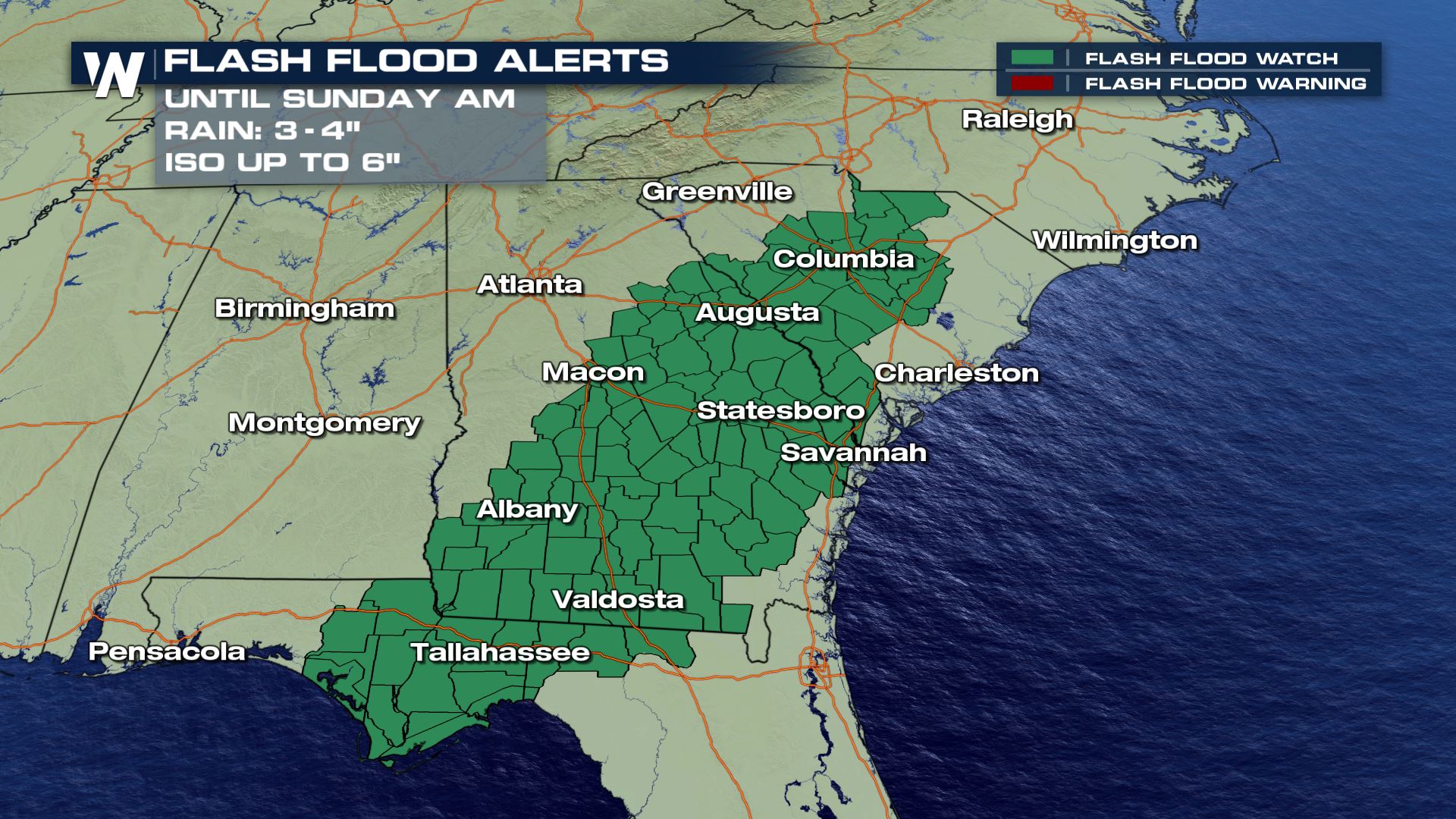
 Flash flooding from heavy rain is also a concern region-wide. Rounds of rain could produce in excess of 3-4" in some spots. Flood alerts are in place for southwest Georgia and Florida and the midlands of South Carolina.
 Stay with WeatherNation for the latest updates on this developing system and make sure to have multiple ways to get warnings.
While gusty downdraft winds in excess of 60 mph are the biggest threat, a brief, weak spin-up tornado can't be ruled out. This is especially possible with bowing line segments or any thunderstorms that are able to form ahead of the main line.
Flash flooding from heavy rain is also a concern region-wide. Rounds of rain could produce in excess of 3-4" in some spots. Flood alerts are in place for southwest Georgia and Florida and the midlands of South Carolina.
Forecast
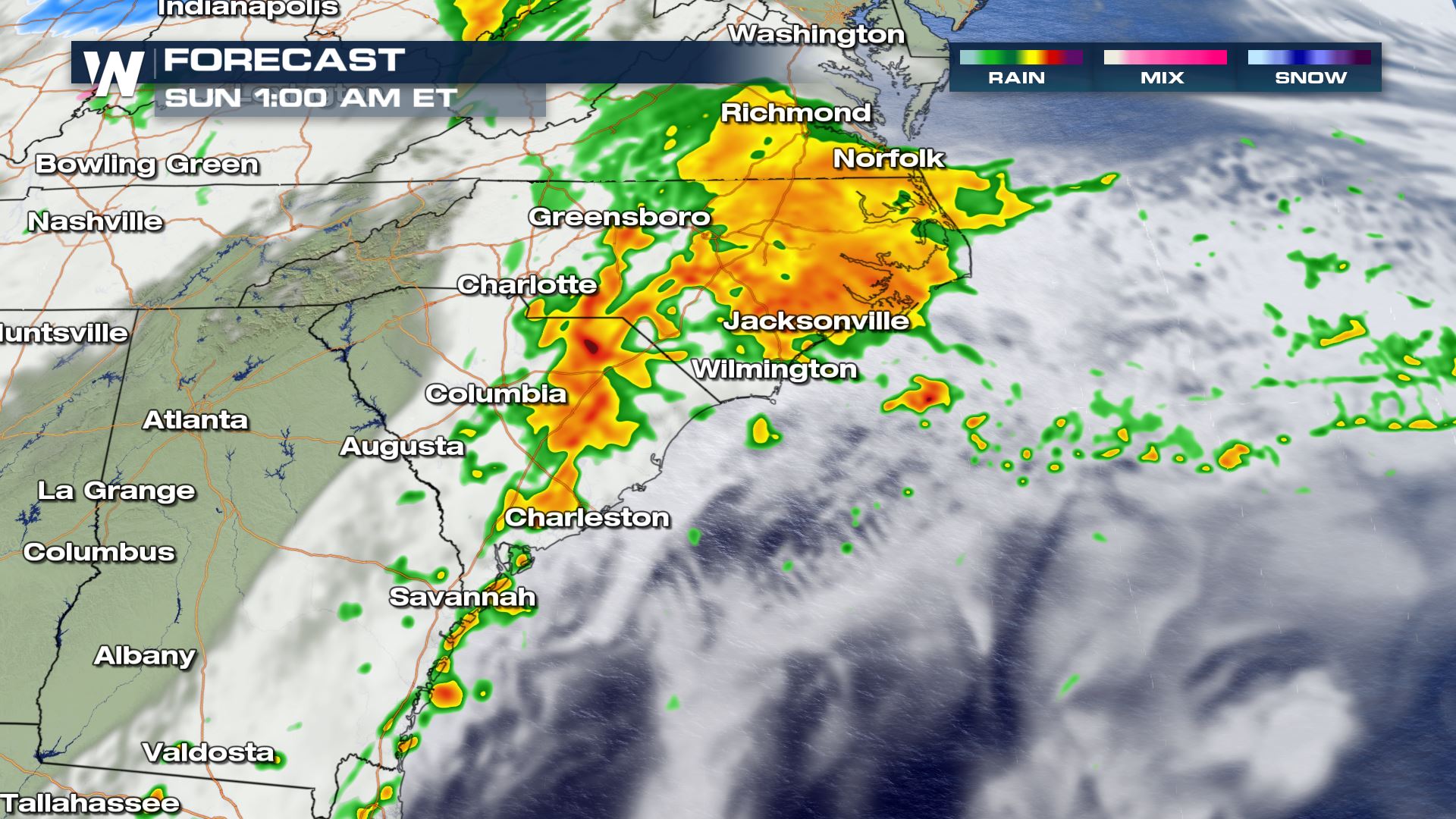
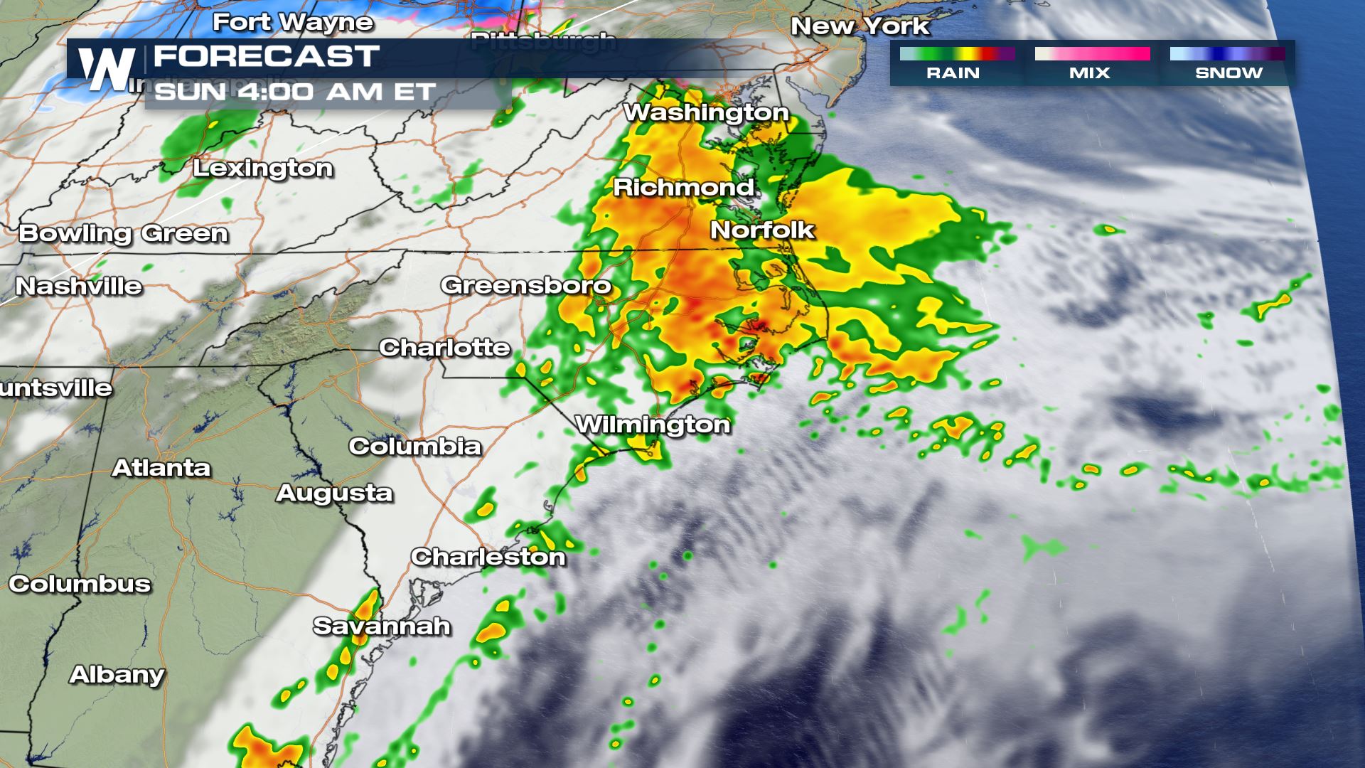
While the severe weather threat decreases overnight, heavy rain is still likely across North Carolina and Virginia. By mid-morning Sunday the rain should be offshore as the low pressure center moves into the Atlantic Ocean.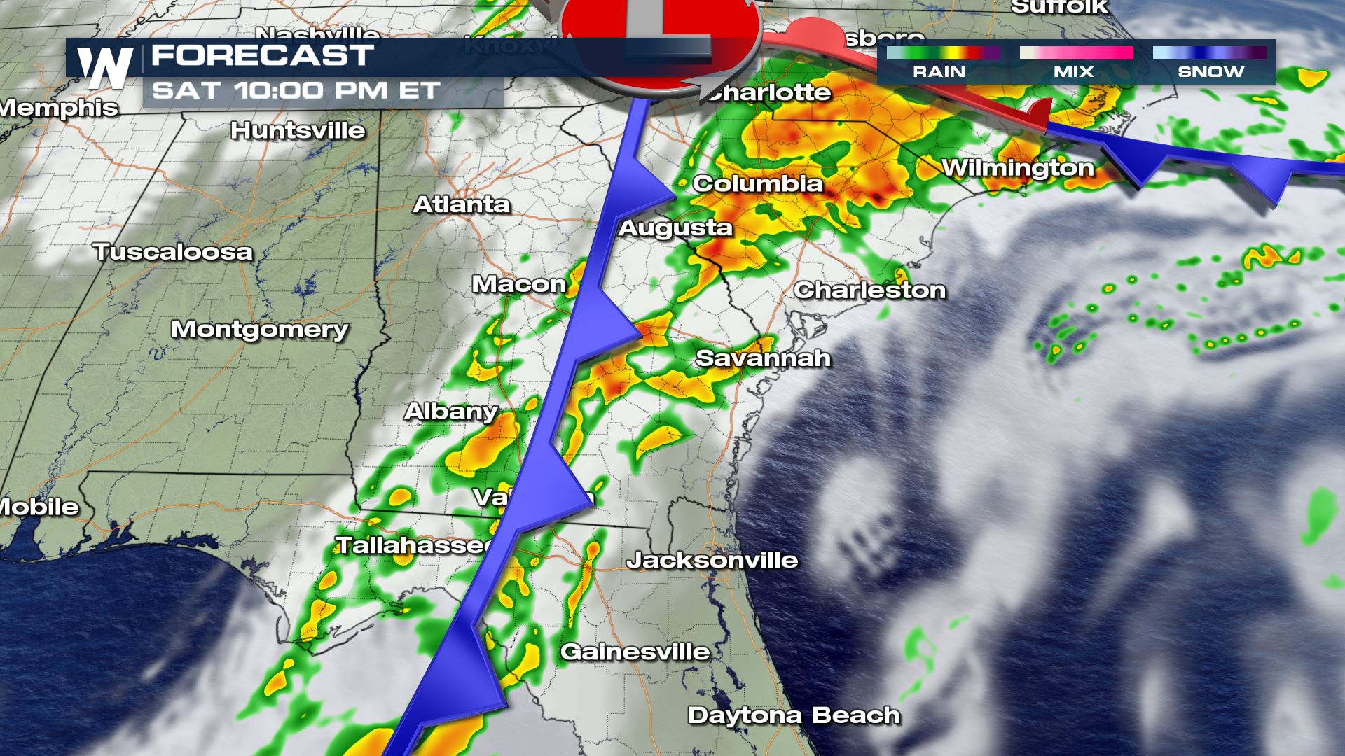
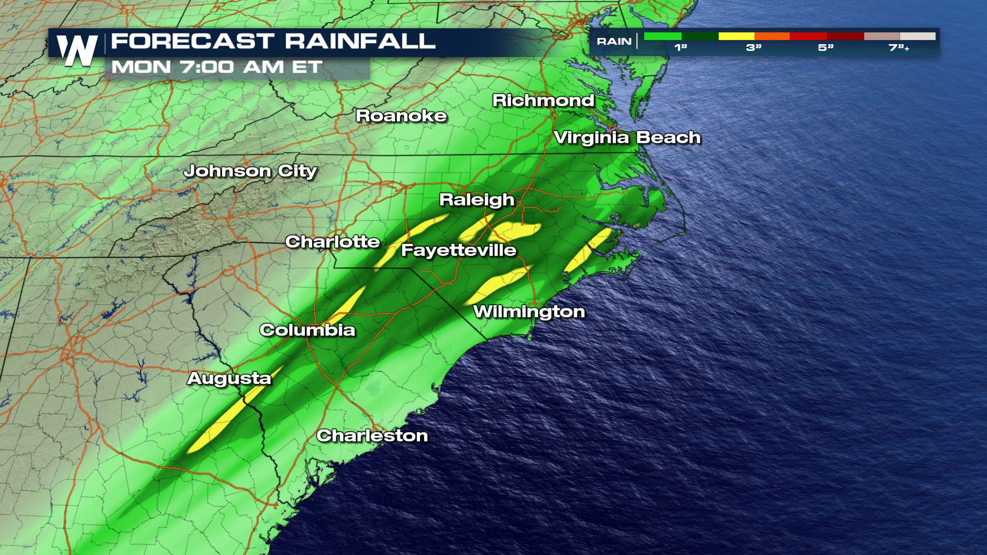
Forecast Rain
Rain reports have already come in from Florida up to 6" so far. Rain totals could be in excess of 3-4" in some spots and localized flooding could be a concern.
Stay with WeatherNation for the latest updates on this developing system and make sure to have multiple ways to get warnings.All Weather News
More
More Storms for the East Through Monday
A low-pressure system that moved through the
2 Aug 2026 10:40 PM

Wildfire Outbreak in the Pacific Northwest
SPOKANE, WA - On Saturday, August 1st, the Ol
2 Aug 2026 10:35 PM


After Reaching Category 5, Genevieve Weakens in the Pacific
PacificGenevieve formed on last Friday south
2 Aug 2026 6:25 PM

Flooding, Severe Storms Target the Midwest Again
After an active week of storms across the nor
1 Aug 2026 1:40 AM

Flooding Risk Increases as Heavy Rain Targets the Tri-State Area
Tuesday, heavy rainfall moved across the Nort
30 Jul 2026 12:25 AM

Severe Weather: Energy From the Midwest Now in the Southeast
UPPER MIDWEST - Through Monday, dangerous tor
29 Jul 2026 10:30 PM