Severe Thunderstorm Threat Continues in the Northeast
Top Stories
28 Aug 2020 7:30 AM
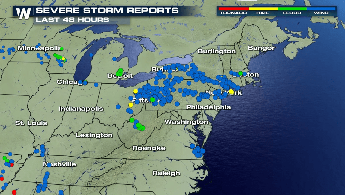
A front that arrived earlier this week from Canada, now coupled with Tropical Depression Laura, will bring a continued chance for strong thunderstorms across the Northeast into this weekend. There have been numerous reports of strong wind gusts and large hail over the last couple of days (as seen in the map above).
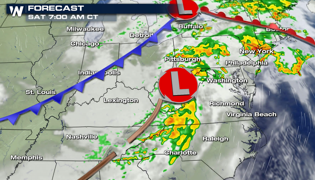
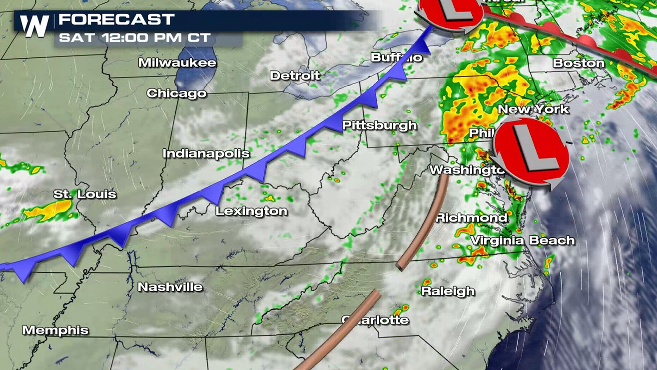
 The forecast shows an active afternoon and evening, with several storms forming near a warm front. Along with instability and energy, wind shear in the atmosphere will help to sustain severe storms and may produce damaging wind gusts.
 Higher humidity will stream northward from the Gulf of Mexico with Laura, building moisture in the atmosphere. As temperatures warm, atmospheric energy will increase and aid in thunderstorm development Saturday.
 WeatherNation will be tracking the severe risk for this week with VIPIR Radar updates. Keep checking back for more information on-air and online.
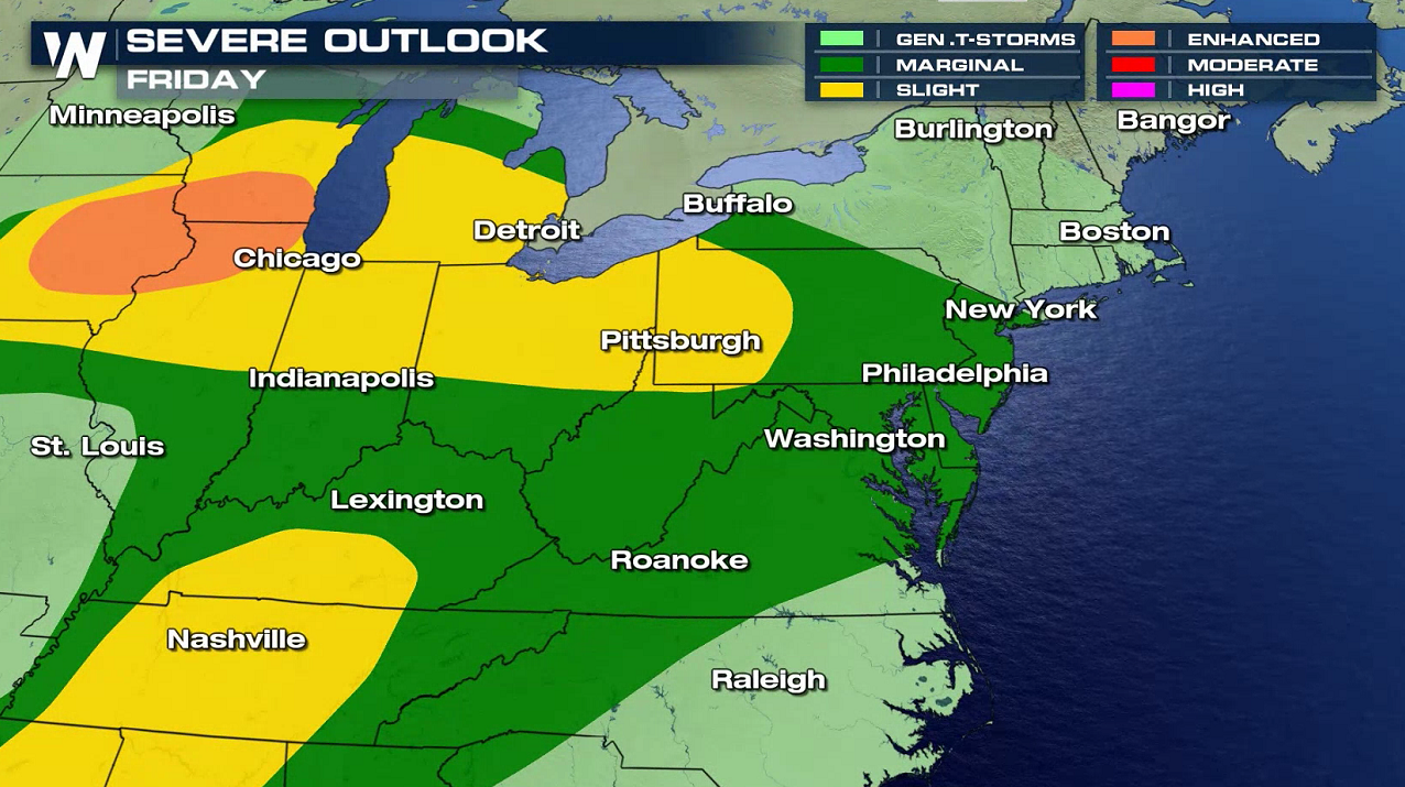
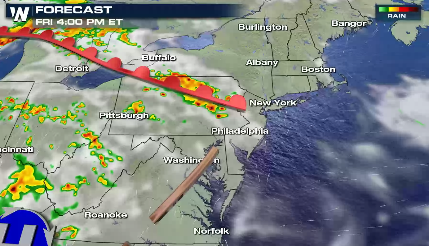
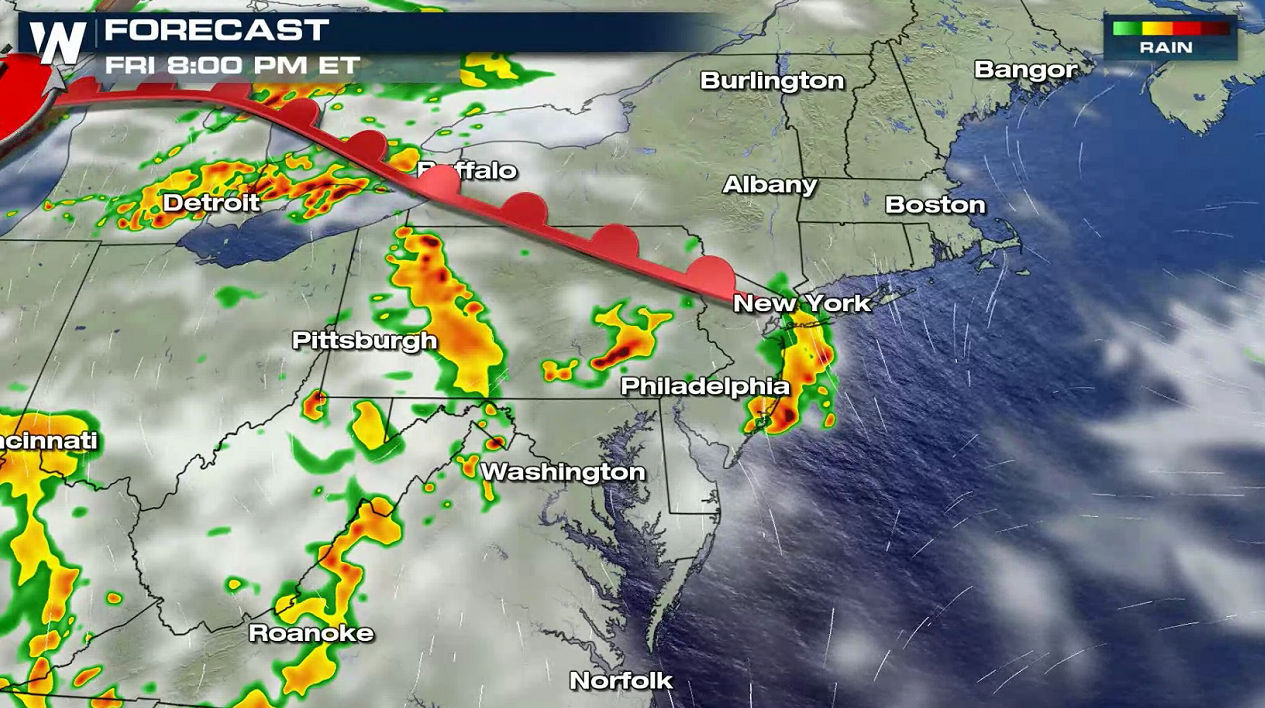
FRIDAY
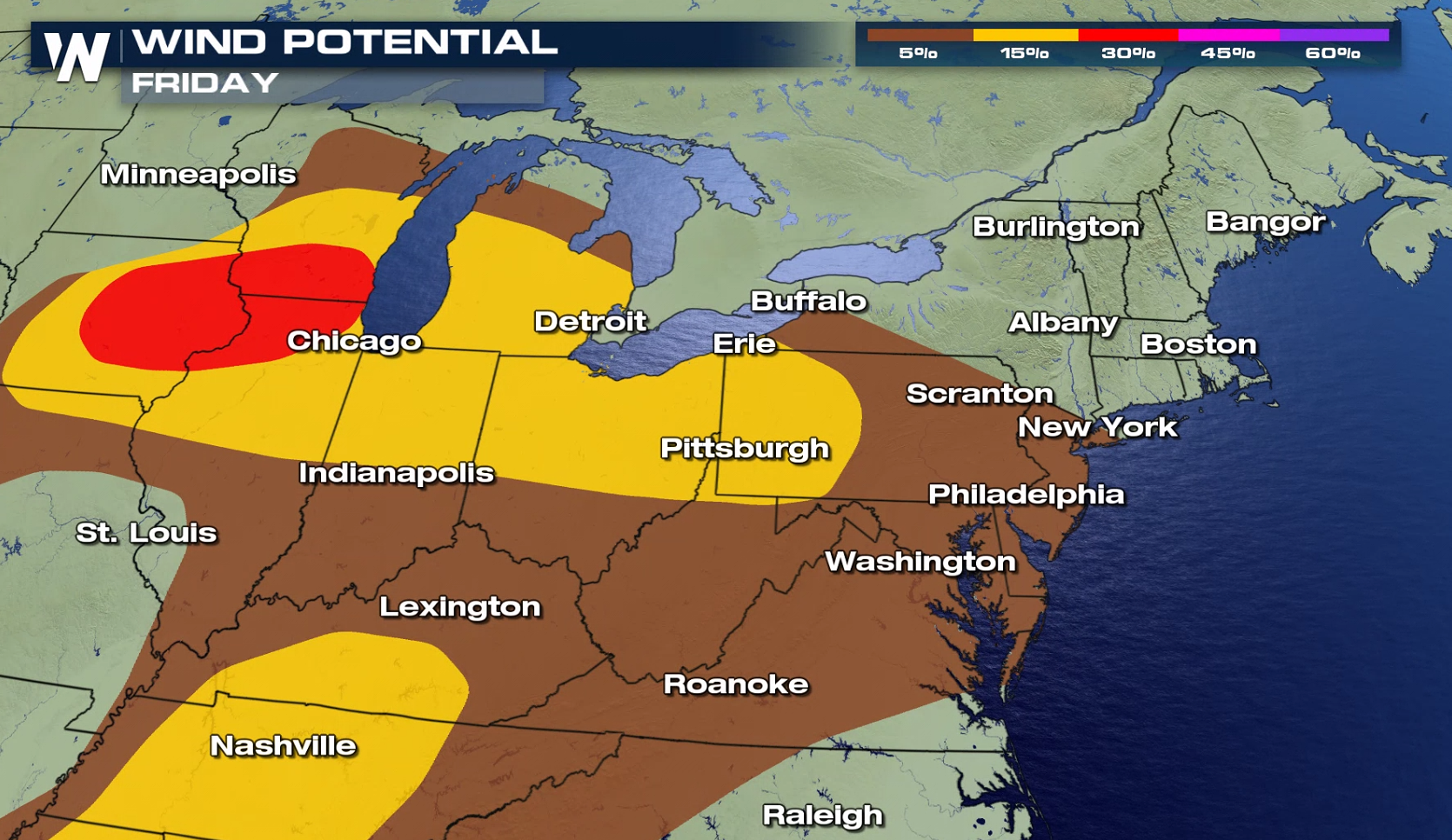
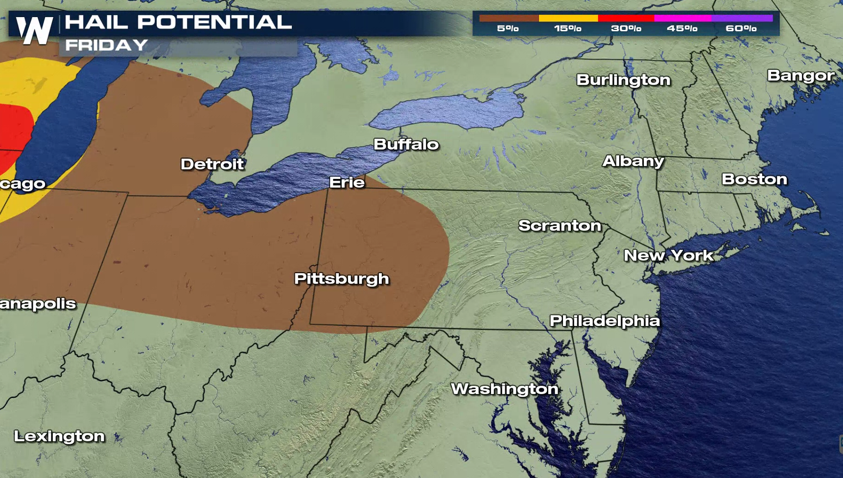
For today (Friday), a warm front will lift northward and be the focus for thunderstorms. There will also be several lake/sea-breeze boundaries present. The risk area extends from the Middle Atlantic coast into the Ohio and Tennessee Valleys. Strong wind gusts are the main threat, with a low chance for large hail and tornadoes.
The forecast shows an active afternoon and evening, with several storms forming near a warm front. Along with instability and energy, wind shear in the atmosphere will help to sustain severe storms and may produce damaging wind gusts.
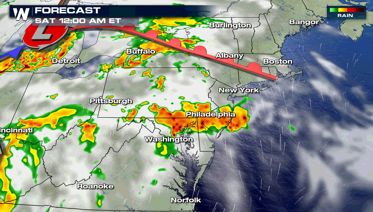
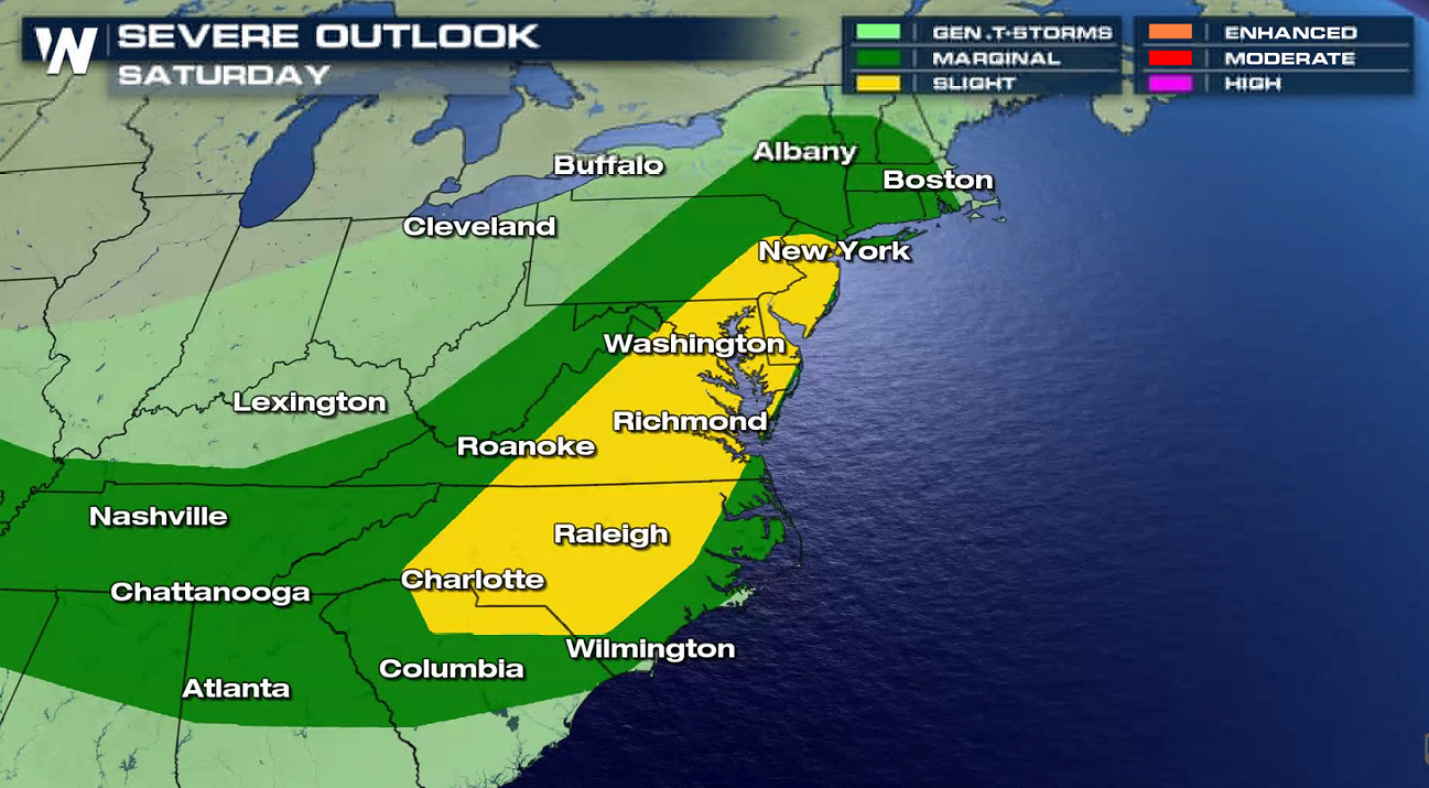
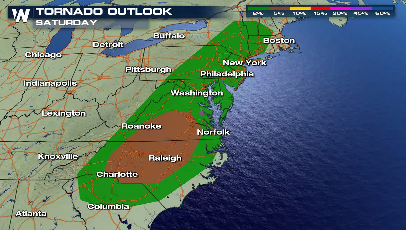
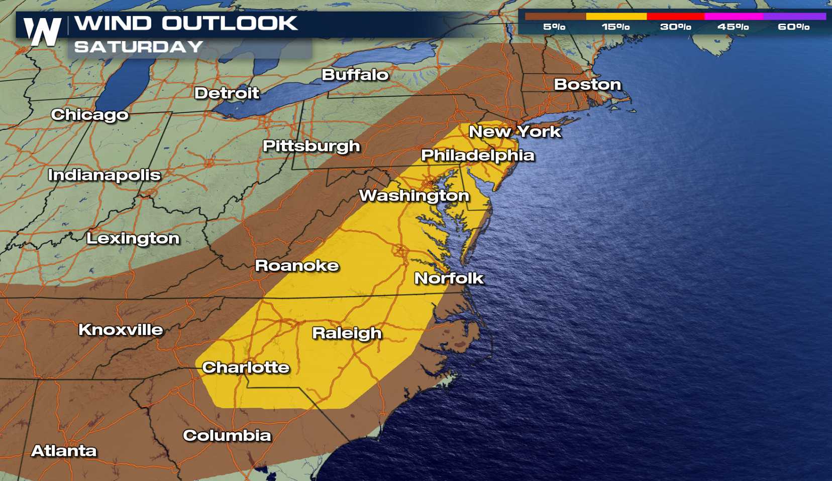
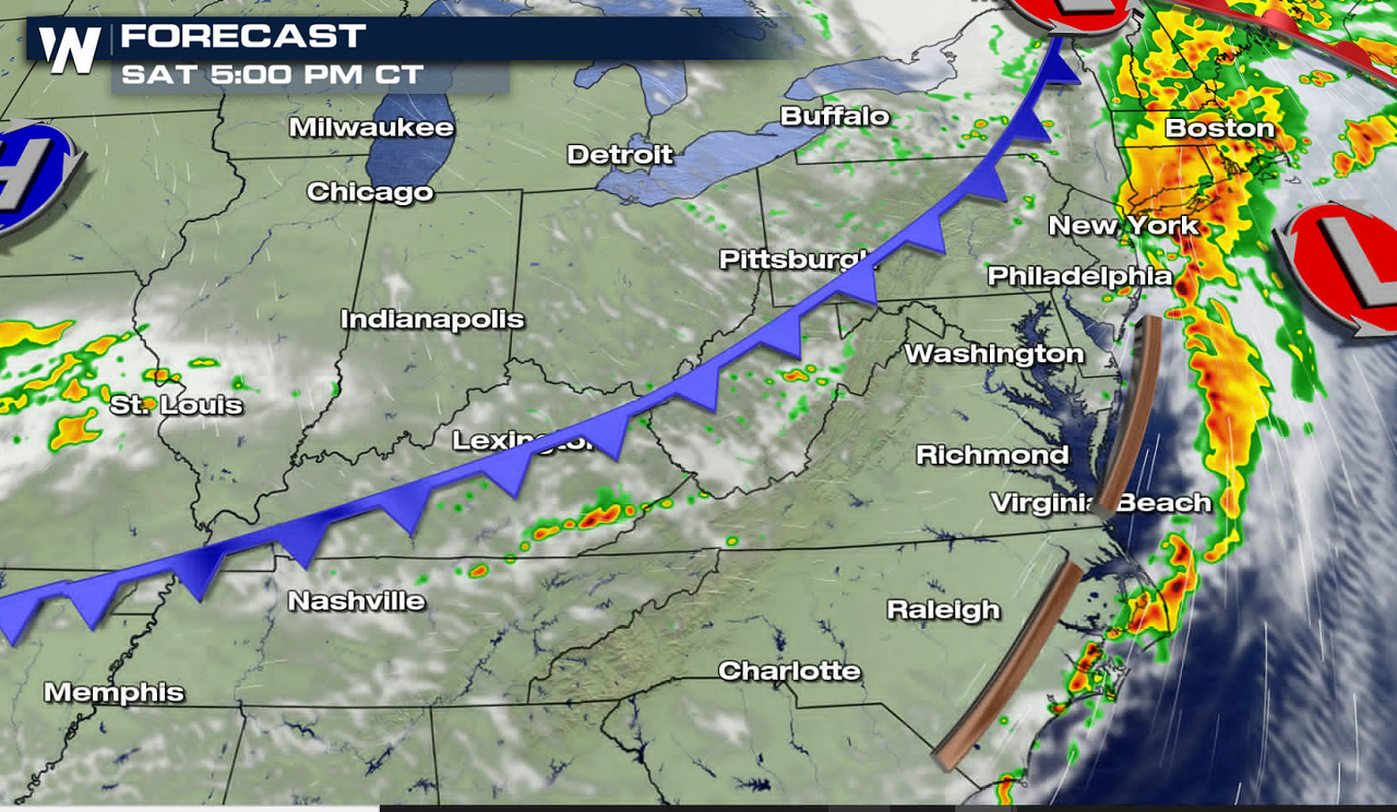
SATURDAY
The threat for severe thunderstorms will linger across the Mid-Atlantic and southern New England on Saturday. Added humidity from Tropical Depression Laura may lead to localized flooding.
Higher humidity will stream northward from the Gulf of Mexico with Laura, building moisture in the atmosphere. As temperatures warm, atmospheric energy will increase and aid in thunderstorm development Saturday.
WeatherNation will be tracking the severe risk for this week with VIPIR Radar updates. Keep checking back for more information on-air and online.All Weather News
More
More Storms for the East Through Monday
A low-pressure system that moved through the
3 Aug 2026 12:20 PM


After Reaching Category 5, Genevieve Weakens in the Pacific
PacificGenevieve formed last Friday south of
3 Aug 2026 12:30 AM

Flooding, Severe Storms Target the Midwest Again
After an active week of storms across the nor
1 Aug 2026 1:40 AM

Flooding Risk Increases as Heavy Rain Targets the Tri-State Area
Tuesday, heavy rainfall moved across the Nort
30 Jul 2026 12:25 AM

Severe Weather: Energy From the Midwest Now in the Southeast
UPPER MIDWEST - Through Monday, dangerous tor
29 Jul 2026 10:30 PM