Severe Storm Forecast Through the Weekend
Special Stories
29 Nov 2019 9:30 AM
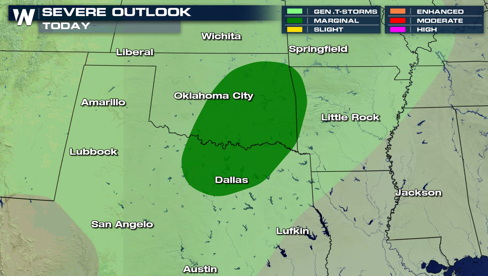
As the next wave of energy spills off the Rocky Mountains and into the Southern Plains into this weekend, the risk of severe weather returns to the forecast. The SPC, or Storm Prediction Center, has issued a marginal risk of isolated severe storms Friday afternoon. Areas with the best chances will be from Oklahoma City south into the Dallas area. The largest threats will likely be damaging winds and small pea sized hail.
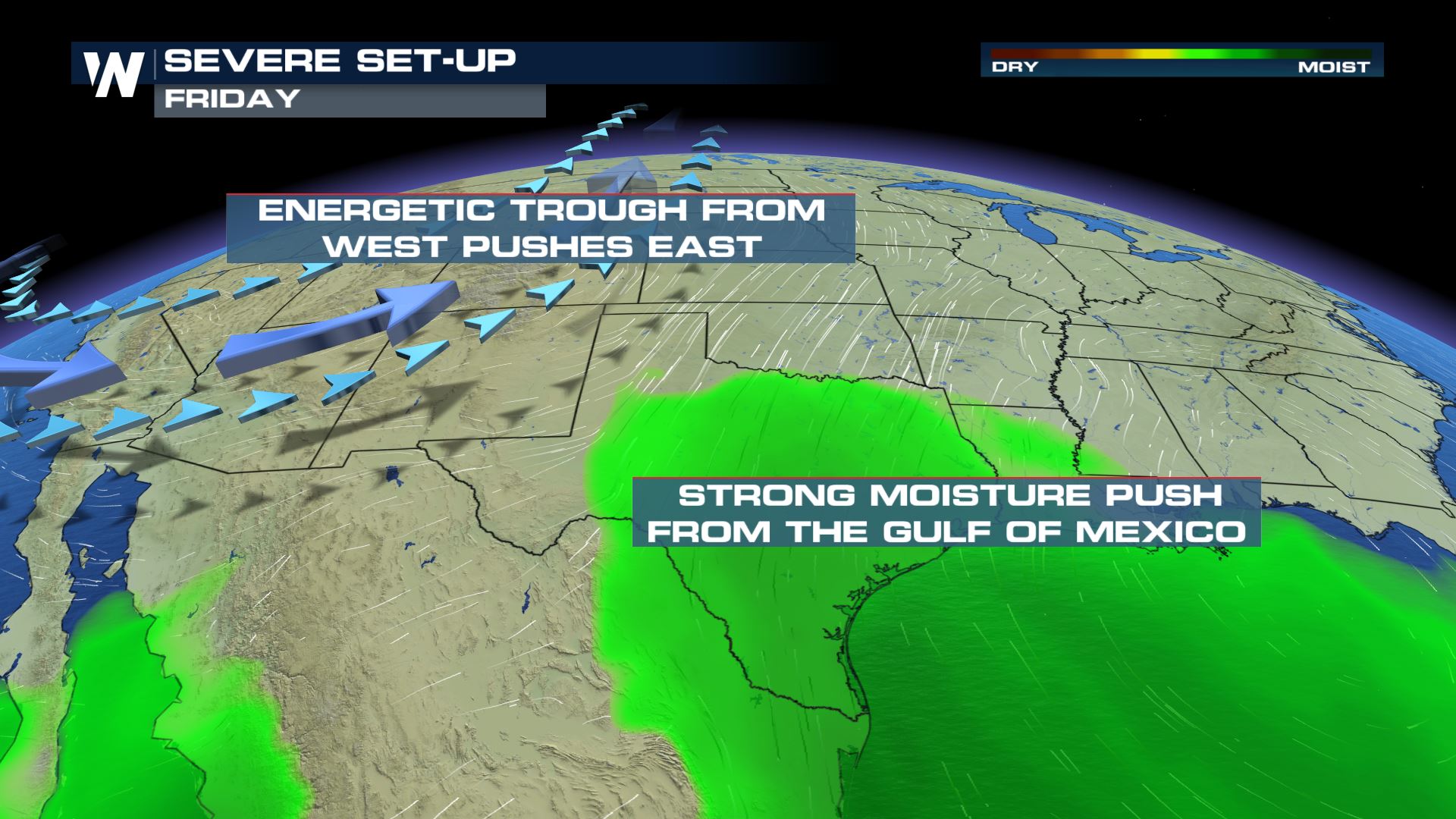
 Moisture will also stream in from the Gulf of Mexico ahead of the cold front. As dew point temperatures remain in the upper 60s and low 70s, the atmosphere will have the chance for strong to possible severe storms throughout the afternoon and into the evening time frame.
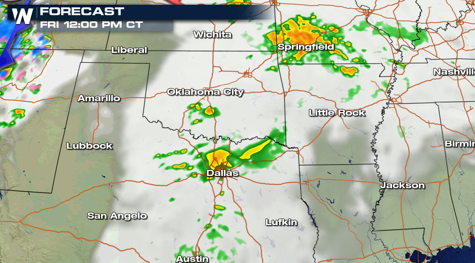
 By this afternoon (Friday), stronger storms will move through the region. Our forecast models have an area of storm activity from Dallas to Oklahoma City area by 12 PM. Another wave develops ahead of a cold front in the evening.
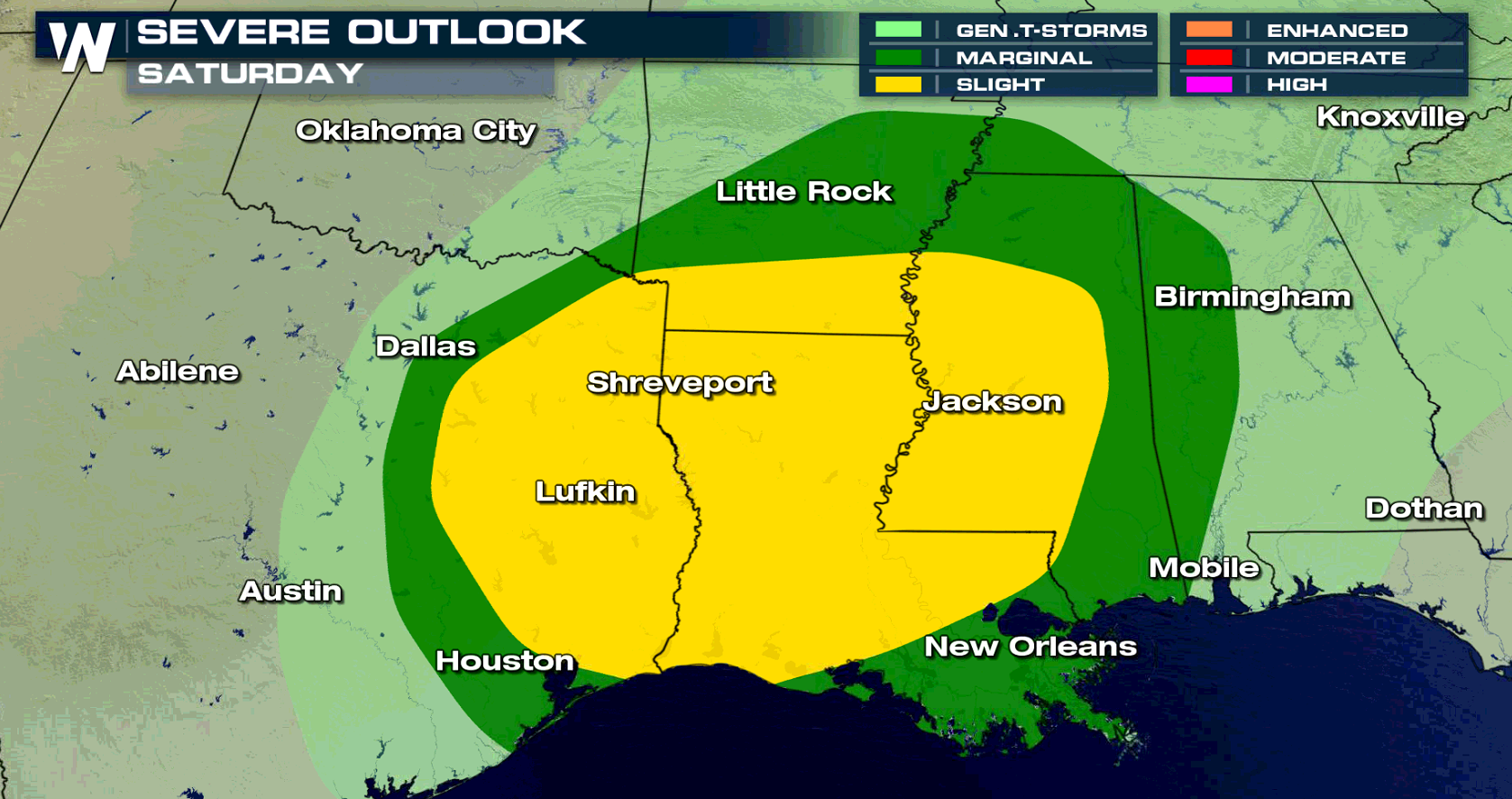
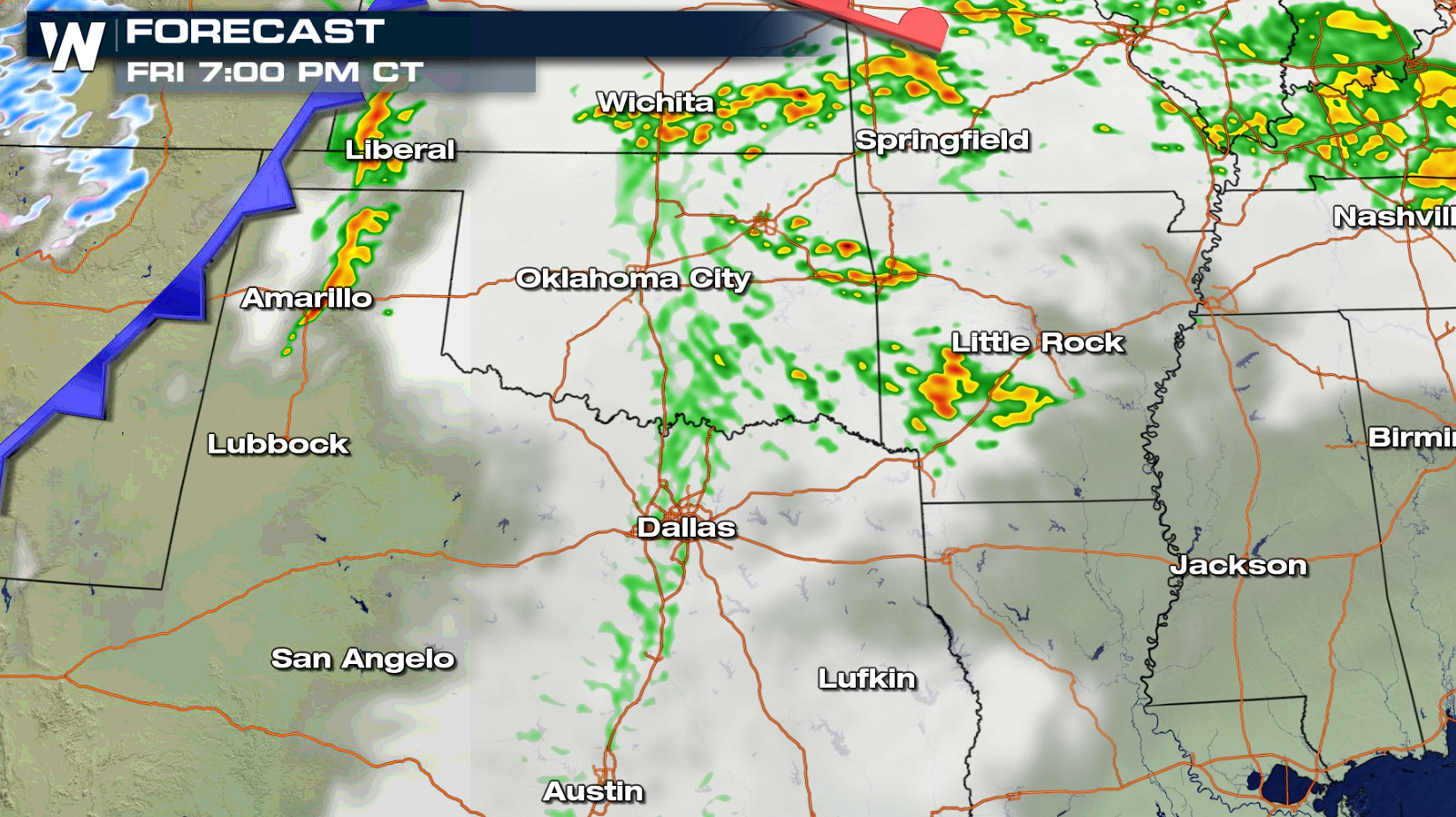 As the cold front moves to the east and southeast into Saturday, the risk of severe storms will become more widespread. There is a more widespread potential for severe storms on Saturday in the Deep South.
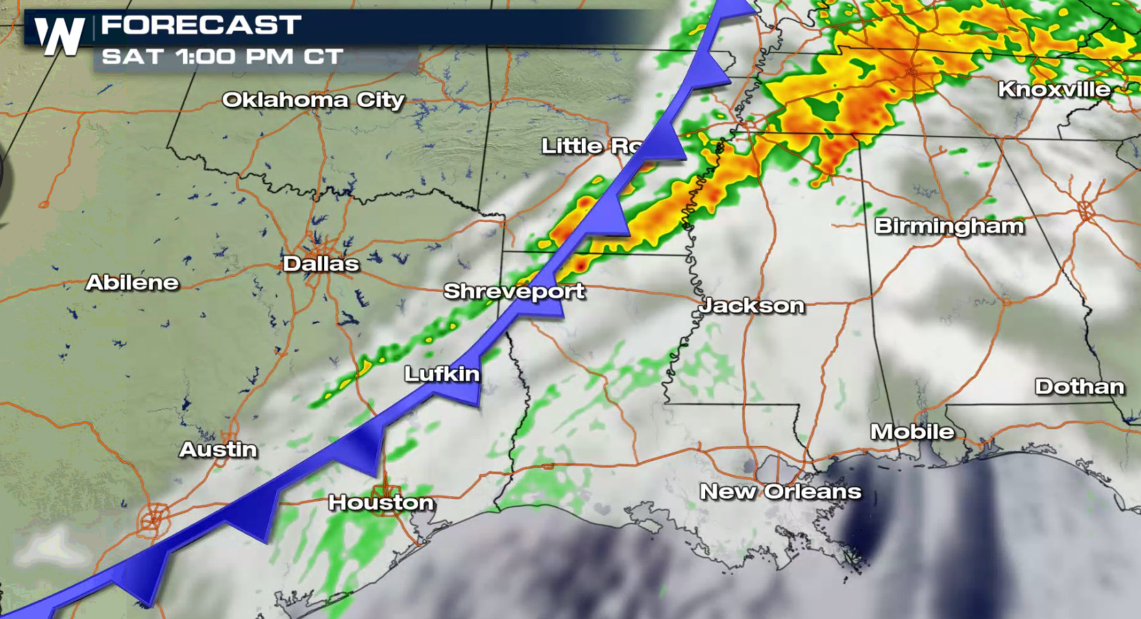
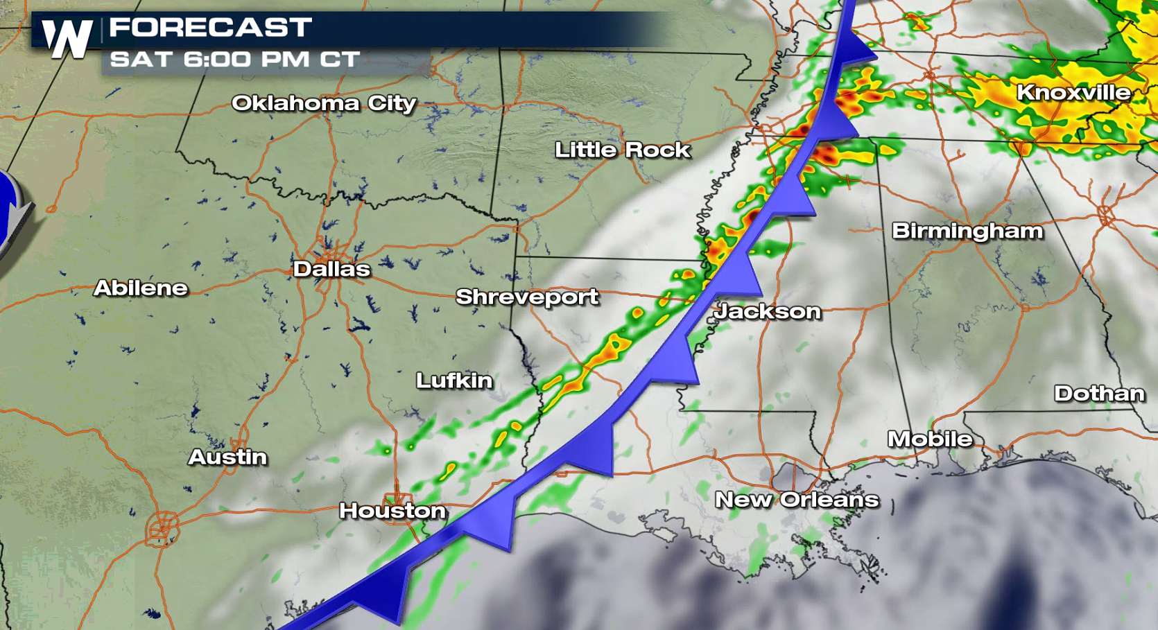
 This is timing of storms early Saturday morning as the frontal boundary moves into east Texas and areas of Arkansas and Louisiana. Showers and thunderstorms will continue to remain overhead through the day for the area.
 Forecasts are always subject to change, so be sure to follow WeatherNation for all the latest developments.
 Moisture will also stream in from the Gulf of Mexico ahead of the cold front. As dew point temperatures remain in the upper 60s and low 70s, the atmosphere will have the chance for strong to possible severe storms throughout the afternoon and into the evening time frame.
 By this afternoon (Friday), stronger storms will move through the region. Our forecast models have an area of storm activity from Dallas to Oklahoma City area by 12 PM. Another wave develops ahead of a cold front in the evening.

 As the cold front moves to the east and southeast into Saturday, the risk of severe storms will become more widespread. There is a more widespread potential for severe storms on Saturday in the Deep South.
 This is timing of storms early Saturday morning as the frontal boundary moves into east Texas and areas of Arkansas and Louisiana. Showers and thunderstorms will continue to remain overhead through the day for the area.

 Forecasts are always subject to change, so be sure to follow WeatherNation for all the latest developments.
All Weather News
More