Severe Storms Likely Into Sunday

Special Stories
17 Aug 2019 8:59 PM
The threat of thunderstorms, some severe, will continue into the early morning hours of Sunday. The danger of damaging winds, large hail and excessive lightning will exist. Also, there may be an isolated tornado or two into early Sunday morning.
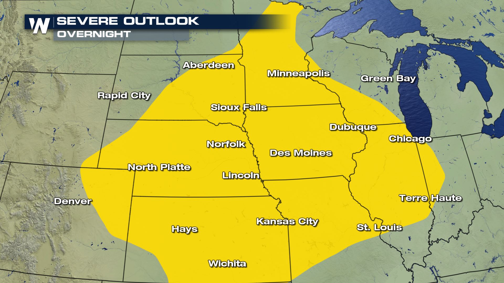 The severe weather threat overnight where yellow areas indicate locations that could get severe storms.
The cause of the thunderstorms will be a cold front moving across the central Plains. The individual thunderstorms will move to the east in various areas from Minnesota to Kansas and over to Missouri eventually.
The severe weather threat overnight where yellow areas indicate locations that could get severe storms.
The cause of the thunderstorms will be a cold front moving across the central Plains. The individual thunderstorms will move to the east in various areas from Minnesota to Kansas and over to Missouri eventually.
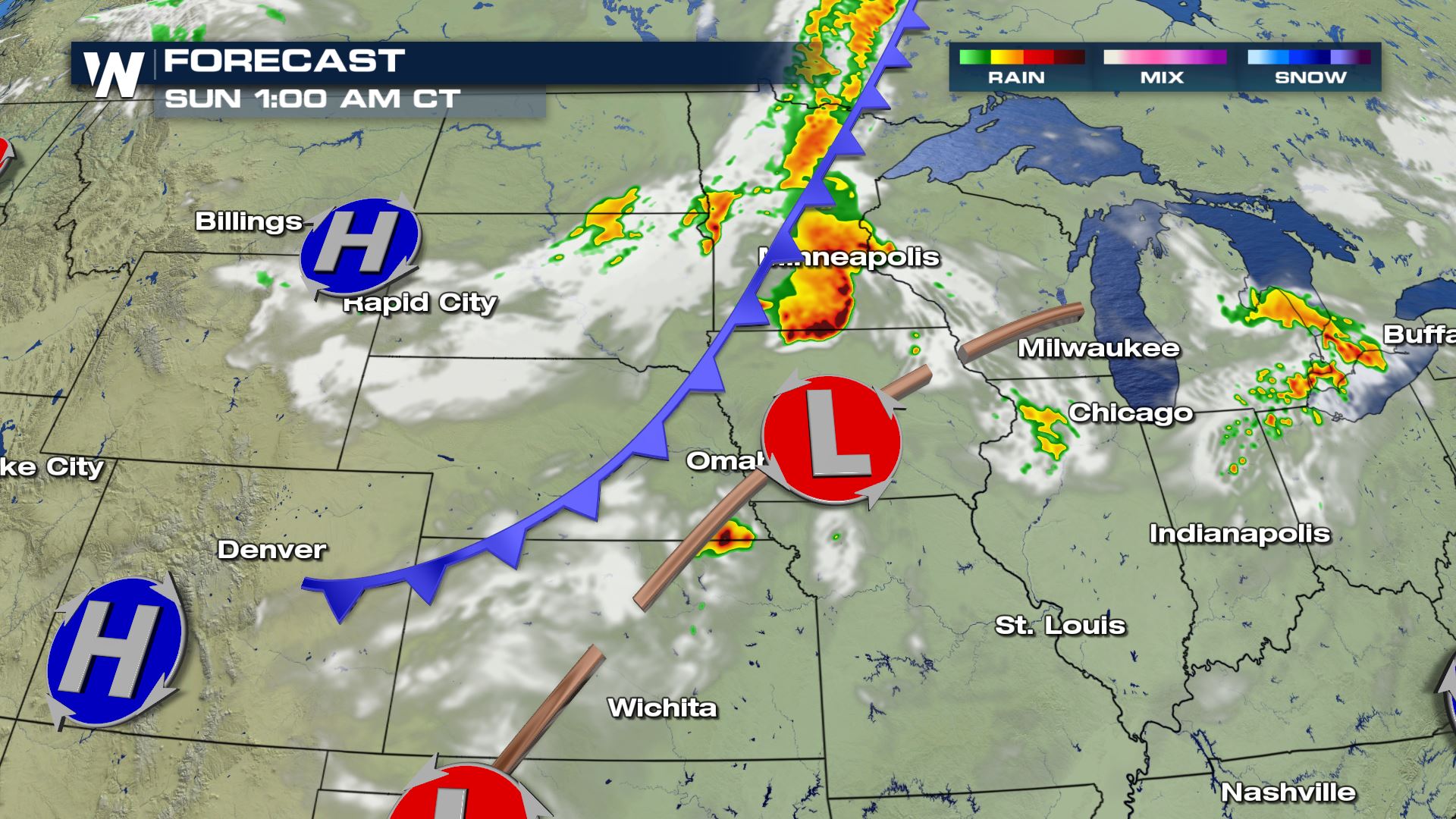 The simulated radar early Sunday morning.
The thunderstorms look to hold together quite well overnight and into Sunday, while sometimes the nighttime hours can help diminish the storms. It does not appear to be the case this night, as the heat/instability and stronger upper-level winds will keep the thunderstorms going.
The simulated radar early Sunday morning.
The thunderstorms look to hold together quite well overnight and into Sunday, while sometimes the nighttime hours can help diminish the storms. It does not appear to be the case this night, as the heat/instability and stronger upper-level winds will keep the thunderstorms going.
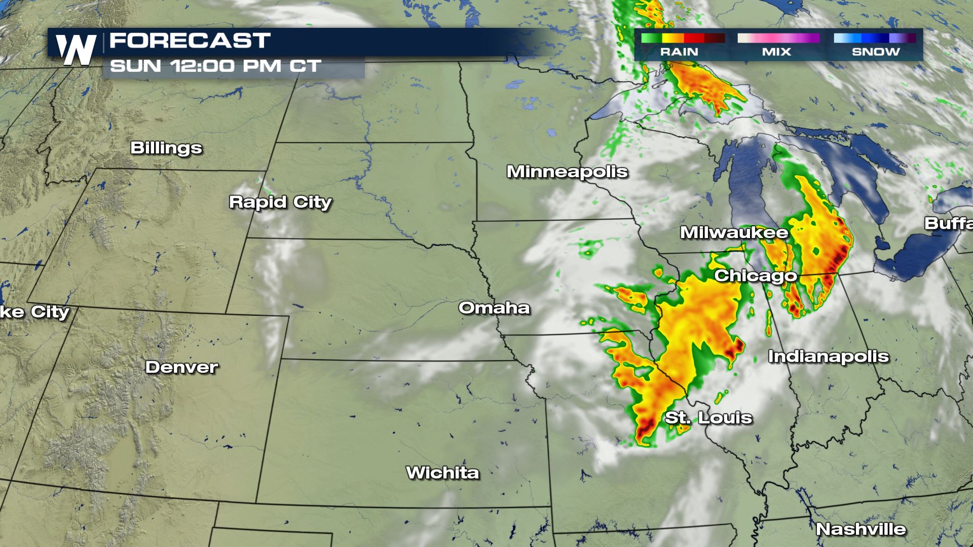 The simulated radar Sunday afternoon.
The severe weather threat then sets up from Oklahoma to Michigan on Sunday (daylight hours 7 a.m. and beyond).
The simulated radar Sunday afternoon.
The severe weather threat then sets up from Oklahoma to Michigan on Sunday (daylight hours 7 a.m. and beyond).
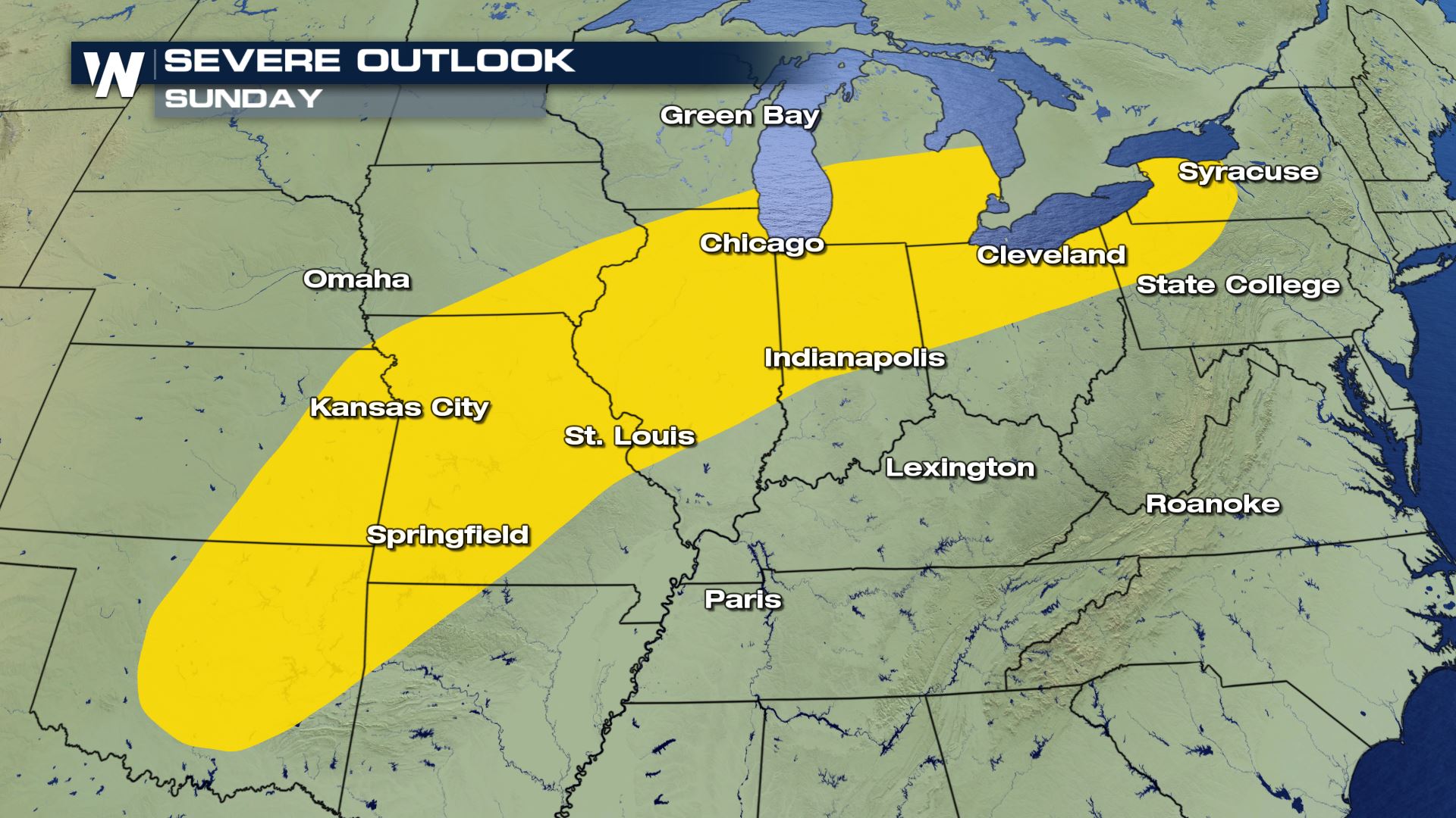 The severe chances highlighted in yellow where these areas could get severe storms.
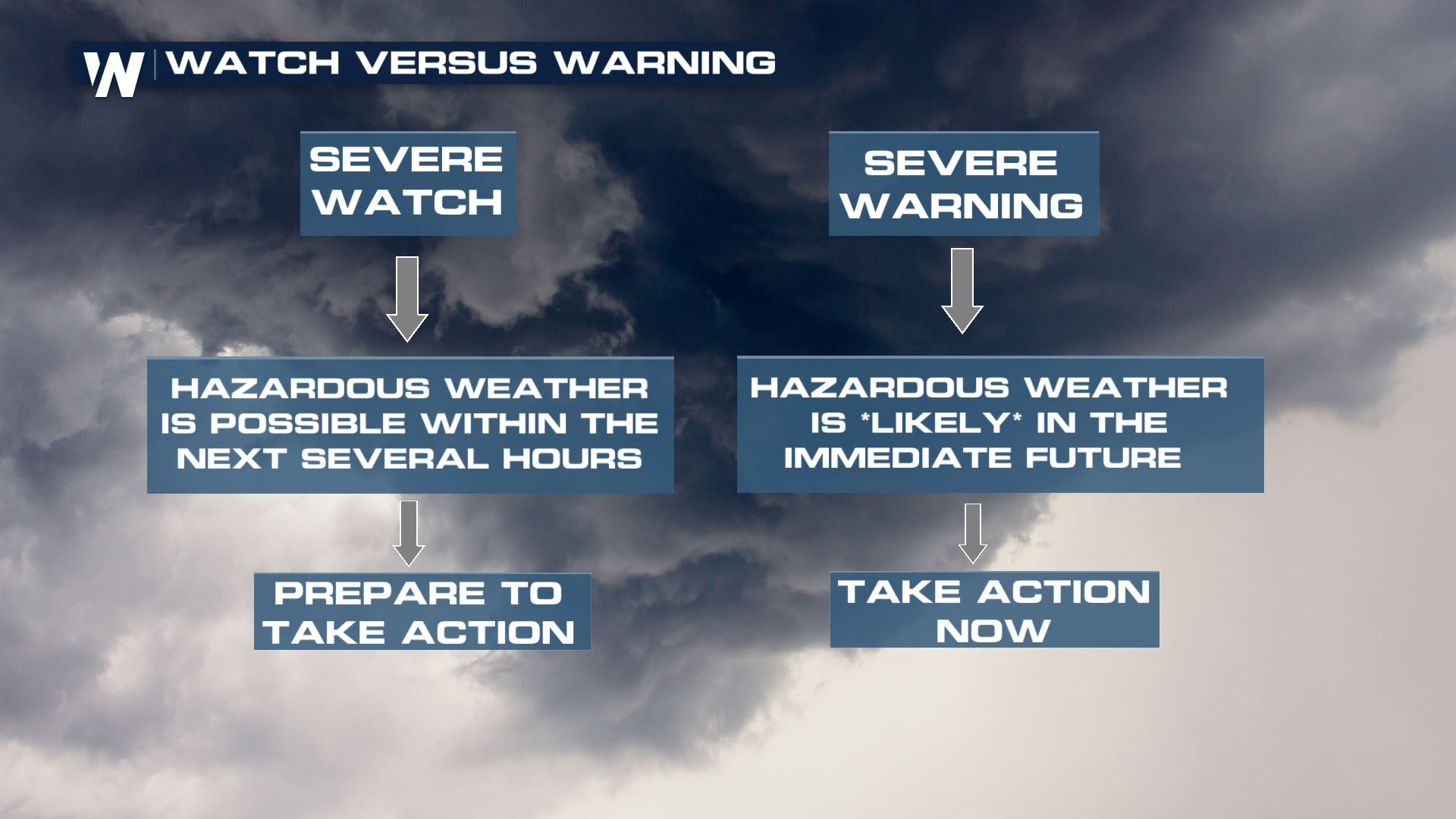
Here's what to do. Listen out for severe weather alerts such as *severe thunderstorm warnings* or *tornado warnings.* When you hear warning, you'll want to take action now. That means getting to your safe place as soon as you can.
The severe chances highlighted in yellow where these areas could get severe storms.
Here's what to do. Listen out for severe weather alerts such as *severe thunderstorm warnings* or *tornado warnings.* When you hear warning, you'll want to take action now. That means getting to your safe place as soon as you can.
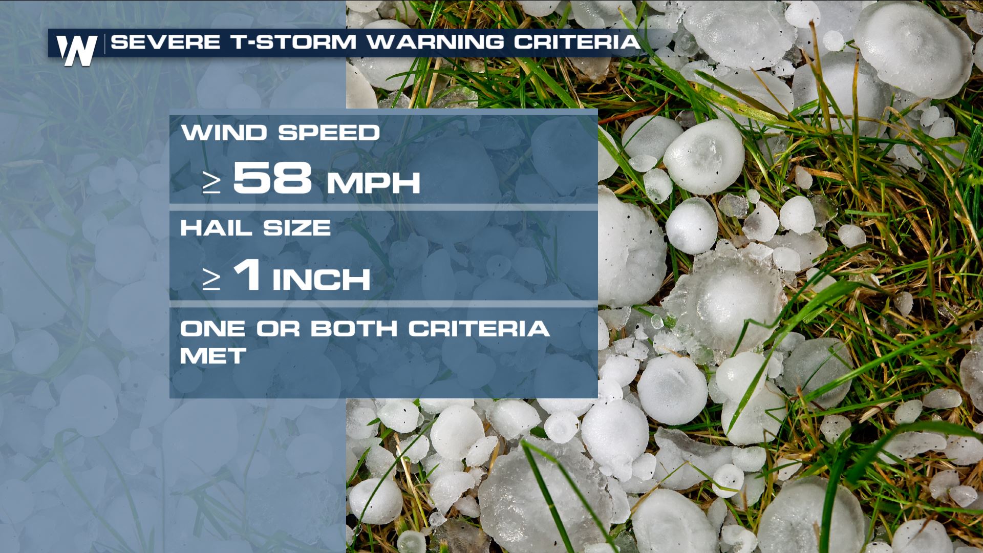
 In terms of what this weather can bring, a severe storm can bring 58 mph winds or stronger and 1" thick hail or larger.
 For WeatherNation, Meteorologist Steve Glazier
The severe weather threat overnight where yellow areas indicate locations that could get severe storms.
The cause of the thunderstorms will be a cold front moving across the central Plains. The individual thunderstorms will move to the east in various areas from Minnesota to Kansas and over to Missouri eventually.
The simulated radar early Sunday morning.
The thunderstorms look to hold together quite well overnight and into Sunday, while sometimes the nighttime hours can help diminish the storms. It does not appear to be the case this night, as the heat/instability and stronger upper-level winds will keep the thunderstorms going.
The simulated radar Sunday afternoon.
The severe weather threat then sets up from Oklahoma to Michigan on Sunday (daylight hours 7 a.m. and beyond).
The severe chances highlighted in yellow where these areas could get severe storms.
Here's what to do. Listen out for severe weather alerts such as *severe thunderstorm warnings* or *tornado warnings.* When you hear warning, you'll want to take action now. That means getting to your safe place as soon as you can.
In terms of what this weather can bring, a severe storm can bring 58 mph winds or stronger and 1" thick hail or larger.
For WeatherNation, Meteorologist Steve GlazierAll Weather News
More

Flooding Risk Increases as Heavy Rain Targets the Tri-State Area
Tuesday, heavy rainfall moved across the Nort
30 Jul 2026 12:25 AM

After Reaching Category 5, Genevieve Weakens in the Pacific
PacificFausto is now a post-tropical cyclone.
30 Jul 2026 12:00 AM

Severe Weather: Energy From the Midwest Now in the Southeast
UPPER MIDWEST - Through Monday, dangerous tor
29 Jul 2026 10:30 PM


Southeast Flood Risk Lingers Near Stalled Front
A stalled boundary over the Southeast will ke
25 Jul 2026 10:55 AM

Another Round of Storms Targets the Northeast
Tuesday brought severe weather again across p
23 Jul 2026 1:15 AM