Severe Storms Possible Monday & Tuesday
Special Stories
21 Jul 2019 8:18 PM
Strong to severe storms will be possible again on Monday and Tuesday in the eastern U.S. However, once the storms pass, the heat wave will be over in the east. We'll explain that in a moment. But first, the severe threat. Where will it be?
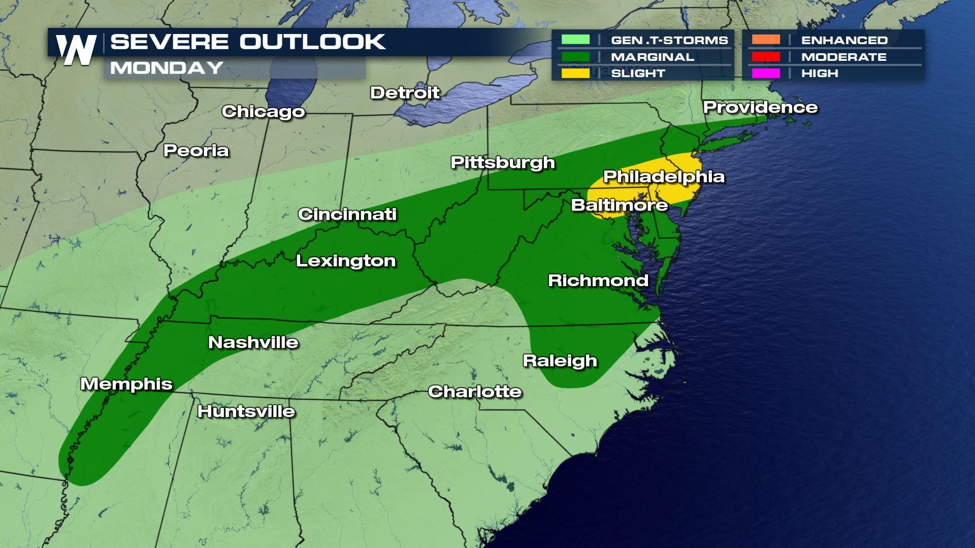
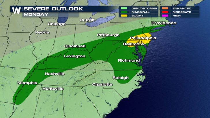
As a cold front sweeps across the eastern third of the country, it will encounter very hot and humid air. The cold front will lift this air, triggering showers and thunderstorms. Some of these storms may contain winds over 58 mile per hour. Once this happens, Severe Thunderstorm Warnings will be issued. The green shaded area in the map below indicates a Marginal Risk. There will be a higher risk of severe storms in the yellow shaded Slight Risk area, including Philadelphia and Baltimore.
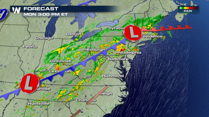
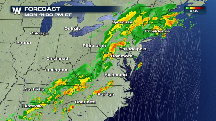
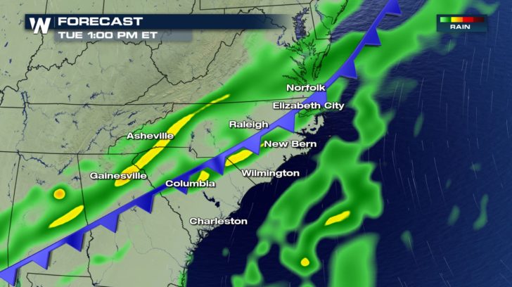
 The following two maps show shower and thunderstorm coverage as the front pushes through the region. The afternoon and evening hours offer the greatest chance of severe storms. By late Monday evening, heavy rain will be the primary threat.
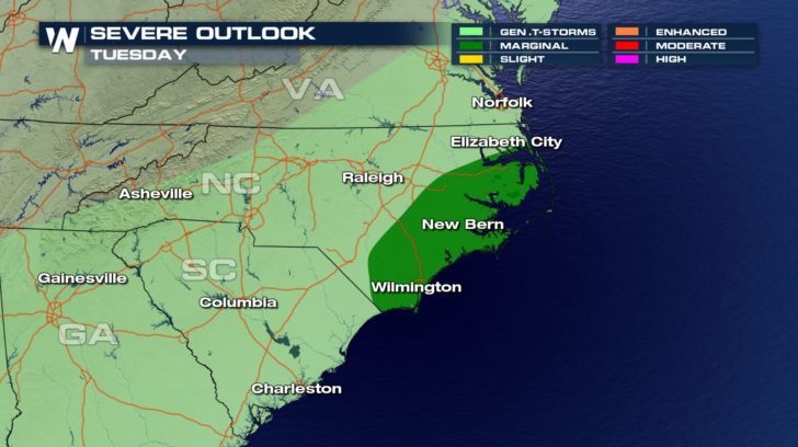
 The cold front will be off the coast in the northeast on Monday. However, the tail end of the cold front will come through parts of the southeast on Tuesday. A Marginal Risk of severe storms with damaging winds is in effect for extreme eastern North Carolina.
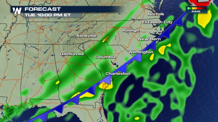
 The following two maps show shower and thunderstorm coverage as the front pushes through the region. The afternoon and evening hours offer the greatest chance of severe storms. Straight line winds over 58 miles per hour will be the primary threat.
 The front will be pushing off the coast Tuesday evening, thereby ending the severe weather threat.
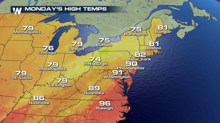
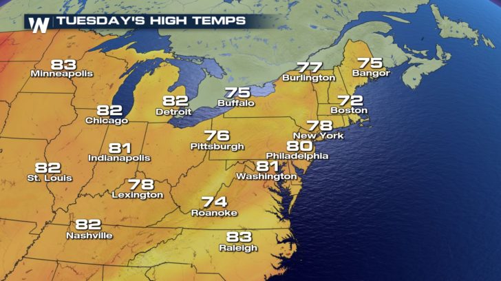
 Nobody likes severe storms, but there will be a silver lining to this weather event, cooler temps! And after this weekend's heatwave, most folks in the east are going to love that! Check out temps in New York City on Monday and Tuesday. The 90's are gone! Lower 80's on Monday, and upper 70's on Tuesday! Some nice heat relief there.
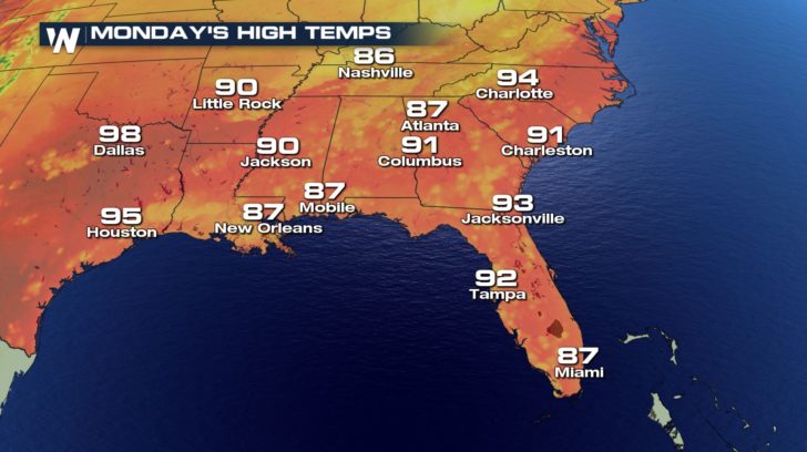
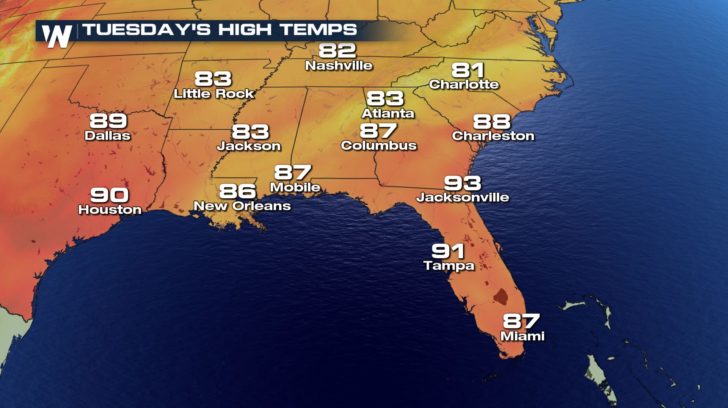
 It will take a little longer for temps to drop in the southeast. But once the cold front passes, Charlotte will drop from 94 to 81 degrees. That's a real treat in July! And gone are the Heat Advisories along the North and South Carolina coast.
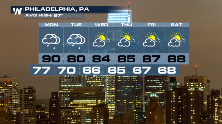
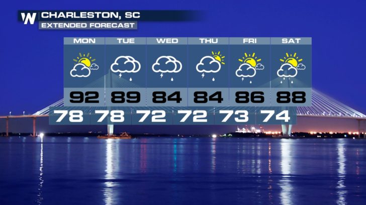
 Here are 7-day forecasts for Philadelphia and Charleston. Temperatures will stay at or below normal much of the week. Enjoy!
 For WeatherNation: Meteorologist Matt Monroe
The following two maps show shower and thunderstorm coverage as the front pushes through the region. The afternoon and evening hours offer the greatest chance of severe storms. By late Monday evening, heavy rain will be the primary threat.
The cold front will be off the coast in the northeast on Monday. However, the tail end of the cold front will come through parts of the southeast on Tuesday. A Marginal Risk of severe storms with damaging winds is in effect for extreme eastern North Carolina.
The following two maps show shower and thunderstorm coverage as the front pushes through the region. The afternoon and evening hours offer the greatest chance of severe storms. Straight line winds over 58 miles per hour will be the primary threat.
The front will be pushing off the coast Tuesday evening, thereby ending the severe weather threat.
Nobody likes severe storms, but there will be a silver lining to this weather event, cooler temps! And after this weekend's heatwave, most folks in the east are going to love that! Check out temps in New York City on Monday and Tuesday. The 90's are gone! Lower 80's on Monday, and upper 70's on Tuesday! Some nice heat relief there.
It will take a little longer for temps to drop in the southeast. But once the cold front passes, Charlotte will drop from 94 to 81 degrees. That's a real treat in July! And gone are the Heat Advisories along the North and South Carolina coast.
Here are 7-day forecasts for Philadelphia and Charleston. Temperatures will stay at or below normal much of the week. Enjoy!
For WeatherNation: Meteorologist Matt MonroeAll Weather News
More


More Storms for the East Sunday and Monday
A low-pressure system crashing through the Mi
2 Aug 2026 2:20 AM

After Reaching Category 5, Genevieve Weakens in the Pacific
PacificGenevieve formed on last Friday south
2 Aug 2026 1:30 AM

Flooding, Severe Storms Target the Midwest Again
After an active week of storms across the nor
1 Aug 2026 1:40 AM

Flooding Risk Increases as Heavy Rain Targets the Tri-State Area
Tuesday, heavy rainfall moved across the Nort
30 Jul 2026 12:25 AM

Severe Weather: Energy From the Midwest Now in the Southeast
UPPER MIDWEST - Through Monday, dangerous tor
29 Jul 2026 10:30 PM