Severe Thunderstorms Possible The Rest of the Week

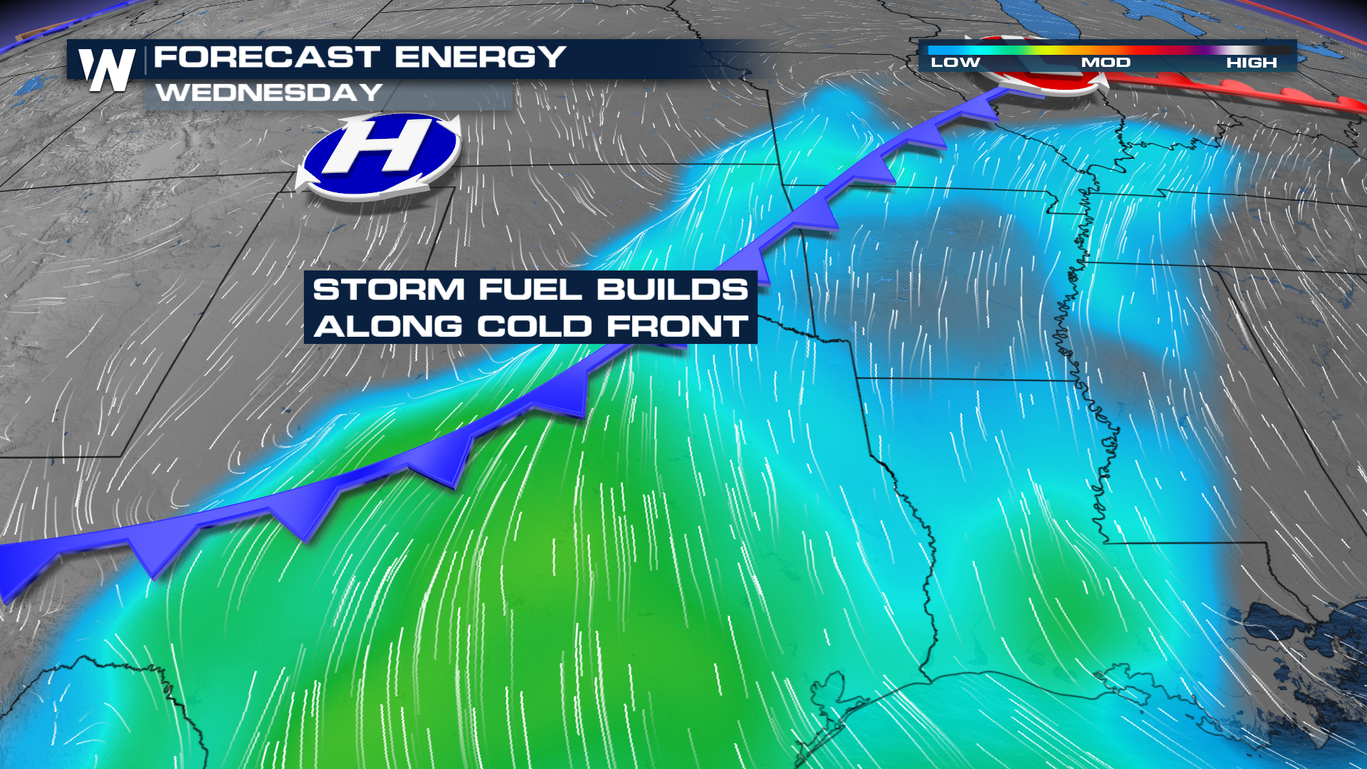
As we head through the rest of the work week, an upper-low will move across the Intermountain West and into the Central Plains, increasing chances for severe thunderstorms and heavy rain. The upper-level ridge responsible for record heat across the Southwest will begin to break down, allowing the upper-level low, currently moving through the Rockies, to move east, bringing strong jet stream winds overhead.
Wednesday
Wednesday the SPC has issued a SLIGHT (level 2 out of 5) risk for severe storms for the threat of isolated to scattered severe thunderstorms from north Texas through Illinois with the primary threats of large hail and isolated wind damage.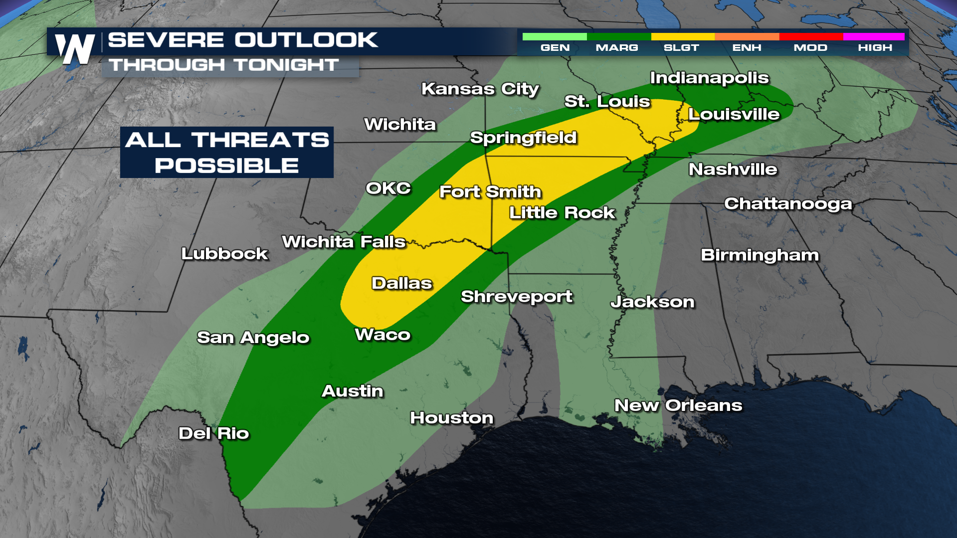
As we move into the evening and overnight hours, more thunderstorms are likely along this stalled boundary. The biggest threats will be wind and hail. Although a few isolated tornadoes could be possible.
Thursday - Friday
Our next trough swings in later this week and targets some of the same areas for severe weather. On Thursday, the Storm Prediction Center has issued a SLIGHT (level 2 out of 5) risk for severe weather across portions of the Plains. Large hail, severe winds, and a tornado or two will all be possible.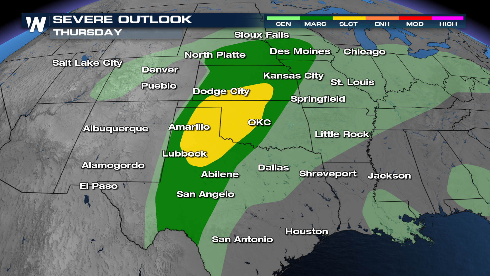
The Storm Prediction Center has issued an additional outlook for Friday. This time, they've upgraded their outlook to an ENHANCED (level 3 out of 5) risk for severe weather. Several major cities are in this enhanced outlook, including OKC, Kansas City, and Tulsa. Strong winds, large hail, and even tornadoes are expected, however the SPC believes the heaviest severe weather in their enhanced-shaded area. The timing of these storms will likely head into Friday night. Make sure you have several ways to get alerts, and have your severe weather plan in place for this weekend.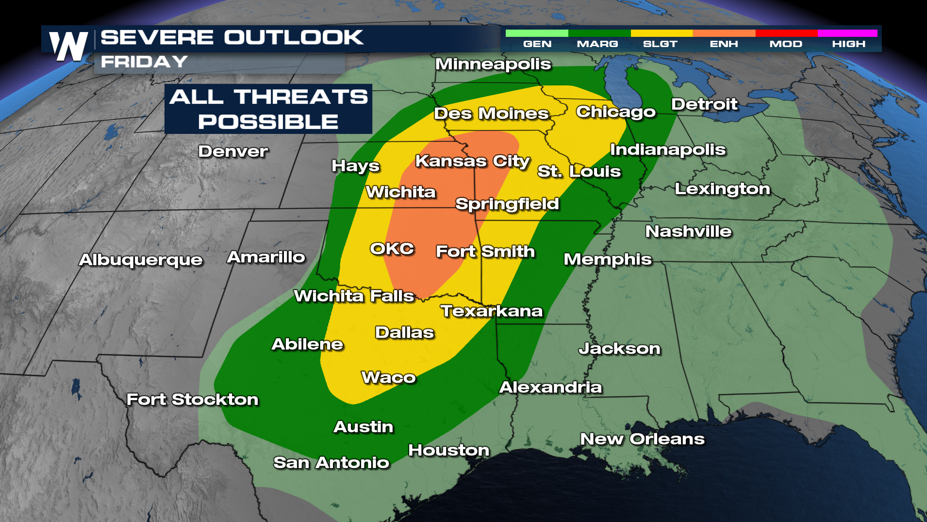
Timing out these storms later this week, scattered to severe thunderstorms are expected to begin Thursday afternoon and evening and continue through the overnight. Initially, the dryline will help to pop some supercells in west Texas. These storms are expected to move east into the Plains later in the afternoon and evening. By nightfall, the low-level jet will strengthen, keeping the risk for severe storms going through the overnight period and into Friday.
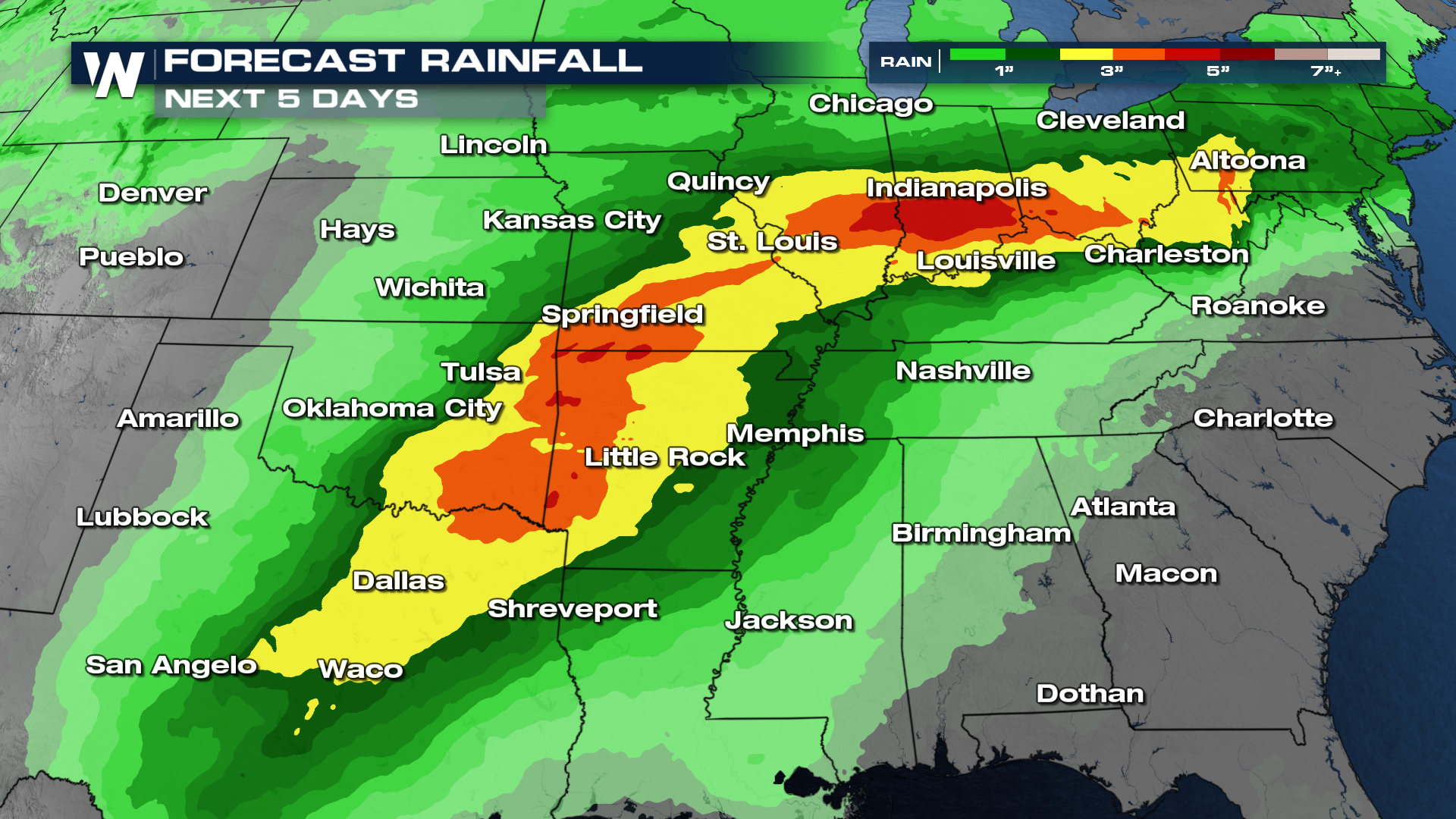
In addition, as deep moisture continues to move north, heavy rain will become a hazard. Significant rainfall looks to be possible from North Texas up through the Ohio Valley through next week, as a moisture-laden atmosphere continues to interact with strong upper-level energy.
As the severe weather season begins to ramp up, so too does our coverage! Severe Weather Awareness Week is here! Make sure you tune in, as we get prepared for the upcoming season with interviews, tips, and some really interesting facts!


