Severe Weather Chances Across the Great Lakes Friday
Special Stories
13 Sep 2019 8:01 AM
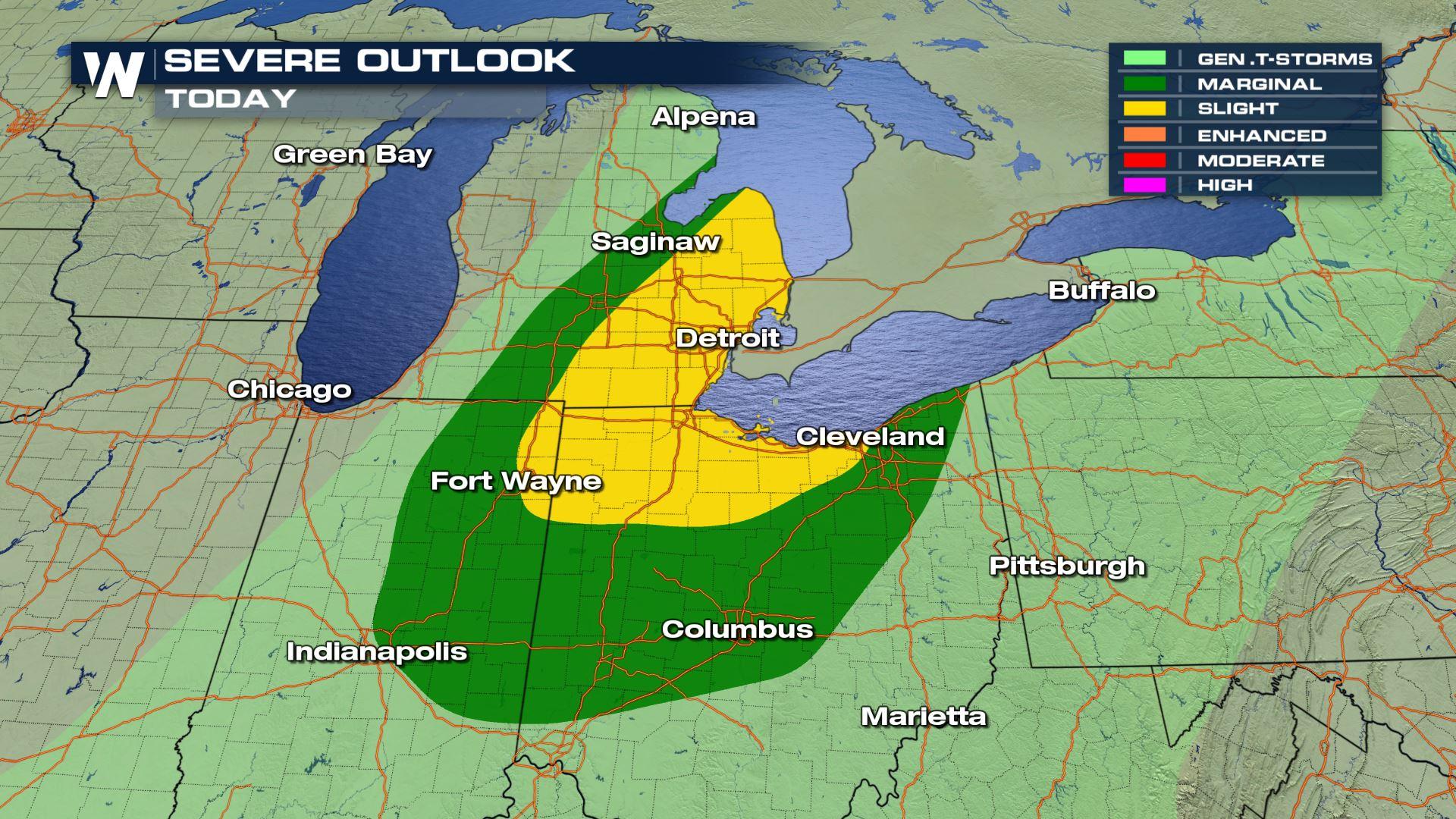
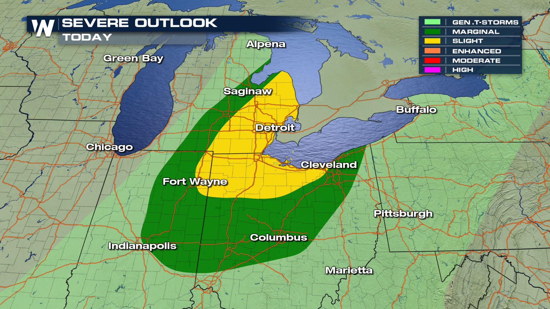
As another frontal boundary moves across areas in the Great Lakes, severe storms may possibly form this afternoon and into the evening hours. It's a fast moving system, so the threat of severe weather will likely decrease late Friday evening.
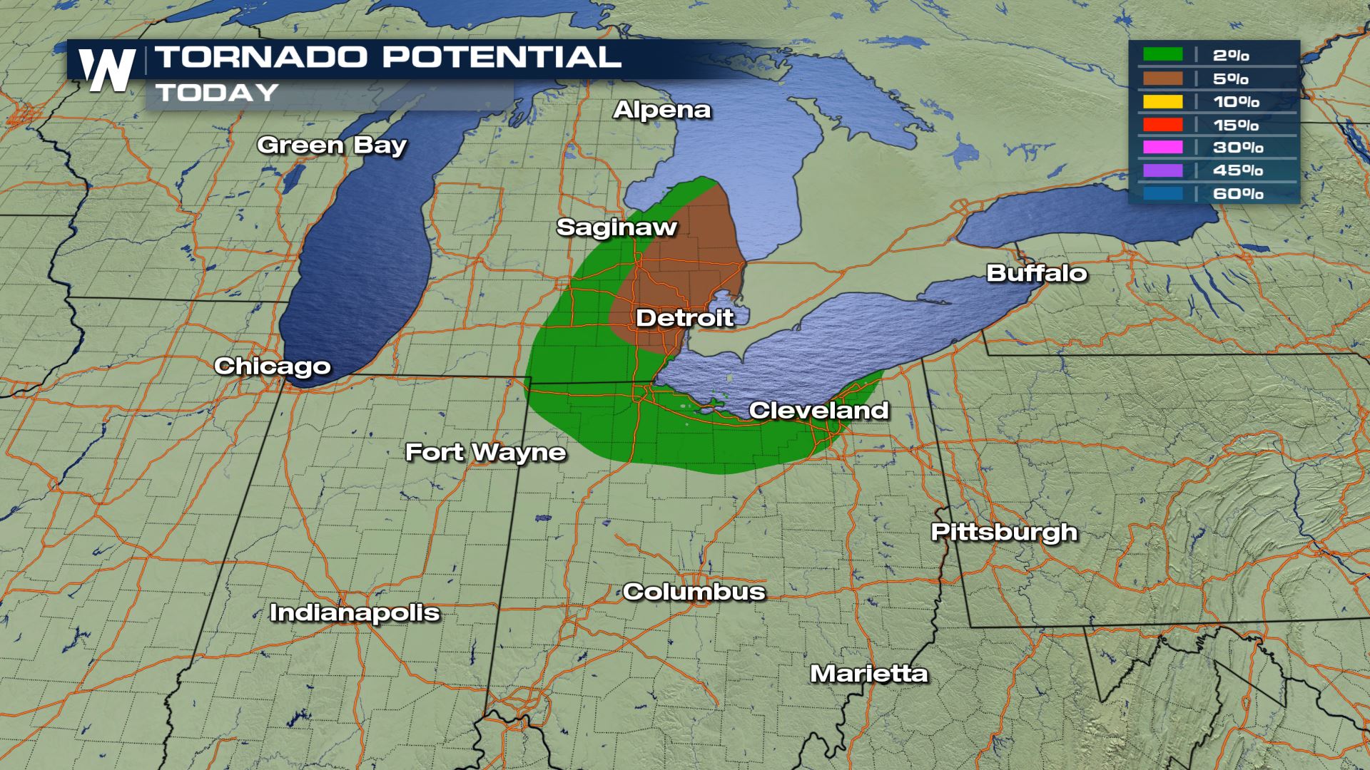
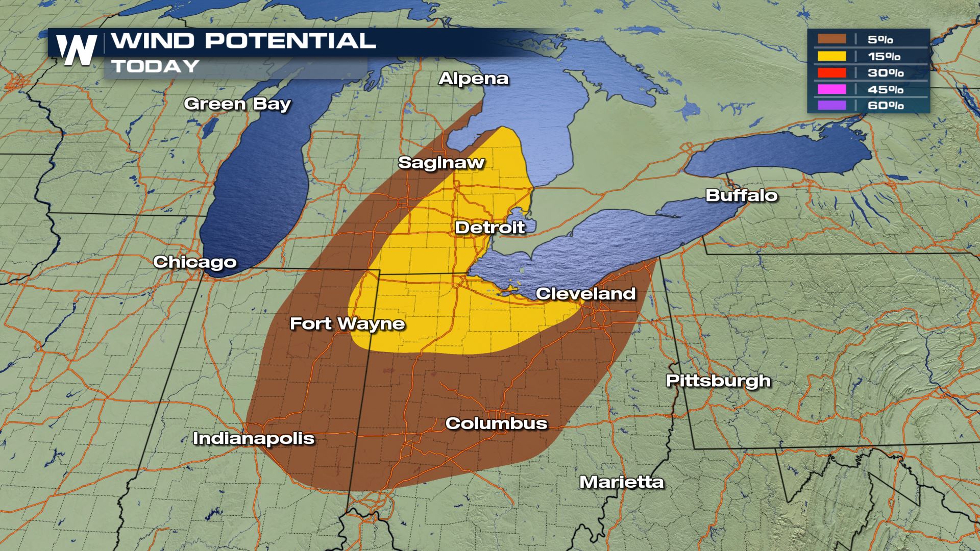
 The largest threats Friday evening will be the possibility of isolated tornadoes, especially in the brown shaded area, which has a 5% chance of tornadic development.
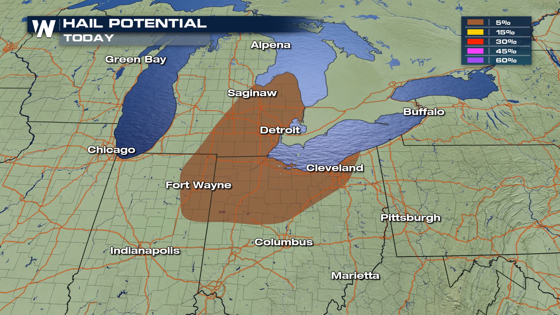
 As some of these storms may tower to nearly 40,000', large hail may also fall throughout the area. Hail stones may exceed 1" in diameter under the strongest storms. Make sure your car is under the carport or in the garage!
 Damaging winds will also be a possibilty as cold outflow winds will likely accompany these storms. Gusts may exceed 50 MPH causing minor damage to property. Make sure to have light objects put away during these evening storms!
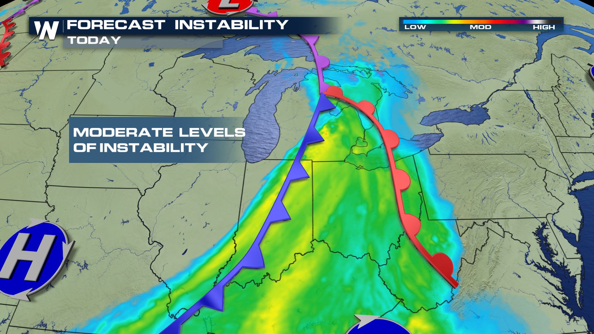
 As the storm system approaches, there will be moderate levels of instability in the atmosphere, promoting the chances for severe weather. Per our forecast models, the highest area of instability will be in the warm section of the cold front!
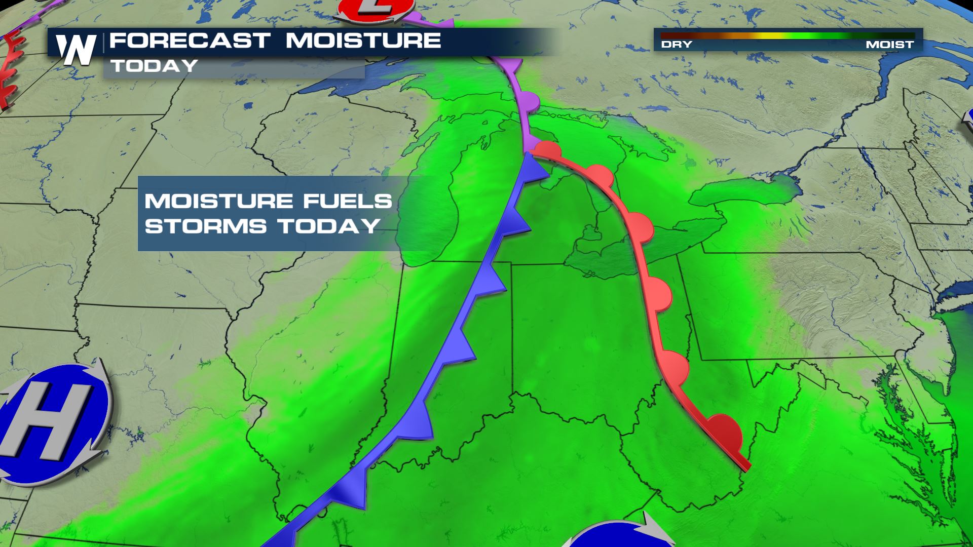
 Dewpoint values will also be high for the area, with readings in the 60°s and low 70°s. This available moisture will help fuel the thunderstorms and destabilize the atmosphere as well.
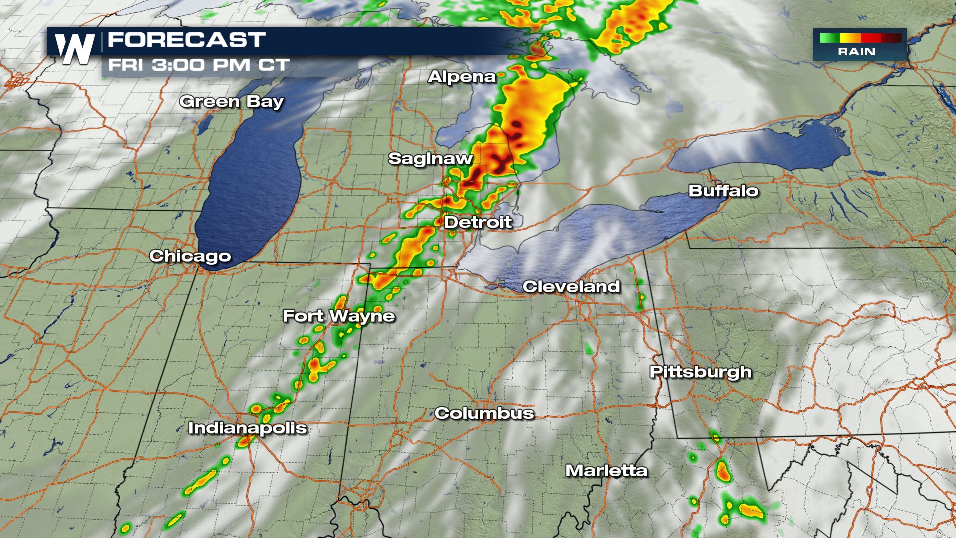
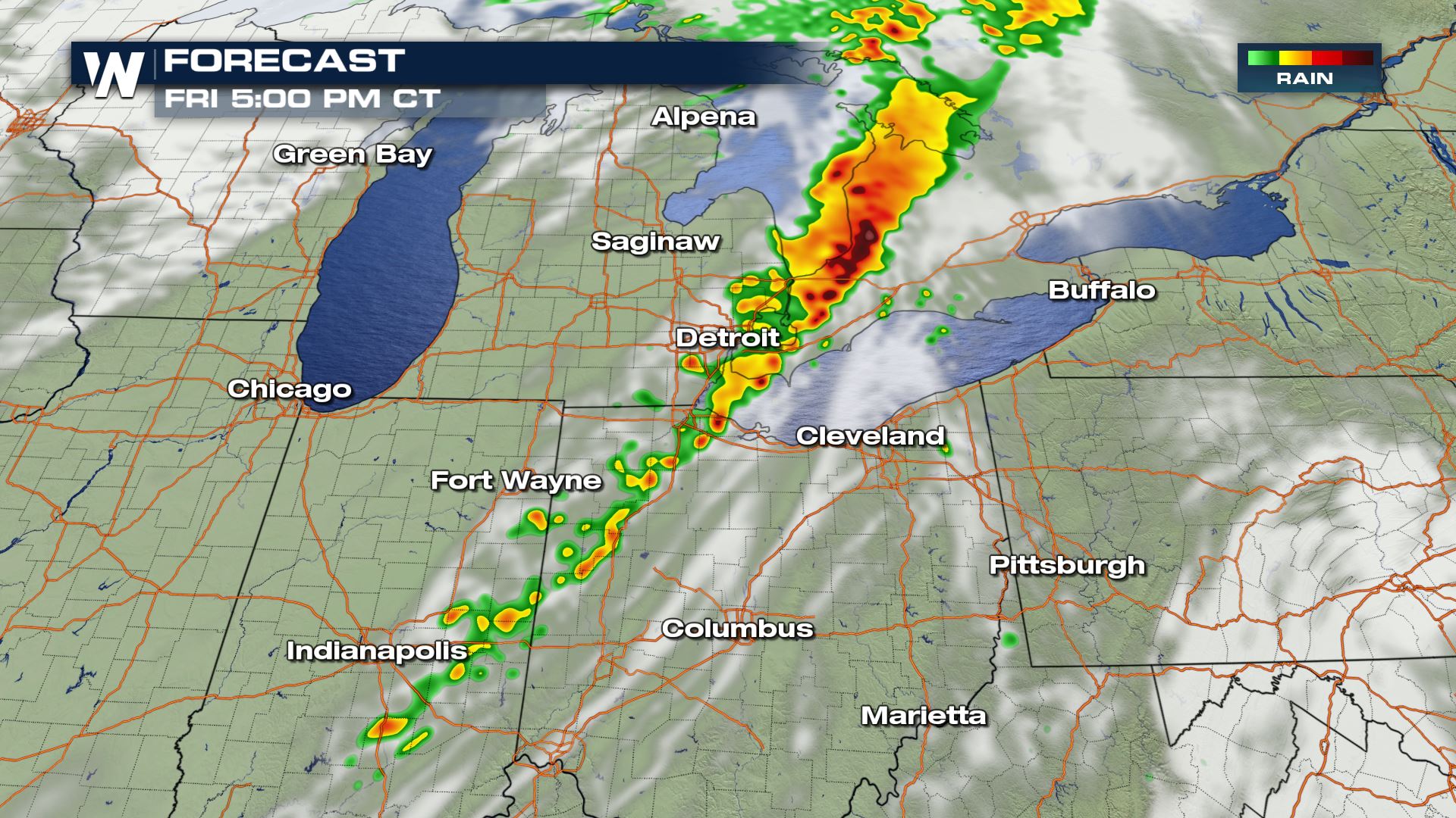
 Here is the break-down with the timing of the thunderstorms Friday afternoon.
 For WeatherNation, I'm Meteorologist Greg Rule
The largest threats Friday evening will be the possibility of isolated tornadoes, especially in the brown shaded area, which has a 5% chance of tornadic development.
As some of these storms may tower to nearly 40,000', large hail may also fall throughout the area. Hail stones may exceed 1" in diameter under the strongest storms. Make sure your car is under the carport or in the garage!
Damaging winds will also be a possibilty as cold outflow winds will likely accompany these storms. Gusts may exceed 50 MPH causing minor damage to property. Make sure to have light objects put away during these evening storms!
As the storm system approaches, there will be moderate levels of instability in the atmosphere, promoting the chances for severe weather. Per our forecast models, the highest area of instability will be in the warm section of the cold front!
Dewpoint values will also be high for the area, with readings in the 60°s and low 70°s. This available moisture will help fuel the thunderstorms and destabilize the atmosphere as well.
Here is the break-down with the timing of the thunderstorms Friday afternoon.
For WeatherNation, I'm Meteorologist Greg RuleAll Weather News
More

Flooding, Severe Storms Target the Midwest Again
After an active week of storms across the nor
1 Aug 2026 1:40 AM


After Reaching Category 5, Genevieve Weakens in the Pacific
PacificFausto is now a post-tropical cyclone.
31 Jul 2026 1:30 AM

Flooding Risk Increases as Heavy Rain Targets the Tri-State Area
Tuesday, heavy rainfall moved across the Nort
30 Jul 2026 12:25 AM

Severe Weather: Energy From the Midwest Now in the Southeast
UPPER MIDWEST - Through Monday, dangerous tor
29 Jul 2026 10:30 PM