Severe Weather Continues Saturday
Top Stories
24 Apr 2021 7:00 PM
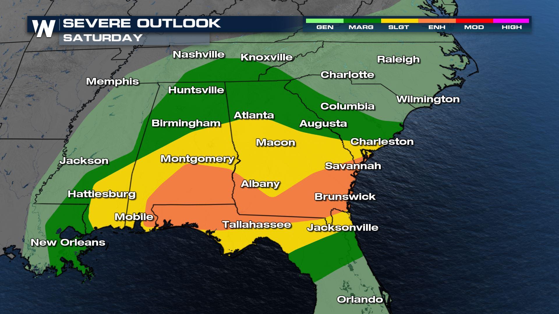
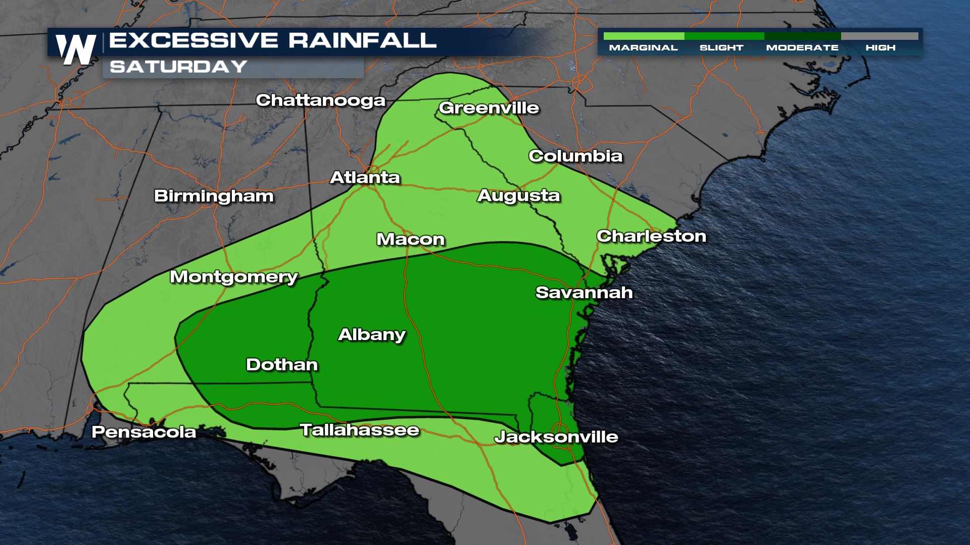
Strong to severe storms will continue into the nighttime hours on Saturday as a powerful cold-front brings widespread heavy rain, damaging wind gusts and isolated large hail to the deep south. There is an enhanced risk for severe weather (level 3 on a scale of 5) through the rest of the night for Alabama, Georgia, and Florida.
We have seen multiple tornado warnings throughout the day on Saturday and a few isolated tornadoes will be possible into the nighttime hours on Saturday. Please have a way to get severe weather alerts on your phone while you are sleeping. 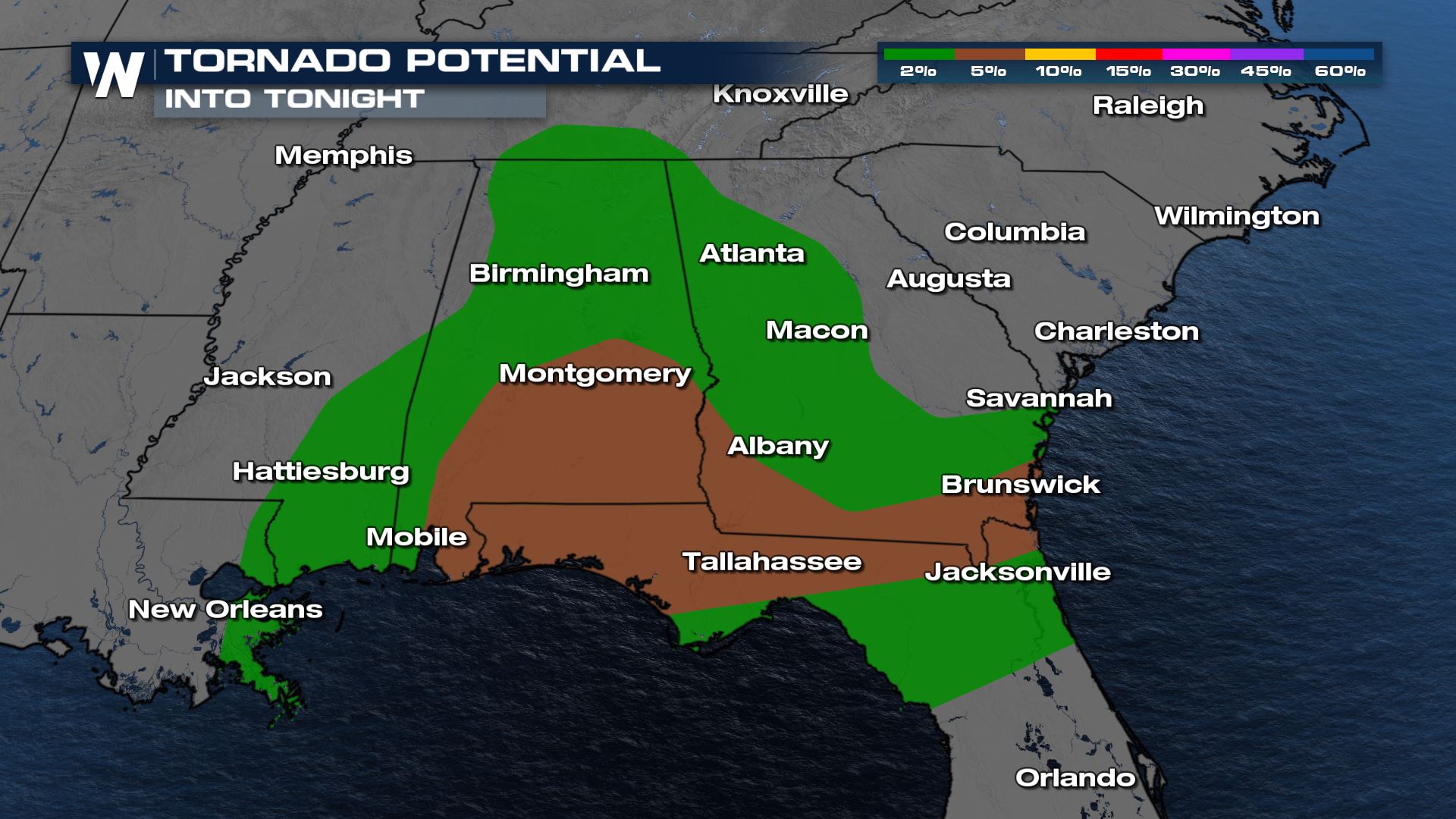
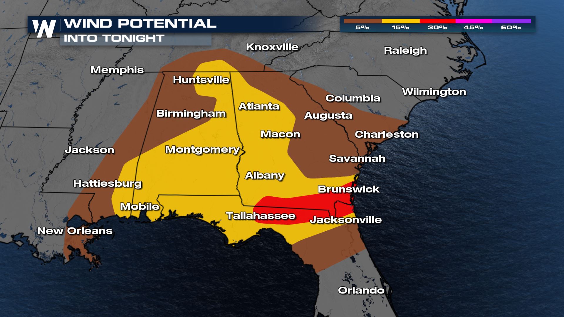 Strong and severe storms will move east along the cold front, impacting areas between the I-75 and I-95 corridors into the late evening hours on Saturday. After midnight, most of the storm activity will be over the Atlantic Ocean with a diminishing storm potential for the panhandle of Florida.
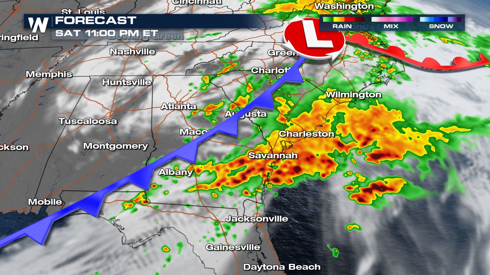
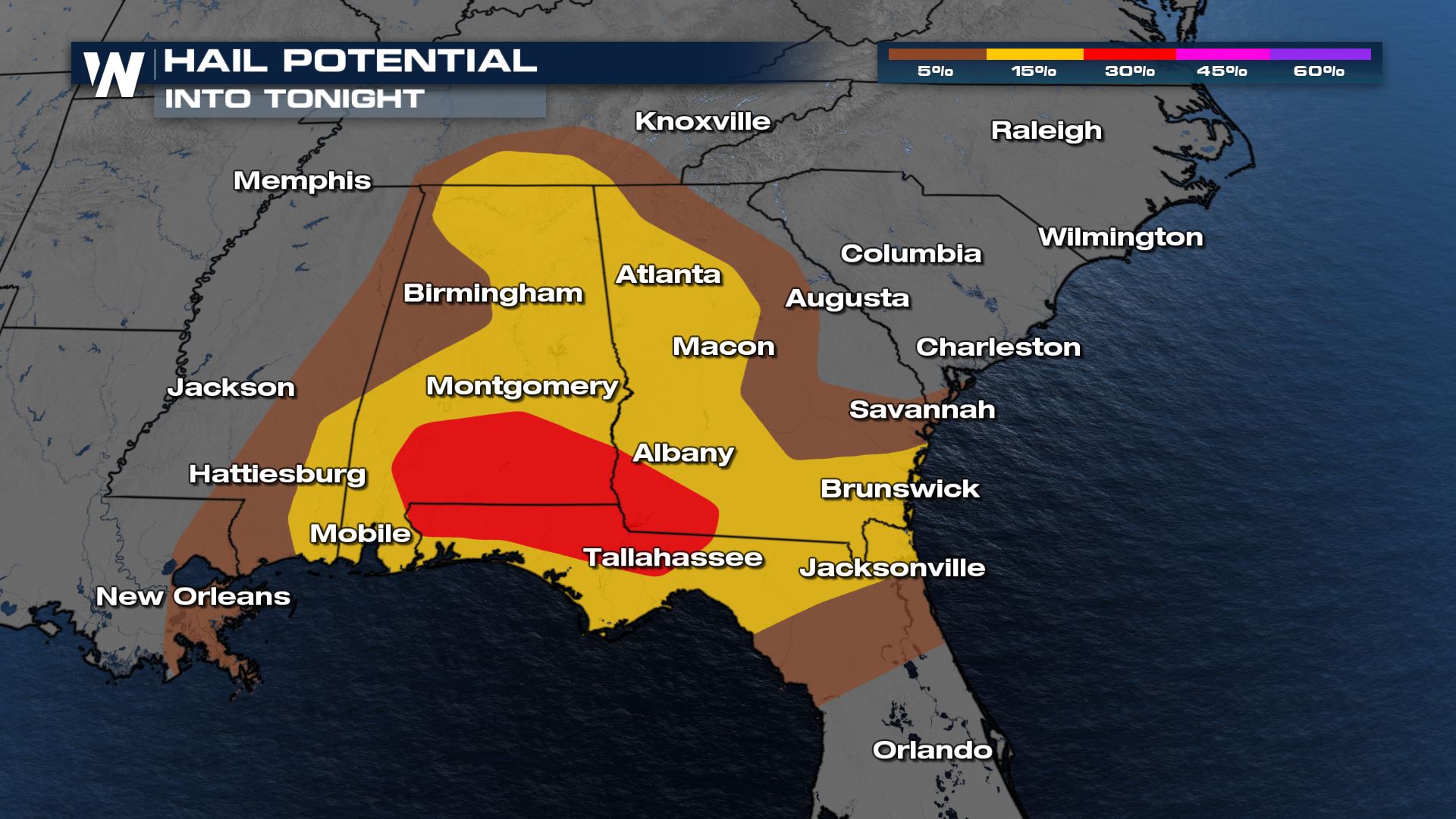
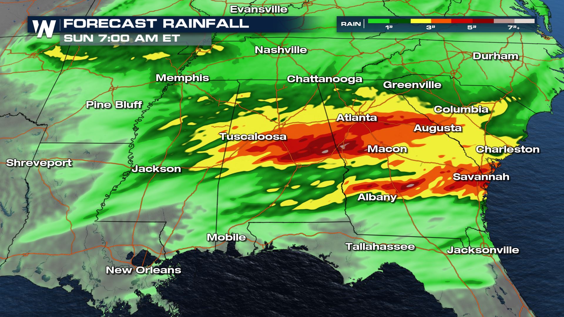
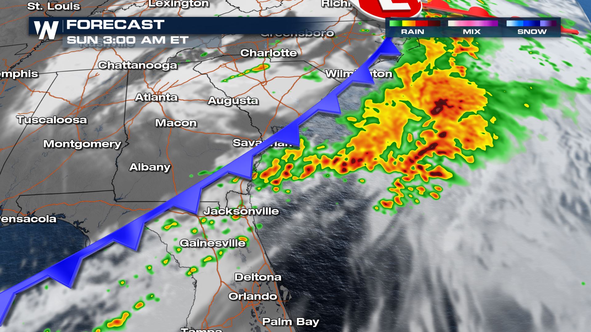 Rain totals throughout the South and Southeast could top 3-5" in spots. Localized heavier rain totals are possible where storms train across the same places. Brief ponding on the roads is also possible especially in areas that tend to flood easily.
 Be sure to check into WeatherNation for the very latest on the potential for severe storms in the Southeast.
Strong and severe storms will move east along the cold front, impacting areas between the I-75 and I-95 corridors into the late evening hours on Saturday. After midnight, most of the storm activity will be over the Atlantic Ocean with a diminishing storm potential for the panhandle of Florida.
Rain totals throughout the South and Southeast could top 3-5" in spots. Localized heavier rain totals are possible where storms train across the same places. Brief ponding on the roads is also possible especially in areas that tend to flood easily.
Be sure to check into WeatherNation for the very latest on the potential for severe storms in the Southeast.All Weather News
More
Wildfire Outbreak in the Pacific Northwest
SPOKANE, WA - On Saturday, August 1st, the Ol
2 Aug 2026 7:20 PM

More Storms for the East Through Monday
A low-pressure system that moved through the
2 Aug 2026 7:20 PM


After Reaching Category 5, Genevieve Weakens in the Pacific
PacificGenevieve formed on last Friday south
2 Aug 2026 6:25 PM

Flooding, Severe Storms Target the Midwest Again
After an active week of storms across the nor
1 Aug 2026 1:40 AM

Flooding Risk Increases as Heavy Rain Targets the Tri-State Area
Tuesday, heavy rainfall moved across the Nort
30 Jul 2026 12:25 AM

Severe Weather: Energy From the Midwest Now in the Southeast
UPPER MIDWEST - Through Monday, dangerous tor
29 Jul 2026 10:30 PM