Severe Weather Extended into Tuesday
Special Stories
27 May 2019 11:27 AM
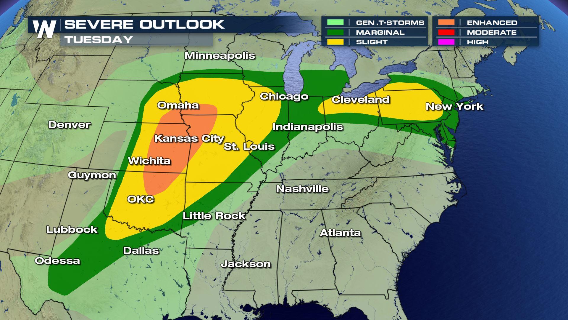
SEVERE OUTLOOK
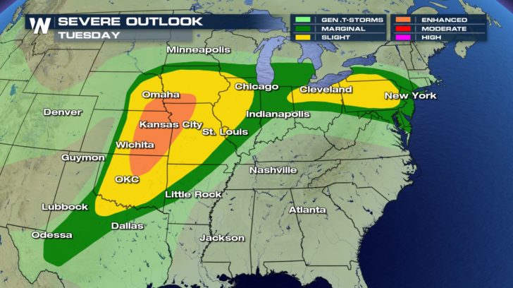 The severe weather threat doesn't stop today. We'll see the threat of severe weather continue into our Tuesday.
An enhanced risk is already in place for areas from Iowa to Oklahoma. This means numerous severe thunderstorms will be possible on Tuesday.
The severe weather threat doesn't stop today. We'll see the threat of severe weather continue into our Tuesday.
An enhanced risk is already in place for areas from Iowa to Oklahoma. This means numerous severe thunderstorms will be possible on Tuesday.
CENTRAL FORECAST
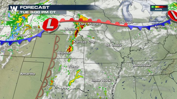
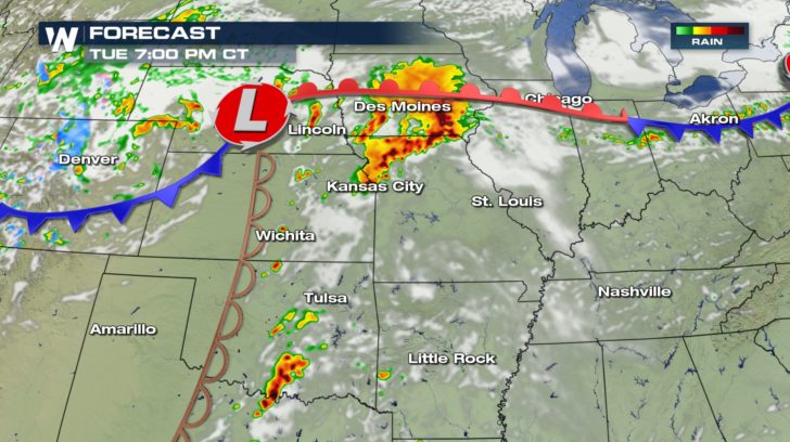
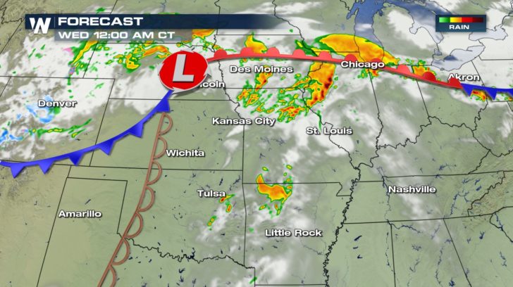 Starting with the central region, storms will start to fire off around 3 PM on Tuesday and will last throughout the night.
These storms will be quite strong. They could possess large hail, damaging winds, and even tornadoes.
Starting with the central region, storms will start to fire off around 3 PM on Tuesday and will last throughout the night.
These storms will be quite strong. They could possess large hail, damaging winds, and even tornadoes.
NORTHEAST FORECAST
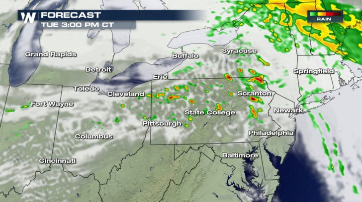
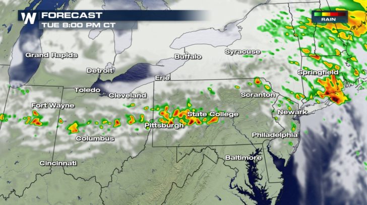
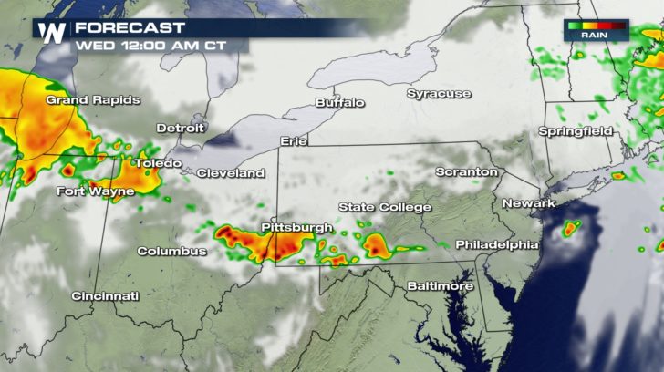 The northeast will not have as high of a threat as the central region, but scattered severe storms could still be possible.
These storms will also start to fire off around 3 PM Tuesday and last into Wednesday morning.
The northeast will not have as high of a threat as the central region, but scattered severe storms could still be possible.
These storms will also start to fire off around 3 PM Tuesday and last into Wednesday morning.All Weather News
More
East Gears Up for Stormy, Wet Weekend
A low pressure system crashing through the Mi
1 Aug 2026 11:35 AM


Flooding, Severe Storms Target the Midwest Again
After an active week of storms across the nor
1 Aug 2026 1:40 AM


After Reaching Category 5, Genevieve Weakens in the Pacific
PacificFausto is now a post-tropical cyclone.
31 Jul 2026 1:30 AM

Flooding Risk Increases as Heavy Rain Targets the Tri-State Area
Tuesday, heavy rainfall moved across the Nort
30 Jul 2026 12:25 AM

Severe Weather: Energy From the Midwest Now in the Southeast
UPPER MIDWEST - Through Monday, dangerous tor
29 Jul 2026 10:30 PM