Severe Weather Chances Linger Friday in the Southeast
Special Stories
26 Mar 2021 9:00 AM
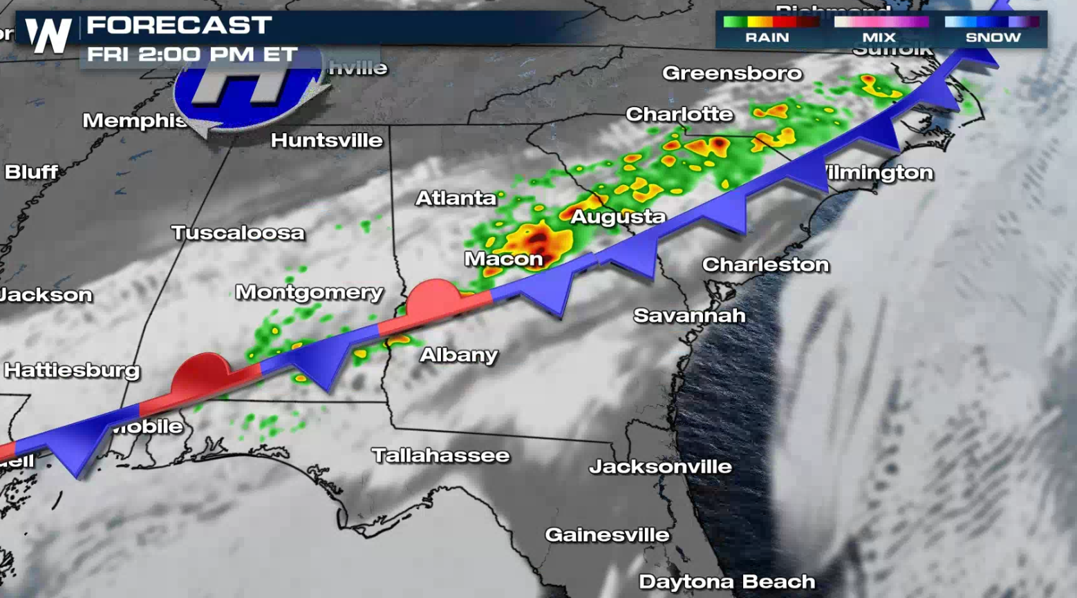
After a severe weather outbreak Thursday, the risk for severe thunderstorms continues today (Friday) for the Southeast, although likely not as widespread or intense. There is a marginal risk for severe thunderstorms (level 1 on a scale of 1 to 5) from the outer banks of North Carolina into Georgia. A second area is focused near the Mississippi Delta.
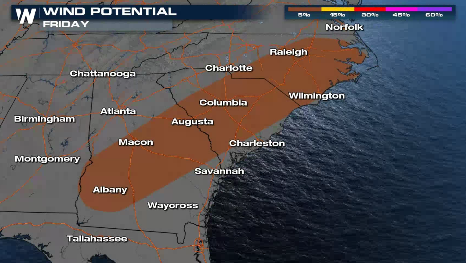
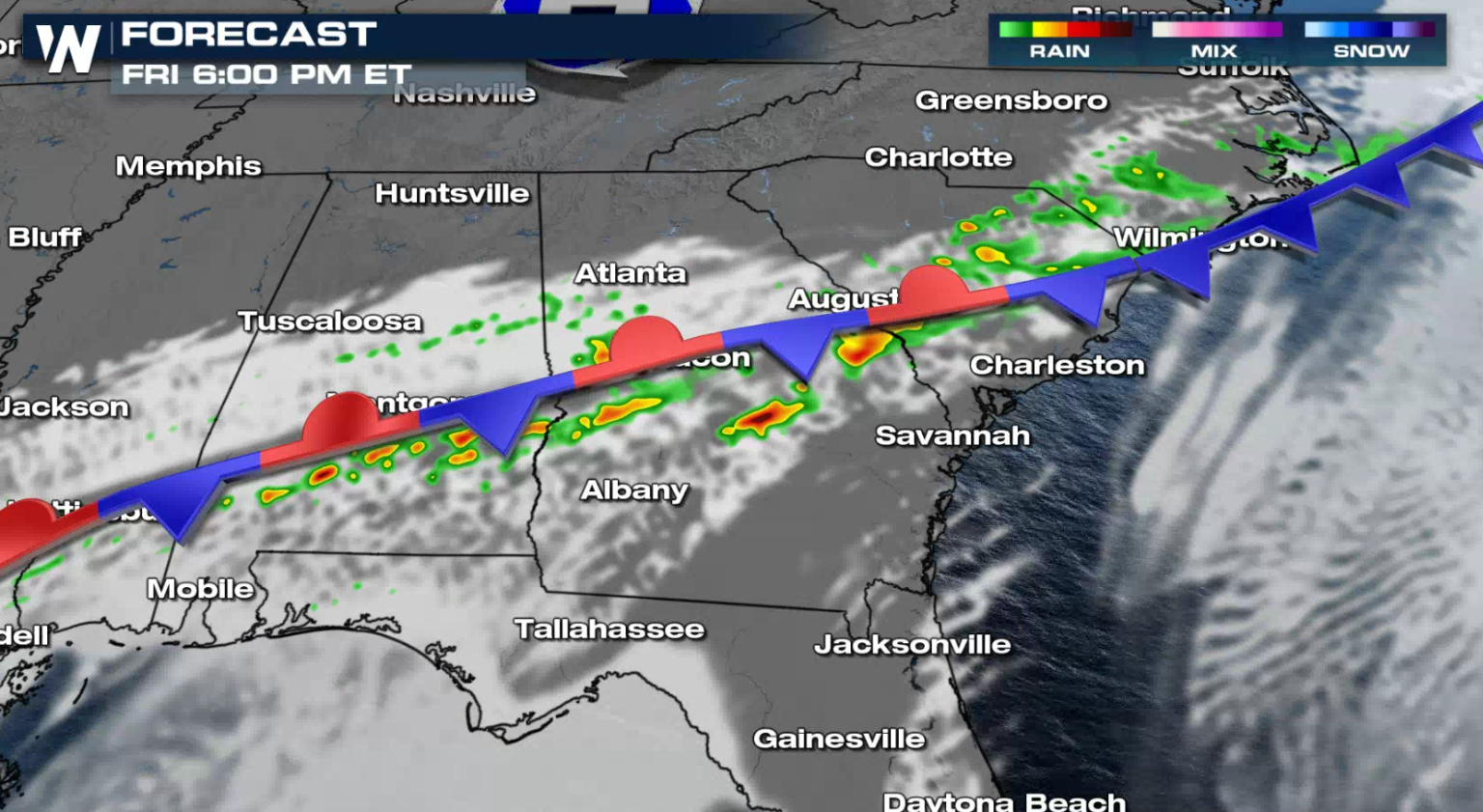
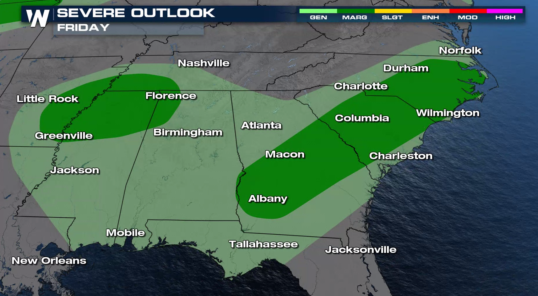 A stalled front will spur the chance for isolated severe storms from Georgia through North Carolina, primarily with the threat of damaging winds.
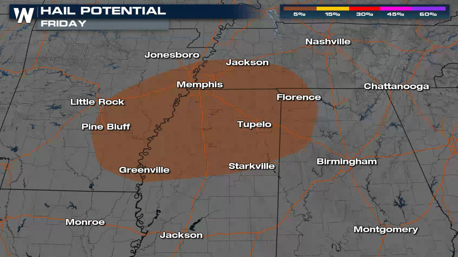
 Large hail is the main concern for the second risk area in the Mississippi Delta. This highlights a limited threat for overnight thunderstorms into early Saturday that could produce hail greater than an inch in diameter.
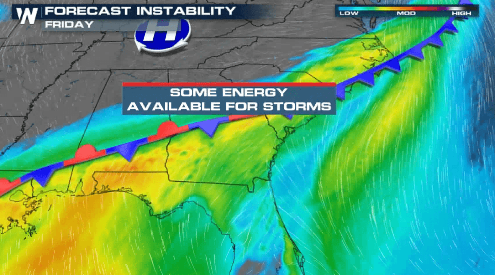
 The strong storm system from Thursday has weakened with diminished upper level support. Moderate instability coupled with a well defined cold front will fuel severe thunderstorm development in the late afternoon. Storms will continue into the early evening before diminishing.
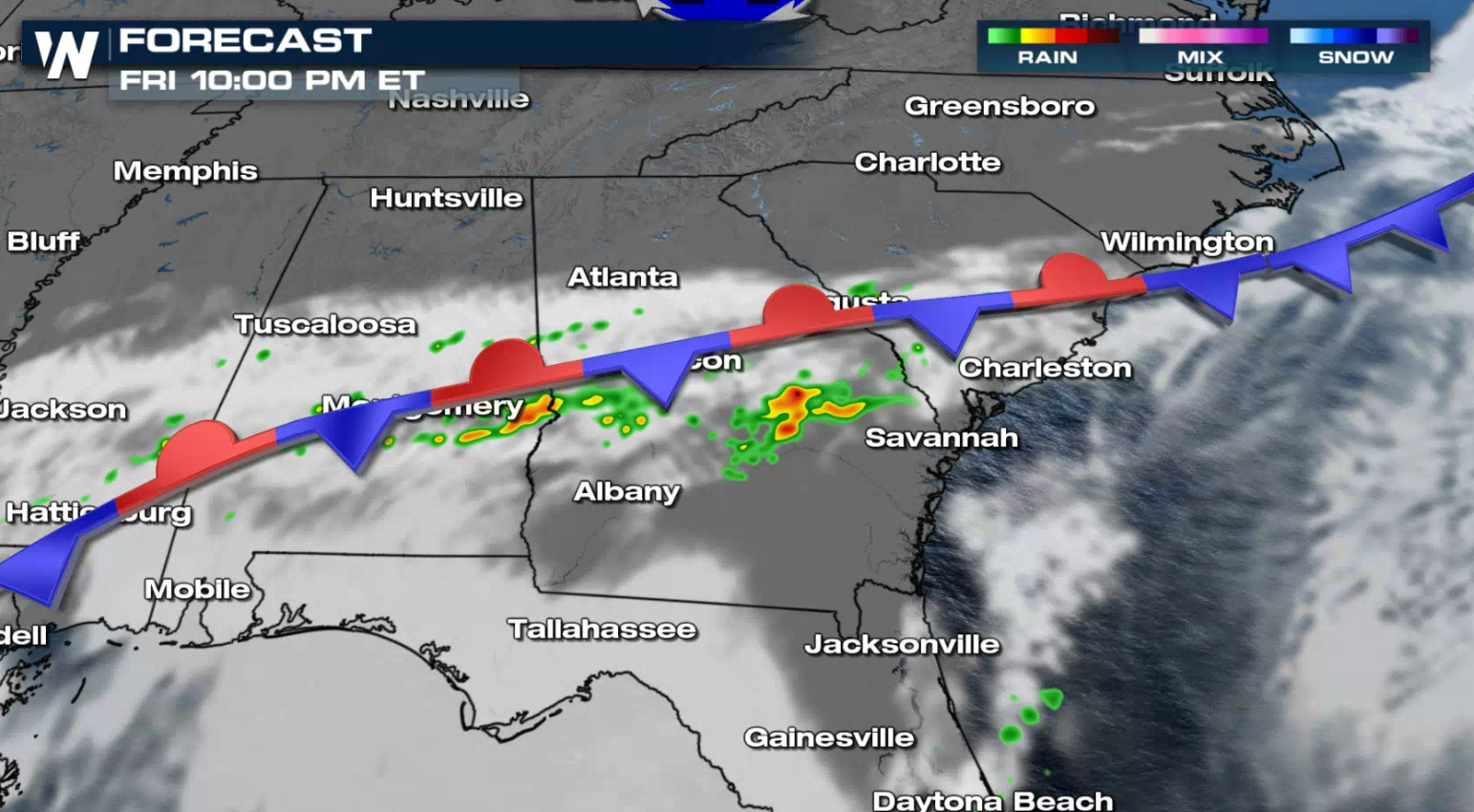 There is an additional threat for severe thunderstorms in the Southeast on Saturday. If you are in the risk areas, check back with WeatherNation on-air and online for forecast updates and the latest alerts.
A stalled front will spur the chance for isolated severe storms from Georgia through North Carolina, primarily with the threat of damaging winds.
Large hail is the main concern for the second risk area in the Mississippi Delta. This highlights a limited threat for overnight thunderstorms into early Saturday that could produce hail greater than an inch in diameter.
The strong storm system from Thursday has weakened with diminished upper level support. Moderate instability coupled with a well defined cold front will fuel severe thunderstorm development in the late afternoon. Storms will continue into the early evening before diminishing.
There is an additional threat for severe thunderstorms in the Southeast on Saturday. If you are in the risk areas, check back with WeatherNation on-air and online for forecast updates and the latest alerts.All Weather News
More
Severe Storms Target the Midwest to the Northeast
UPPER MIDWEST - Dangerous tornadoes have alre
28 Jul 2026 1:45 AM

Tropics: Fausto Heads towards Hawaii; Genevieve Cat 4 Hurricane
PacificHurricane Fausto continues to track we
28 Jul 2026 1:45 AM


Southeast Flood Risk Lingers Near Stalled Front
A stalled boundary over the Southeast will ke
25 Jul 2026 10:55 AM

Another Round of Storms Targets the Northeast
Tuesday brought severe weather again across p
23 Jul 2026 1:15 AM

Another Round of Severe Weather for the Upper Midwest and Great Lakes
The upper-level low train continues to keep t
21 Jul 2026 1:45 AM