Severe Weather Outlook for the Rest of the Work Week
Special Stories
18 Sep 2018 10:02 AM
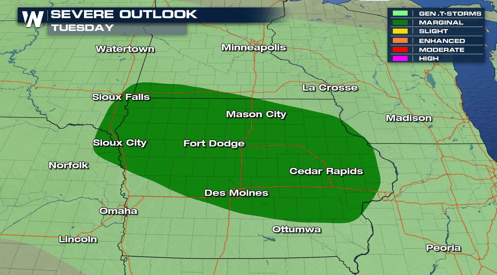
Even with the calendar flipping over to September, severe weather season continues in the northern tier of the nation. A stalled front over the Upper Midwest will bring a marginal risk for severe thunderstorms today (Tuesday), mainly focused in northern and central Iowa.
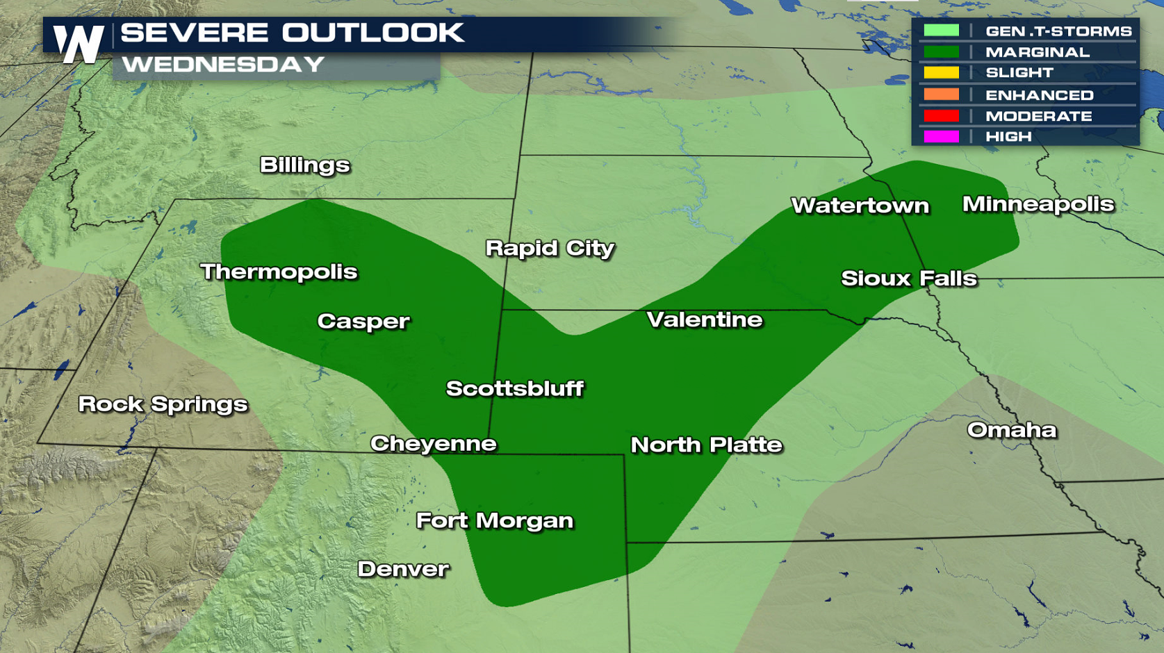
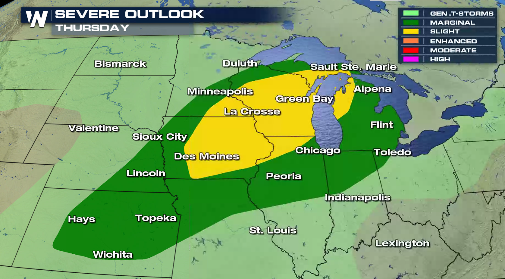
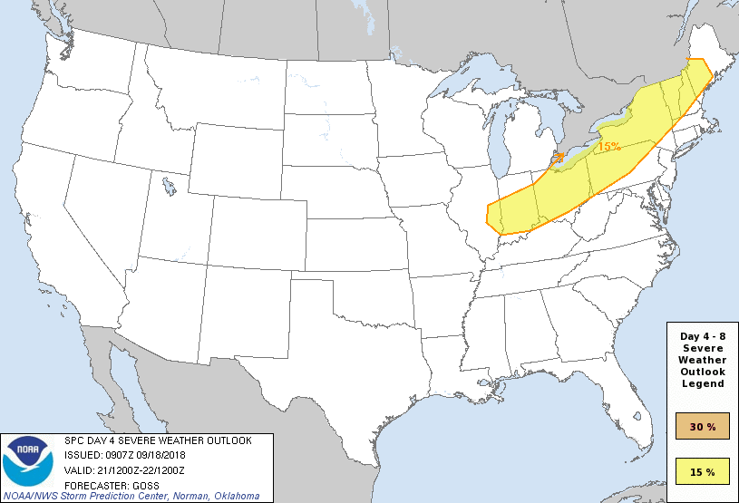 The front will barely move on Wednesday as upper level energy sweeps across the Rockies. There is a marginal severe weather risk from Upper Midwest to the Front Range. The system starts to move eastward for the rest of the work week. With more instability in the atmosphere, there is a slight risk for severe storms from the western Great Lakes to the central Plains on Thursday, sweeping into the Northeast on Friday.
For WeatherNation: Meteorologist Mace Michaels
The front will barely move on Wednesday as upper level energy sweeps across the Rockies. There is a marginal severe weather risk from Upper Midwest to the Front Range. The system starts to move eastward for the rest of the work week. With more instability in the atmosphere, there is a slight risk for severe storms from the western Great Lakes to the central Plains on Thursday, sweeping into the Northeast on Friday.
For WeatherNation: Meteorologist Mace MichaelsAll Weather News
More
Wildfire Outbreak in the Pacific Northwest
SPOKANE, WA - On Saturday, August 1st, the Ol
3 Aug 2026 1:55 AM

More Storms for the East Through Monday
A low-pressure system that moved through the
3 Aug 2026 1:50 AM


After Reaching Category 5, Genevieve Weakens in the Pacific
PacificGenevieve formed last Friday south of
3 Aug 2026 12:30 AM

Flooding, Severe Storms Target the Midwest Again
After an active week of storms across the nor
1 Aug 2026 1:40 AM

Flooding Risk Increases as Heavy Rain Targets the Tri-State Area
Tuesday, heavy rainfall moved across the Nort
30 Jul 2026 12:25 AM

Severe Weather: Energy From the Midwest Now in the Southeast
UPPER MIDWEST - Through Monday, dangerous tor
29 Jul 2026 10:30 PM