Severe Weather Outlooks for Tuesday and Wednesday
Special Stories
1 Jul 2019 7:42 AM
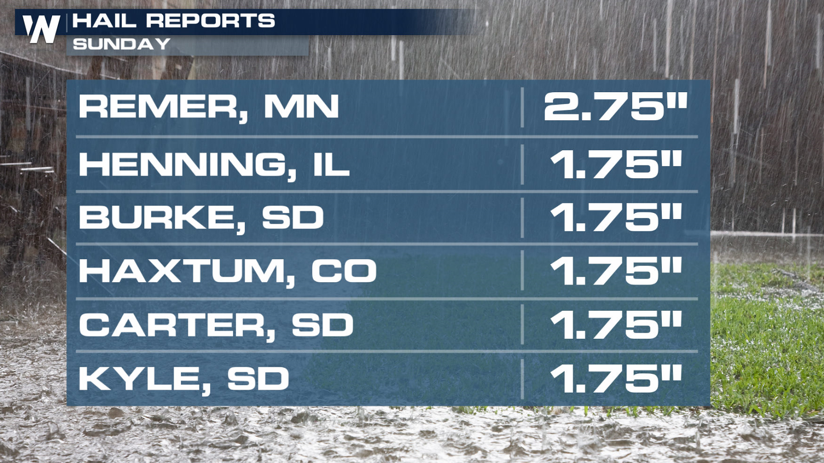
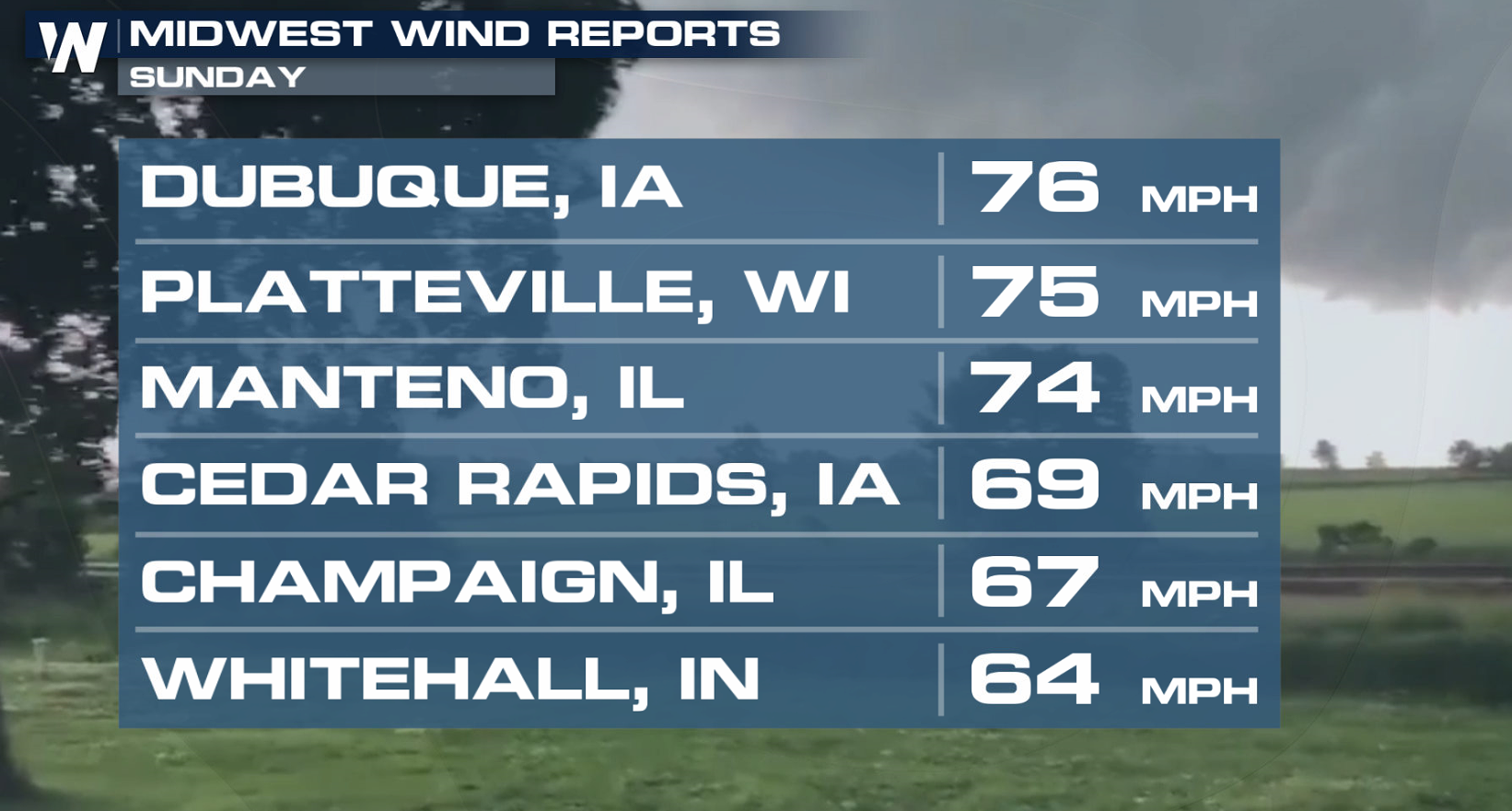
Severe weather moved across the Upper Midwest and Northern Plains this weekend with large hail and strong winds. Hail larger than golf balls and gusts greater than 70 mph were reported on Sunday.
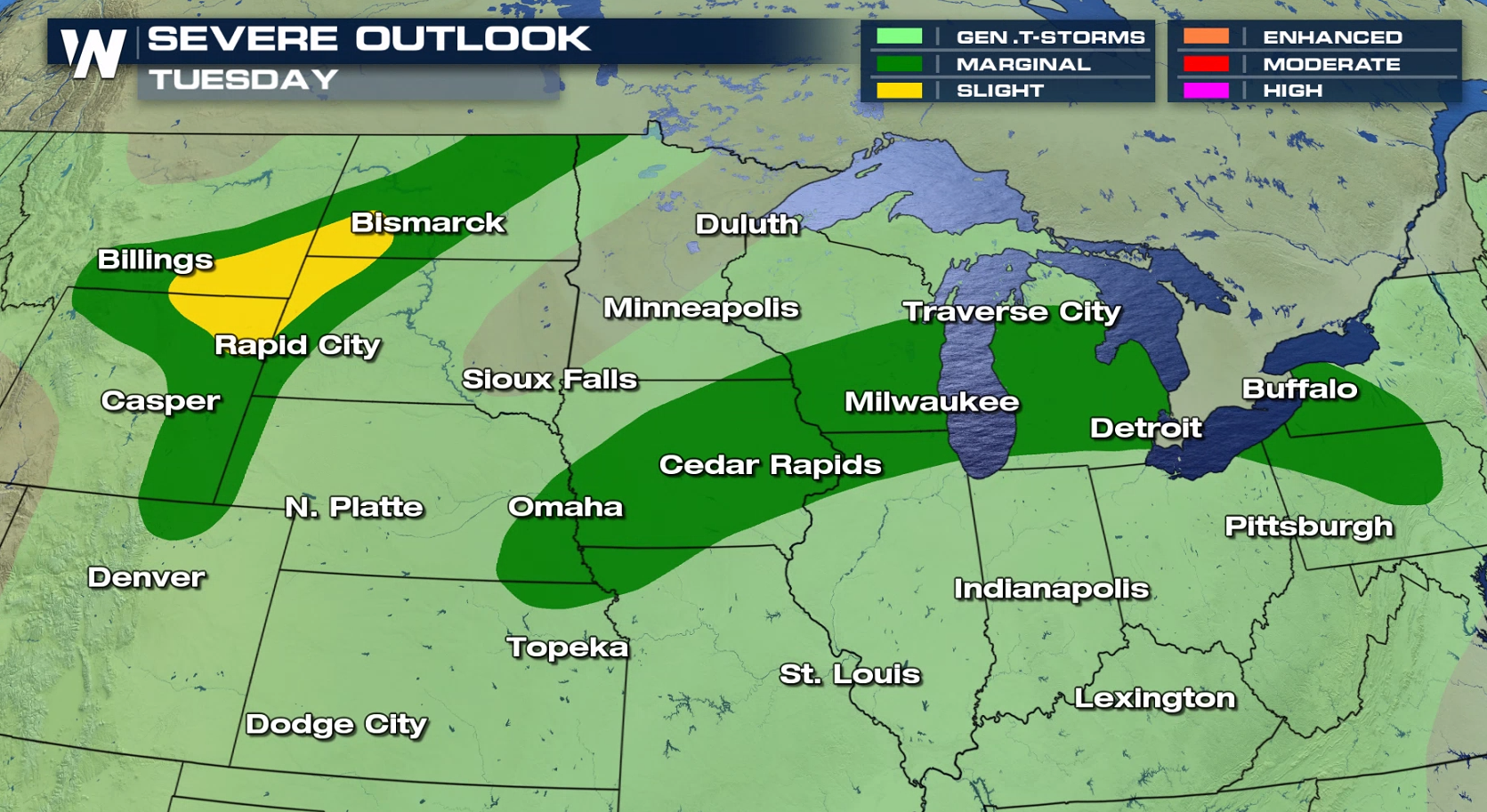
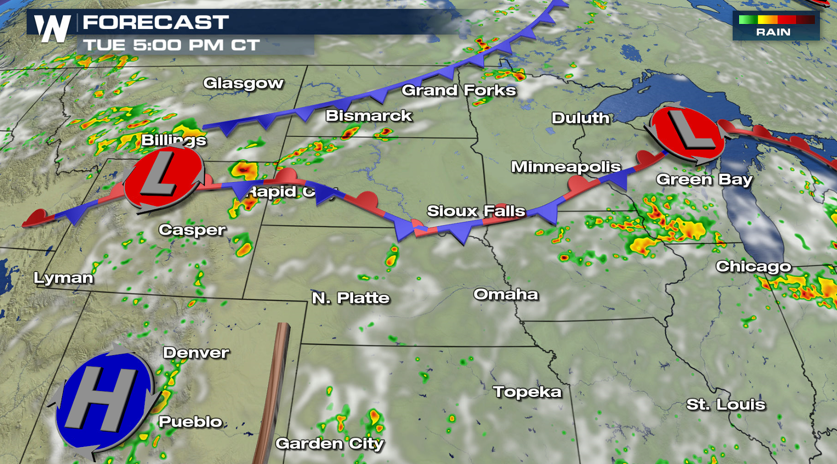
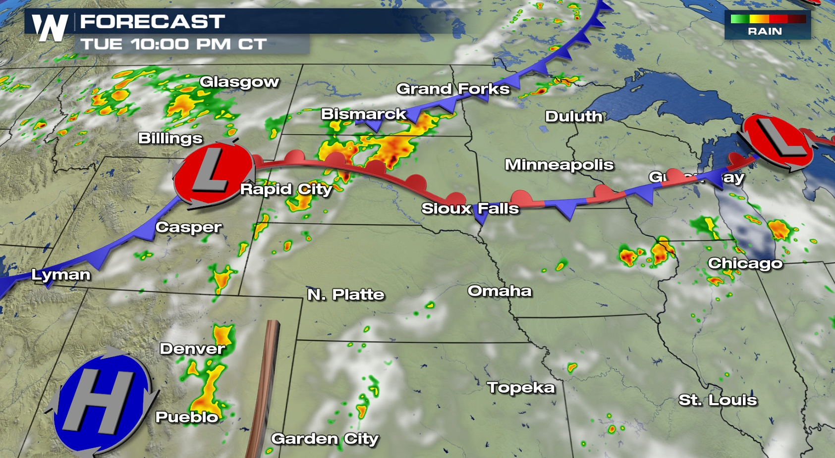
 The risk area today (Monday) remains in the High Plains and Upper Midwest, with little change found for Tuesday. There is a slight risk for severe thunderstorms near a low pressure center in Montana, Wyoming, North and South Dakota. A marginal risk is found near the Great Lakes, along a stationary front.
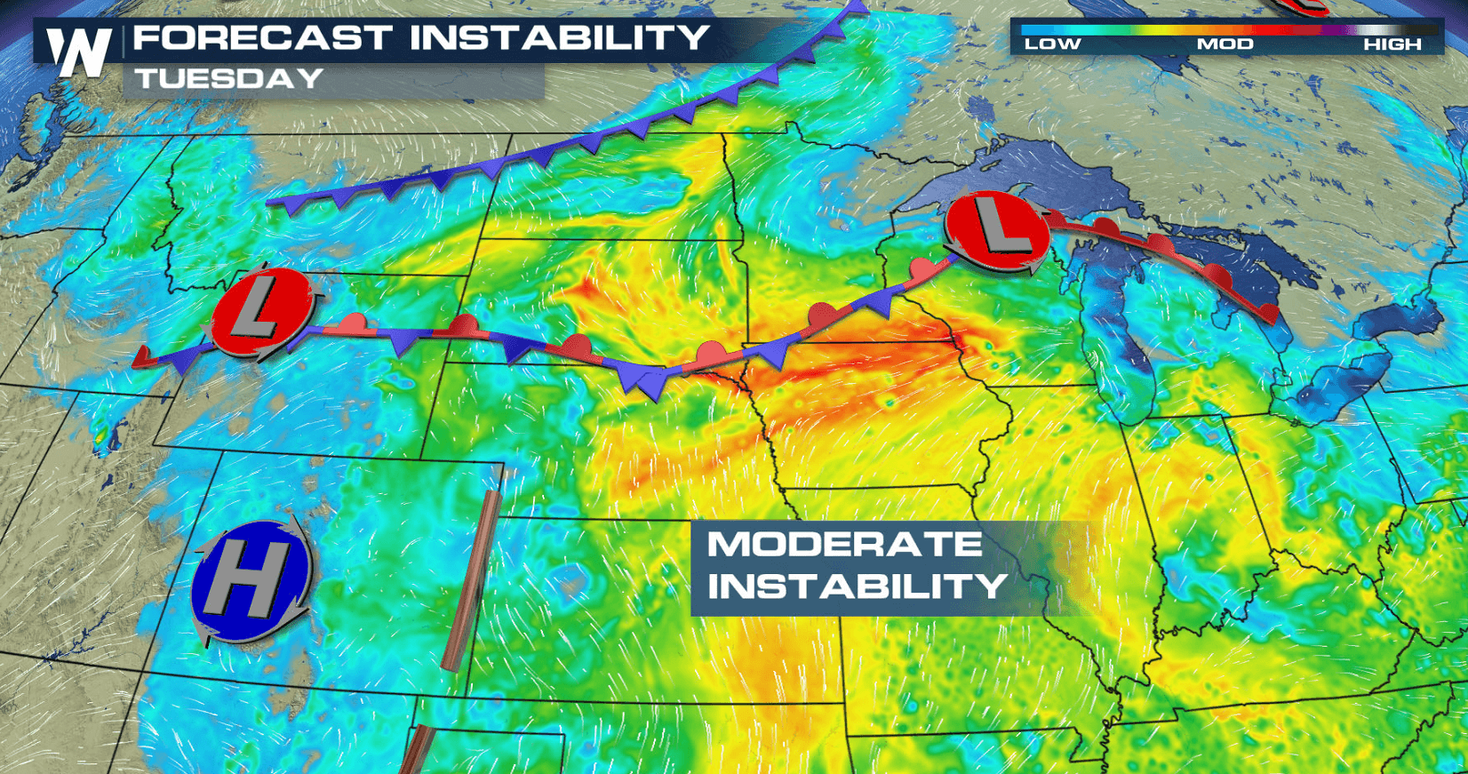
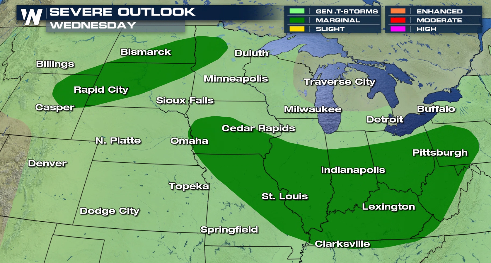
 Lower instability and a weaker Jet Stream will lead to fewer severe storms on Wednesday. There is a marginal risk in the Ohio Valley and Northern Plains. The same two storm systems will produce some severe storms, but overall coverage will likely be less.
 For WeatherNation: Meteorologist Mace Michaels
The risk area today (Monday) remains in the High Plains and Upper Midwest, with little change found for Tuesday. There is a slight risk for severe thunderstorms near a low pressure center in Montana, Wyoming, North and South Dakota. A marginal risk is found near the Great Lakes, along a stationary front.
Lower instability and a weaker Jet Stream will lead to fewer severe storms on Wednesday. There is a marginal risk in the Ohio Valley and Northern Plains. The same two storm systems will produce some severe storms, but overall coverage will likely be less.
For WeatherNation: Meteorologist Mace MichaelsAll Weather News
More
East Gears Up for Stormy, Wet Weekend
A low pressure system crashing through the Mi
1 Aug 2026 11:35 AM


Flooding, Severe Storms Target the Midwest Again
After an active week of storms across the nor
1 Aug 2026 1:40 AM


After Reaching Category 5, Genevieve Weakens in the Pacific
PacificFausto is now a post-tropical cyclone.
31 Jul 2026 1:30 AM

Flooding Risk Increases as Heavy Rain Targets the Tri-State Area
Tuesday, heavy rainfall moved across the Nort
30 Jul 2026 12:25 AM

Severe Weather: Energy From the Midwest Now in the Southeast
UPPER MIDWEST - Through Monday, dangerous tor
29 Jul 2026 10:30 PM