Severe Weather Possible in the Midwest Today

Top Stories
13 Aug 2021 2:30 PM
A slow moving front from the Ohio Valley and Great Lakes into the Plains has been producing severe thunderstorms all week. Once again on Thursday, there were dozens of reports of damaging wind gusts and large hail.
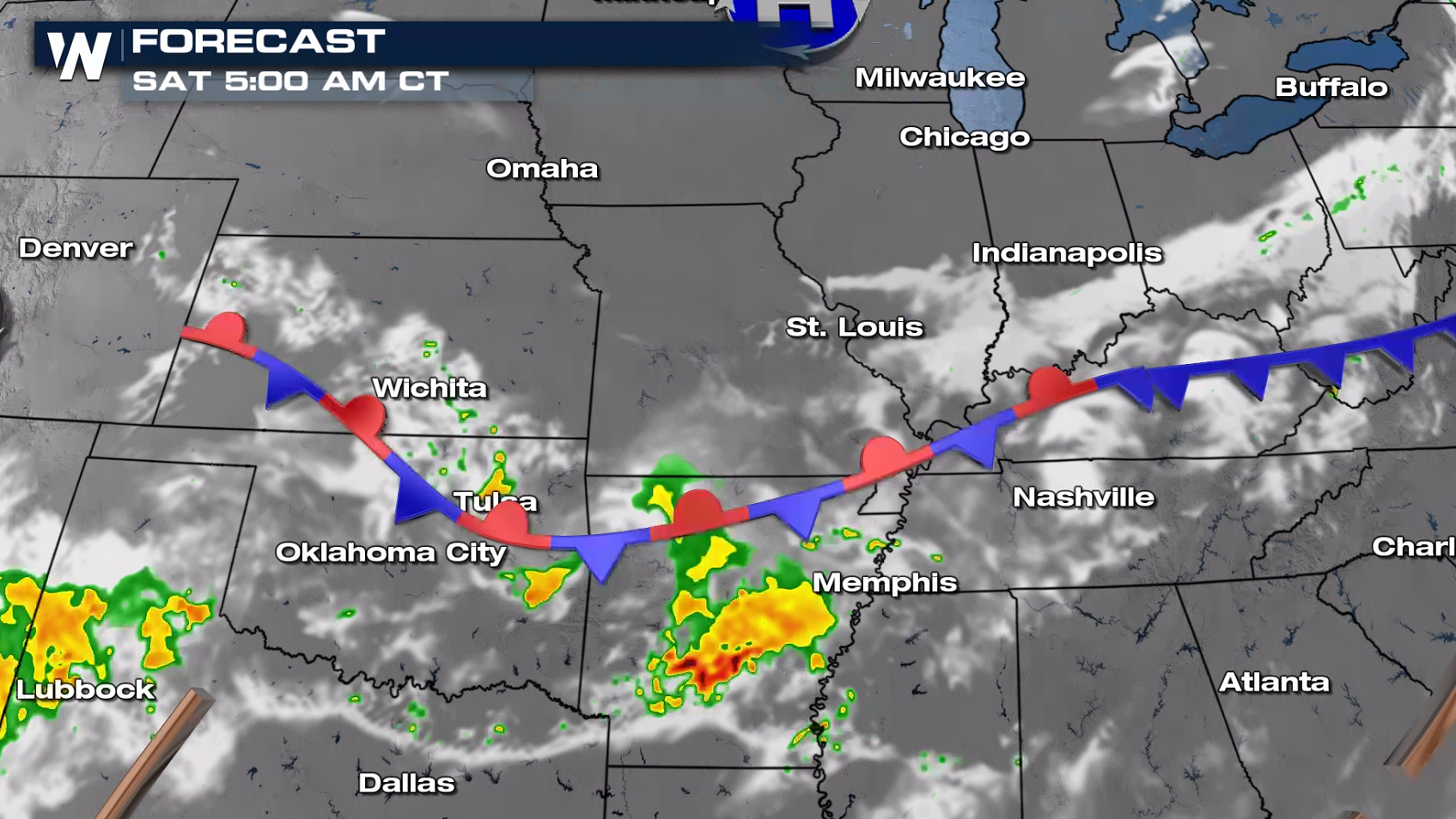
 Moderate to high instability and the slow moving cold front will be the main ingredients for severe weather. Damaging wind gusts will be the main concern in the marginal risk area from the central Plains into the Ohio and Tennessee Valleys.
 Storms will continue through the first part of the evening with gusty winds and hail our primary threats.
 Once the sun sets and heating ends, overall storm intensity and coverage will diminish in the overnight. A few storms will continue in the southern Plains and Tennessee Valley.
 For more on the severe weather threat, join WeatherNation throughout the day, streaming for free on Pluto, Roku and Tubi!
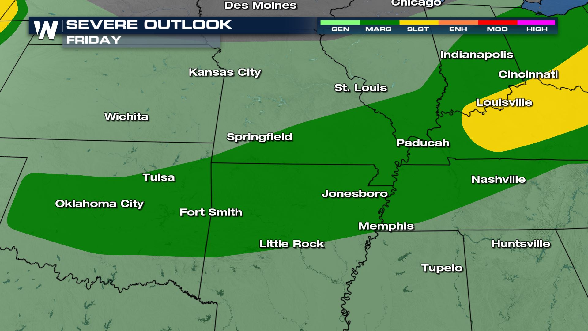
Central Severe
The front will sag southward today (Friday), but energy aloft will weaken. Severe weather is still possible, although overall coverage will likely be lower.
Moderate to high instability and the slow moving cold front will be the main ingredients for severe weather. Damaging wind gusts will be the main concern in the marginal risk area from the central Plains into the Ohio and Tennessee Valleys.
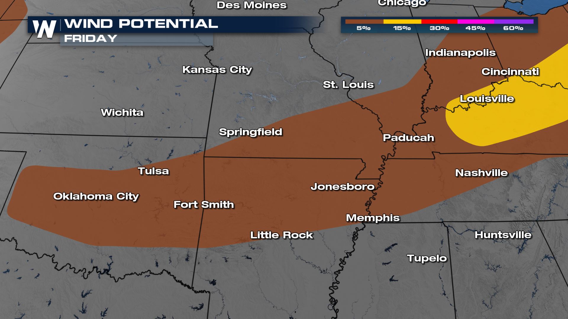
Storms will continue through the first part of the evening with gusty winds and hail our primary threats.
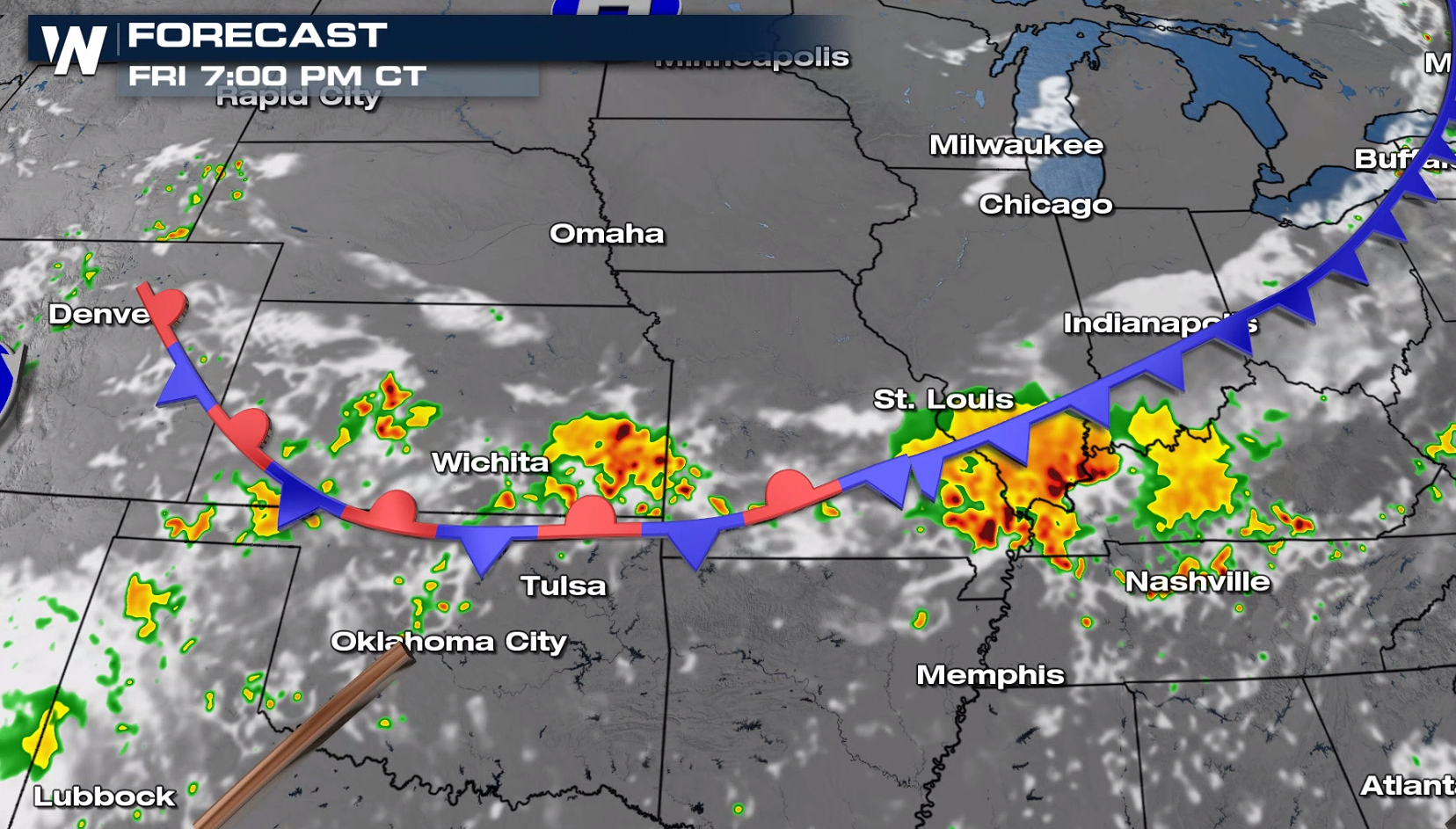
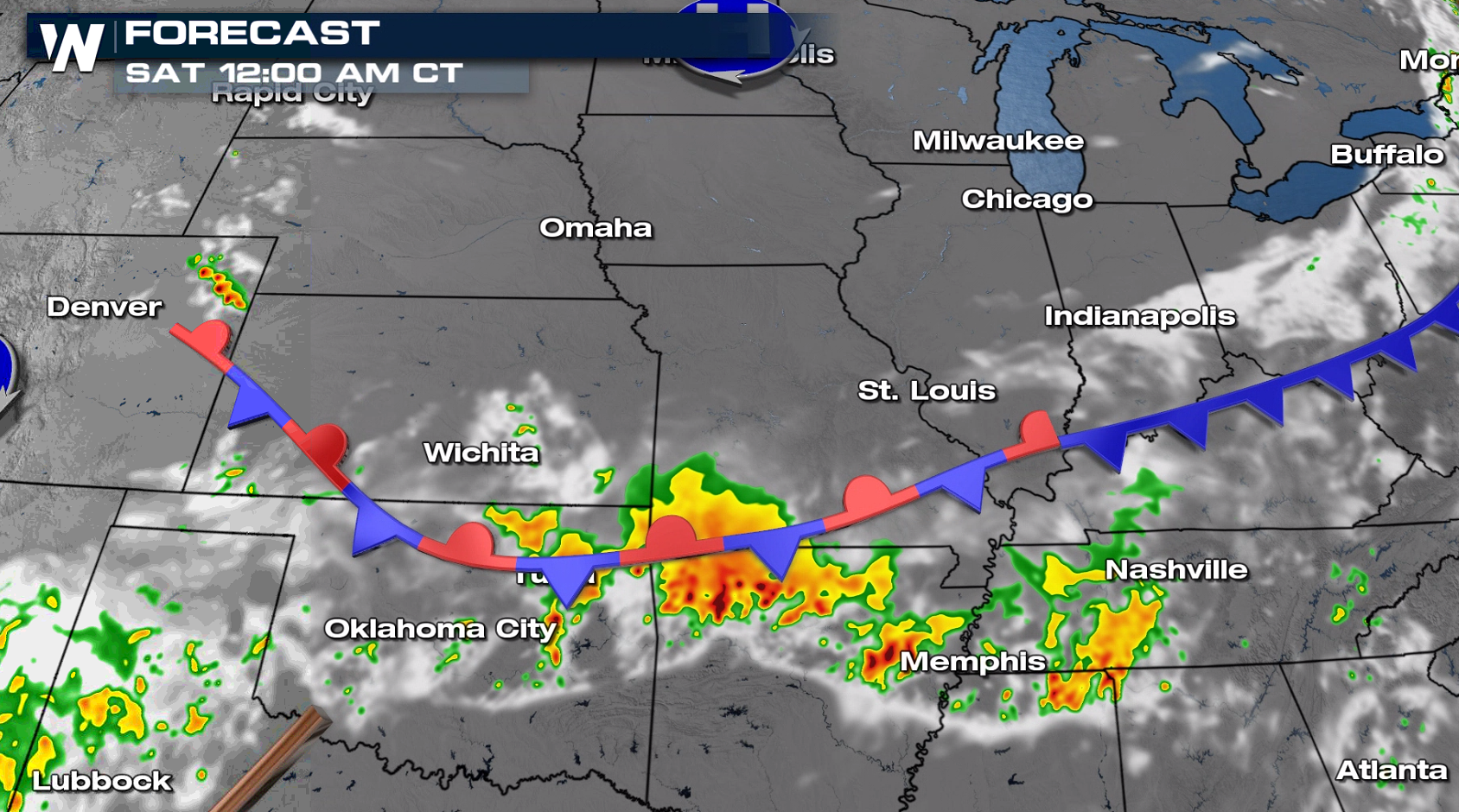
Once the sun sets and heating ends, overall storm intensity and coverage will diminish in the overnight. A few storms will continue in the southern Plains and Tennessee Valley.
For more on the severe weather threat, join WeatherNation throughout the day, streaming for free on Pluto, Roku and Tubi!All Weather News
More
More Storms for the East Through Monday
A low-pressure system that moved through the
2 Aug 2026 10:40 PM

Wildfire Outbreak in the Pacific Northwest
SPOKANE, WA - On Saturday, August 1st, the Ol
2 Aug 2026 10:35 PM


After Reaching Category 5, Genevieve Weakens in the Pacific
PacificGenevieve formed on last Friday south
2 Aug 2026 6:25 PM

Flooding, Severe Storms Target the Midwest Again
After an active week of storms across the nor
1 Aug 2026 1:40 AM

Flooding Risk Increases as Heavy Rain Targets the Tri-State Area
Tuesday, heavy rainfall moved across the Nort
30 Jul 2026 12:25 AM

Severe Weather: Energy From the Midwest Now in the Southeast
UPPER MIDWEST - Through Monday, dangerous tor
29 Jul 2026 10:30 PM