Severe Weather Potential through the Memorial Day Weekend into Next Week
Special Stories
24 May 2019 6:57 AM
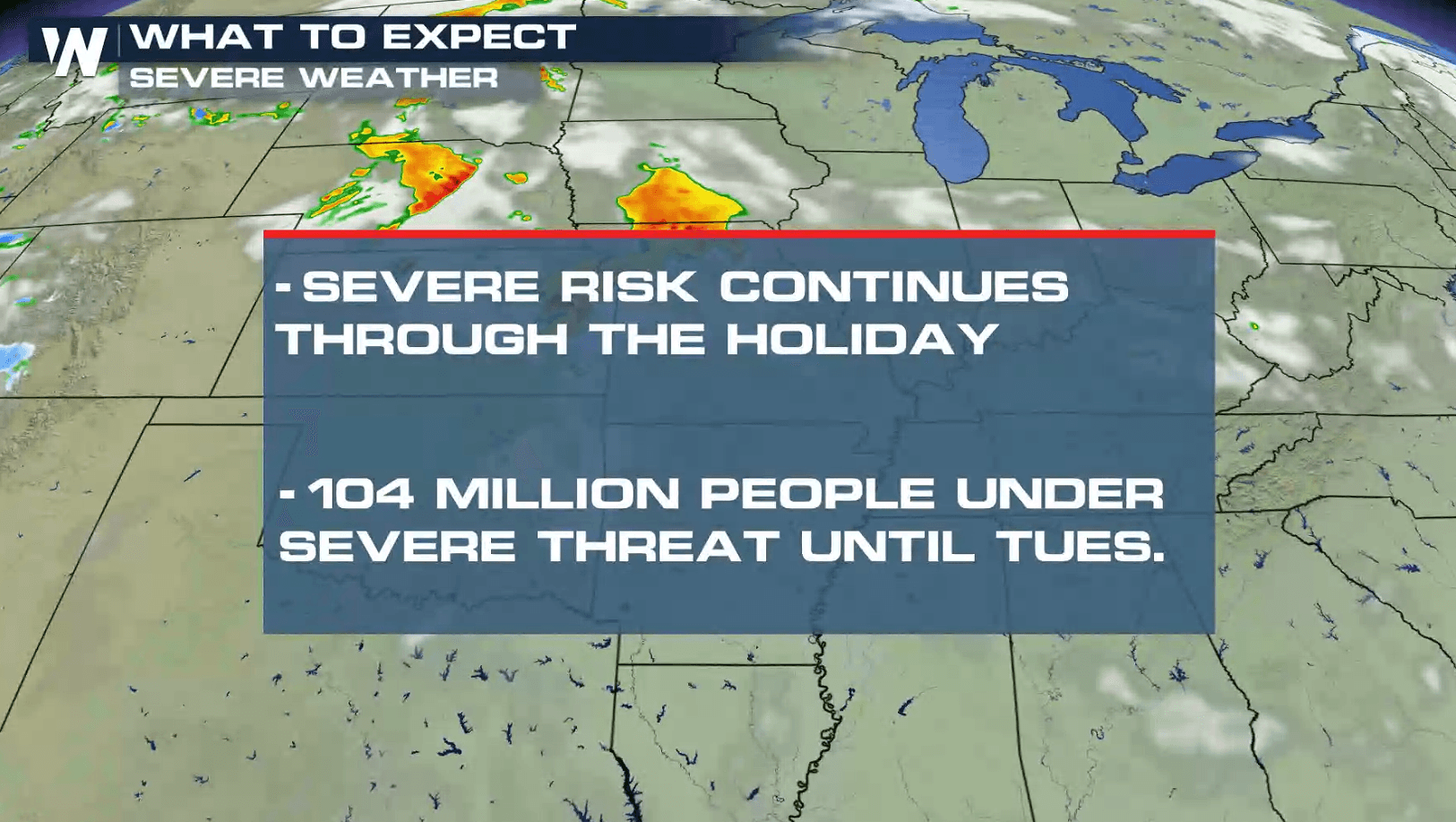
As expected, it has been a very active week of severe thunderstorms with destructive tornadoes in Oklahoma and Missouri. Severe weather chances will continue through this weekend and into early next week from the central & southern Plains into the Northeast. More tornadoes are possible, along with damaging wind gusts and large hail.
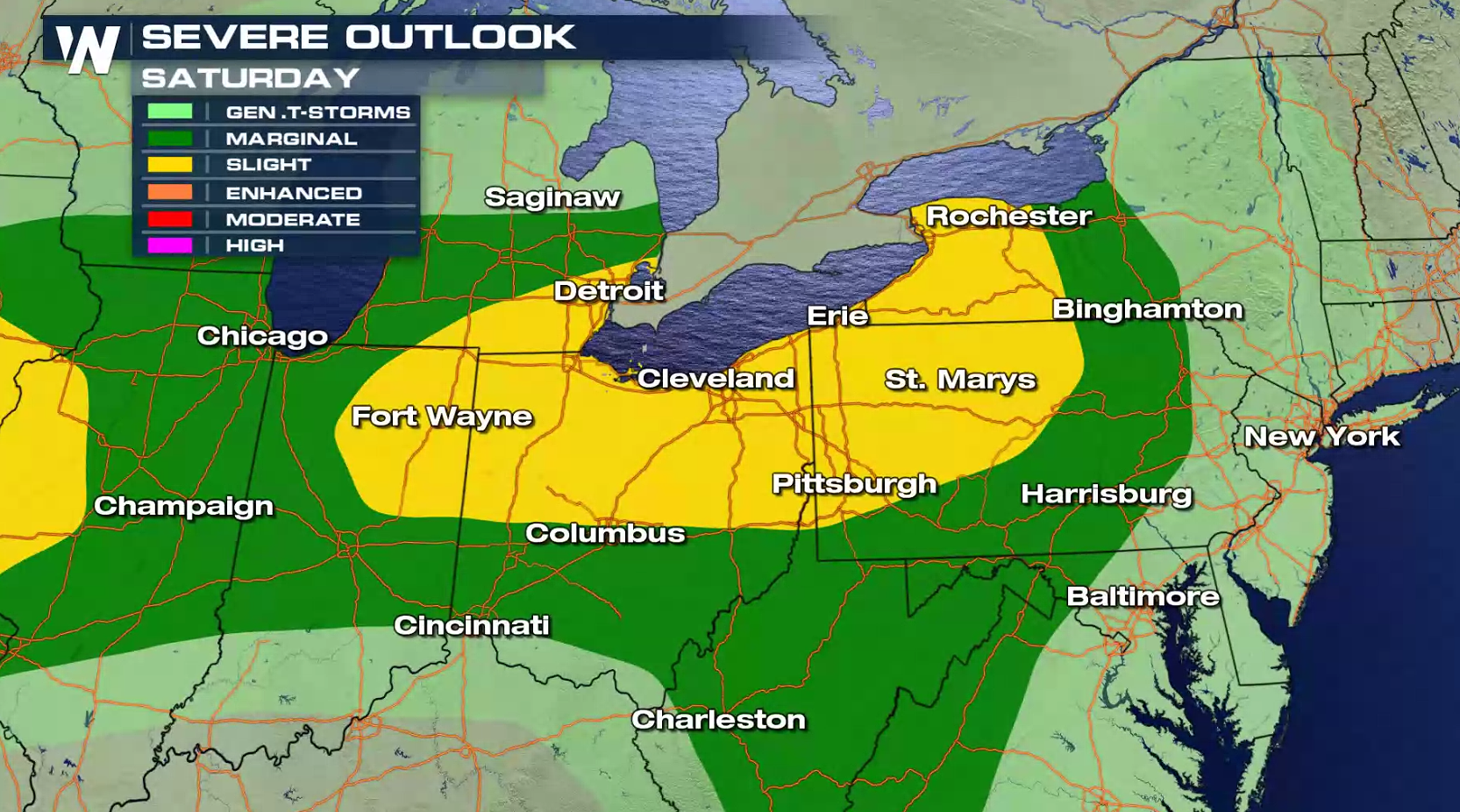
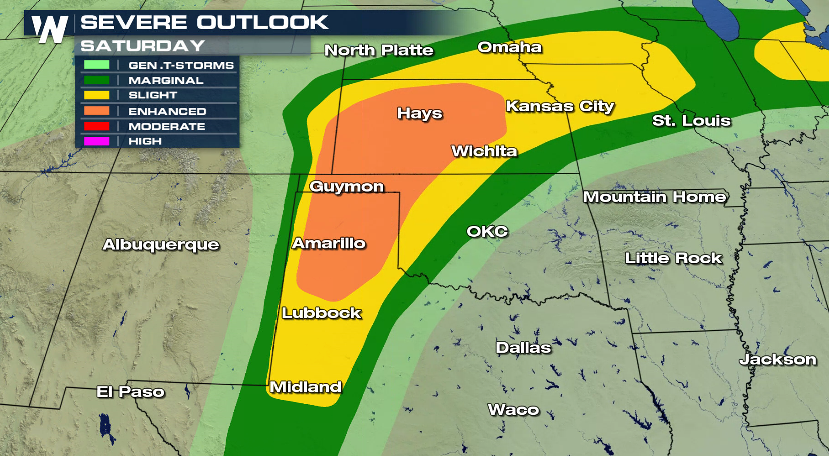
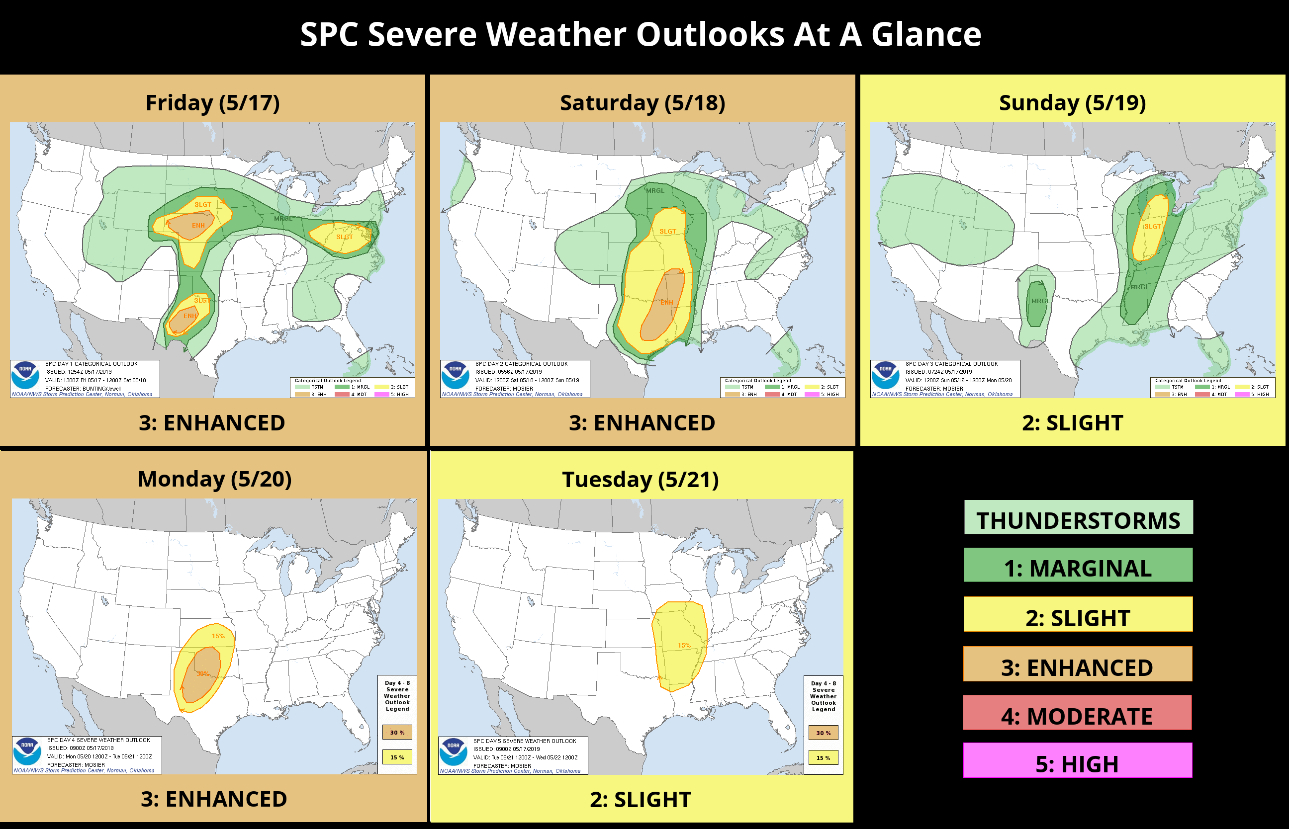 The weekend will start with severe weather again possible on Saturday from the Great Lakes to the southern Plains. The frontal boundary will barely move as another area of upper-level energy rides through the Jet Stream. Winds aloft will support supercells, especially in the central Plains in the late afternoon and evening.
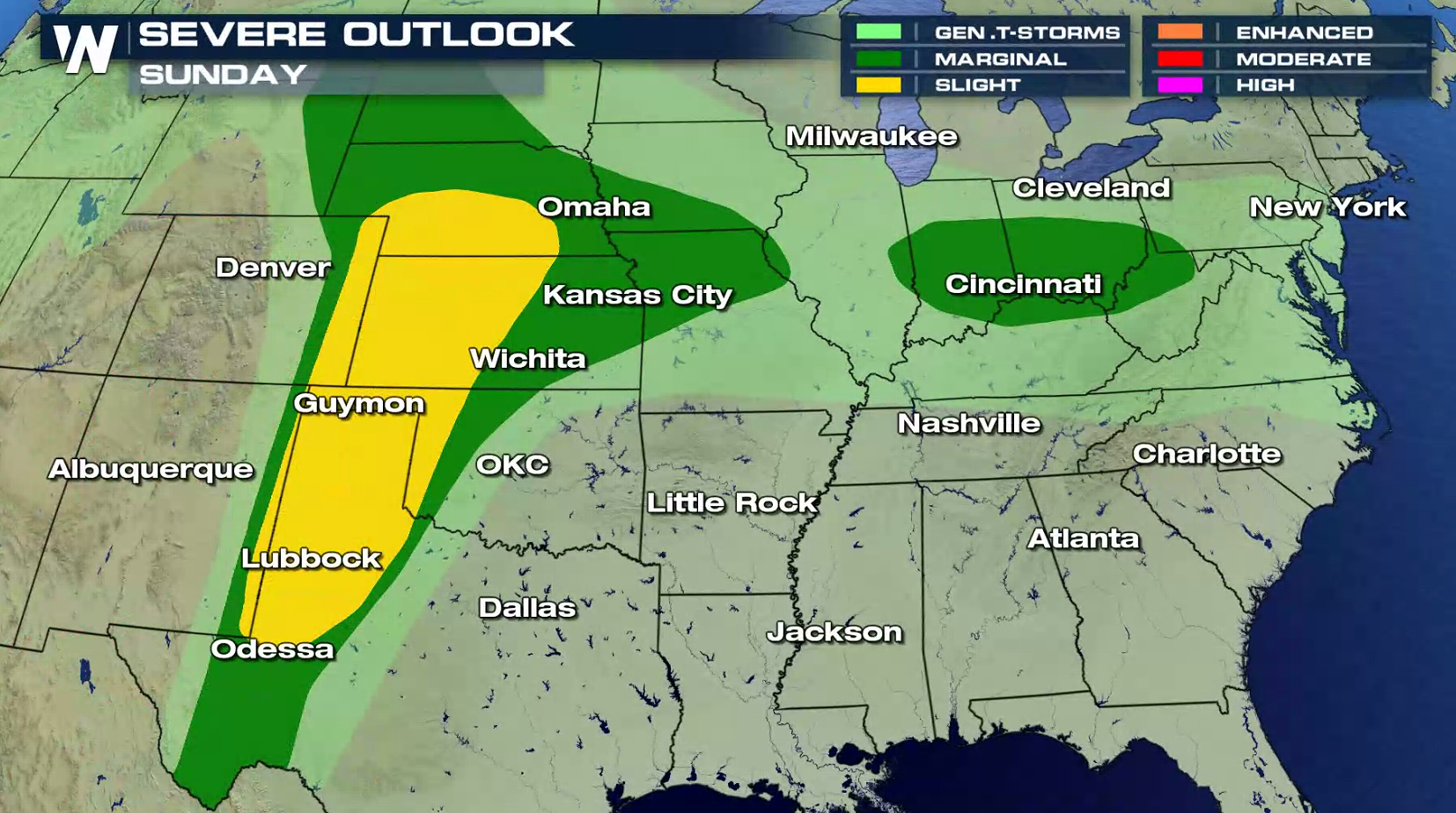
 On Sunday, upper level energy will weaken and instability will be lower. Severe thunderstorms are still possible, although overall strength and coverage will likely be less.
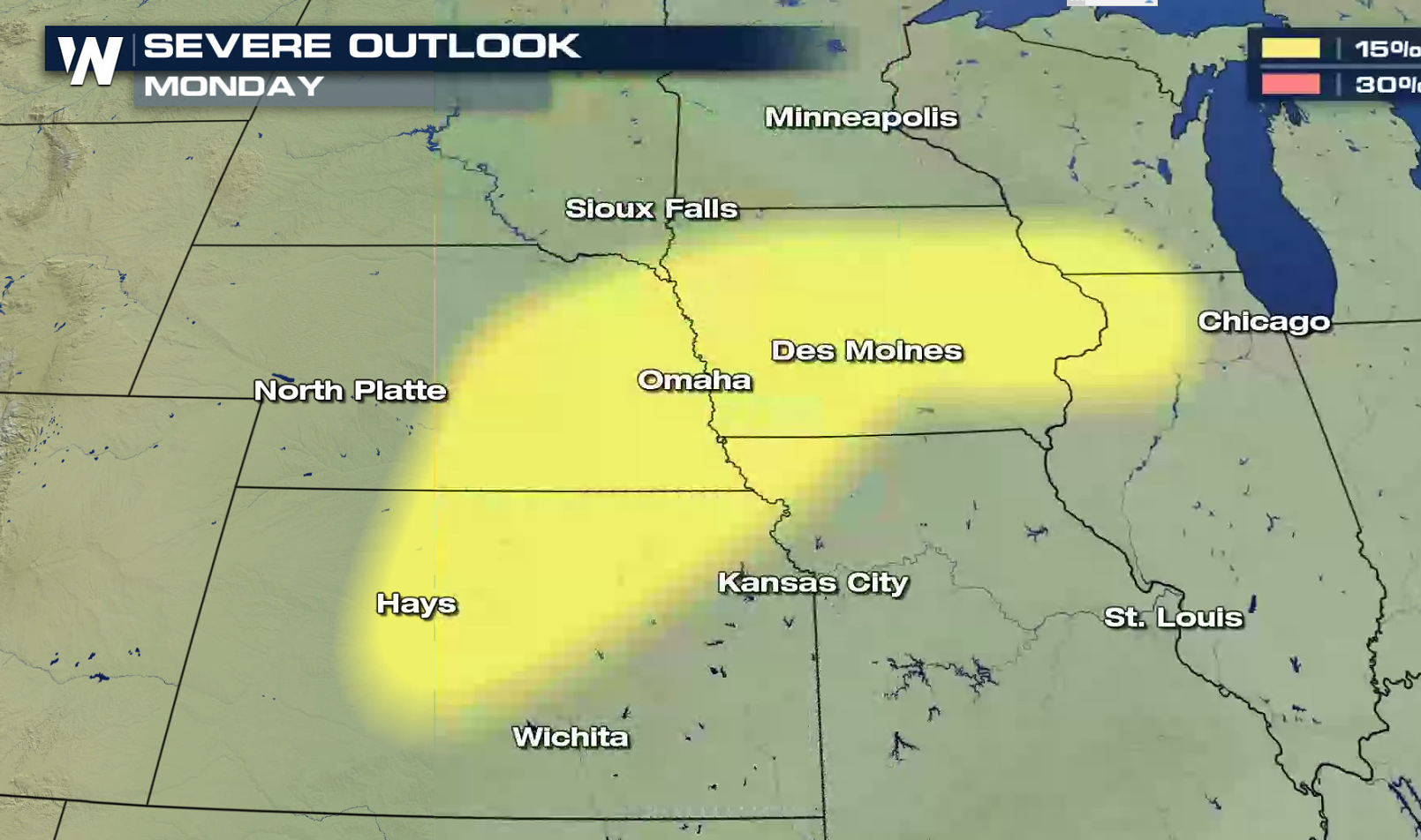
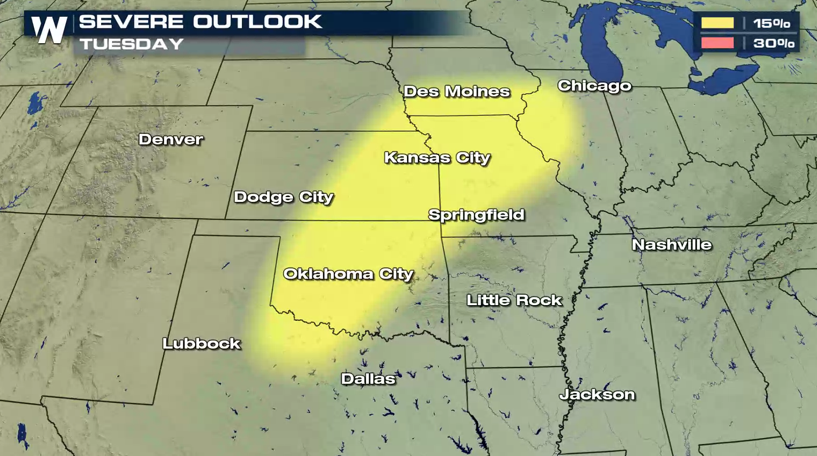
 Through the rest of holiday weekend and into early next week, severe weather chances will continue to be focused on the Plains. At the time of this article, the Storm Prediction Center has assigned a general 15% risk of severe storms Monday and Tuesday at any spot within the outlook area (yellow). Detailed risk levels for each day will be assigned throughout the weekend.
 Severe weather season is extremely active right now. Stay tuned to WeatherNation for complete storm coverage. You can watch on the Dish Network, Roku, Fire TV, Pluto TV, Apple TV, and on any mobile device with the free WeatherNation App.
The weekend will start with severe weather again possible on Saturday from the Great Lakes to the southern Plains. The frontal boundary will barely move as another area of upper-level energy rides through the Jet Stream. Winds aloft will support supercells, especially in the central Plains in the late afternoon and evening.
On Sunday, upper level energy will weaken and instability will be lower. Severe thunderstorms are still possible, although overall strength and coverage will likely be less.
Through the rest of holiday weekend and into early next week, severe weather chances will continue to be focused on the Plains. At the time of this article, the Storm Prediction Center has assigned a general 15% risk of severe storms Monday and Tuesday at any spot within the outlook area (yellow). Detailed risk levels for each day will be assigned throughout the weekend.
Severe weather season is extremely active right now. Stay tuned to WeatherNation for complete storm coverage. You can watch on the Dish Network, Roku, Fire TV, Pluto TV, Apple TV, and on any mobile device with the free WeatherNation App.All Weather News
More
Flash Flooding for the Carolinas This Week
Another stalled front in the Carolinas is for
22 Jul 2026 10:50 AM

Another Round of Storms Targets the Northeast
Another cold front is dropping east and will
22 Jul 2026 10:45 AM

Pacific Northwest Fires Bringing Down the Air Quality
Conditions have been really dry out west. We'
22 Jul 2026 10:45 AM

Tropical Storm Bertha Continues Westward Along the Gulf Coast
AtlanticTropical Storm Bertha is moving slowl
22 Jul 2026 10:30 AM

Another Round of Severe Weather for the Upper Midwest and Great Lakes
The upper-level low train continues to keep t
21 Jul 2026 1:45 AM

Air Quality Improvements in the Forecast
Wildfires burning in Northwestern Ontario, Ca
20 Jul 2026 7:20 PM

Monsoon Moisture Brings Weekend Flood Threat
The monsoon has returned to the southwestern
19 Jul 2026 1:30 AM