Severe Weather Sunday in the Midwest
Special Stories
11 Oct 2020 5:00 PM
*Latest Update*
A severe thunderstorm watch is now in effect until midnight CT.
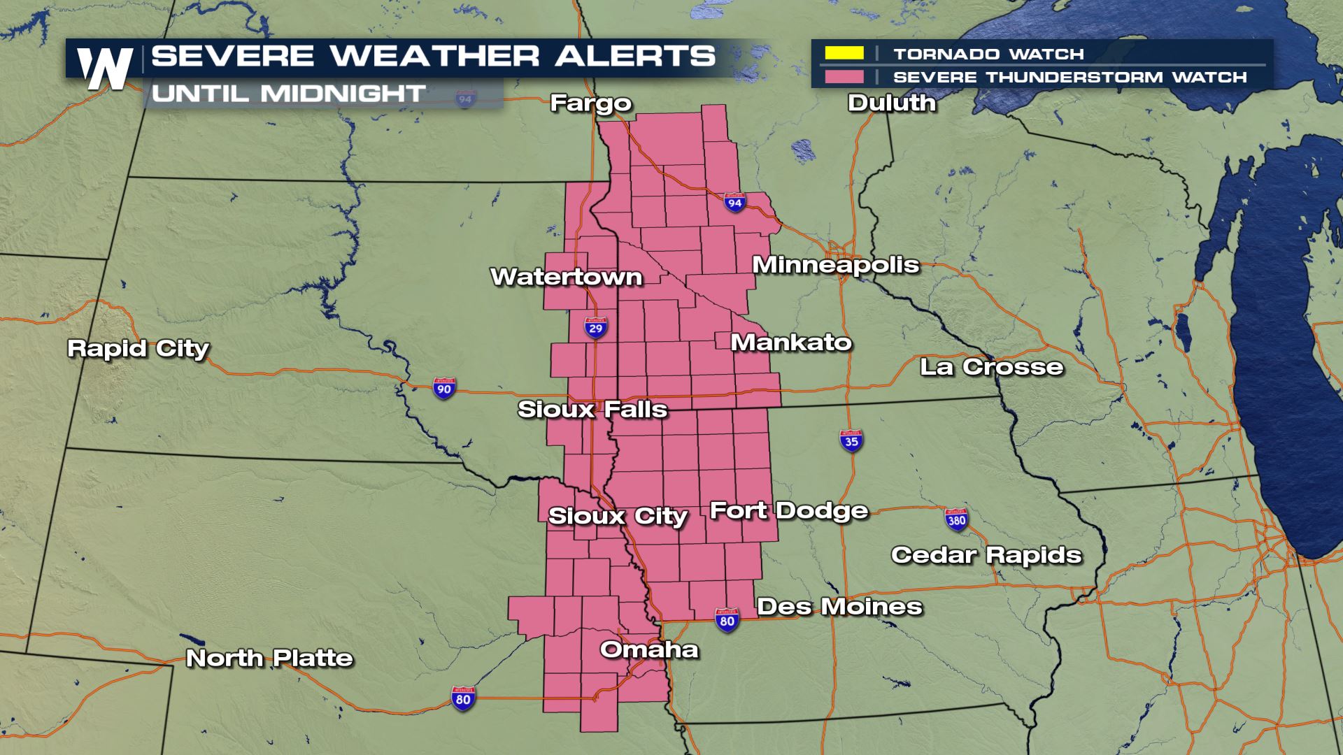 The jet energy coming out of the Pacific northwest plus a cold front will interact with warm and humid air across the High Plains to make a severe weather threat for Minnesota and Iowa on Sunday. The main threats will be gusty straight line winds but a tornado can't be ruled out in southern Minnesota and northern Iowa.
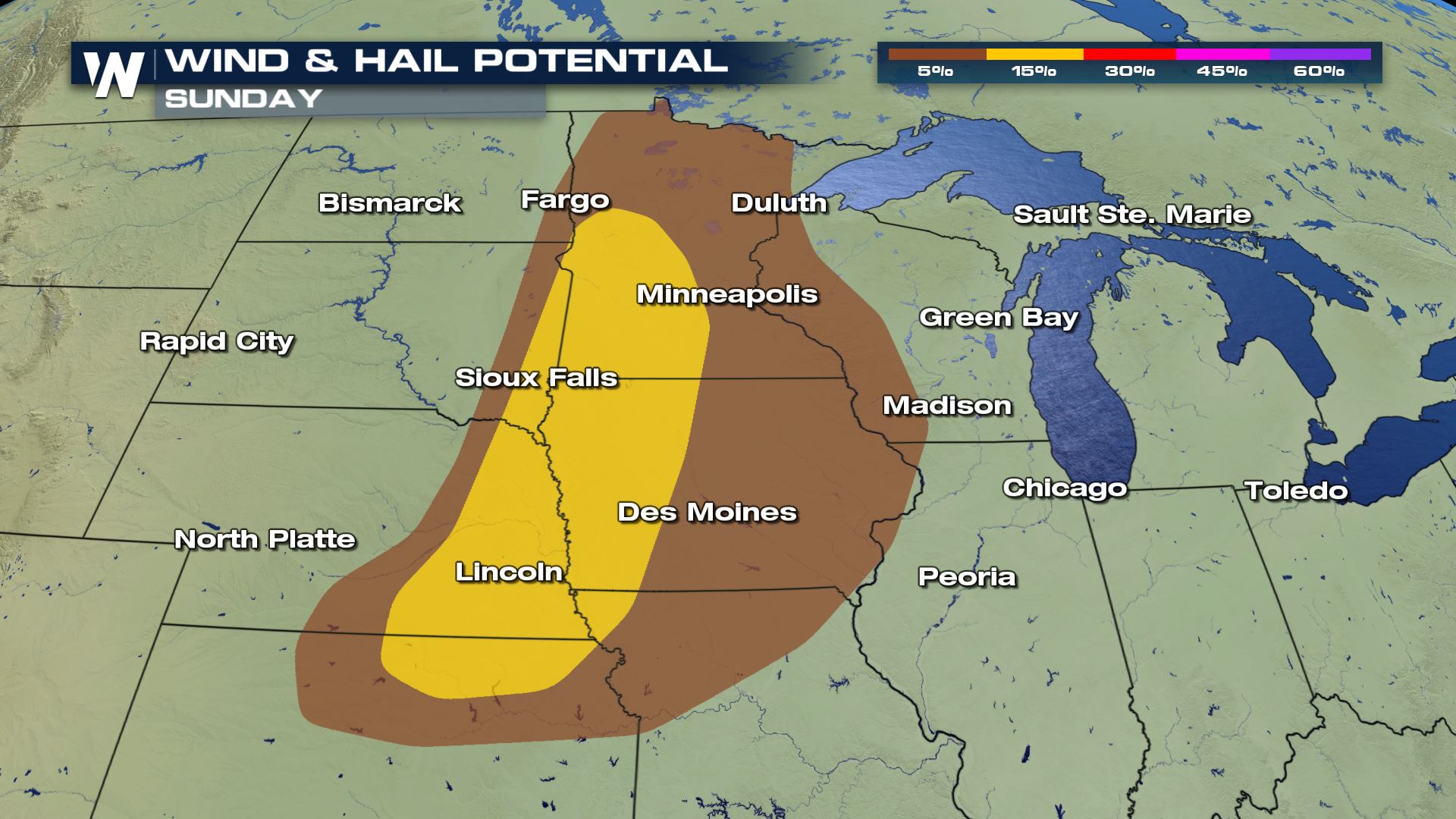
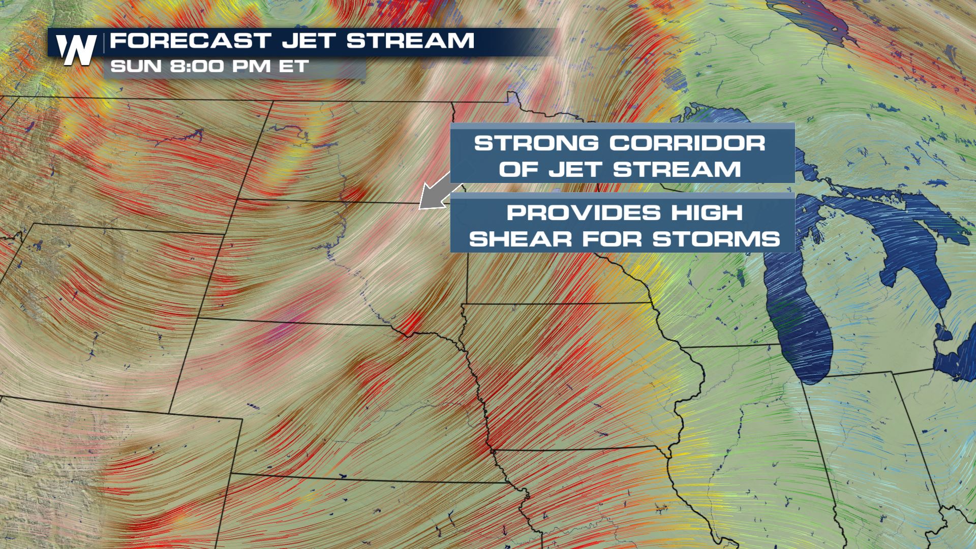 The strong jet stream winds aloft will add to the atmospheric shear, which is wind speed and direction changing with height. Strong shear is needed to support updrafts for gusty thunderstorms with hail as well as isolated tornadoes. Instability in the form of warm, humid air ahead of the cold front adds further energy at the surface.
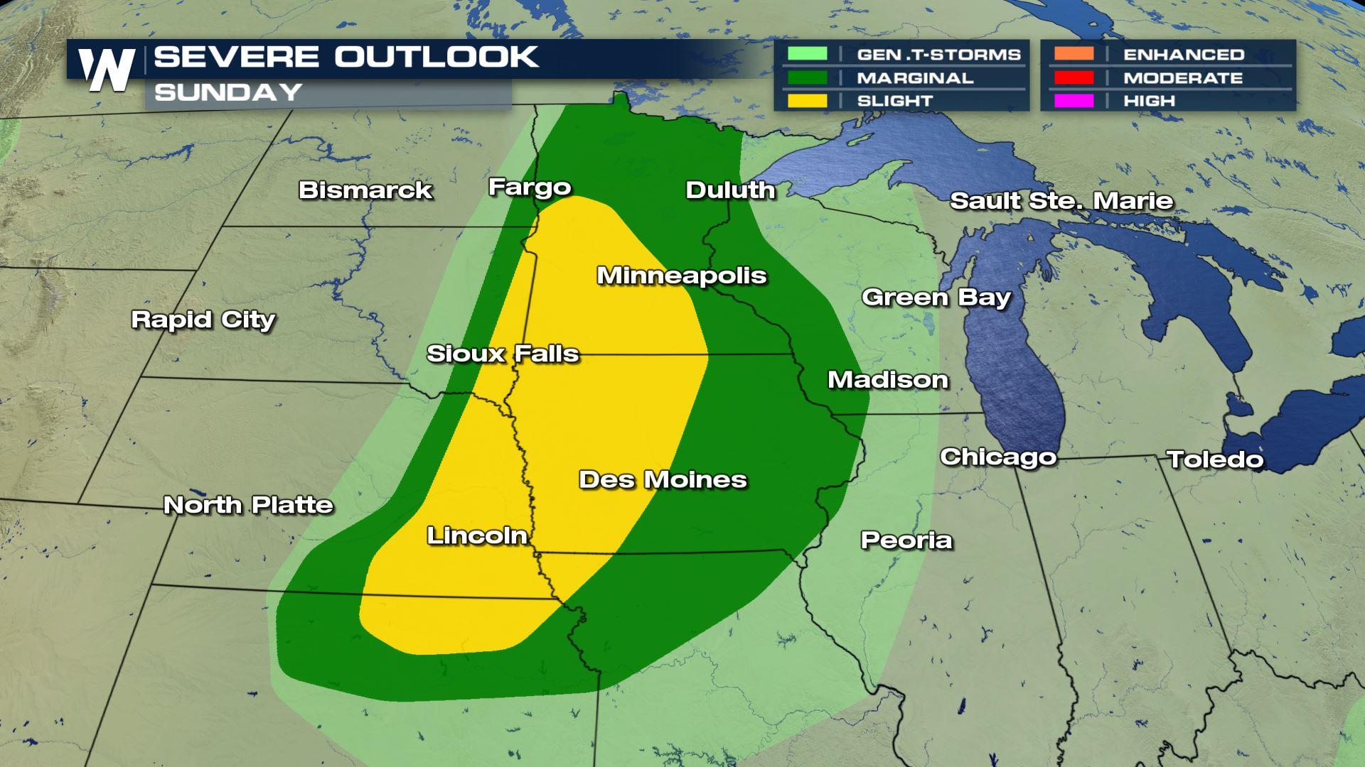
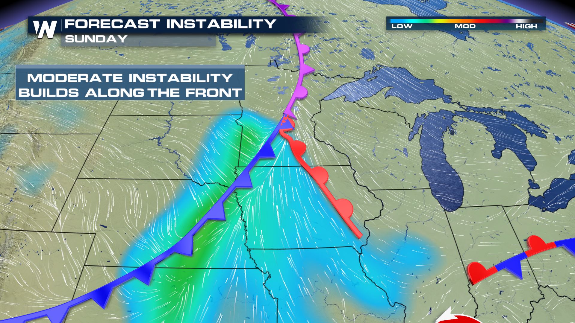 The primary threats will be gusty straight line winds in excess of 60 mph and large hail. Areas in yellow (level 2 out of 5) are in a more favorable environment for severe storms. Areas in green (level 1 out of 5) are in a less favorable environment for severe storms, although it will still be possible.
 Isolated tornadoes are possible in southern Minnesota and northern Iowa mainly into the late afternoon hours.
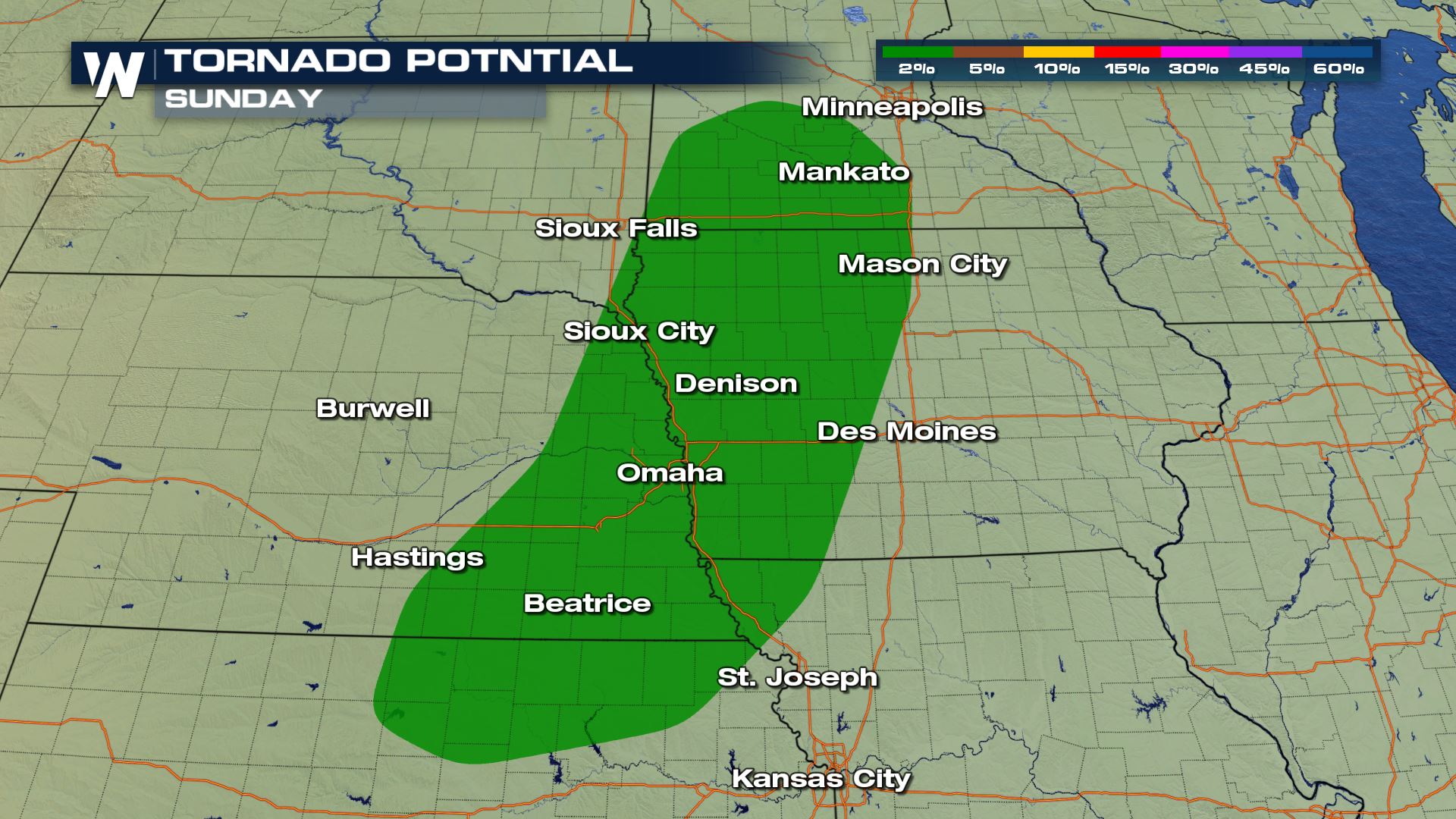
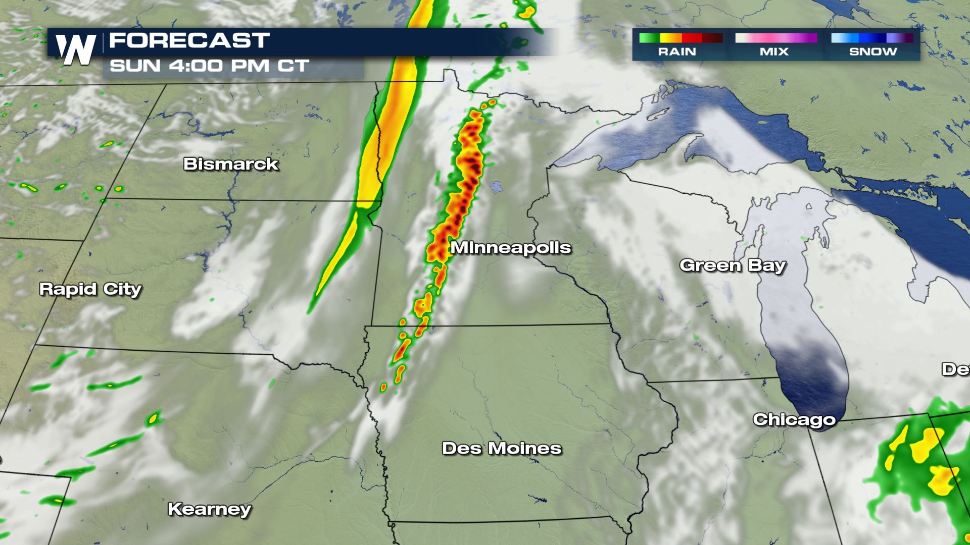
 The storms are expected to form along the cold front during peak heating in the late afternoon and early evening. Rain and thunderstorms will work eastward during the late night hours.
The jet energy coming out of the Pacific northwest plus a cold front will interact with warm and humid air across the High Plains to make a severe weather threat for Minnesota and Iowa on Sunday. The main threats will be gusty straight line winds but a tornado can't be ruled out in southern Minnesota and northern Iowa.
The strong jet stream winds aloft will add to the atmospheric shear, which is wind speed and direction changing with height. Strong shear is needed to support updrafts for gusty thunderstorms with hail as well as isolated tornadoes. Instability in the form of warm, humid air ahead of the cold front adds further energy at the surface.
The primary threats will be gusty straight line winds in excess of 60 mph and large hail. Areas in yellow (level 2 out of 5) are in a more favorable environment for severe storms. Areas in green (level 1 out of 5) are in a less favorable environment for severe storms, although it will still be possible.
Isolated tornadoes are possible in southern Minnesota and northern Iowa mainly into the late afternoon hours.
The storms are expected to form along the cold front during peak heating in the late afternoon and early evening. Rain and thunderstorms will work eastward during the late night hours.
All Weather News
More

More Storms for the East Through Monday
A low-pressure system that moved through the
3 Aug 2026 12:20 PM


After Reaching Category 5, Genevieve Weakens in the Pacific
PacificGenevieve formed last Friday south of
3 Aug 2026 12:30 AM

Flooding, Severe Storms Target the Midwest Again
After an active week of storms across the nor
1 Aug 2026 1:40 AM

Flooding Risk Increases as Heavy Rain Targets the Tri-State Area
Tuesday, heavy rainfall moved across the Nort
30 Jul 2026 12:25 AM