Severe Weather Threat Friday from Michigan to Arkansas
Special Stories
23 Oct 2020 11:05 AM
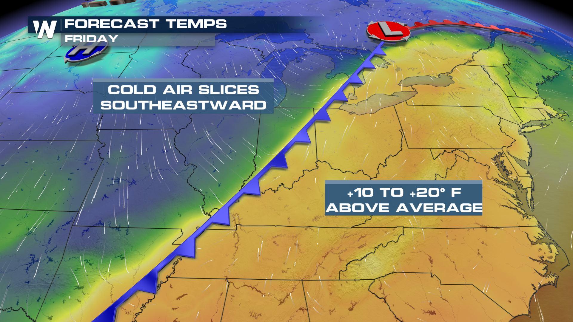
A strong cold front that brought heavy rain and strong winds to the Plains and Midwest on Thursday will continue to progress eastward Friday, spurring a threat for severe storms. Strong winds in the upper levels of the atmosphere, combined with warm temperatures and surging moisture, will promote moderate instability along the front, especially in the afternoon hours.
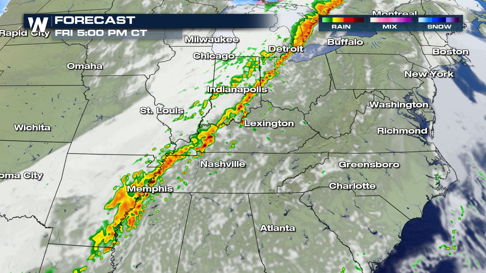
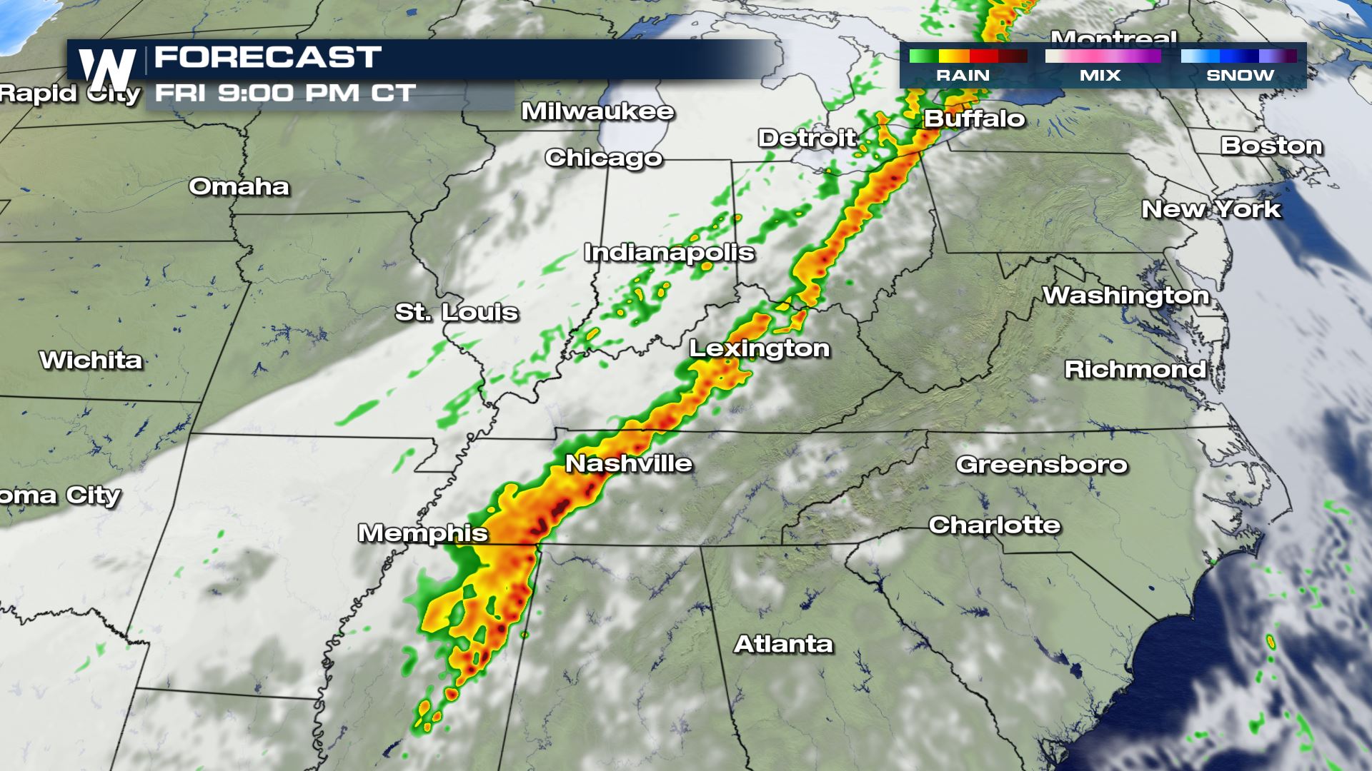
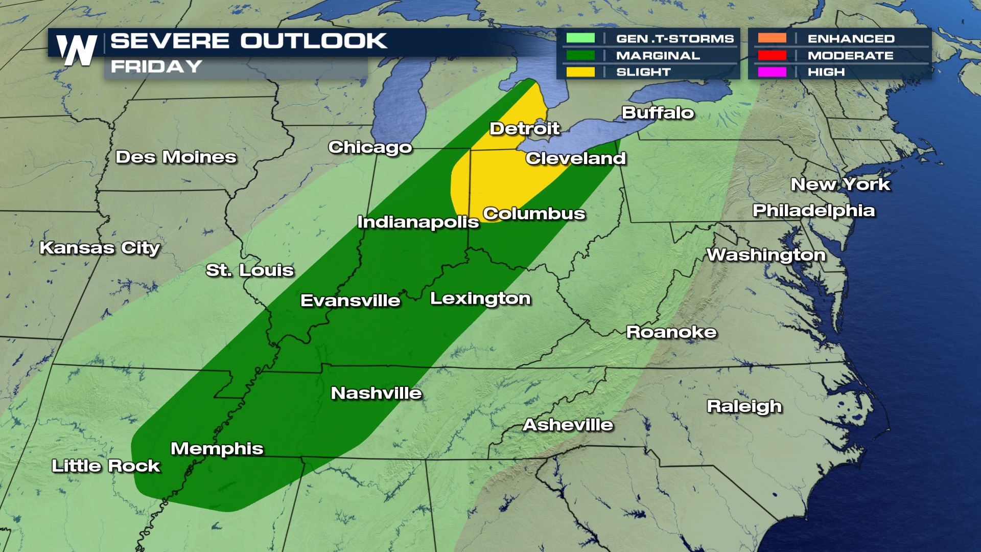 A slight risk (category 2 out of 5) has been issued around the western shores of Lake Erie, including the cities of Detroit, Toledo, and Fort Wayne. The city of Cleveland is on the edge of the slight risk, but is in the marginal (category 1 out of 5) which stretches southward into Northeast Arkansas and Northern Mississippi.
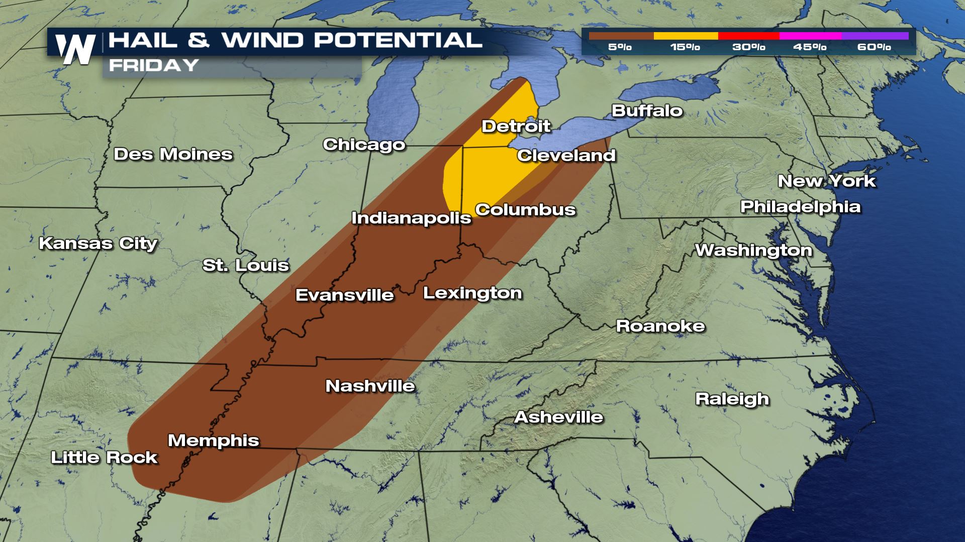 The primary concern in the risk are will be the threat for large hail, greater than 1 inch in diameter, and strong wind gusts, over 58 mph.
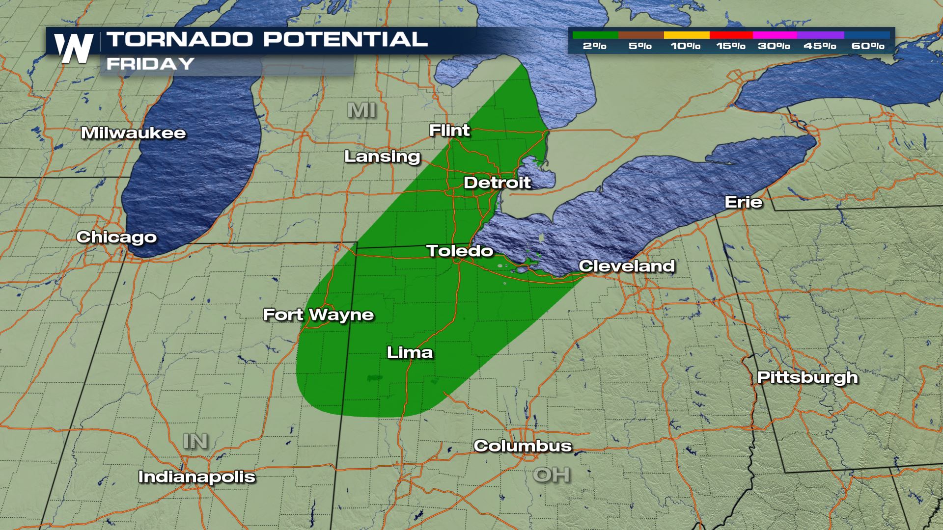 Isolated tornadoes are also possible, primarily in the slight risk area from Fort Wayne to the north, including Detroit.
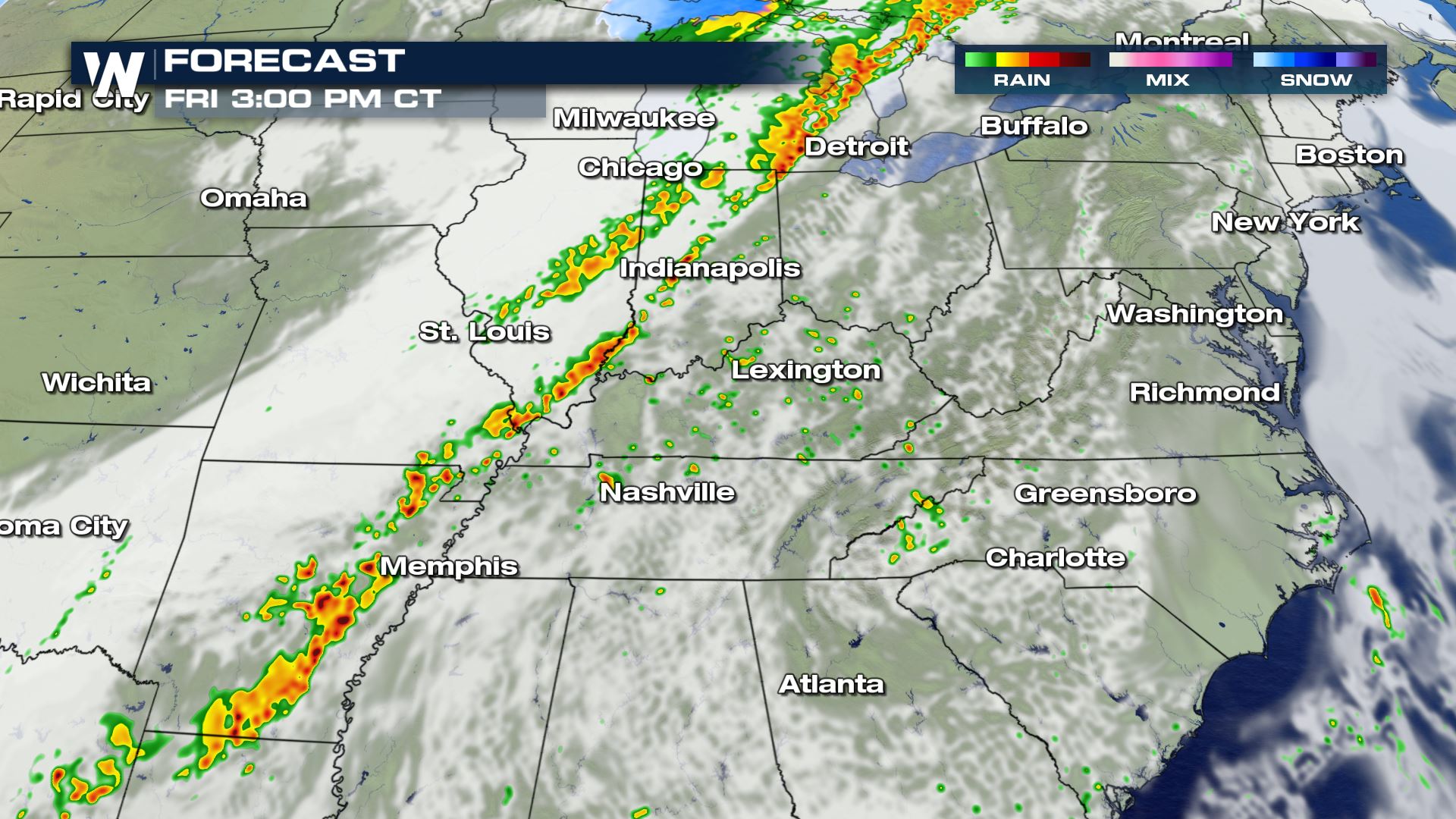 The cold front already produced a few severe storms in Texas and Michigan early Friday, but the potential is likely to increase through the afternoon as warm and moist air is able to build ahead of the line. These forecast radar images are meant to help understand the timing and scope of the severe weather threat.
 This story will be updated as additional data becomes available. Stay tuned to our broadcast and live stream for the latest information. Warnings are always scrolling at the bottom of our screen.
A slight risk (category 2 out of 5) has been issued around the western shores of Lake Erie, including the cities of Detroit, Toledo, and Fort Wayne. The city of Cleveland is on the edge of the slight risk, but is in the marginal (category 1 out of 5) which stretches southward into Northeast Arkansas and Northern Mississippi.
The primary concern in the risk are will be the threat for large hail, greater than 1 inch in diameter, and strong wind gusts, over 58 mph.
Isolated tornadoes are also possible, primarily in the slight risk area from Fort Wayne to the north, including Detroit.
The cold front already produced a few severe storms in Texas and Michigan early Friday, but the potential is likely to increase through the afternoon as warm and moist air is able to build ahead of the line. These forecast radar images are meant to help understand the timing and scope of the severe weather threat.
This story will be updated as additional data becomes available. Stay tuned to our broadcast and live stream for the latest information. Warnings are always scrolling at the bottom of our screen.All Weather News
More
Wildfire Outbreak in the Pacific Northwest
SPOKANE, WA - On Saturday, August 1st, the Ol
2 Aug 2026 7:20 PM

More Storms for the East Through Monday
A low-pressure system that moved through the
2 Aug 2026 7:20 PM


After Reaching Category 5, Genevieve Weakens in the Pacific
PacificGenevieve formed on last Friday south
2 Aug 2026 6:25 PM

Flooding, Severe Storms Target the Midwest Again
After an active week of storms across the nor
1 Aug 2026 1:40 AM

Flooding Risk Increases as Heavy Rain Targets the Tri-State Area
Tuesday, heavy rainfall moved across the Nort
30 Jul 2026 12:25 AM

Severe Weather: Energy From the Midwest Now in the Southeast
UPPER MIDWEST - Through Monday, dangerous tor
29 Jul 2026 10:30 PM