Severe Weather Threat for Tuesday
Special Stories
8 Apr 2019 11:41 AM
FORECAST
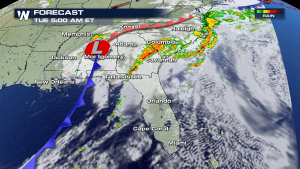 Severe weather has be dominating in the south and southeast over the last couple of days. The severe weather threat does not stop for today, though.
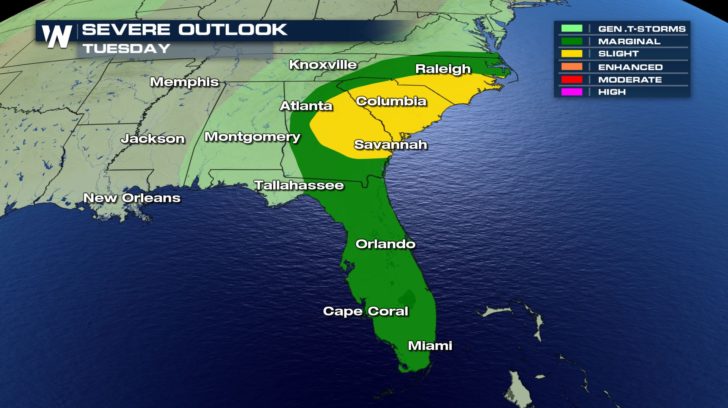
On Tuesday, we will see an increase of severe chances as we head into the afternoon. This severe potential will also linger into our evening hours as the cold front continues to slide off the coast.
A slight chance of severe weather is already in place for North Carolina, South Carolina, and Georgia which means scattered severe thunderstorms will be possible.
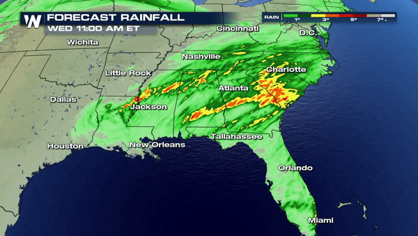
RAINFALL FORECAST
Severe weather has be dominating in the south and southeast over the last couple of days. The severe weather threat does not stop for today, though.
On Tuesday, we will see an increase of severe chances as we head into the afternoon. This severe potential will also linger into our evening hours as the cold front continues to slide off the coast.
A slight chance of severe weather is already in place for North Carolina, South Carolina, and Georgia which means scattered severe thunderstorms will be possible.
RAINFALL FORECAST
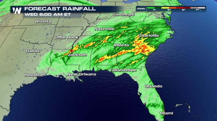 Rainfall totals will be very high over the next 36 hours. Areas in the Carolinas to Mississippi could receive an additional 4 inches of rain. This means flooding might also be a possibility. Stay safe!
Severe weather has be dominating in the south and southeast over the last couple of days. The severe weather threat does not stop for today, though.
On Tuesday, we will see an increase of severe chances as we head into the afternoon. This severe potential will also linger into our evening hours as the cold front continues to slide off the coast.
A slight chance of severe weather is already in place for North Carolina, South Carolina, and Georgia which means scattered severe thunderstorms will be possible.
RAINFALL FORECAST
Rainfall totals will be very high over the next 36 hours. Areas in the Carolinas to Mississippi could receive an additional 4 inches of rain. This means flooding might also be a possibility. Stay safe!All Weather News
More

More Storms for the East Through Monday
A low-pressure system that moved through the
3 Aug 2026 12:20 PM


After Reaching Category 5, Genevieve Weakens in the Pacific
PacificGenevieve formed last Friday south of
3 Aug 2026 12:30 AM

Flooding, Severe Storms Target the Midwest Again
After an active week of storms across the nor
1 Aug 2026 1:40 AM

Flooding Risk Increases as Heavy Rain Targets the Tri-State Area
Tuesday, heavy rainfall moved across the Nort
30 Jul 2026 12:25 AM