Snow Chances for the Upper Midwest

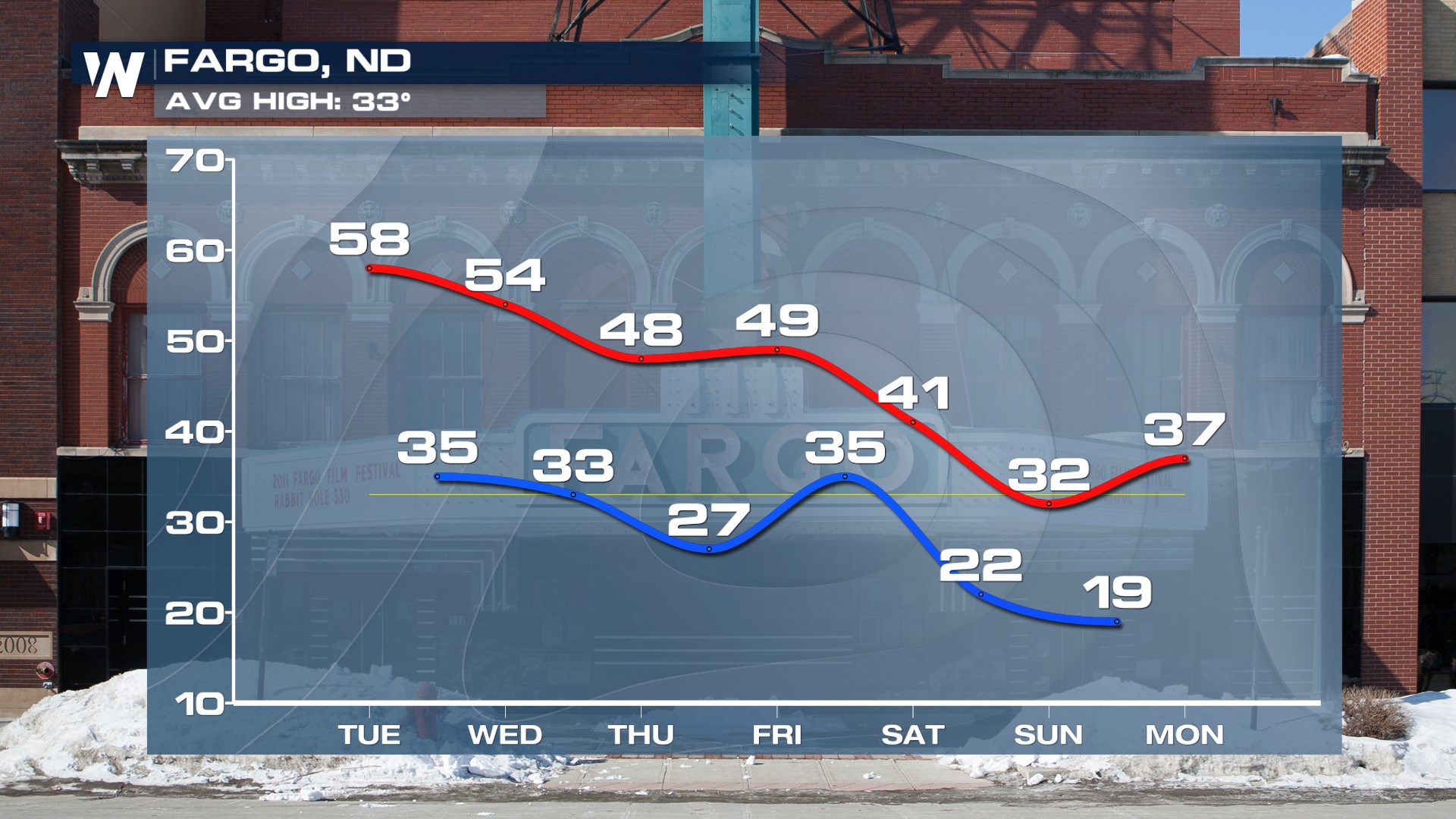
After record-setting heat in the High Plains this week, an incoming cold front and low-pressure system will team up to knock temperatures back along with the potential for snow and rain in the Upper Midwest and Great Lakes. Highs drop from near 60 in North Dakota (about 25° above average) to the 30s by the weekend.
 There is a discrepancy, as there often is with the Spring months, on how much snow we could see in the Upper Midwest and where exactly it will be. The Baron model puts a streak of snow through SE Minnesota, northern Wisconsin and the U.P. of Michigan, while the GFS model trends a bit further south with snow reaching into northern Iowa. Bottom line, we are a few days out so this forecast will be fine-tuned.

 Moisture moves out of the Rockies and into the High Plains of the Dakotas, Iowa, and Nebraska on Wednesday but temperatures will be too warm to support snowfall. Instead, there is a severe weather threat in the central Plains. As temperatures fall and the storm system moves into the Upper Midwest rain transitions to snow through Thursday evening and overnight. By Friday morning all rain and snow chances will be impacting the northern Great Lakes region with a corridor of icing too.


