Snow Moves from Rockies to Plains Friday

Snow was falling in the Four Corners Thursday as a cold low pressure system moved through the region. We've already seen up to half a foot of snow in New Mexico, Utah and Nevada, and some of the ski resorts in Arizona have gotten more than 17" of snow!
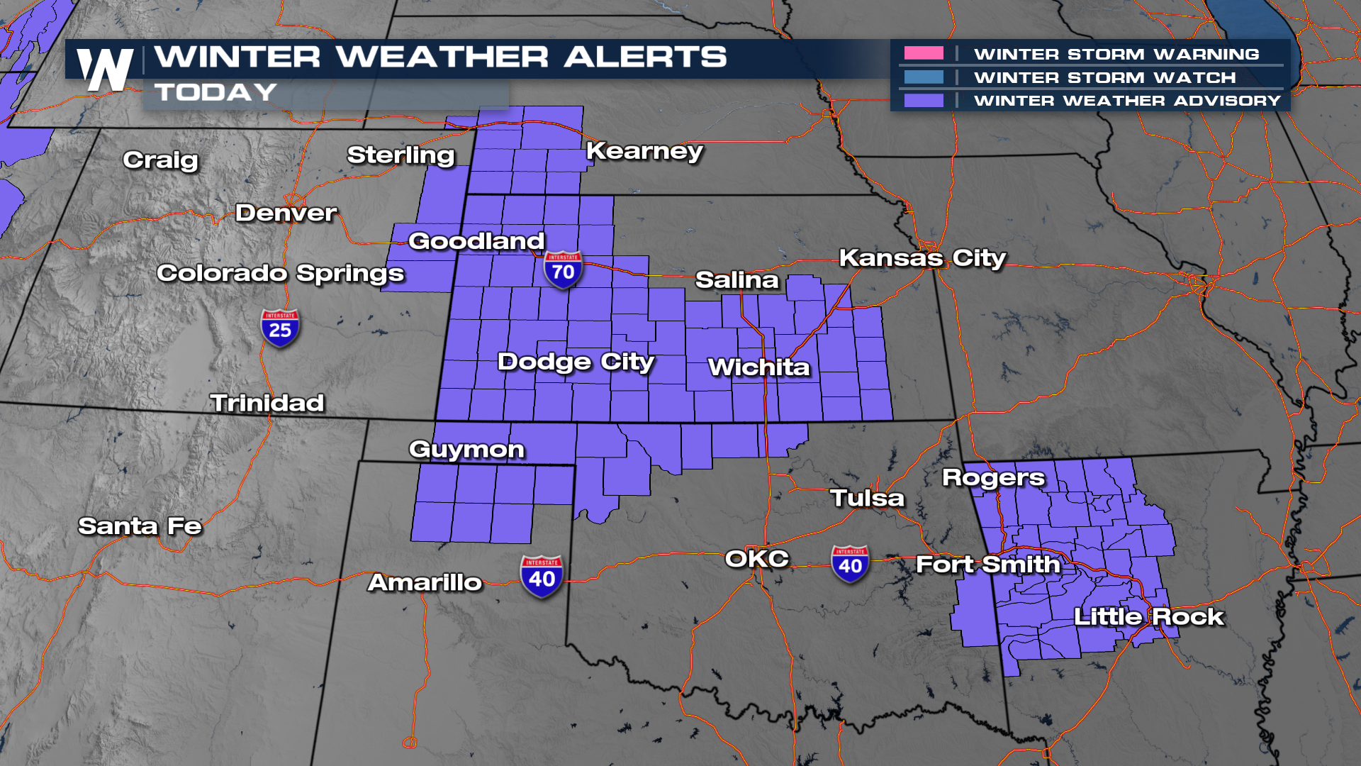
As the area of low pressure moves east of the Rockies and runs in to cold air already in place over the Plains, for Kansas, Nebraska, Oklahoma and northern Arkansas. As a result, winter weather alerts are in effect through Friday for a 1-3" of snow. There could also be a glaze of ice as snow melts onto warmer surfaces, meaning a few slippery spots on elevated bridges and overpasses on I-25, I-70, I-35 and I-40 are possible.
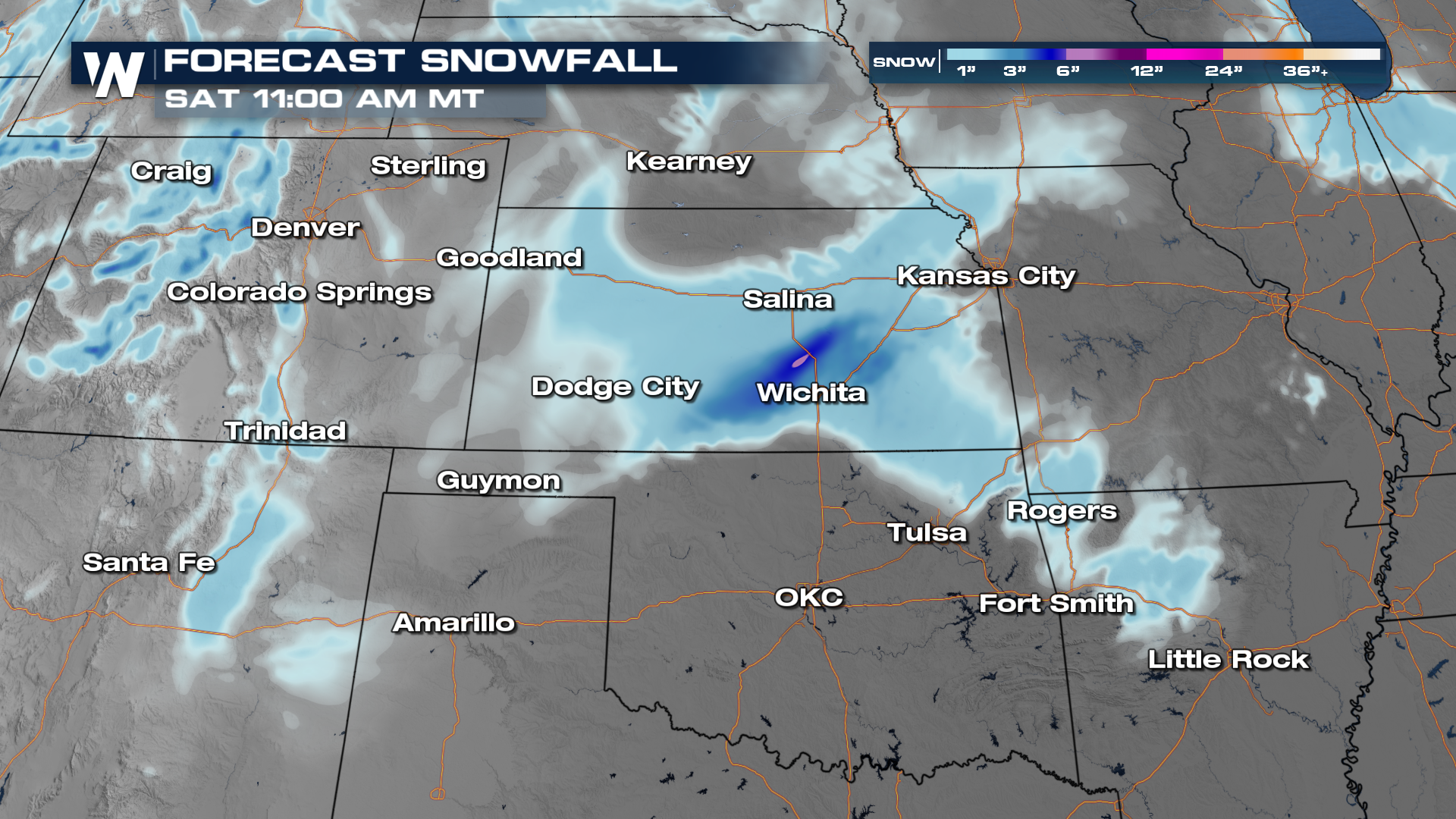 The heaviest snow for the Plains will fall into mid-morning Friday before temperatures rise above freezing. There will be ice mixed in as well, especially across southeast Kansas where temperatures will hover just above freezing. As temperatures warm through the region during the day, any winter precip will change back over to rain. Another burst of moisture could produce a few rain and snow showers late tonight but most of us are drier after midday Friday.


