Snow and Wind Ahead for the Upper Midwest and Great Lakes
Special Stories
30 Mar 2018 9:43 AM
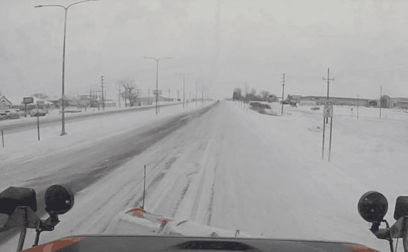
[Plow camera from Detroit Lakes, MN this morning. From Minnesota Department of Transportation]
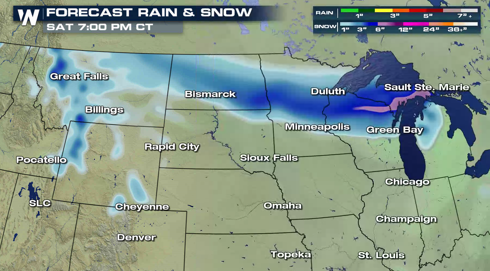
A fast moving storm system has brought one round of heavy snow to the Upper Midwest and another swath will move into the area to start this weekend. 3" to 6" fell in parts of North Dakota and Minnesota last night and earlier this morning. Additional accumulations of 6" to 12" are likely in a narrow band that develops later tonight through Saturday.
https://twitter.com/WeatherNation/status/979715707016396800
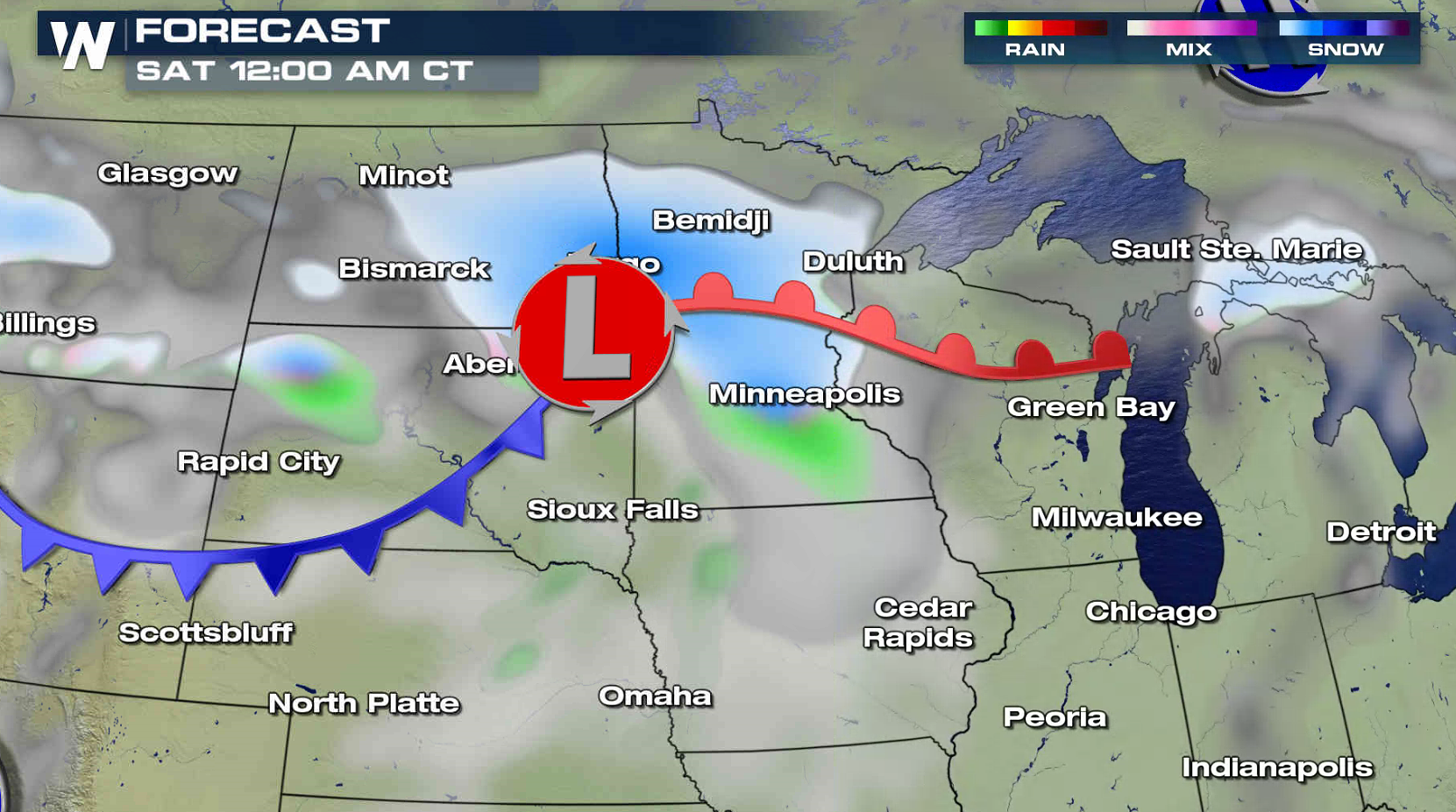
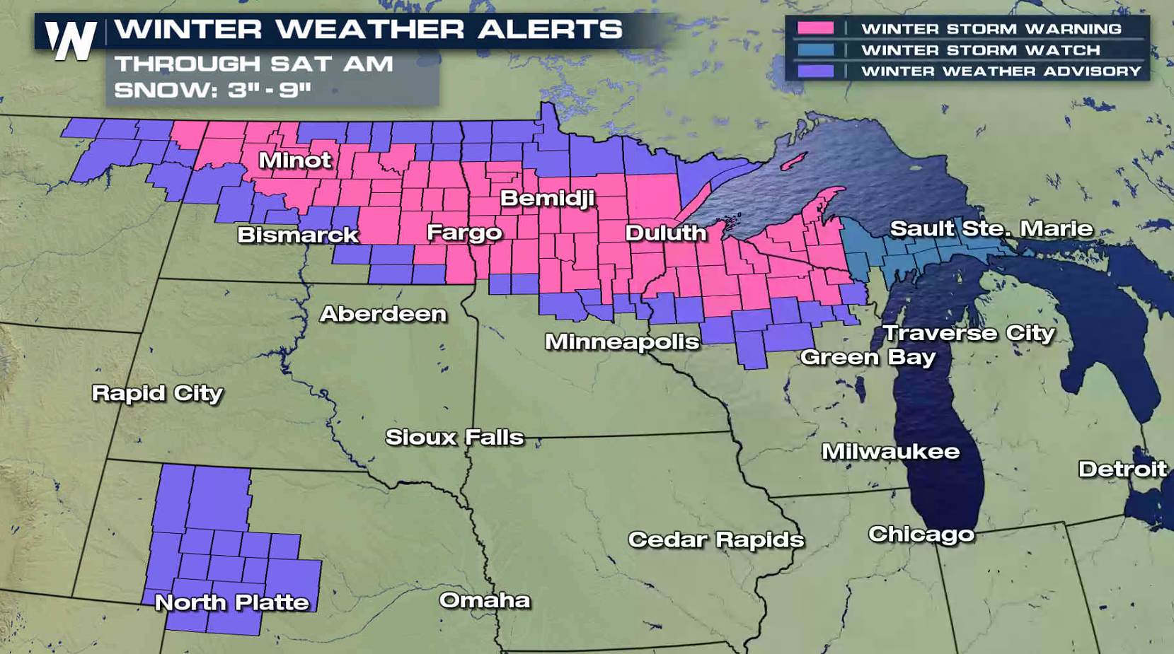 Winter Storm Warnings have been issued from North Dakota to the Upper Peninsula of Michigan. The lead area of snow has developed along the front side of a warm front. This area will weaken as it moves through Wisconsin and Michigan this afternoon.
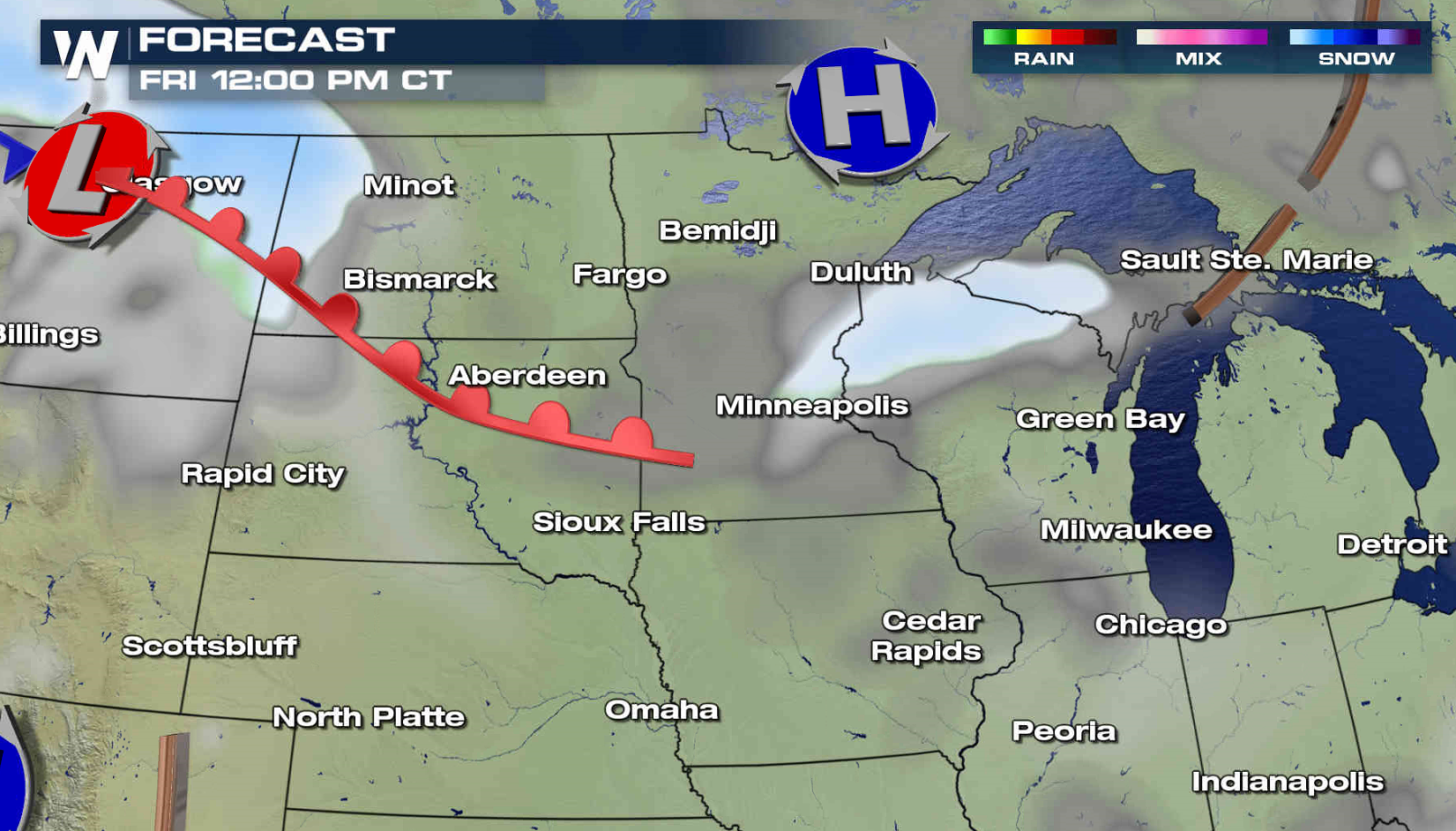
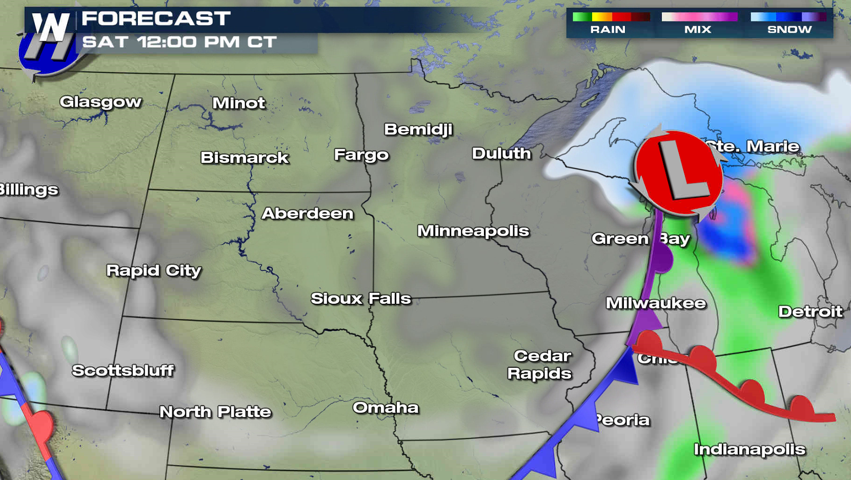
A second area of heavy snow will develop along the low pressure center moving out of Canada. It will slide across North Dakota this afternoon and into Minnesota and Wisconsin tonight. The wind is expected to increase, with some gusts to 40 mph. This will significant blowing snow, reducing visibility and create near blizzard conditions in open areas. The system will move into northern Michigan and the Upper Peninsula for Saturday with additional snowfall.
Winter Storm Warnings have been issued from North Dakota to the Upper Peninsula of Michigan. The lead area of snow has developed along the front side of a warm front. This area will weaken as it moves through Wisconsin and Michigan this afternoon.
A second area of heavy snow will develop along the low pressure center moving out of Canada. It will slide across North Dakota this afternoon and into Minnesota and Wisconsin tonight. The wind is expected to increase, with some gusts to 40 mph. This will significant blowing snow, reducing visibility and create near blizzard conditions in open areas. The system will move into northern Michigan and the Upper Peninsula for Saturday with additional snowfall.
 For WeatherNation: Meteorologist Mace Michaels
Winter Storm Warnings have been issued from North Dakota to the Upper Peninsula of Michigan. The lead area of snow has developed along the front side of a warm front. This area will weaken as it moves through Wisconsin and Michigan this afternoon.
A second area of heavy snow will develop along the low pressure center moving out of Canada. It will slide across North Dakota this afternoon and into Minnesota and Wisconsin tonight. The wind is expected to increase, with some gusts to 40 mph. This will significant blowing snow, reducing visibility and create near blizzard conditions in open areas. The system will move into northern Michigan and the Upper Peninsula for Saturday with additional snowfall.
For WeatherNation: Meteorologist Mace MichaelsAll Weather News
More

Tropics: Fausto Heads towards Hawaii; Genevieve Cat 4 Hurricane
PacificTropical Storm Fausto continues to tra
28 Jul 2026 10:30 AM

Severe Storms Target the Midwest to the Northeast
UPPER MIDWEST - Through Monday, dangerous tor
28 Jul 2026 10:25 AM

Southeast Flood Risk Lingers Near Stalled Front
A stalled boundary over the Southeast will ke
25 Jul 2026 10:55 AM

Another Round of Storms Targets the Northeast
Tuesday brought severe weather again across p
23 Jul 2026 1:15 AM

Another Round of Severe Weather for the Upper Midwest and Great Lakes
The upper-level low train continues to keep t
21 Jul 2026 1:45 AM

Air Quality Improvements in the Forecast
Wildfires burning in Northwestern Ontario, Ca
20 Jul 2026 7:20 PM