Soggy 4th Along Gulf Due to Tropical Low
Top Stories
3 Jul 2018 3:21 PM
A tropical low along the coastline of the Gulf of Mexico will bring rounds of heavy rainfall through the 4th of July, mainly impacting the Texas and Louisiana coastlines.
The slow-moving storm was drifting westward along the Louisiana coast as of Tuesday evening, bringing rain to mostly Louisiana and coastal Mississippi and Alabama.
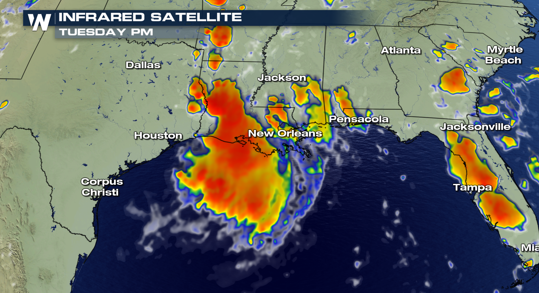 Through mid-afternoon Tuesday, the system had dropped nearly an inch of rain in New Orleans, with more expected through Tuesday and Wednesday. Gulfport, Mississippi had seen nearly two-and-a-half inches of rain since Sunday. Localized flooding is possible in coastal Louisiana and Texas through Wednesday evening, particularly with localized downpours.
By Wednesday, the heavy rain will slide west into southwestern Louisiana and southeast Texas, potentially soaking Houston, Beaumont and Port Arthur. It'll likely lead to a wet and stormy 4th of July in these areas.
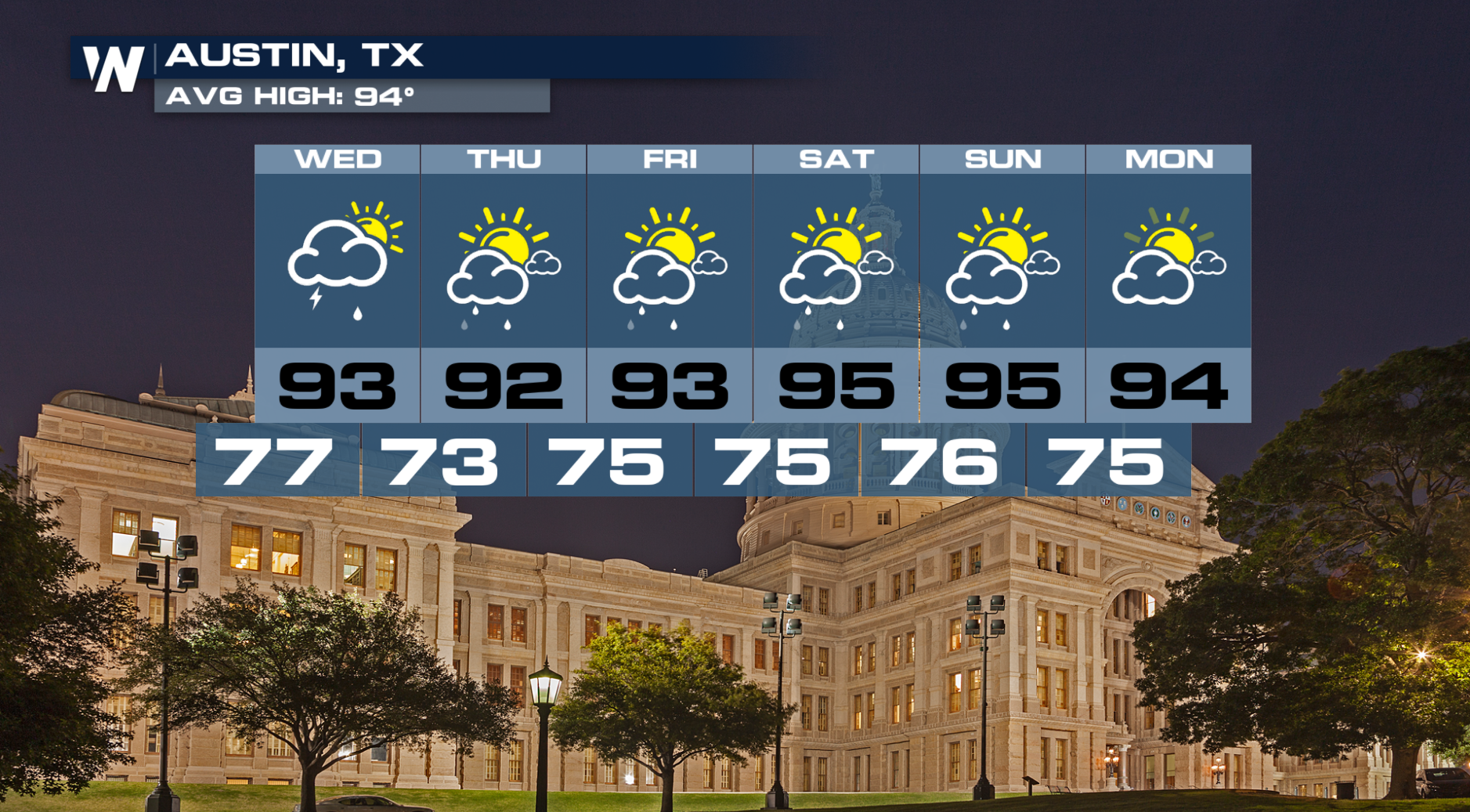
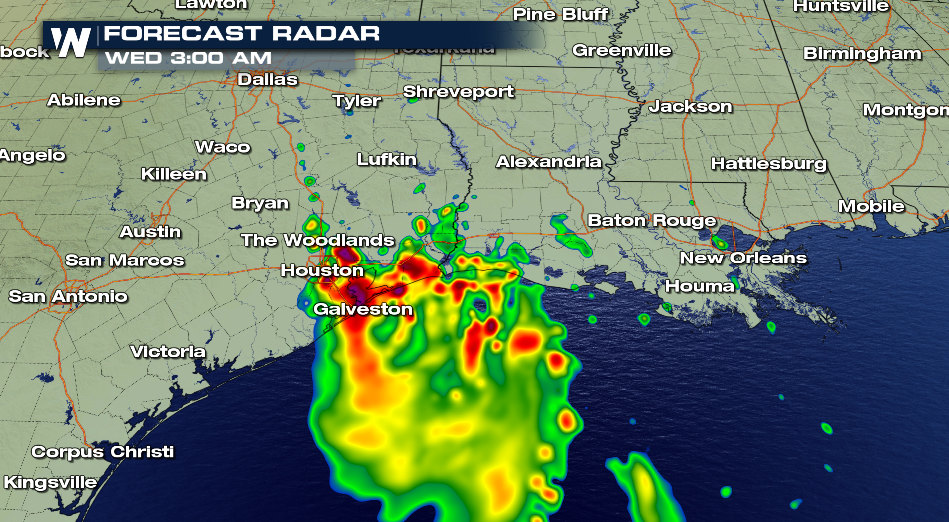 There isn't expected to be any tropical development with this low, according to the National Hurricane Center. The system moves inland and will move through central Texas, including Austin and San Antonio, on Wednesday and Thursday, before moving into northern Mexico by later Thursday and Friday.
 Stay with WeatherNation for the latest on this tropical low.
For WeatherNation: Meteorologist Chris Bianchi
 Through mid-afternoon Tuesday, the system had dropped nearly an inch of rain in New Orleans, with more expected through Tuesday and Wednesday. Gulfport, Mississippi had seen nearly two-and-a-half inches of rain since Sunday. Localized flooding is possible in coastal Louisiana and Texas through Wednesday evening, particularly with localized downpours.
By Wednesday, the heavy rain will slide west into southwestern Louisiana and southeast Texas, potentially soaking Houston, Beaumont and Port Arthur. It'll likely lead to a wet and stormy 4th of July in these areas.
 There isn't expected to be any tropical development with this low, according to the National Hurricane Center. The system moves inland and will move through central Texas, including Austin and San Antonio, on Wednesday and Thursday, before moving into northern Mexico by later Thursday and Friday.
 Stay with WeatherNation for the latest on this tropical low.
For WeatherNation: Meteorologist Chris Bianchi
Stay with WeatherNation for the latest on this tropical low.
For WeatherNation: Meteorologist Chris BianchiAll Weather News
More