State of Emergency Declared for all West Virginia Counties
Special Stories
17 Feb 2018 3:29 PM
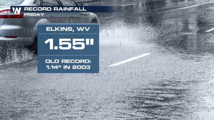
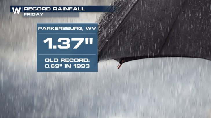
Governor Jim Justice declared a State of Emergency for all 55 counties in West Virginia this weekend. This is in response to heavy rainfall across the state since Friday morning. The threat of flooding will continue through Sunday.
https://twitter.com/WVGovernor/status/964866271128047616
The WV State Emergency Operations Center (EOC) is on "enhanced watch status" according to the office of the governor. This means that officials will continue to monitor the situation and will be ready to respond to any additional reports of flooding. According to the office, the West Virginia National Guard has been notified and is standing by to assist any agencies as needed.
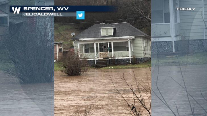
Pictures via social media showed the high water in West Virginia Friday. The picture below was taken from Spencer, WV in Roane County from Twitter user @EliCaldwell
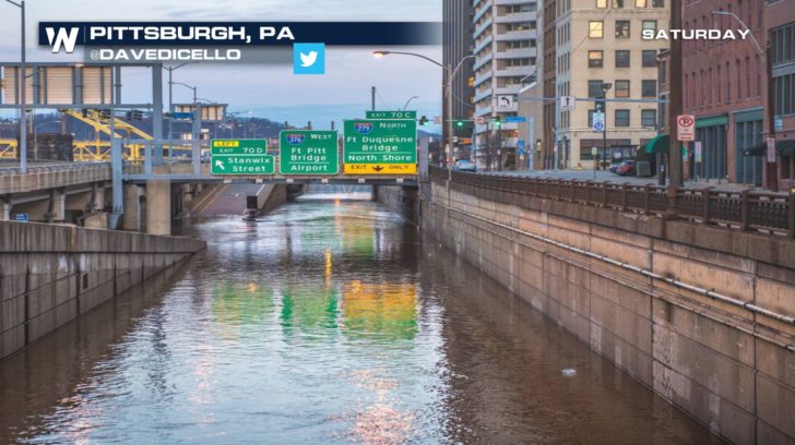
 On Saturday people in Pittsburgh, PA were watching the Ohio River very closely as it rose to minor flood stage, peaking at 25.61 feet. It is forecast to return below flood stage Saturday night or Sunday morning. The following pictures are courtesy and credit Twitter user @davedicello
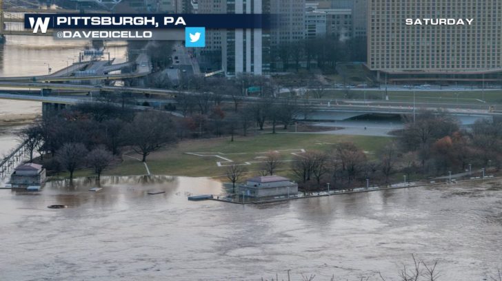
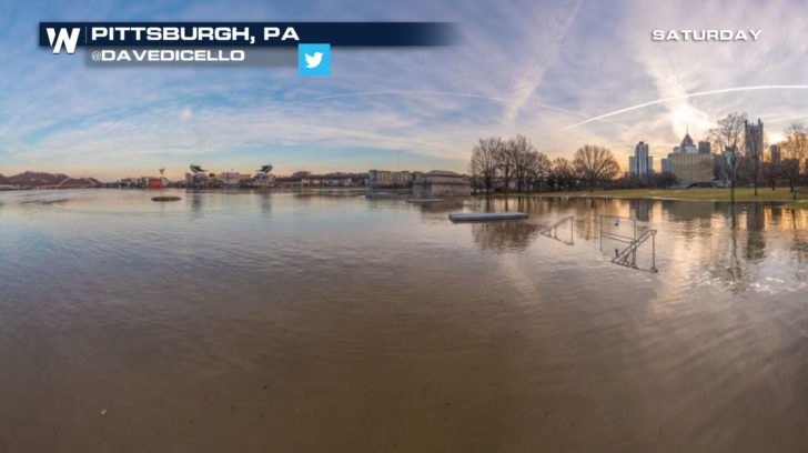 Rain and a few snow showers will continue on Saturday. The heaviest rain should finish by 10 p.m. est Saturday while snow showers linger in the mountains until Sunday morning. The weather pattern will become very warm and possibly wet again this week.
 Snapshot of flood alerts taken Saturday afternoon February 17, 2018
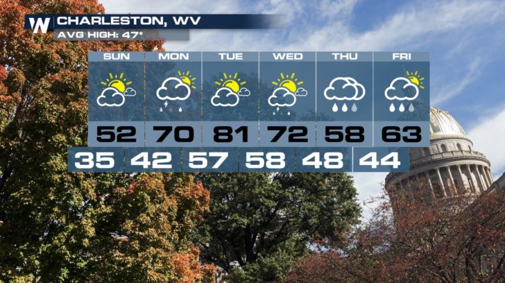 Forecast valid for Sunday, February 18 to Friday, February 23
We will keep you updated on the top weather stories, such as this, via our Facebook and Twitter pages.
For WeatherNation, Meteorologist Steve Glazier


 On Saturday people in Pittsburgh, PA were watching the Ohio River very closely as it rose to minor flood stage, peaking at 25.61 feet. It is forecast to return below flood stage Saturday night or Sunday morning. The following pictures are courtesy and credit Twitter user @davedicello


 Rain and a few snow showers will continue on Saturday. The heaviest rain should finish by 10 p.m. est Saturday while snow showers linger in the mountains until Sunday morning. The weather pattern will become very warm and possibly wet again this week.
 Snapshot of flood alerts taken Saturday afternoon February 17, 2018
 Forecast valid for Sunday, February 18 to Friday, February 23
We will keep you updated on the top weather stories, such as this, via our Facebook and Twitter pages.
For WeatherNation, Meteorologist Steve Glazier
Forecast valid for Sunday, February 18 to Friday, February 23
We will keep you updated on the top weather stories, such as this, via our Facebook and Twitter pages.
For WeatherNation, Meteorologist Steve GlazierAll Weather News
More