Severe Storms Possible in the Southeast
Top Stories
18 Feb 2021 1:40 PM
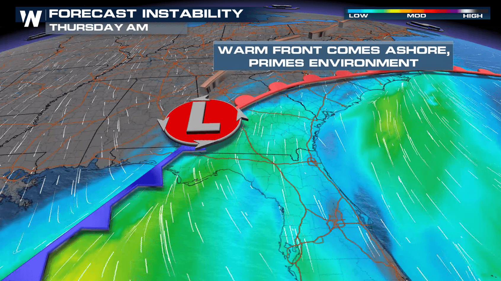
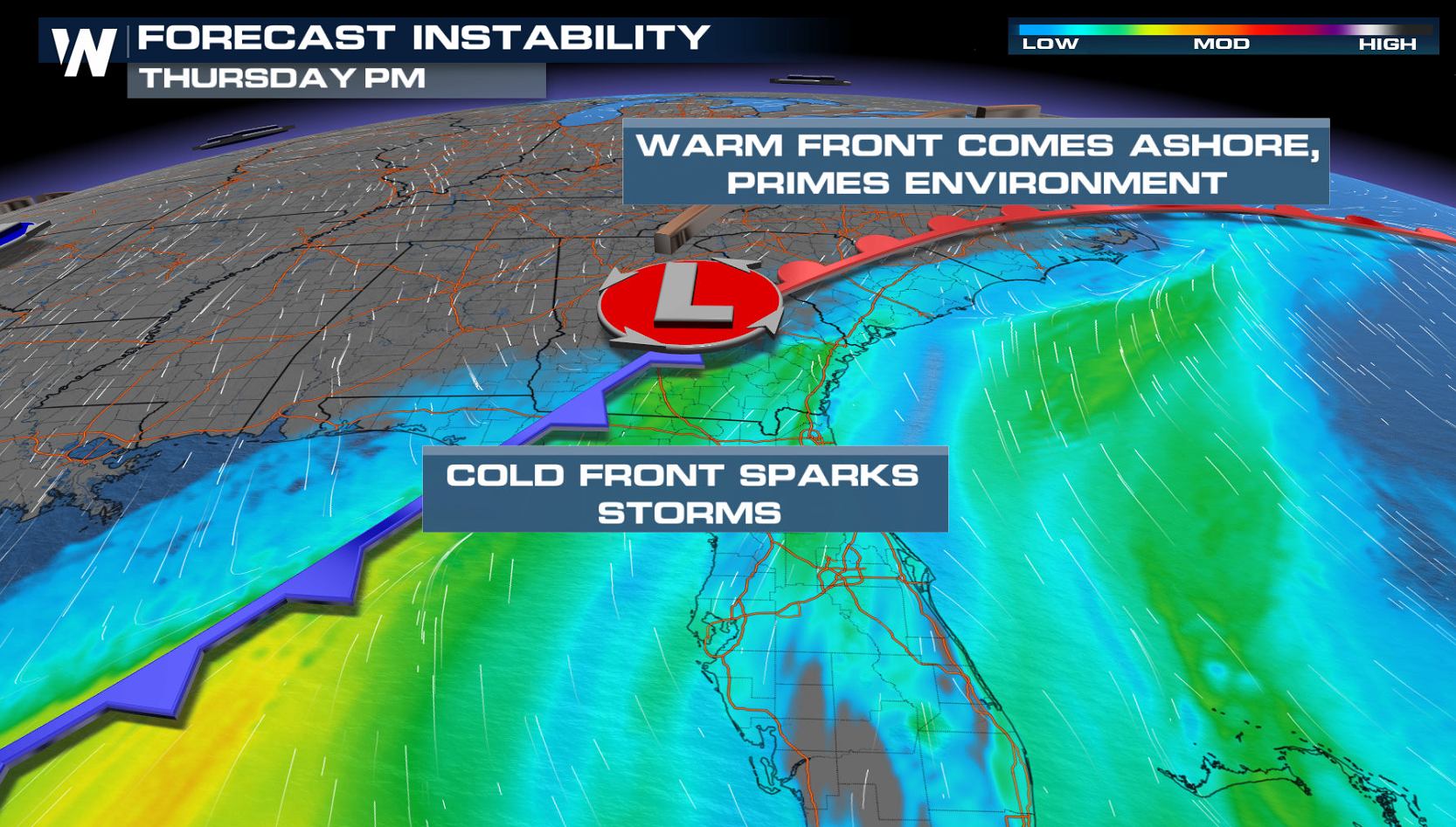
A low pressure system coming out of the Gulf of Mexico will bring the chance for severe storms across the Southeast. This is the same low pressure system that has produced snow along the Mississippi River and southern Plains. There is a substantial amount of energy associated with the system to create severe weather, including a risk for tornadoes.
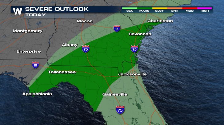 Severe weather is possible from Florida's Big Bend through southern Georgia to the coast of South Carolina near Charleston. The risk areas have been issued by the Storm Prediction Center and are highlighting the potential for tornadoes, damaging wind, and hail.
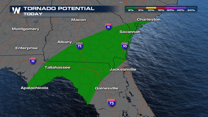 There is a 2% risk of tornadoes from Florida to South Carolina. If you live in any of these areas, you will want to have a severe weather plan in place.
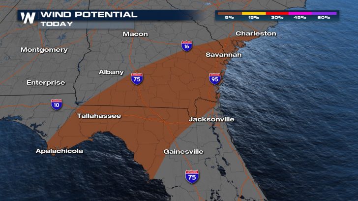 The cold front could be bringing winds in excess of 58 mph with gusts much stronger. This will lead to the possibility of localize tree damage and power outages with the intense wind gusts.
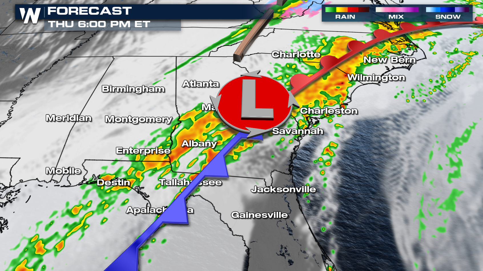
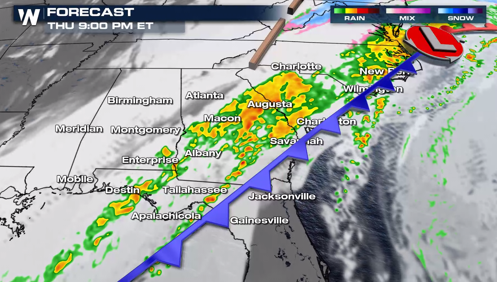
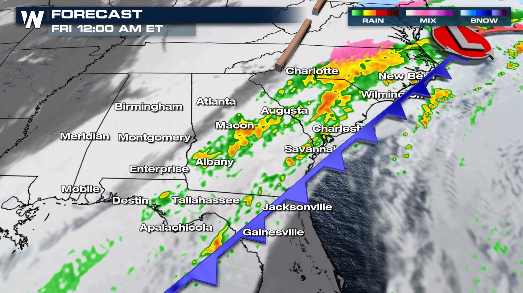
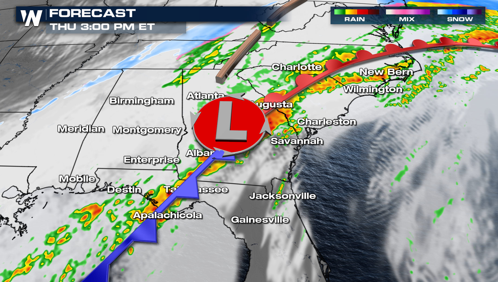 Thunderstorms will be most numerous along the low pressure center and warm & cold fronts. Heavy rain and severe storms will be possible.
 Keep checking with WeatherNation for more updates!
Severe Outlook
Severe weather is possible from Florida's Big Bend through southern Georgia to the coast of South Carolina near Charleston. The risk areas have been issued by the Storm Prediction Center and are highlighting the potential for tornadoes, damaging wind, and hail.
Severe Risks
There is a 2% risk of tornadoes from Florida to South Carolina. If you live in any of these areas, you will want to have a severe weather plan in place.
The cold front could be bringing winds in excess of 58 mph with gusts much stronger. This will lead to the possibility of localize tree damage and power outages with the intense wind gusts.
Forecast
Thunderstorms will be most numerous along the low pressure center and warm & cold fronts. Heavy rain and severe storms will be possible.
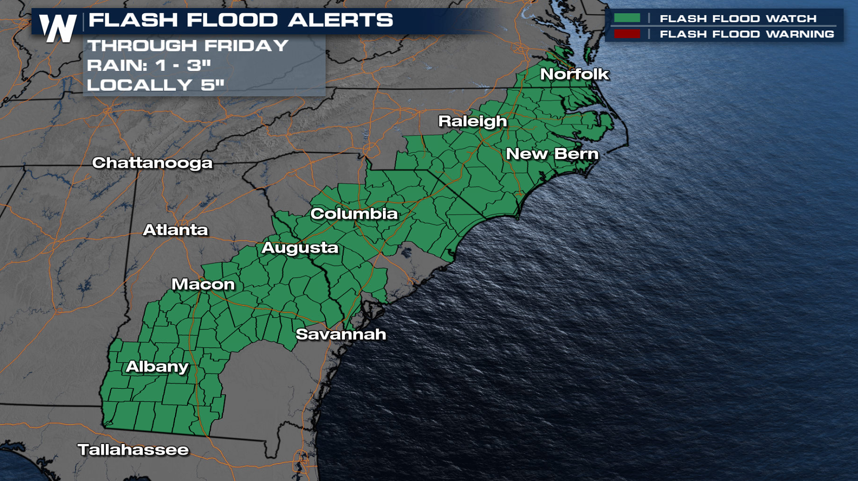
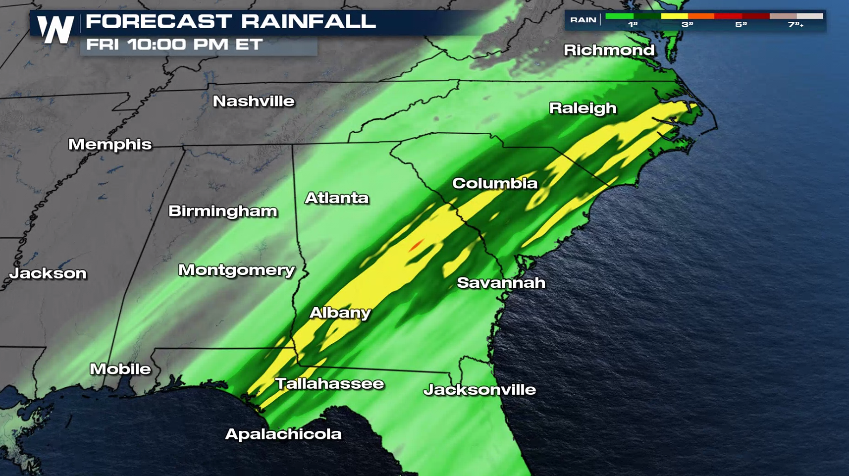
Rainfall
With high humidity in the atmosphere, flooding rains are possible in the Southeast. Up to 5" could occur, prompting Flash Flood Watches from Virginia to Georgia.
Keep checking with WeatherNation for more updates!All Weather News
More
Wildfire Outbreak in the Pacific Northwest
SPOKANE, WA - On Saturday, August 1st, the Ol
3 Aug 2026 1:55 AM

More Storms for the East Through Monday
A low-pressure system that moved through the
3 Aug 2026 1:50 AM


After Reaching Category 5, Genevieve Weakens in the Pacific
PacificGenevieve formed last Friday south of
3 Aug 2026 12:30 AM

Flooding, Severe Storms Target the Midwest Again
After an active week of storms across the nor
1 Aug 2026 1:40 AM

Flooding Risk Increases as Heavy Rain Targets the Tri-State Area
Tuesday, heavy rainfall moved across the Nort
30 Jul 2026 12:25 AM

Severe Weather: Energy From the Midwest Now in the Southeast
UPPER MIDWEST - Through Monday, dangerous tor
29 Jul 2026 10:30 PM