Stormy Start to the Week
Special Stories
25 Mar 2018 11:12 AM
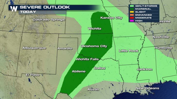
Things look to remain unsettled across the Southern Plains into the middle of the week. This Sunday, a strong to severe storm is possible across the area but the better chances will be into the start of the week.
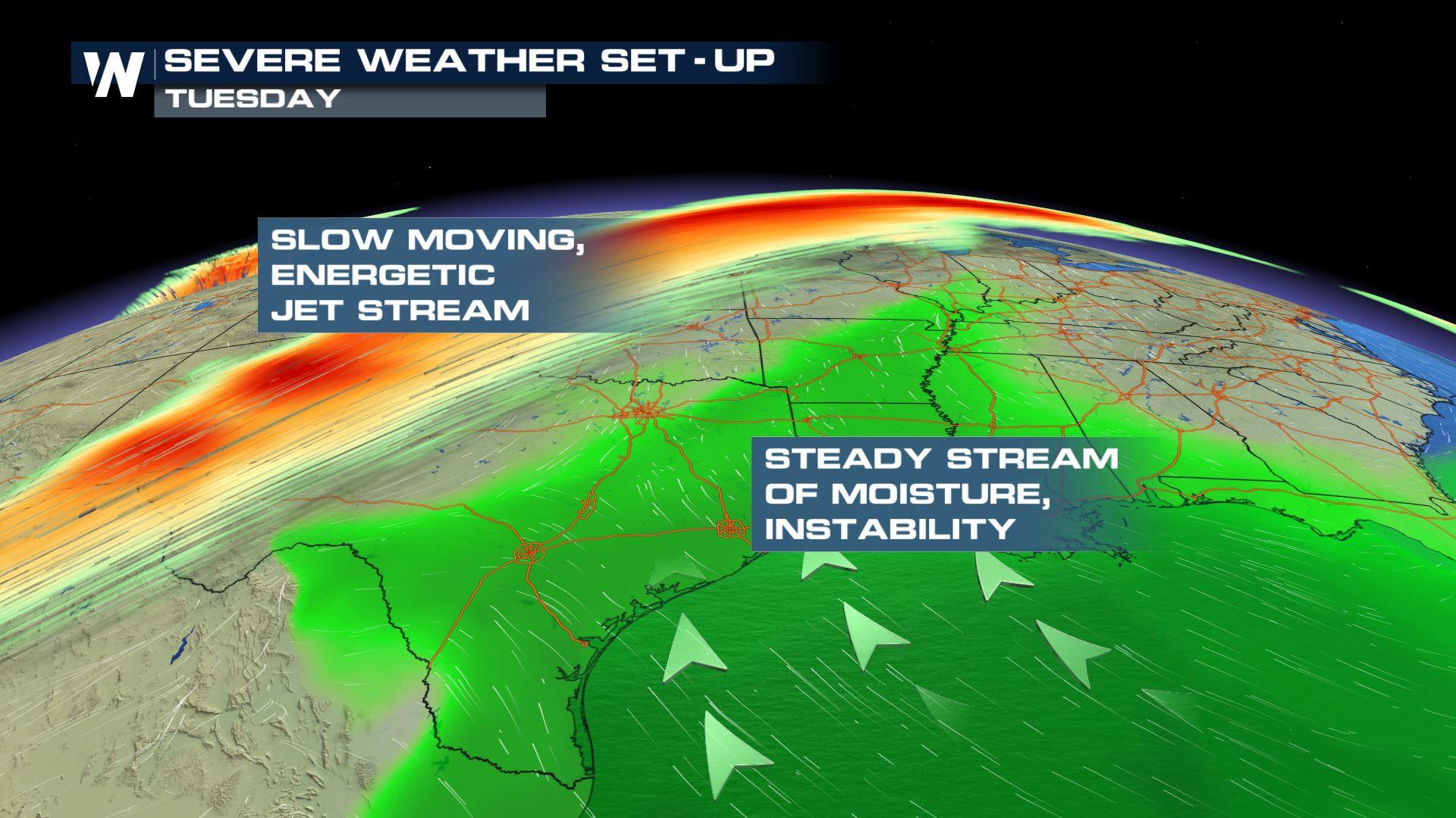
 The set-up is a slow moving cold front. In the upper levels of the atmosphere, that is a jet stream maximum that will supply plenty of energy into the atmosphere. At the surface, warm, moist air is being pumped ahead of the system.
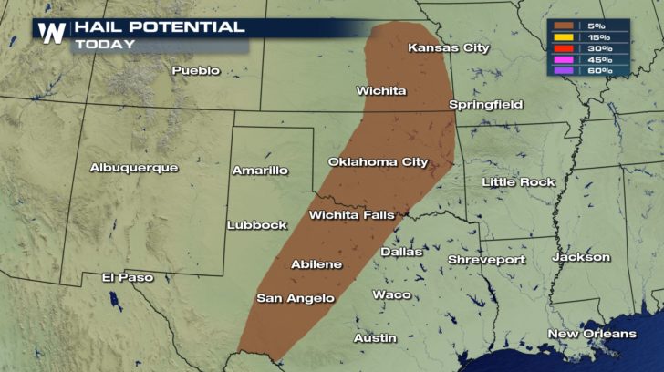
 Today, any severe storm that does form could bring with it large hail from Kansas to Texas.
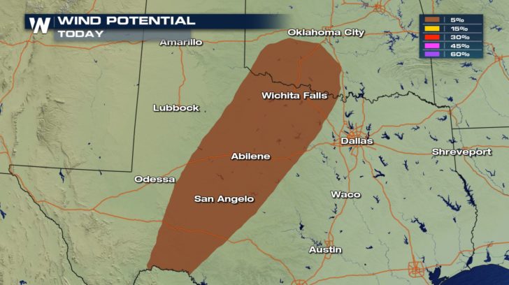
 Winds could also gust up to 50 or 60 mph.
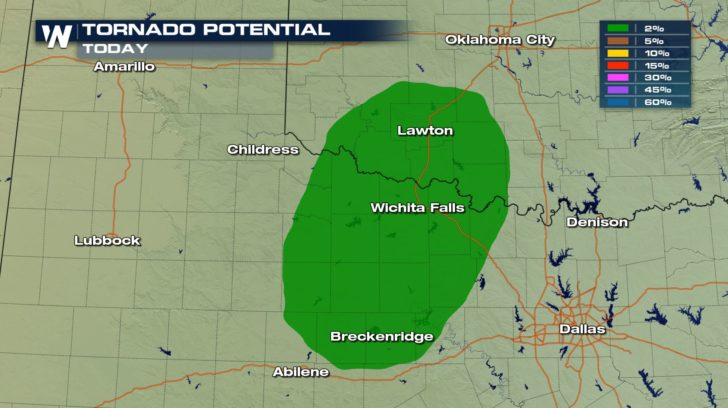
 Also, with the wind sheer, or changing wind direction with height, tornadoes are also a possibility. Make sure you have your alerts turned on your phone and that you are staying weather aware.
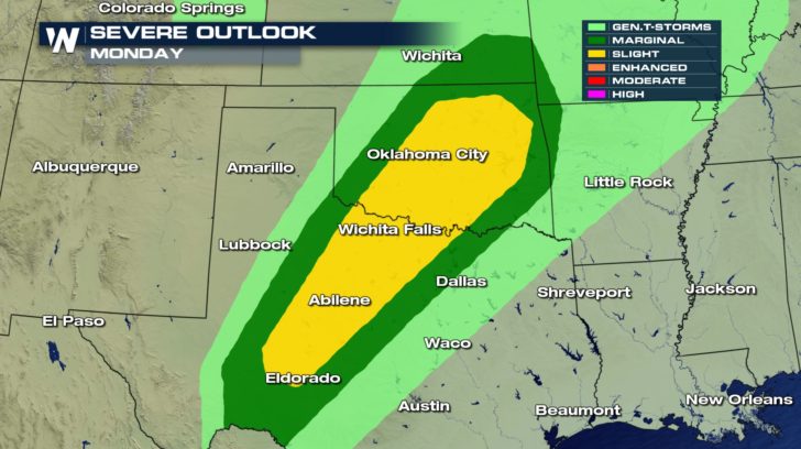
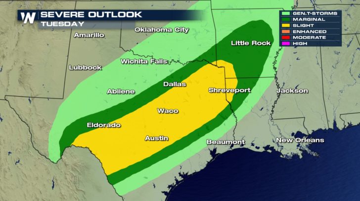
 The risk for severe storms is even greater tomorrow and Tuesday across the almost same region. This front really isn't moving quickly so the area of greatest likelihood only shifts slightly each day.
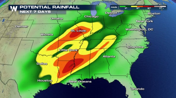
 Since this system is slow moving and has ample amounts of moisture to work with, flooding may become a concern as we head through this week.
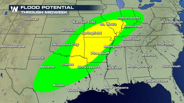 Some locations across the Mississippi River Valley could see 2-4" of rain. Some spots could see locally more.
 For WeatherNation, Meteorologist Kate Mantych.
The set-up is a slow moving cold front. In the upper levels of the atmosphere, that is a jet stream maximum that will supply plenty of energy into the atmosphere. At the surface, warm, moist air is being pumped ahead of the system.
Today, any severe storm that does form could bring with it large hail from Kansas to Texas.
Winds could also gust up to 50 or 60 mph.
Also, with the wind sheer, or changing wind direction with height, tornadoes are also a possibility. Make sure you have your alerts turned on your phone and that you are staying weather aware.
The risk for severe storms is even greater tomorrow and Tuesday across the almost same region. This front really isn't moving quickly so the area of greatest likelihood only shifts slightly each day.
Since this system is slow moving and has ample amounts of moisture to work with, flooding may become a concern as we head through this week.
Some locations across the Mississippi River Valley could see 2-4" of rain. Some spots could see locally more.
For WeatherNation, Meteorologist Kate Mantych.All Weather News
More
Watching the Gulf for Tropical Development
In the Atlantic basin, we are keeping a very
18 Jul 2026 2:10 AM

Monsoon Moisture Brings Weekend Flood Threat
The monsoon has returned to the southwestern
18 Jul 2026 2:00 AM

Severe Storms Target the Northeast Saturday
While smoke and heat have made headlines in t
18 Jul 2026 1:55 AM

Thick Wildfire Smoke Continues to Pour Across the Great Lakes, East Coast
Wildfires burning in Northwestern Ontario, Ca
18 Jul 2026 1:45 AM

After Historic Flooding, Flood Risk Moves West Saturday
TEXAS HILL COUNTRY - Life-threatening floodin
18 Jul 2026 1:00 AM

Heat Alerts Across the Nation End Thursday
ALL-TIME RECORD HIGHS were broken across the
16 Jul 2026 1:00 AM

Rare Enhanced Severe Threat For New England
WHAT TO EXPECT The SPC has issued a severe ou
15 Jul 2026 1:35 AM